Mouse Mat > Africa > Gabon > Maps
Mouse Mat : Map, Afrique Equatoriale; L'Ouest Africain, 1914. Creator: Unknown


![]()
Home Decor From Heritage Images
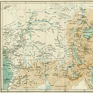
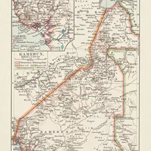
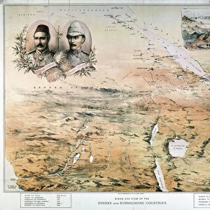
Map, Afrique Equatoriale; L'Ouest Africain, 1914. Creator: Unknown
Map, Afrique Equatoriale; L'Ouest Africain, 1914. From "Grande Geographie Bong Illustree", 1914
Heritage Images features heritage image collections
Media ID 36295127
© The Print Collector/Heritage Images
Angola Belgian Belgian Congo Cameroon Cartography Central Africa Central African Colonies Colony Congo Equatorial Map Making Mapmaking Portugal Portuguese Rhodesia Africa Scramble For Africa Sudan
Mouse Mat
A high quality photographic print manufactured into a durable wipe clean mouse mat (27x22cm) with a non slip backing, which works with all mice.
Archive quality photographic print in a durable wipe clean mouse mat with non slip backing. Works with all computer mice
Estimated Image Size (if not cropped) is 18.4cm x 25.4cm (7.2" x 10")
Estimated Product Size is 21.8cm x 26.9cm (8.6" x 10.6")
These are individually made so all sizes are approximate
Artwork printed orientated as per the preview above, with portrait (vertical) orientation to match the source image.
FEATURES IN THESE COLLECTIONS
> Africa
> Angola
> Related Images
> Africa
> Cameroon
> Related Images
> Africa
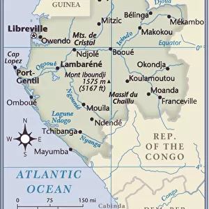
> Gabon
> Related Images
> Africa
> Sudan
> Related Images
> Africa
> Zimbabwe
> Rhodesia
EDITORS COMMENTS
This map print, titled "Map, Afrique Equatoriale; L'Ouest Africain" and dated 1914, offers a fascinating glimpse into the colonial era of Africa. The map depicts the westernmost region of Central Africa, encompassing present-day Angola, Cameroon, Gabon, and parts of the Democratic Republic of the Congo, Central African Republic, Chad, and Sudan. The map was published in the renowned Belgian geography magazine "Grande Geographie Bong Illustree," indicating its origins in the Belgian colonial empire. The map is a testament to the intense competition and scramble for African territories during the late 19th and early 20th centuries. British, French, Belgian, Portuguese, and German colonies are clearly demarcated, reflecting the complex political landscape of the time. The map's intricate detailing and vibrant color palette make it an engaging representation of the geography and territorial claims during this period. The map's creation coincides with the height of European colonialism in Africa, as powers like Belgium, France, Britain, Portugal, and Germany sought to expand their empires and exert influence over the African continent. The map serves as a visual reminder of the historical significance of this era, which shaped the political, economic, and social landscape of Africa and the world at large. Despite the map's unknown creator, it remains an essential historical artifact, providing valuable insights into the geography and colonial history of Central Africa during the 1910s. Its inclusion in "Grande Geographie Bong Illustree" further underscores its importance as a significant piece of cartographic history.
MADE IN THE UK
Safe Shipping with 30 Day Money Back Guarantee
FREE PERSONALISATION*
We are proud to offer a range of customisation features including Personalised Captions, Color Filters and Picture Zoom Tools
SECURE PAYMENTS
We happily accept a wide range of payment options so you can pay for the things you need in the way that is most convenient for you
* Options may vary by product and licensing agreement. Zoomed Pictures can be adjusted in the Basket.