
Belgian Congo Collection
"Exploring the Heart of Africa: Unveiling the Belgian Congo" Step back in time to witness a captivating journey through the enigmatic landscapes of the Belgian Congo


All Professionally Made to Order for Quick Shipping
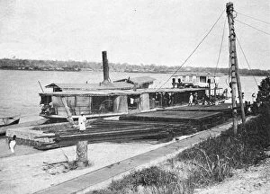
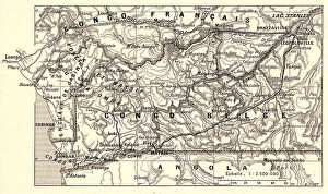
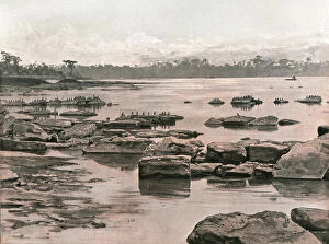
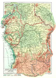
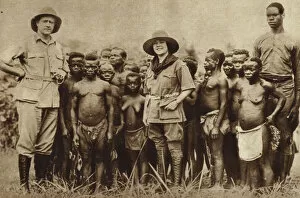
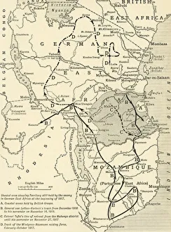
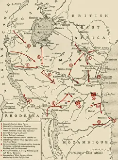
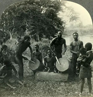
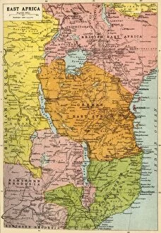
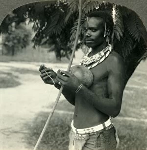
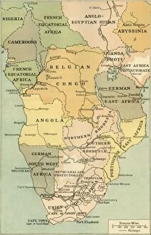
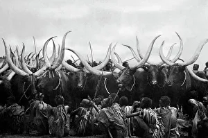
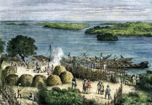
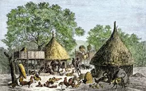
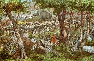
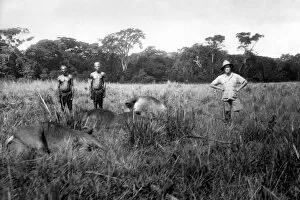
"Exploring the Heart of Africa: Unveiling the Belgian Congo" Step back in time to witness a captivating journey through the enigmatic landscapes of the Belgian Congo. In this black and white photograph, an American explorer and his wife stand alongside a group of African Pygmies, their faces filled with curiosity and wonder. The image captures a moment frozen in time, symbolizing the meeting of two vastly different worlds. Accompanying this snapshot is a map illustrating the closing phases of the East African Campaign during World War I. It serves as a testament to the historical significance of this region, where conflicts unfolded amidst breathtaking natural beauty. Another map showcases colonial possessions in East Africa during that era, shedding light on European powers' scramble for control over vast territories. Transporting us further into history is an intriguing glimpse into "The Conquest of Cameroons, " depicting scenes from World War I's early years. This unknown creator skillfully portrays soldiers navigating treacherous terrain while striving for dominance over foreign lands. A vivid scene emerges from "The Drums of Africa, " revealing life within Ikoko village on Lake Ntomba in Belgian Congo during the 1930s. The rhythmic beats echo through lush surroundings as villagers celebrate their vibrant culture—a reminder that beneath colonization's shadow lies resilience and rich traditions. Delving deeper into geopolitical dynamics, we encounter John Bartholomew & Son's meticulously crafted map showcasing East Africa during World War I—an intricate web connecting nations embroiled in conflict across borders defined by power struggles. Shifting focus to daily life, livestock grazing peacefully against picturesque horizons paints a serene picture—Ruanda-Urundi thriving under Belgian rule between 1920-1930—a period when agriculture flourished amid changing times. Stepping onto river waters teeming with history, we find ourselves aboard Steamer Hainaut—the lifeline connecting communities along high rivers—its presence epitomizing the Belgian Congo's interconnectedness and resilience.