Fraud Blocker Skip to main content

Old County Map Collection

Step back in time with these stunning old county maps. Explore the intricate details and historical significance of each region as you journey through centuries past

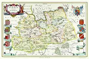
Background imageOld County Map Collection: Old County Map of Surrey 1648 by Johan Blaeu from the Atlas Novus

Old County Map of Surrey 1648 by Johan Blaeu from the Atlas Novus
This detailed and most attractive reproduction map of Surrey has been carefully art worked from a scan of an antique original

Background imageOld County Map Collection: Old County Map of Wigtown Scotland 1847 by A&C Black

Old County Map of Wigtown Scotland 1847 by A&C Black
A finely detailed facimile remastered in full colour from an antique original map of Wigtownshire featured in A&C Blacks Atlas of 1847

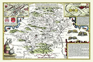
Background imageOld County Map Collection: Old County Map of Hertfordshire 1611 by John Speed

Old County Map of Hertfordshire 1611 by John Speed
A facimile of John Speeds historical map of Hertfordshire originally published for the " Theatre of the Empire of Great Britain"

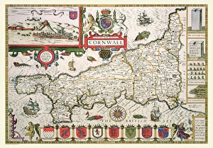
Background imageOld County Map Collection: Old County Map of Cornwall 1611 by John Speed

Old County Map of Cornwall 1611 by John Speed
A facimile of John Speeds historical map of Cornwall originally published for the " Theatre of the Empire of Great Britain", an atlas to accompany " a history of Great Britain"

Background imageOld County Map Collection: Old County Map of Bedfordshire 1611 by John Speed

Old County Map of Bedfordshire 1611 by John Speed
A fine reproduction of John Speeds historical map of Bedfordshire originally published for the " Theatre of the Empire of Great Britain"

Background imageOld County Map Collection: Old County Map of Shropshire 1836 by Thomas Moule

Old County Map of Shropshire 1836 by Thomas Moule
This is a fine decorative reproduction County Map of Shropshire from the First Edition series of Thomas Moule Maps, originally Published in 1836

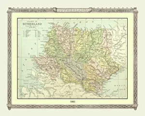
Background imageOld County Map Collection: Old Map of the County of Sutherland from the Philips Handy Atlas of 1882

Old Map of the County of Sutherland from the Philips Handy Atlas of 1882
PHA030

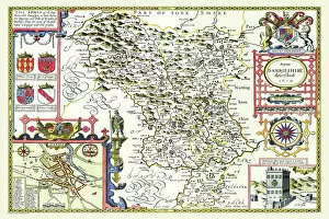
Background imageOld County Map Collection: Old County Map of Derbyshire 1611 by John Speed

Old County Map of Derbyshire 1611 by John Speed
A facimile of John Speeds historical map of Derbyshire originally published for the " Theatre of the Empire of Great Britain", an atlas to accompany " a history of Great Britain"

Background imageOld County Map Collection: Old County Map of Fife 1654 by Johan Blaeu from the Atlas Novus

Old County Map of Fife 1654 by Johan Blaeu from the Atlas Novus
This detailed and most attractive reproduction map of Fife has been carefully art worked from a scan of an antique original

Background imageOld County Map Collection: Old County Map of Kyle and Mid Ayrshire 1654 by johan Blaeu from the Atlas Novus

Old County Map of Kyle and Mid Ayrshire 1654 by johan Blaeu from the Atlas Novus
This detailed and most attractive reproduction map of Kyle and Mid Ayrshire has been carefully art worked from a scan of an antique original

Background imageOld County Map Collection: Old County Map of Lancashire 1611 by John Speed

Old County Map of Lancashire 1611 by John Speed
A facimile of John Speeds historical map of Lancashire published for the " Theatre of the Empire of Great Britain", an atlas to accompany " a history of Great Britain"

Background imageOld County Map Collection: Old County Map of Yorkshire 1611 by John Speed

Old County Map of Yorkshire 1611 by John Speed
A facimile of John Speeds historical map of Yorkshire originally published for the " Theatre of the Empire of Great Britain", an atlas to accompany " a history of Great Britain"

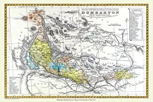
Background imageOld County Map Collection: Old County Map of Dunbartonshire, formally called Dumbartonshire, Scotland 1847 by A&C Black

Old County Map of Dunbartonshire, formally called Dumbartonshire, Scotland 1847 by A&C Black
A finely detailed facimile remastered in full colour from an antique original map of " Dumbartonshire" featured in A&C Blacks Atlas of 1847

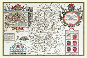
Background imageOld County Map Collection: Old County Map of Nottinghamshire 1611 by John Speed

Old County Map of Nottinghamshire 1611 by John Speed
A facimile of John Speeds historical map of Nottinghamshire originally published for the " Theatre of the Empire of Great Britain"

Background imageOld County Map Collection: Old County Map of Suffolk 1611 by John Speed

Old County Map of Suffolk 1611 by John Speed
A facimile of John Speeds historical map of Norfolk originally published for the " Theatre of the Empire of Great Britain", an atlas to accompany " a history of Great Britain"

Background imageOld County Map Collection: Old County Map of Somersetshire 1611 by John Speed

Old County Map of Somersetshire 1611 by John Speed
A facimile of John Speeds historical map of Somersetshire originally published for the " Theatre of the Empire of Great Britain"

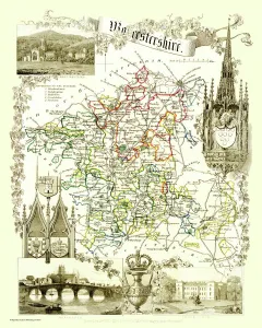
Background imageOld County Map Collection: Old County Map of Worcestershire 1836 by Thomas Moule

Old County Map of Worcestershire 1836 by Thomas Moule
This is a fine decorative reproduction County Map of Worcestershire from the First Edition series of Thomas Moule Maps, originally Published in 1836

Background imageOld County Map Collection: Old County Map of Warwickshire 1648 by Johan Blaeu from the Atlas Novus

Old County Map of Warwickshire 1648 by Johan Blaeu from the Atlas Novus
This detailed and most attractive reproduction map of Warwickshire has been carefully art worked from a scan of an antique original

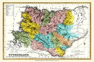
Background imageOld County Map Collection: Old County Map of Sutherland Scotland 1847 by A&C Black

Old County Map of Sutherland Scotland 1847 by A&C Black
A finely detailed facimile remastered in full colour from an antique original map of Sutherland featured in A&C Blacks Atlas of 1847

Background imageOld County Map Collection: Old County Map of Renfrew Scotland 1847 by A&C Black

Old County Map of Renfrew Scotland 1847 by A&C Black
A finely detailed facimile remastered in full colour from an antique original map of Renfrewshire featured in A&C Blacks Atlas of 1847

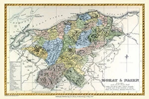
Background imageOld County Map Collection: Old County Map of Moray and Nairn Scotland 1847 by A&C Black

Old County Map of Moray and Nairn Scotland 1847 by A&C Black
A finely detailed facimile remastered in full colour from an antique original map of Moray and Nairn featured in A&C Blacks Atlas of 1847

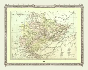
Background imageOld County Map Collection: Old Map of the Counties of Ross and Cromarty from the Philips Handy Atlas of 1882

Old Map of the Counties of Ross and Cromarty from the Philips Handy Atlas of 1882
PHA026

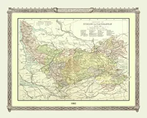
Background imageOld County Map Collection: Old Map of the Counties of Stirling and Clackmannan from the Philips Handy Atlas of 1882

Old Map of the Counties of Stirling and Clackmannan from the Philips Handy Atlas of 1882
PHA029

Background imageOld County Map Collection: Old County Map of Suffolk 1836 by Thomas Moule

Old County Map of Suffolk 1836 by Thomas Moule
This is a fine decorative reproduction County Map of Suffolk from the First Edition series of Thomas Moule Maps, originally Published in 1836

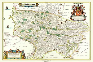
Background imageOld County Map Collection: Old County Map of Renfrewshire Scotland 1654 by Johan Blaue from the Atlas Novus

Old County Map of Renfrewshire Scotland 1654 by Johan Blaue from the Atlas Novus
This detailed and most attractive reproduction map of Renfrewshire, Scotland, has been carefully art worked from a scan of an antique original

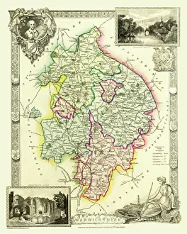
Background imageOld County Map Collection: Old County Map of Warwickshire 1836 by Thomas Moule

Old County Map of Warwickshire 1836 by Thomas Moule
This is a fine decorative reproduction County Map of Warwickshire from the First Edition series of Thomas Moule Maps, originally Published in 1836

Background imageOld County Map Collection: Old County Map of Sussex 1836 by Thomas Moule

Old County Map of Sussex 1836 by Thomas Moule
This is a fine decorative reproduction County Map of Sussex from the First Edition series of Thomas Moule Maps, originally Published in 1836

Background imageOld County Map Collection: Old County Map of Kent 1836 by Thomas Moule

Old County Map of Kent 1836 by Thomas Moule
This is a fine decorative reproduction County Map of Kent from the First Edition series of Thomas Moule Maps, originally Published in 1836

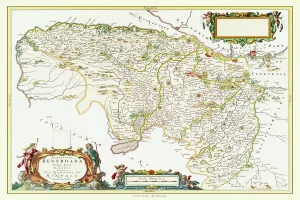
Background imageOld County Map Collection: Old County Map of the East Riding of Yorkshire 1648 by Johan Blaeu from the Atlas Novus

Old County Map of the East Riding of Yorkshire 1648 by Johan Blaeu from the Atlas Novus
This detailed and most attractive reproduction map of the East Riding of Yorkshire has been carefully art worked from a scan of an antique original

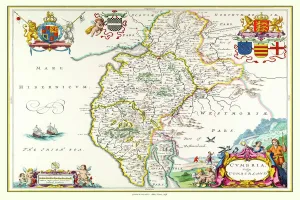
Background imageOld County Map Collection: Old County Map of Cumbria 1648 by Johan Blaeu from the Atlas Novus

Old County Map of Cumbria 1648 by Johan Blaeu from the Atlas Novus
This detailed and most attractive reproduction map of Cumbria has been carefully art worked from a scan of an antique original

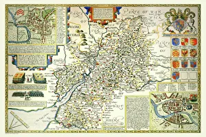
Background imageOld County Map Collection: Old County Map of Gloucestershire 1648 by Johan Blaeu from the Atlas Novus

Old County Map of Gloucestershire 1648 by Johan Blaeu from the Atlas Novus
This detailed and most attractive reproduction map of Gloucestershire has been carefully art worked from a scan of an antique original

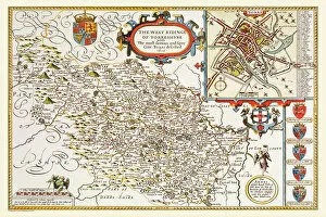
Background imageOld County Map Collection: Old County Map of Yorkshire West Riding 1611 by John Speed

Old County Map of Yorkshire West Riding 1611 by John Speed
A facimile of John Speeds historical map of Yorkshire West Riding originally published for the " Theatre of the Empire of Great Britain"

Background imageOld County Map Collection: Old County Map of Gloucestershire 1611 by John Speed

Old County Map of Gloucestershire 1611 by John Speed
A facimile of John Speeds historical map of Gloucestershire originally published for the " Theatre of the Empire of Great Britain"

Background imageOld County Map Collection: Old County Map of Norfolk 1648 by Johan Blaeu from the Atlas Novus

Old County Map of Norfolk 1648 by Johan Blaeu from the Atlas Novus
This detailed and most attractive reproduction map of Norfolk has been carefully art worked from a scan of an antique original

Background imageOld County Map Collection: Old County Map of Dumfries Scotland 1847 by A&C Black

Old County Map of Dumfries Scotland 1847 by A&C Black
A finely detailed facimile remastered in full colour from an antique original map of Dumfries featured in A&C Blacks Atlas of 1847

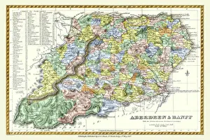
Background imageOld County Map Collection: Old County Map of Aberdeen and Banff Scotland 1847 by A&C Black

Old County Map of Aberdeen and Banff Scotland 1847 by A&C Black
A finely detailed facimile remastered in full colour from an antique original map of Aberdeen and Banff featured in A&C Blacks Atlas of 1847

Background imageOld County Map Collection: Old County Map of Caithness Scotland 1847 by A&C Black

Old County Map of Caithness Scotland 1847 by A&C Black
A finely detailed facimile remastered in full colour from an antique original map of Caithness featured in A&C Blacks Atlas of 1847

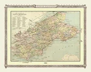
Background imageOld County Map Collection: Old Map of the Counties of Fife and Kinross from the Philips Handy Atlas of 1882

Old Map of the Counties of Fife and Kinross from the Philips Handy Atlas of 1882
PHA014

Background imageOld County Map Collection: Old County Map of Northamptonshire 1611 by John Speed

Old County Map of Northamptonshire 1611 by John Speed
A facimile of John Speeds historical map of Northamptonshire originally published for the " Theatre of the Empire of Great Britain"

Background imageOld County Map Collection: Old County Map of Bedfordshire 1836 by Thomas Moule

Old County Map of Bedfordshire 1836 by Thomas Moule
This is a fine decorative reproduction County Map of Bedfordshire from the First Edition series of Thomas Moule Maps, originally Published in 1836

Background imageOld County Map Collection: Old County Map of Wiltshire 1836 by Thomas Moule

Old County Map of Wiltshire 1836 by Thomas Moule
This is a fine decorative reproduction County Map of Wiltshire from the First Edition series of Thomas Moule Maps, originally Published in 1836

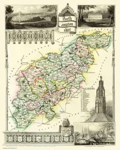
Background imageOld County Map Collection: Old County Map of Northamptonshire 1836 by Thomas Moule

Old County Map of Northamptonshire 1836 by Thomas Moule
This is a fine decorative reproduction County Map of Northamptonshire from the First Edition series of Thomas Moule Maps, originally Published in 1836

Background imageOld County Map Collection: Old County Map of Stirling and Clackmannan Scotland 1847 by A&C Black

Old County Map of Stirling and Clackmannan Scotland 1847 by A&C Black
A finely detailed facimile remastered in full colour from an antique original map of Stirling and Clackmannan featured in A&C Blacks Atlas of 1847

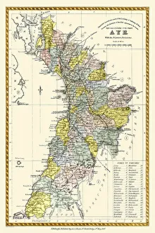
Background imageOld County Map Collection: Old County Map of Ayr Scotland 1847 by A&C Black

Old County Map of Ayr Scotland 1847 by A&C Black
A finely detailed facimile remastered in full colour from an antique original map of Ayr featured in A&C Blacks Atlas of 1847

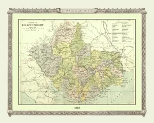
Background imageOld County Map Collection: Old Map of the County of Kirkcudbright from the Philips Handy Atlas of 1882

Old Map of the County of Kirkcudbright from the Philips Handy Atlas of 1882
PHA019

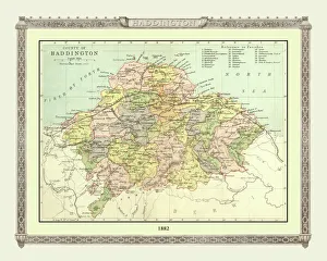
Background imageOld County Map Collection: Old Map of the County of Haddington from the Philips Handy Atlas of 1882

Old Map of the County of Haddington from the Philips Handy Atlas of 1882
PHA016

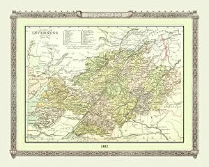
Background imageOld County Map Collection: Old Map of the County of Inverness from the Philips Handy Atlas of 1882

Old Map of the County of Inverness from the Philips Handy Atlas of 1882
PHA017

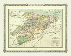
Background imageOld County Map Collection: Old Map of the County of Linlithgow from the Philips Handy Atlas of 1882

Old Map of the County of Linlithgow from the Philips Handy Atlas of 1882
PHA021

Background imageOld County Map Collection: Old County Map of Devonshire 1836 by Thomas Moule

Old County Map of Devonshire 1836 by Thomas Moule
This is a fine decorative reproduction County Map of Devonshire from the First Edition series of Thomas Moule Maps, originally Published in 1836

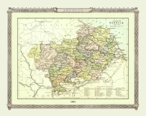
Background imageOld County Map Collection: Old Map of the County of Berwick from the Philips Handy Atlas of 1882

Old Map of the County of Berwick from the Philips Handy Atlas of 1882
PHA006

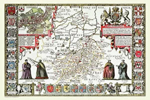
Background imageOld County Map Collection: Old County Map of Cambridgeshire 1611 by John Speed

Old County Map of Cambridgeshire 1611 by John Speed
A facimile of John Speeds historical map of Cambridgeshire originally published for the " Theatre of the Empire of Great Britain"

Background imageOld County Map Collection: Old County Map of Leicestershire 1611 by John Speed

Old County Map of Leicestershire 1611 by John Speed
A facimile of John Speeds historical map of Leicestershire originally published for the " Theatre of the Empire of Great Britain"

Background imageOld County Map Collection: OldCounty Map of Wiltshire 1611 by John Speed

OldCounty Map of Wiltshire 1611 by John Speed
A facimile of John Speeds historical map of Wiltshire published for the " Theatre of the Empire of Great Britain", an atlas to accompany " a history of Great Britain"

Background imageOld County Map Collection: Old County Map of Kurkcudbright Scotland 1847 by A&C Black

Old County Map of Kurkcudbright Scotland 1847 by A&C Black
A finely detailed facimile remastered in full colour from an antique original map of Kurkcudbright featured in A&C Blacks Atlas of 1847

Background imageOld County Map Collection: Old County Map of Kent 1611 by John Speed

Old County Map of Kent 1611 by John Speed
A facimile of John Speeds historical map of Kent originally published for the " Theatre of the Empire of Great Britain", an atlas to accompany " a history of Great Britain"

Background imageOld County Map Collection: Old County Map of Hampshire 1836 by Thomas Moule

Old County Map of Hampshire 1836 by Thomas Moule
This is a fine decorative reproduction County Map of Hampshire from the First Edition series of Thomas Moule Maps, originally Published in 1836

Background imageOld County Map Collection: Old County Map of Lancashire 1836 by Thomas Moule

Old County Map of Lancashire 1836 by Thomas Moule
This is a fine decorative reproduction County Map of Lancashire from the First Edition series of Thomas Moule Maps, originally Published in 1836

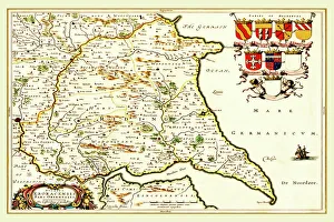
Background imageOld County Map Collection: Old County Map of Yorkshire 1648 by Johan Blaeu from the Atlas Novus

Old County Map of Yorkshire 1648 by Johan Blaeu from the Atlas Novus
This detailed and most attractive reproduction map of Yorkshire has been carefully art worked from a scan of an antique original

Background imageOld County Map Collection: Old County Map of Kent 1648 by Johan Blaeu from the Atlas Novus

Old County Map of Kent 1648 by Johan Blaeu from the Atlas Novus
This detailed and most attractive reproduction map of Kent has been carefully art worked from a scan of an antique original

Background imageOld County Map Collection: Old County Map of Aberdeen and Banff 1654 by Johan Blaeu from the Atlas Novus

Old County Map of Aberdeen and Banff 1654 by Johan Blaeu from the Atlas Novus
This detailed and most attractive reproduction map of Aberdeen and Banff has been carefully art worked from a scan of an antique original

Background imageOld County Map Collection: Old County Map of Pembrokeshire, Wales 1611 by John Speed

Old County Map of Pembrokeshire, Wales 1611 by John Speed
A facimile of John Speeds historical map of Pembrokeshire originally published for the " Theatre of the Empire of Great Britain"

Background imageOld County Map Collection: Old County Map of Sussex 1648 by Johan Blaeu from the Atlas Novus

Old County Map of Sussex 1648 by Johan Blaeu from the Atlas Novus
This detailed and most attractive reproduction map of Sussex has been carefully art worked from a scan of an antique original

Background imageOld County Map Collection: Old County Map of Ross and Cromarty Scotland 1847 by A&C Black

Old County Map of Ross and Cromarty Scotland 1847 by A&C Black
A finely detailed facimile remastered in full colour from an antique original map of Ross and Cromarty featured in A&C Blacks Atlas of 1847

Background imageOld County Map Collection: Old County Map of Fife and Kinross Scotland 1847 by A&C Black

Old County Map of Fife and Kinross Scotland 1847 by A&C Black
A finely detailed facimile remastered in full colour from an antique original map of Fife and Kinross featured in A&C Blacks Atlas of 1847

Background imageOld County Map Collection: Old County Map of Forfar Scotland 1847 by A&C Black

Old County Map of Forfar Scotland 1847 by A&C Black
A finely detailed facimile remastered in full colour from an antique original map of Forfar featured in A&C Blacks Atlas of 1847

Background imageOld County Map Collection: Old County Map of Kincardine Scotland 1847 by A&C Black

Old County Map of Kincardine Scotland 1847 by A&C Black
A finely detailed facimile remastered in full colour from an antique original map of Kincardine featured in A&C Blacks Atlas of 1847

Background imageOld County Map Collection: Old Map of the Counties of Argyll and Bute from the Philips Handy Atlas of 1882

Old Map of the Counties of Argyll and Bute from the Philips Handy Atlas of 1882
PHA003

Background imageOld County Map Collection: Old Map of the County of Peebles from the Philips Handy Atlas of 1882

Old Map of the County of Peebles from the Philips Handy Atlas of 1882
PHA023

Background imageOld County Map Collection: Old Map of the County of Lanark from the Philips Handy Atlas of 1882

Old Map of the County of Lanark from the Philips Handy Atlas of 1882
PHA020

Background imageOld County Map Collection: Old Map of the Counties of Elgin and Nairn from the Philips Handy Atlas of 1882

Old Map of the Counties of Elgin and Nairn from the Philips Handy Atlas of 1882
PHA013

Background imageOld County Map Collection: Old Map of the County of Forfar from the Philips Handy Atlas of 1882

Old Map of the County of Forfar from the Philips Handy Atlas of 1882
PHA015

Background imageOld County Map Collection: Old Map of the County of Roxburgh from the Philips Handy Atlas of 1882

Old Map of the County of Roxburgh from the Philips Handy Atlas of 1882
PHA027

Background imageOld County Map Collection: Old Map of the County of Edinburgh from the Philips Handy Atlas of 1882

Old Map of the County of Edinburgh from the Philips Handy Atlas of 1882
PHA010

Background imageOld County Map Collection: Old Map of the County of Perth from the Philips Handy Atlas of 1882

Old Map of the County of Perth from the Philips Handy Atlas of 1882
PHA024

Background imageOld County Map Collection: Old County Map of Caernarvonshire, Wales 1611 by John Speed

Old County Map of Caernarvonshire, Wales 1611 by John Speed
A facimile of John Speeds historical map of Caernarvonshire originally published for the " Theatre of the Empire of Great Britain"

Background imageOld County Map Collection: Old County Map of Buckinghamshire 1648 by Johan Blaeu from the Atlas Novus

Old County Map of Buckinghamshire 1648 by Johan Blaeu from the Atlas Novus
This detailed and most attractive reproduction map of Buckinghamshire has been carefully art worked from a scan of an antique original

Background imageOld County Map Collection: Old County Map of Bedfordshire 1648 by Johan Blaeu from the Atlas Novus

Old County Map of Bedfordshire 1648 by Johan Blaeu from the Atlas Novus
This detailed and most attractive reproduction map of Bedfordshire has been carefully art worked from a scan of an antique original

Background imageOld County Map Collection: Old County Map of Dorsetshire 1611 by John Speed

Old County Map of Dorsetshire 1611 by John Speed
A facimile of John Speeds historical map of Dorsetshire originally published for the " Theatre of the Empire of Great Britain", an atlas to accompany " a history of Great Britain"

Background imageOld County Map Collection: Old County Map of Cambridgeshire 1648 by Johan Blaeu from the Atlas Novus

Old County Map of Cambridgeshire 1648 by Johan Blaeu from the Atlas Novus
This detailed and most attractive reproduction map of Cambridgeshire has been carefully art worked from a scan of an antique original

Background imageOld County Map Collection: Old County Map of Cambridgeshire 1836 by Thomas Moule

Old County Map of Cambridgeshire 1836 by Thomas Moule
This is a fine decorative reproduction County Map of Cambridgeshire from the First Edition series of Thomas Moule Maps, originally Published in 1836

Background imageOld County Map Collection: Old County Map of Gloucestershire 1836 by Thomas Moule

Old County Map of Gloucestershire 1836 by Thomas Moule
This is a fine decorative reproduction County Map of Gloucestershire from the First Edition series of Thomas Moule Maps, originally Published in 1836

Background imageOld County Map Collection: Old County Map of Berkshire 1836 by Thomas Moule

Old County Map of Berkshire 1836 by Thomas Moule
This is a fine decorative reproduction County Map of Berkshire from the First Edition series of Thomas Moule Maps, originally Published in 1836

Background imageOld County Map Collection: Old County Map of Herefordshire 1836 by Thomas Moule

Old County Map of Herefordshire 1836 by Thomas Moule
This is a fine decorative reproduction County Map of Herefordshire from the First Edition series of Thomas Moule Maps, originally Published in 1836

Background imageOld County Map Collection: Old County Map of Westmoreland 1836 by Thomas Moule

Old County Map of Westmoreland 1836 by Thomas Moule
This is a fine decorative reproduction County Map of Westmoreland from the First Edition series of Thomas Moule Maps, originally Published in 1836


All Professionally Made to Order for Quick Shipping

Step back in time with these stunning old county maps. Explore the intricate details and historical significance of each region as you journey through centuries past. The Old County Map of Fife 1654 by Johan Blaeu from the Atlas Novus takes us on a voyage to this Scottish gem, showcasing its rich heritage and captivating landscapes. Immerse yourself in the history that shaped this enchanting county. Travel further south to Hertfordshire with the Old County Map of Hertfordshire 1611 by John Speed. Uncover hidden gems within this picturesque county, where ancient villages and sprawling countryside await your discovery. Delve into Worcestershire's past with the Old County Map of Worcestershire 1836 by Thomas Moule. Witness how time has transformed this land, yet still preserved its timeless beauty and charm. John Speed returns once more with his masterpiece, the Old County Map of Cornwall 1611. Lose yourself amidst rugged coastlines, quaint fishing villages, and tales of pirates that echo through its history. Shropshire beckons with its own story etched upon the Old County Map of Shropshire 1836 by Thomas Moule. Traverse rolling hillsides dotted with medieval castles and immerse yourself in a world steeped in legend. Journey now to Kyle and Mid Ayrshire through Johan Blaeu's eyes in his map from the Atlas Novus dating back to 1654. Discover an area brimming with natural wonders, including lochs, glens, and historic sites waiting for your exploration. Experience Lancashire's vibrant past through John Speed's lens in his renowned Old County Map of Lancashire 1611. From bustling cities like Manchester to serene coastal towns like Blackpool, every corner holds stories untold. Yorkshire awaits your arrival on John Speed's iconic map from 1611.

© Copyright Media Storehouse, All Rights Reserved 2003 - 2024
Facebook     Pinterest     100% Payment Secure     Reviews IO