Fraud Blocker Skip to main content

Map Collection (page 9)

"Journey through Time and Space: Exploring the World of Maps" Maps have been an essential tool for centuries

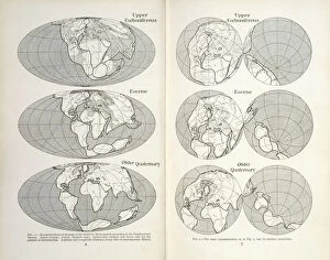
Background imageMap Collection: Continental drift maps

Continental drift maps
Reconstruction of the map of the world for three periods according to the Displacement Theory. Figs 1-2 from The Origin of Continents and Oceans (1924) by Alfred Wegener
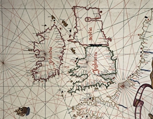
Background imageMap Collection: Spanish map of England, Scotland and Ireland

Spanish map of England, Scotland and Ireland
A Spanish map of England, Scotland and Ireland and the coast of northern France from the time of the Anglo Spanish War. Joan Martines (1556-1591). Date: 1587

Background imageMap Collection: Map / Britain / Scotland

Map / Britain / Scotland
A map of Scotland 1817

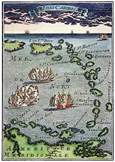
Background imageMap Collection: CARIBBEAN MAP. A map of the Caribbean islands: woodcut, French, c. 1688

CARIBBEAN MAP. A map of the Caribbean islands: woodcut, French, c. 1688

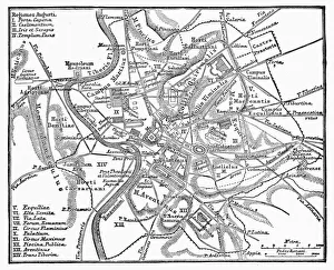
Background imageMap Collection: ROMAN EMPIRE: MAP OF ROME. Plan of Rome at the time of Augustus, first Roman emperor, 27 B. C

ROMAN EMPIRE: MAP OF ROME. Plan of Rome at the time of Augustus, first Roman emperor, 27 B. C. -14 A. D
ROMAN EMPIRE: MAP OF ROME. Plan of Rome at the time of Augustus, first Roman emperor, 27 B.C.-14 A.D

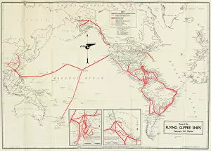
Background imageMap Collection: Pan American Airways route map

Pan American Airways route map
Pan American Airways System global route map of the Flying Clipper Ships (passengers, mail, express). circa 1938

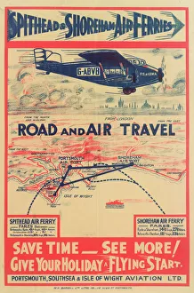
Background imageMap Collection: Spithead & Shoreham Air Ferries Poster

Spithead & Shoreham Air Ferries Poster
Poster, Spithead & Shoreham Air Ferries, showing a passenger plane G-ABVB above a map of the south coast. Save time, see more, give your holiday a flying start

Background imageMap Collection: Coggeshall, Essex

Coggeshall, Essex
Map of Coggeshall, Essex, by John Agas, 21 May 1619 Date: 21st May 1619

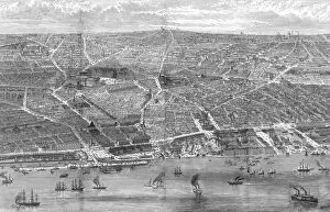
Background imageMap Collection: Liverpool birds eye view, 1886

Liverpool birds eye view, 1886
A magnificent birds eye view of Liverpool from the Mersey in 1886, showing the then-new public buildings, at the time of Queen Victorias visit to the Liverpool Exhibition

Background imageMap Collection: MAP OF EUROPE, 12th CENTURY. A 19th century map of Europe as it was politically constituted in

MAP OF EUROPE, 12th CENTURY. A 19th century map of Europe as it was politically constituted in the 12th century

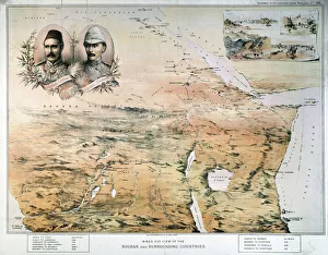
Background imageMap Collection: AFRICA: MAP. Birds eye view of the Sudan and surrounding countries

AFRICA: MAP. Birds eye view of the Sudan and surrounding countries. English lithograph map, 1884, of north, central, and east Africa

Background imageMap Collection: CANTINO WORLD MAP, 1502. Western half of the Cantino map of the world

CANTINO WORLD MAP, 1502. Western half of the Cantino map of the world, 1502, showing (at left) the Tordesillas Treaty demarcation line of 1494 which divided the non-Christian (i.e)

Background imageMap Collection: MAP OF AFRICA from the 1595 edition of Abraham Ortelius atlas Theatrum Orbis Terrarum

MAP OF AFRICA from the 1595 edition of Abraham Ortelius atlas Theatrum Orbis Terrarum
MAP OF AFRICA from the 1595 edition of Abraham Ortelius atlas " Theatrum Orbis Terrarum."

Background imageMap Collection: BERING STRAIT MAP, 1593. Cornelis de Jodes 1593 map of Western North America showing the fabled

BERING STRAIT MAP, 1593. Cornelis de Jodes 1593 map of Western North America showing the fabled province of Quivira in California and the Bering Strait (El Streto de Anian)

Background imageMap Collection: ICELAND: MAP, 1595. Map of Iceland from a 1595 edition of Abraham Ortelius atlas Theatrum

ICELAND: MAP, 1595. Map of Iceland from a 1595 edition of Abraham Ortelius atlas Theatrum Orbis Terrarum

Background imageMap Collection: ST. BRENDAN: MASS. St. Brendan and his monks celebrate Mass on the back of a whale

ST. BRENDAN: MASS. St. Brendan and his monks celebrate Mass on the back of a whale. Color engraving after a medieval illumination

Background imageMap Collection: TENOCHTITLAN (MEXICO CITY). Mexico City at the time of the Spanish Conquest

TENOCHTITLAN (MEXICO CITY). Mexico City at the time of the Spanish Conquest: colored woodcut from the Latin edition of Cortes Second Letter, Nuremberg, 1524

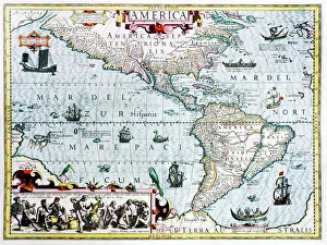
Background imageMap Collection: 17th century map of the New World

17th century map of the New World
Western Hemisphere, 17th century Dutch map. This shows the New World that was being discovered by Europeans exploring the Western Hemisphere of the Earth

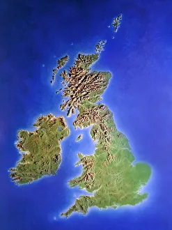
Background imageMap Collection: Relief map of the United Kingdom and Eire

Relief map of the United Kingdom and Eire, lit from the east

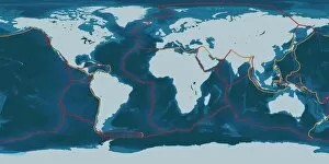
Background imageMap Collection: Earths tectonic plates

Earths tectonic plates. Global map showing the boundaries of the tectonic plates that make up the Earths crust. The eight major plates are the: African Plate, Antarctic Plate, Indian Plate

Background imageMap Collection: Continental drift, 100 million years ago

Continental drift, 100 million years ago. Map of the Earth showing the continents some 100 million years after the start of the break-up of the ancient supercontinent of Pangea

Background imageMap Collection: PROY2A-00017

PROY2A-00017
Map of Europe in the time of Charlemagne, 768-814 AD. Printed color lithograph, 19th century

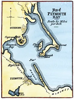
Background imageMap Collection: Map of Plymouth Bay, Massachusetts

Map of Plymouth Bay, Massachusetts
Plymouth Bay on the northern coast of Cape Cod, Massachusetts. Hand colored woodcut of a 19th-century illustration

Background imageMap Collection: East Jersey and West Jersey

East Jersey and West Jersey
Map of colonial East and West Jersey, late 1600s. Hand-colored woodcut of a 19th-century illustration

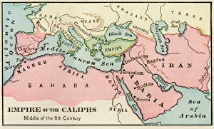
Background imageMap Collection: Arab empire, mid-700s

Arab empire, mid-700s
Empire of the Arab Caliphs, middle of the 8th century. Printed color lithograph

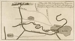
Background imageMap Collection: Bridgewater Canal Map

Bridgewater Canal Map
Map showing the route of the proposed canal from Worsley to Manchester and thence to the Mersey, to be built by engineer James Brindley for the duke of Bridgewater

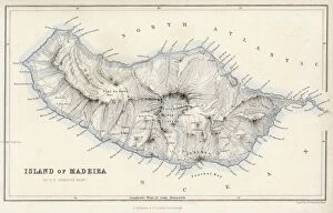
Background imageMap Collection: Map / Europe / Madeira 19C

Map / Europe / Madeira 19C
Map of Madeira

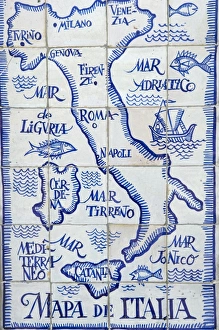
Background imageMap Collection: Map of Italy and the Mediterranean made out of ceramic tiles on a street in Seville

Map of Italy and the Mediterranean made out of ceramic tiles on a street in Seville, Spain

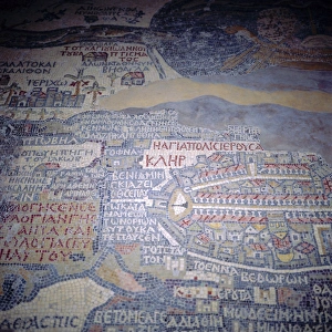
Background imageMap Collection: Madaba Mosaic Map, 6th century AD, detail showing Jerusalem, Madaba, Jordan

Madaba Mosaic Map, 6th century AD, detail showing Jerusalem, Madaba, Jordan, Middle East " The mosaic represents the biblical land from Egypt to Lebanon including Sinai, Israel

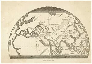
Background imageMap Collection: Marco Polo / Map

Marco Polo / Map
A map tracing the journeys made by Marco Polo

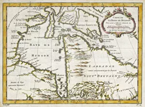
Background imageMap Collection: Hudsons Bay Map

Hudsons Bay Map
HUDSONs BAY, at the time of the Seven Years War, showing French and English forts including Fort York, the principal settlement of the Hudsons Bay Company

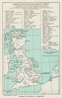
Background imageMap Collection: VIKING MAP

VIKING MAP
A map showing the Viking names for places in Britain

Background imageMap Collection: Lorgues / Caribbean Map

Lorgues / Caribbean Map
A map showing the travels of Columbus in the Caribbean

Background imageMap Collection: Atlantis / Map

Atlantis / Map
Map showing Atlantis during the period of its greatest prosperity

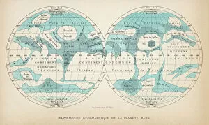
Background imageMap Collection: French map of the planet Mars

French map of the planet Mars
A French map of the planet Mars, showing two views

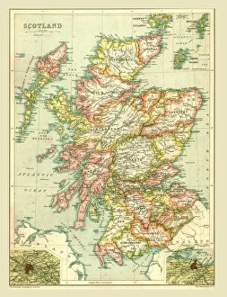
Background imageMap Collection: Map of Scotland, 1902. Creator: Unknown

Map of Scotland, 1902. Creator: Unknown
Map of Scotland, 1902. Showing the various counties and islands including the Hebrides, the Shetlands and the Orkneys, and an inset of the rail networks of Glasgow and Edinburgh

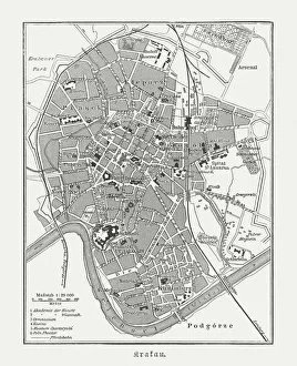
Background imageMap Collection: Historical city map of Krakow, Poland, wood engraving, published 1897

Historical city map of Krakow, Poland, wood engraving, published 1897
Historical city map of Krakow, Poland. Wood engraving, published in 1897

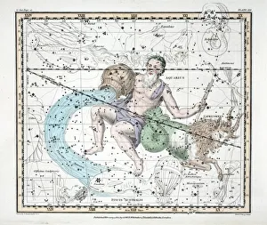
Background imageMap Collection: The Constellations (Plate XXI) Capricorn and Aquarius, from A Celestial Atlas by Alexander Jamieson

The Constellations (Plate XXI) Capricorn and Aquarius, from A Celestial Atlas by Alexander Jamieson, pub. London 1822 (hand coloured engraving). Tenth and eleventh Sign of the Zodiac

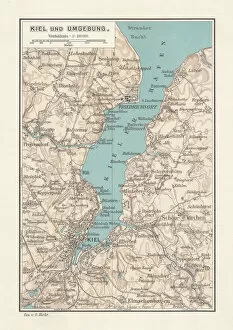
Background imageMap Collection: Map of Kiel, capital of Schleswig-Holstein, Germany, lithograph, published 1887

Map of Kiel, capital of Schleswig-Holstein, Germany, lithograph, published 1887
Map of Kiel and surroundings, capital and most populous city in the northern German state of Schleswig-Holstein. Lithograph, published in 1887

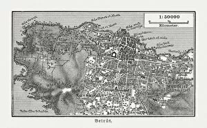
Background imageMap Collection: Historic city map of Beirut, Lebanon, wood engraving, published 1897

Historic city map of Beirut, Lebanon, wood engraving, published 1897
Historic city map of Beirut - capital and largest city of Lebanon. Wood engraving, published in 1897

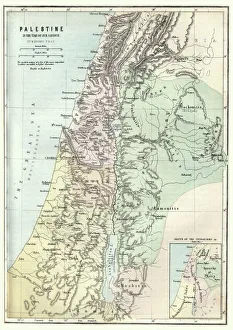
Background imageMap Collection: Map of Palestine in the time of Jesus Christ

Map of Palestine in the time of Jesus Christ
Vintage engraving of Map of Palestine in the time of Jesus Christ

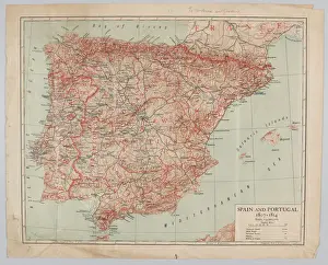
Background imageMap Collection: Map - Spain and Portugal, 1807-1814

Map - Spain and Portugal, 1807-1814
Spain and Portugal, 1807-1814. From a collection of maps relevant to campaigns between 1794-1815. From the collection of the former Buffs Regimental Museum

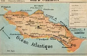
Background imageMap Collection: Ile d Oleron - off the French Atlantic Coast

Ile d Oleron - off the French Atlantic Coast
Ile d Oleron - an island off the Atlantic coast of France, on the southern side of the Pertuis d Antioche strait. It is the second largest island of Metropolitan France, after Corsica

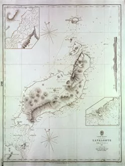
Background imageMap Collection: Map of Lanzarote, Canary Islands

Map of Lanzarote, Canary Islands, with soundings in fathoms. Date: 1835

Background imageMap Collection: Sydney, Australia - Map of Sydney and Port Jackson

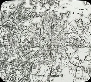
Sydney, Australia - Map of Sydney and Port Jackson
Slide showing a map of Sydney and Port Jackson, with the areas of the city labelled.. Boswell Collection. Slide number 5. Sydney is the most populous city in Australia

Background imageMap Collection: Card commemorating Graf Spee destruction, WW2

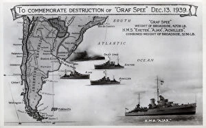
Card commemorating Graf Spee destruction, WW2
Card commemorating the destruction of the German cruiser, Admiral Graf Spee, on 13 December 1939 by HMS Exeter, Ajax and Achilles following the Battle of the River Plate. Date: 1939

Background imageMap Collection: Coal mining by G. H. Davis

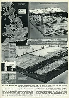
Coal mining by G. H. Davis
Coal mine working and outcrop production: how coal, so vital to every form of war industry, can be won from opencast veins at shallow depths. Date: 1944

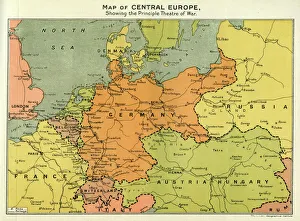
Background imageMap Collection: Map of Central Europe, World War One

Map of Central Europe, World War One
Map of Central Europe in World War One, showing the Principal Theatre of War. Date: World War One


All Professionally Made to Order for Quick Shipping

"Journey through Time and Space: Exploring the World of Maps" Maps have been an essential tool for centuries, guiding us through uncharted territories and helping us understand our world. From the Thirteen original colonies in 1776 to William Smith's groundbreaking Geological Map, these visual representations have shaped our understanding of geography, history, and even ourselves. Step onto a Reflexology foot map, where every pressure point tells a story about our well-being. Or immerse yourself in the intricate details of Richard de Bello's masterpiece - The Hereford Mappa Mundi (c1285), a medieval treasure that showcases both geographical knowledge and artistic finesse. Travel back in time with antique maps like the Roman Empire or Britain under the Anglo Saxons; they offer glimpses into ancient civilizations that once thrived. And let's not forget the Falkland Islands Royal Engineer briefing map from 1982, reminding us how maps play crucial roles during times of conflict. Delve into Al-Idrisi's world map from 1154 or explore GWR Network Map from c1920s - each capturing different eras' perspectives on global connectivity. Swindon Works Map from c1940s takes you behind-the-scenes of industrial revolution marvels. Finally, lose yourself in a mesmerizing journey across Ancient Greece as you trace your finger along its contours on an old parchment-like map. Discover mythical lands and legendary tales that still resonate today, and are more than just navigational aids; they are gateways to exploration and understanding. They tell stories of triumphs, discoveries, cultures lost to time but preserved within their lines. So next time you unfold a map or scroll through digital coordinates (like EXPL2A-00352), remember that you hold much more than directions – you hold pieces of history waiting to be explored anew.