Fraud Blocker Skip to main content

Map Collection (page 8)

"Journey through Time and Space: Exploring the World of Maps" Maps have been an essential tool for centuries

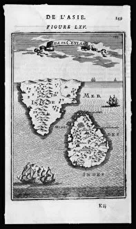
Background imageMap Collection: Map / Asia / Sri Lanka 1719

Map / Asia / Sri Lanka 1719
ISLE DE CEYLAN and southern India

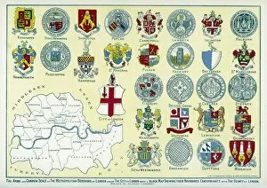
Background imageMap Collection: London arms and seals

London arms and seals
The Arms and Common Seals of the Metropolitan Boroughs of London and of the City of London, with a block map showing their boundaries

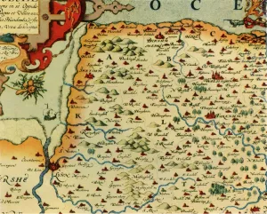
Background imageMap Collection: Saxtons Map of Norfolk, 1574, (1944). Creator: Christopher Saxton
Saxtons Map of Norfolk, 1574, (1944). Creator: Christopher Saxton
Saxtons Map of Norfolk, 1574, (1944). Detail of the county of Norfolk, showing rivers, towns and villages, and a ship in The Wash

Background imageMap Collection: Antique map, Isle of Man 19th Century

Antique map, Isle of Man 19th Century
Vintage engraving of a Isle of Man 19th Century with detail of Douglas

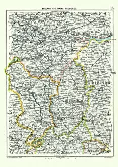
Background imageMap Collection: Antique map, West Yorkshire, Derby, Nottingham, Lincoln, 19th Century

Antique map, West Yorkshire, Derby, Nottingham, Lincoln, 19th Century
Vintage engraving of a Antique map, West Yorkshire, Derby, Nottingham, Lincoln, Stafford, Leicester, Rutland, England. 19th Century

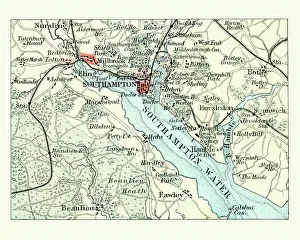
Background imageMap Collection: Antique map, Southampton, England, 19th Century

Antique map, Southampton, England, 19th Century
Vintage engraving of a Antique map Southampton, , England, 19th Century

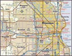
Background imageMap Collection: Milwaukee, Wisconsin Area Street Map

Milwaukee, Wisconsin Area Street Map

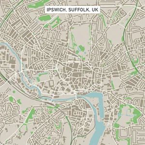
Background imageMap Collection: Ipswich Suffolk UK City Street Map

Ipswich Suffolk UK City Street Map
Vector Illustration of a City Street Map of Ipswich, Suffolk, UK. Included files are EPS (v10) and Hi-Res JPG. Data courtesy from Ordnance Survey: VectorMap District https

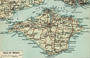
Background imageMap Collection: Isle of Wight. c20th Century. Artist: John Bartholomew

Isle of Wight. c20th Century. Artist: John Bartholomew
Isle of Wight. c20th Century. [John Bartholomew & Son, Edinburgh]

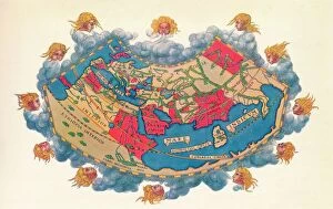
Background imageMap Collection: Ptolemys Map of the World cA. D 150. (1912) Artist: Claudius Ptolemy

Ptolemys Map of the World cA. D 150. (1912) Artist: Claudius Ptolemy
Ptolemys Map of the World cA.D 150. The Ptolemy world map is a map of the known world to Hellenistic society in the 2nd century AD

Background imageMap Collection: Antique map of Ancient Greece

Antique map of Ancient Greece

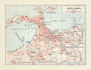
Background imageMap Collection: City map of Alexandria, Egypt, lithograph, published in 1897

City map of Alexandria, Egypt, lithograph, published in 1897
City map of Alexandria, Egypt. Lithograph, published in 1897

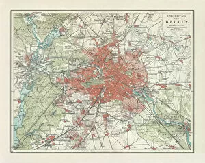
Background imageMap Collection: City map of Berlin and surrounding, Germany, lithograph, published 1897

City map of Berlin and surrounding, Germany, lithograph, published 1897
City map of Berlin and surrounding, capital of Germany. Lithograph, published in 1897

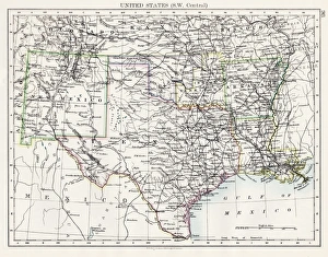
Background imageMap Collection: United States South West Central map 1897

United States South West Central map 1897
The World-Wide Atlas of Modern Geography, Political and Physical W. & A.K. Johnston - London 1897

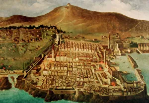
Background imageMap Collection: Dubrovnik. Map of the city before the earthquake of 1667

Dubrovnik. Map of the city before the earthquake of 1667. Croatia

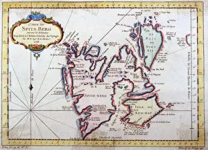
Background imageMap Collection: Map of Spitsbergen, Norway

Map of Spitsbergen, Norway
Map of Spitsbergen, Svalbard, Norway Date: 1758

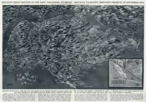
Background imageMap Collection: Singapore, bastion in the East, by G. H. Davis

Singapore, bastion in the East, by G. H. Davis
Britains great bastion in the East: Singapore, stubborn obstacle to Japans ambitious projects in Southern Asia during the Second World War

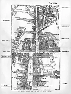
Background imageMap Collection: Map of the St. Jamess & Bond Street areas of London

Map of the St. Jamess & Bond Street areas of London
A map of the St. Jamess and Bond Street areas of London, with a number of key landmarks annotated including the famous gentlemens clubs of St

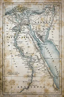
Background imageMap Collection: Map of Egypt

Map of Egypt
Illustration of a Map of Egypt

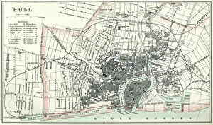
Background imageMap Collection: Map of Hull

Map of Hull
Vintage map from 1880 of Hull in the East Riding of Yorkshire, England. The city of Hull has served as market town, military supply port, trading hub, fishing and whaling centre

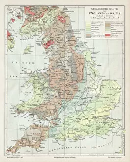
Background imageMap Collection: England and wales map 1895

England and wales map 1895
Meyers Konversations-Lexikon. Ein Nachschlagewerk des allgemeinen Wissens, 5th edition 17 volumes Bibliographisches Institut - Leipzig 1895-1897

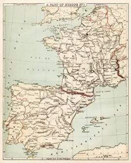
Background imageMap Collection: Map of Spain and France 1869

Map of Spain and France 1869
Cornells Grammars-School Geography - S.S. Cornell - New York D. Appleton and Company 1869

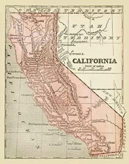
Background imageMap Collection: Old map of California 1855

Old map of California 1855
System of Geography for the use of schools by Sidney E. Morse - Published by Harper & Brothers - New York 1855

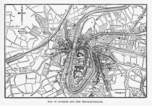
Background imageMap Collection: Map of the City of Durham, England Victorian Engraving, 1840

Map of the City of Durham, England Victorian Engraving, 1840
Very Rare, Beautifully Illustrated Antique Engraving of Map of the City of Durham, England Victorian Engraving, 1840. Source: Original edition from my own archives

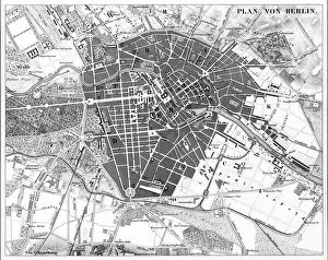
Background imageMap Collection: Berlin, Germany Map

Berlin, Germany Map
Engraved illustrations of a Map of the City of Berlin, Germany from Iconographic Encyclopedia of Science, Literature and Art, Published in 1851. Copyright has expired on this artwork

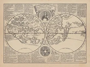
Background imageMap Collection: World map by Martin Behaim, 1492, wood engraving, published 1884

World map by Martin Behaim, 1492, wood engraving, published 1884
World map by Martin Behaim, 1492. Woodcut engraving from my archive, published in 1884

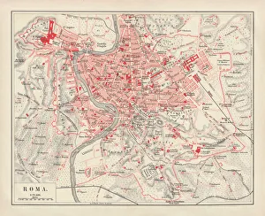
Background imageMap Collection: City map of Rome, lithograph, published in 1878

City map of Rome, lithograph, published in 1878
City map of Rome, Italy. Lithograph, published in 1878

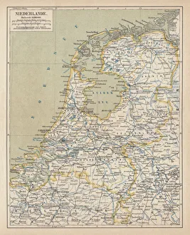
Background imageMap Collection: Map of the Netherlands, lithograph, published in 1877

Map of the Netherlands, lithograph, published in 1877
Map of the Netherlands. Lithograph, published in 1877

Background imageMap Collection: Antique map of Ancient Greece

Antique map of Ancient Greece, 1864

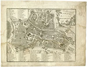
Background imageMap Collection: 17th century city, plan of Augsburg, Germany

17th century city, plan of Augsburg, Germany
Typical fortifications and references. Rich in details, beautifully aged paperPublished by J. Stockdale, Piccadilly 1800

Background imageMap Collection: Map of Berlin 1895

Map of Berlin 1895
Map of Berlin (surroundings), Germany

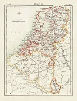
Background imageMap Collection: Holland map 1881

Holland map 1881
Encyclopedia Britannica 9th Edition Vol XII Philadelphia j.M. Stoddart & Co 1881

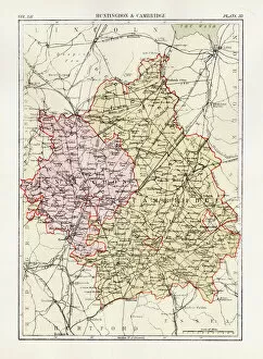
Background imageMap Collection: Huntingdon and Cambridge map 1881

Huntingdon and Cambridge map 1881
Encyclopedia Britannica 9th Edition Vol XII Philadelphia j.M. Stoddart & Co 1881

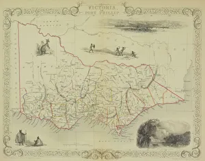
Background imageMap Collection: Antique map of Victoria or Port Phillip in Australia with vignettes

Antique map of Victoria or Port Phillip in Australia with vignettes

Background imageMap Collection: Antique map of Russia

Antique map of Russia

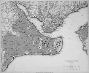
Background imageMap Collection: Antique map of Constantinople, present day Istanbul

Antique map of Constantinople, present day Istanbul

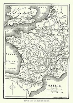
Background imageMap Collection: Map of Ancient Gaul (France)

Map of Ancient Gaul (France)
Vintage engraving of a Map of Ancient Gaul (France)

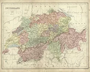
Background imageMap Collection: Antique map of Switzerland in the 19th Century

Antique map of Switzerland in the 19th Century, 1873

Background imageMap Collection: Map of Scandinavia

Map of Scandinavia

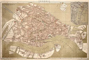
Background imageMap Collection: Map of Venice 1898

Map of Venice 1898
Antique illustration of a Map of Venice 1898

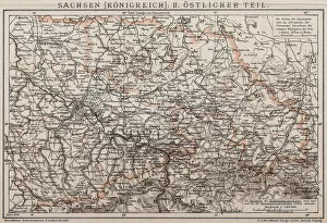
Background imageMap Collection: Kingdom of Saxony, Eastern part

Kingdom of Saxony, Eastern part
Antique illustration of a Kingdom of Saxony, Eastern part

Background imageMap Collection: Buenos Aires map

Buenos Aires map
Antique engraving map of Buenos Aires

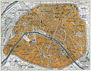
Background imageMap Collection: City map of Paris

City map of Paris
Antique illustration of a City map of Paris

Background imageMap Collection: Taste map of a human tongue, light green area sensitive to bitter taste

Taste map of a human tongue, light green area sensitive to bitter taste, yellow areas sensitive to sour taste, blue areas sensitive to salt taste, purple area sensitive to sweet taste

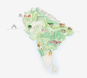
Background imageMap Collection: Illustrated map of India showing ancient Mauryan empire

Illustrated map of India showing ancient Mauryan empire

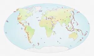
Background imageMap Collection: Illustration of world map showing sites of volcanic activity

Illustration of world map showing sites of volcanic activity

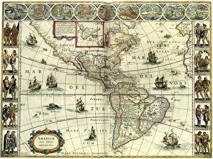
Background imageMap Collection: MAP: AMERICAS, c1630. A map of North and South America created by Dutch cartographer

MAP: AMERICAS, c1630. A map of North and South America created by Dutch cartographer and atlas maker Willem Blaeu. Map, c1630

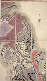
Background imageMap Collection: First geological map of Britain, 1815 C016 / 5683

First geological map of Britain, 1815 C016 / 5683
First geological map of Britain, detail of the north east coast (figure 8). This map was published in 1815 by British geologist William Smith (1769-1839)


All Professionally Made to Order for Quick Shipping

"Journey through Time and Space: Exploring the World of Maps" Maps have been an essential tool for centuries, guiding us through uncharted territories and helping us understand our world. From the Thirteen original colonies in 1776 to William Smith's groundbreaking Geological Map, these visual representations have shaped our understanding of geography, history, and even ourselves. Step onto a Reflexology foot map, where every pressure point tells a story about our well-being. Or immerse yourself in the intricate details of Richard de Bello's masterpiece - The Hereford Mappa Mundi (c1285), a medieval treasure that showcases both geographical knowledge and artistic finesse. Travel back in time with antique maps like the Roman Empire or Britain under the Anglo Saxons; they offer glimpses into ancient civilizations that once thrived. And let's not forget the Falkland Islands Royal Engineer briefing map from 1982, reminding us how maps play crucial roles during times of conflict. Delve into Al-Idrisi's world map from 1154 or explore GWR Network Map from c1920s - each capturing different eras' perspectives on global connectivity. Swindon Works Map from c1940s takes you behind-the-scenes of industrial revolution marvels. Finally, lose yourself in a mesmerizing journey across Ancient Greece as you trace your finger along its contours on an old parchment-like map. Discover mythical lands and legendary tales that still resonate today, and are more than just navigational aids; they are gateways to exploration and understanding. They tell stories of triumphs, discoveries, cultures lost to time but preserved within their lines. So next time you unfold a map or scroll through digital coordinates (like EXPL2A-00352), remember that you hold much more than directions – you hold pieces of history waiting to be explored anew.