Fraud Blocker Skip to main content

Map Collection (page 3)

"Journey through Time and Space: Exploring the World of Maps" Maps have been an essential tool for centuries

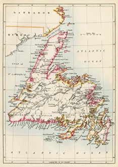
Background imageMap Collection: Newfoundland, 1870s

Newfoundland, 1870s
Map of Newfoundland, Canada, 1870s. Printed color lithograph
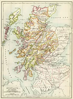
Background imageMap Collection: GGBR2A-00076

GGBR2A-00076
Map of Scotland in the 1520s, showing territories of the Highland Clans. Printed color lithograph of a 19th century illustration

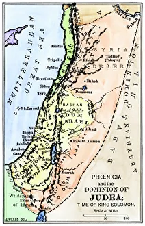
Background imageMap Collection: Map of ancient Palestine kingdoms of Judah and Israel

Map of ancient Palestine kingdoms of Judah and Israel
Map of Phoenicia and Judea in the time of King Solomon, 10th century BC. Hand-colored woodcut of a 19th-century illustration

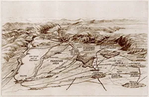
Background imageMap Collection: Partition. Map of East and West Punjab

Partition. Map of East and West Punjab
The areas of the Western and Eastern Punjab where there were many outbreaks of violence between Muslims, Sikhs and Hindus following Partition and the creation of modern India and Pakistan

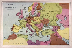
Background imageMap Collection: Europe Map C1918

Europe Map C1918
The map of Europe after World War One

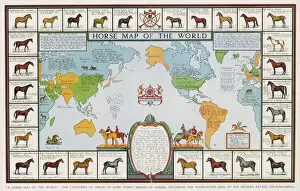
Background imageMap Collection: Horse Map of World 1936

Horse Map of World 1936
Horse map of the world, showing different breeds

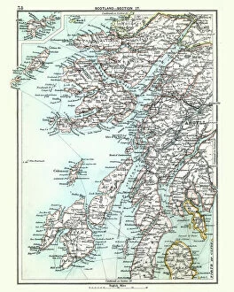
Background imageMap Collection: Antique map, Scotland, Jura, Mull, Argyll, Islay 19th Century

Antique map, Scotland, Jura, Mull, Argyll, Islay 19th Century
Vintage engraving of a Antique map, Scotland, Jura, Mull, Argyll, Islay 19th Century

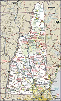
Background imageMap Collection: New Hampshire Highway Map

New Hampshire Highway Map
Reference Maps, Top Sellers Art Prints, 103312572

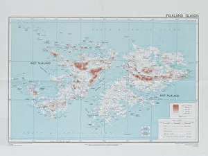
Background imageMap Collection: Falklands War - 1982

Falklands War - 1982
Directorate of Overseas Surveys map of the Falklands Islands, 1983 (c). One of four maps of the Falkland Islands, 1982 (c)-1984 (c)

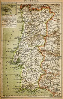
Background imageMap Collection: Map of Portugal

Map of Portugal
Antique illustration engraving map og Portugal

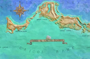
Background imageMap Collection: Caribbean, TURKS & CAICOS-Providenciales island-Grace Bay: Mural Map of Turks

Caribbean, TURKS & CAICOS-Providenciales island-Grace Bay: Mural Map of Turks
Caribbean, Turks and Caicos, Providenciales Island, Grace Bay: Mural Map of Turks & Caicos Islands

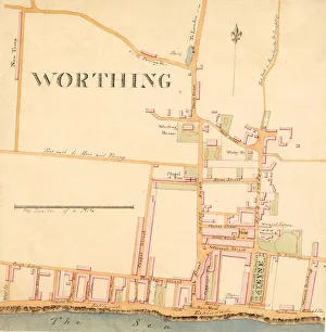
Background imageMap Collection: Street Plan of Worthing c1830

Street Plan of Worthing c1830
Shows Warwick House and gardens, Wortley House, Marine Library, Sea House Hotel, and New Town (built c1820s on what is now Clifton Road)

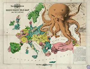
Background imageMap Collection: Serio-comic war map for the year 1877

Serio-comic war map for the year 1877

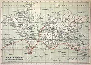
Background imageMap Collection: Map Darwins Beagle Voyage South America

Map Darwins Beagle Voyage South America
Map of the World with Voyage of the Beagle coloured in red. Appendix from " The Voyage of HMS Beagle" by Charles Darwin (Cover Title) New Edition 1890 John Murray Publishers

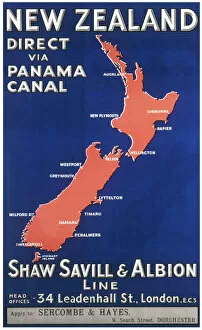
Background imageMap Collection: New Zealand travel poster

New Zealand travel poster
Poster produced by the Shaw, Saville and Albion Line advertising their passenger liners to New Zealand via the Panama Canal

Background imageMap Collection: Map of Caribbean

Map of Caribbean
The Caribbean, with the West Indies, and the coasts of the United States and the Spanish possessions which later became Texas and Mexico, and the northern coast of S. America

Background imageMap Collection: Map / Asia / India C1870

Map / Asia / India C1870
India, showing the various Presidencies under British rule

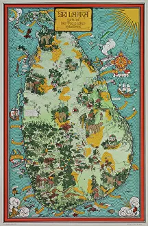
Background imageMap Collection: Sri Lanka - Ceylon. Her tea and other industries

Sri Lanka - Ceylon. Her tea and other industries
A larger version of this uncommon pictorial poster map was originally published by the Ceylon Tea Propaganda Board in 1933

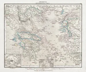
Background imageMap Collection: Greece at the beginning of the Peloponnesian War (431-404 BC)

Greece at the beginning of the Peloponnesian War (431-404 BC)
Antique Map of Greece at the beginning of the Peloponnesian War (431 - 404 BC) with the different tribal groups. Steel engraving with hand colored borderlines, published in 1861

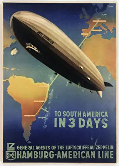
Background imageMap Collection: Poster, Zeppelin to South America

Poster, Zeppelin to South America
Poster advertising the German Zeppelin Hamburg-American Line, LZ 127 Graf Zeppelin airship service from Friedrichshafen, Germany, to Buenos Aires, Argentina. circa 1934

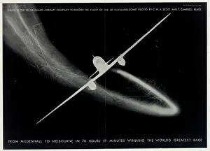
Background imageMap Collection: De Havilland Aircraft Company Poster

De Havilland Aircraft Company Poster
Poster, De Havilland Aircraft Company, From Mildenhall to Melbourne in 70 Hours 59 Minutes winning the Worlds Greatest Race

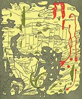
Background imageMap Collection: Anglo-Saxon 10th century world map

Anglo-Saxon 10th century world map
Anglo-Saxon world map, dating from the 10th century. East is top. This map of the known world was probably produced by an Irish monk

Background imageMap Collection: British Empire world map, 19th century

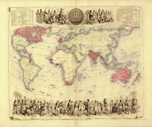
British Empire world map, 19th century
British Empire world map. This world map shows the 19th-century British Empire (pink) and its indigenous peoples. Five illustrations (clockwise from upper left) show the people of Australia

Background imageMap Collection: Avebury / Stukeley Map

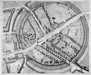
Avebury / Stukeley Map
A beautifully drawn overhead plan of the stone circles and embankment ditches at Avebury. Stukeleys accuracy is impressive, charting every stone, pasture and building

Background imageMap Collection: Map of South East England, Hampshire, Dorset, Wiltshire 1891

Map of South East England, Hampshire, Dorset, Wiltshire 1891
Antique Map of Map of South East England, showing Hampshire, Dorset, Wiltshire, and the Isle of Wight 1891

Background imageMap Collection: Roman Republic and Carthage during the Second Punic War (218-201-BC)

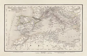
Roman Republic and Carthage during the Second Punic War (218-201-BC)
Ancient map of the Roman Republic and Carthage during the Second Punic War (218 to 201 BC). Legend in Latin language. Steel engraving with hand colored borderlines, published in 1861

Background imageMap Collection: Antique colored illustrations: Geological map of England and Wales

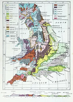
Antique colored illustrations: Geological map of England and Wales

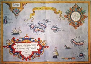
Background imageMap Collection: AZORES MAP, c1584. Engraved map by Abraham Ortelius

AZORES MAP, c1584. Engraved map by Abraham Ortelius

Background imageMap Collection: PLYMOUTH, MA, MAP 1605. Samuel de Champlains map of Port St. Louis

PLYMOUTH, MA, MAP 1605. Samuel de Champlains map of Port St. Louis, later settled by the English as Plymouth, Massachusetts, drawn during an expedetion of 1605

Background imageMap Collection: MAP OF FRANCE, c1900. With inset detail of Paris and surrounding area

MAP OF FRANCE, c1900. With inset detail of Paris and surrounding area

Background imageMap Collection: 17th century world map

17th century world map
World map, published around 1664 in Amsterdam, the Netherlands, by Dutch mapmaker Joan Blaeu (c.1599- 1673). The Latin title is Nova et Accuratissima Totius Terrarum Orbis Tabula

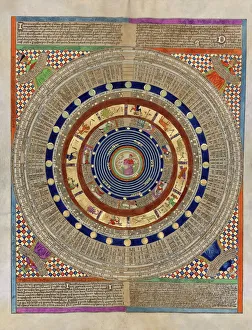
Background imageMap Collection: Catalan Atlas, 14th century

Catalan Atlas, 14th century. The 6-page Catalan Atlas (1375) was produced on vellum by the Jewish cartographer Abraham Cresques

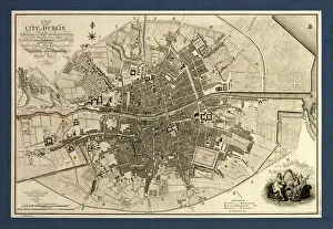
Background imageMap Collection: Map of the City of Dublin, 1797

Map of the City of Dublin, 1797
Map of the City of Dublin, Ireland. Published in 1797, this map includes details of the canals being built at the time. Canal Harbour (lower right)

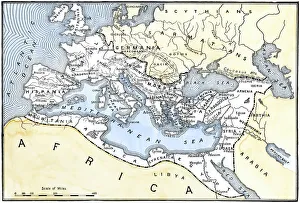
Background imageMap Collection: Map of the Roman Empire

Map of the Roman Empire
Map showing the extent of the Roman Empire. Hand-colored woodcut of a 19th-century illustration

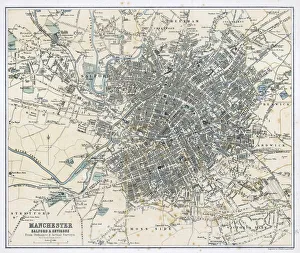
Background imageMap Collection: Map / Manchester 1878

Map / Manchester 1878
Map of Manchester and its environs

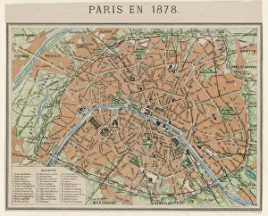
Background imageMap Collection: Street Map 1878

Street Map 1878
An aerial map of Paris, showing the important monuments and the Seine

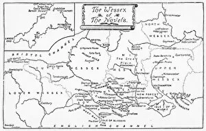
Background imageMap Collection: Map of Wessex

Map of Wessex
A map of the Wessex of the novels

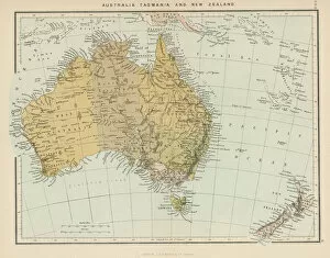
Background imageMap Collection: Maps / Australia / New Zea

Maps / Australia / New Zea
Map showing Australia, Tasmania, New Zealand and neighbouring islands

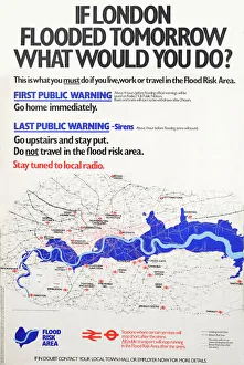
Background imageMap Collection: If London flooded tomorrow, what would you do?

If London flooded tomorrow, what would you do?
Text with map of London, showing Flood Risk Area, and underground and railway lines. If London flooded tomorrow, what would you do

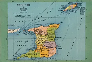
Background imageMap Collection: Trinidad & Tobago Map, c1940s. Creator: Unknown

Trinidad & Tobago Map, c1940s. Creator: Unknown
Trinidad & Tobago Map, c1940s. From " Trinidad - British West Indies, Land of the Humming Bird". [Tichnor Quality Views, Boston]

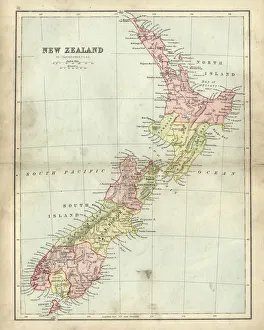
Background imageMap Collection: Antique map of New Zealand in the 19th Century, 1873

Antique map of New Zealand in the 19th Century, 1873
Vintage engraving of a Antique map of New Zealand in the 19th Century, 1873

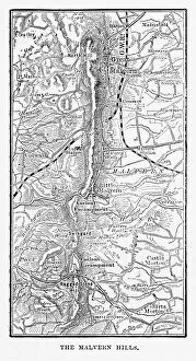
Background imageMap Collection: Map of Malvern Hills in Worcestershire, England Victorian Engraving, 1840

Map of Malvern Hills in Worcestershire, England Victorian Engraving, 1840
Very Rare, Beautifully Illustrated Antique Engraving of Map of Malvern Hills in Worcestershire, England Victorian Engraving, 1840. Source: Original edition from my own archives

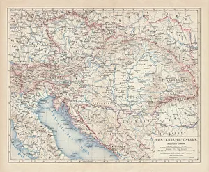
Background imageMap Collection: Austro-Hungarian Empire, Habsburg Monarchy, lithograph, published in 1877

Austro-Hungarian Empire, Habsburg Monarchy, lithograph, published in 1877
Ancient map of Austro-Hungarian Empire. Habsburg Monarchy. Lithograph, published in 1877

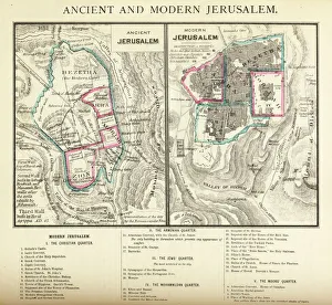
Background imageMap Collection: Ancient and Modern Jerusalem Map Engraving

Ancient and Modern Jerusalem Map Engraving
Engraved illustration of Ancient and Modern Jerusalem Map Engraving from The Popular Pictorial Bible, Containing the Old and New Testaments, Published in 1862. Copyright has expired on this artwork

Background imageMap Collection: Scotland map 1875

Scotland map 1875
The Independent Course Comprehensive Geography by James Monteith, A.S. Barnes & Co, New York & Chicago 1875

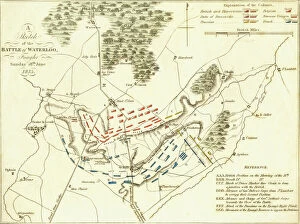
Background imageMap Collection: Battle Of Waterloo

Battle Of Waterloo
A plan of the Battle of Waterloo in present-day Belgium during the Napoleonic Wars, 18th June 1815. Here an Anglo-Allied army under the command of the Duke of Wellington defeated the Imperial French

Background imageMap Collection: Map of Ancient Egypt

Map of Ancient Egypt. Date: 1814

Background imageMap Collection: Oldest map of Palestine, mosaic, dated AD 560, St. Georges Church, Madaba, Jordan

Oldest map of Palestine, mosaic, dated AD 560, St. Georges Church, Madaba, Jordan, Middle East


All Professionally Made to Order for Quick Shipping

"Journey through Time and Space: Exploring the World of Maps" Maps have been an essential tool for centuries, guiding us through uncharted territories and helping us understand our world. From the Thirteen original colonies in 1776 to William Smith's groundbreaking Geological Map, these visual representations have shaped our understanding of geography, history, and even ourselves. Step onto a Reflexology foot map, where every pressure point tells a story about our well-being. Or immerse yourself in the intricate details of Richard de Bello's masterpiece - The Hereford Mappa Mundi (c1285), a medieval treasure that showcases both geographical knowledge and artistic finesse. Travel back in time with antique maps like the Roman Empire or Britain under the Anglo Saxons; they offer glimpses into ancient civilizations that once thrived. And let's not forget the Falkland Islands Royal Engineer briefing map from 1982, reminding us how maps play crucial roles during times of conflict. Delve into Al-Idrisi's world map from 1154 or explore GWR Network Map from c1920s - each capturing different eras' perspectives on global connectivity. Swindon Works Map from c1940s takes you behind-the-scenes of industrial revolution marvels. Finally, lose yourself in a mesmerizing journey across Ancient Greece as you trace your finger along its contours on an old parchment-like map. Discover mythical lands and legendary tales that still resonate today, and are more than just navigational aids; they are gateways to exploration and understanding. They tell stories of triumphs, discoveries, cultures lost to time but preserved within their lines. So next time you unfold a map or scroll through digital coordinates (like EXPL2A-00352), remember that you hold much more than directions – you hold pieces of history waiting to be explored anew.