Fraud Blocker Skip to main content

Map Collection (page 5)

"Journey through Time and Space: Exploring the World of Maps" Maps have been an essential tool for centuries

Background imageMap Collection: Dante / Map of Paradise

Dante / Map of Paradise
Schematic plan of Paradise, visited by Dante Alighieri in company with Beatrice

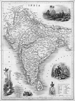
Background imageMap Collection: Map / Asia / India C1850

Map / Asia / India C1850
India under British rule, about the time of the Mutiny

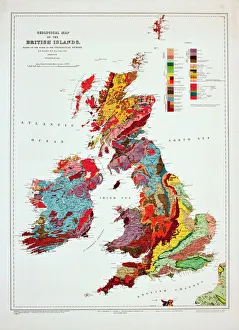
Background imageMap Collection: Geological map of the British Islands

Geological map of the British Islands. 1941
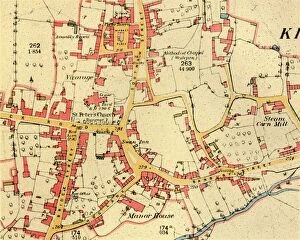
Background imageMap Collection: The Village of Kineton, Warwickshire, 1885-1887, (1944). Creator: Unknown

The Village of Kineton, Warwickshire, 1885-1887, (1944). Creator: Unknown
The Village of Kineton, Warwickshire, 1885-1887, (1944). Map showing the market place, St Peters Church, Wesleyan chapel, the Steam Corn Mill, the Manor House and the River Dene

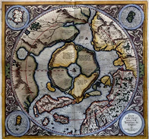
Background imageMap Collection: Atlas of Gerardus Mercator, 1595, map of the Arctic to the North Pole and surrounding

Atlas of Gerardus Mercator, 1595, map of the Arctic to the North Pole and surrounding lands within and outside the Arctic Circle

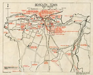
Background imageMap Collection: WW2 - Map of Beirut, Lebanon - with Military locations

WW2 - Map of Beirut, Lebanon - with Military locations
End of WW2 - Map of Beirut, Lebanon showing Military locations important for a British serviceman stationed in the city at the end of the Second World War

Background imageMap Collection: Map of Tenochtitlan. Mexico, 1560. By Alonso de Santa Cruz

Map of Tenochtitlan. Mexico, 1560. By Alonso de Santa Cruz
Map of Tenochtitlan. Mexico, 1560. General islario of all the islands in the world. Work of the chronicler and cosmographer Alonso de Santa Cruz (1505-1567). National Library. Madrid. Spain

Background imageMap Collection: Antique Map of New Zealand

Antique Map of New Zealand
Vintage map of New Zealand, from 1894

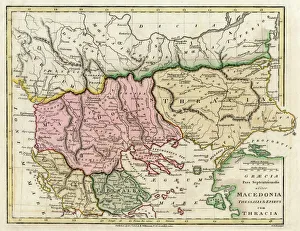
Background imageMap Collection: Map of the Macedonian and Thracian Empire

Map of the Macedonian and Thracian Empire. Date: 1808

Background imageMap Collection: Provincial Airways Poster

Provincial Airways Poster
Poster, Travel by Provincial Airways, with a propeller above a red and black car, and details of the south-west coast route from Croydon to Plymouth. 20th century

Background imageMap Collection: Jersey Airways Poster

Jersey Airways Poster
Jersey Airways Ltd poster, showing a passenger biplane flying from the south coast of Britain to Jersey. Listing duration and costs of flights from London and Portsmouth. 20th century

Background imageMap Collection: STRABO WORLD MAP, c20 A. D. According to the writings of the Greek geographer Strabo

STRABO WORLD MAP, c20 A. D. According to the writings of the Greek geographer Strabo
STRABO WORLD MAP, c20 A.D. According to the writings of the Greek geographer Strabo: a 19th century reconstruction

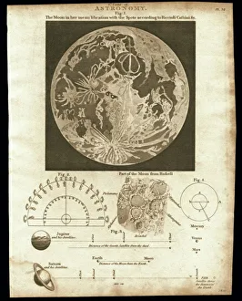
Background imageMap Collection: Early map of the Moon, 1810

Early map of the Moon, 1810
Map of the Moon, 1810. This plate depicts the geographical features of the moon using observations by Cassini and Riccioli

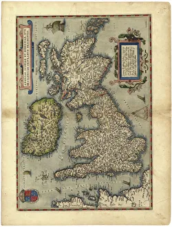
Background imageMap Collection: 16th century map of the British Isles

16th century map of the British Isles
Map of the British Isles, in the 1570 edition of Ortelius Atlas (Theatrum Orbis Terrarum). Abraham Ortelius (1527-1598) was a Flemish mapmaker who is considered to have produced the first true atlas

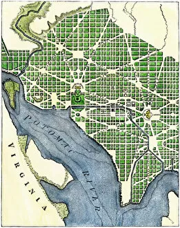
Background imageMap Collection: Plan of Washington DC, 1793

Plan of Washington DC, 1793
Washington DC as originally laid out, 1700s. Hand-colored woodcut reproduction of a 1793 engraving

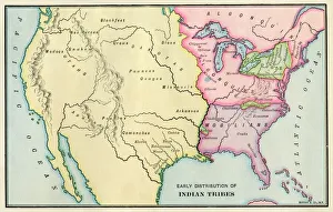
Background imageMap Collection: American Indian tribe locations about 1700

American Indian tribe locations about 1700
Map of Native American locations, circa 1700. Printed lithograph

Background imageMap Collection: GPAC2A-00018

GPAC2A-00018
Map of the Pacific island groups, 1800s. Hand-colored woodcut of a 19th-century illustration

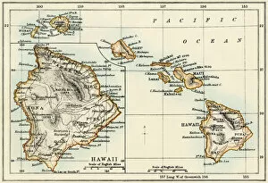
Background imageMap Collection: Map of Hawaii, 1870s

Map of Hawaii, 1870s
Map of the Hawaiian islands, 1870s. Color lithograph reproduction of a 19th-century illustration

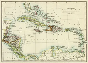
Background imageMap Collection: Caribbean islands, 1870s

Caribbean islands, 1870s
Map of West Indies and the Caribbean Sea, 1800s. Printed color lithograph

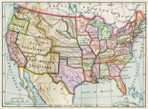
Background imageMap Collection: United States in 1860

United States in 1860
United States and territories at the beginning of the Civil War. Printed lithograph map

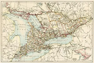
Background imageMap Collection: Ontario, 1870s

Ontario, 1870s
Map of Ontario, Canada, 1870s. Printed color lithograph

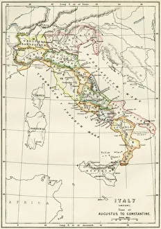
Background imageMap Collection: Regions of Italy in the Roman Empire

Regions of Italy in the Roman Empire
Map of Italy, during the time of Caesar Augustus to Emperor Constantine. Color lithograph of a 19th-century illustration

Background imageMap Collection: EXPL2A-00164

EXPL2A-00164
Map of the United States at the close of the American Revolution, 1783. Printed color lithograph of a 19th-century illustration

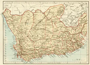
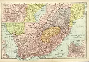
Background imageMap Collection: Map of Cape Colony, South Africa

Map of Cape Colony, South Africa
South Africa when a British colony, 1870s. Printed color lithograph of a 19th-century illustration

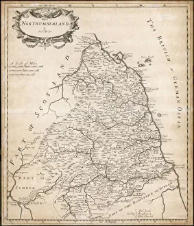
Background imageMap Collection: Map of Northumberland

Map of Northumberland
Map of the English county of Northumberland by Robert Morden, originally produced for the 1695 edition of Camdens Britannia

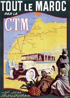
Background imageMap Collection: Poster for French railways to Morocco

Poster for French railways to Morocco
Poster for French railways, serving Tangier, Casablanca, Marrakech and other exotic locations

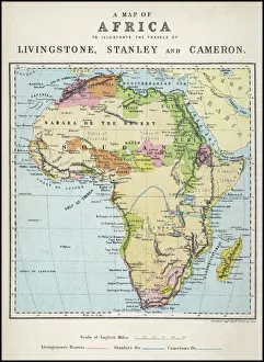
Background imageMap Collection: Map of Africa illustrating travels of explorers

Map of Africa illustrating travels of explorers
A map of Africa which illustrates the travels of Livingstone, Stanley and Cameron. Date: 19th Century

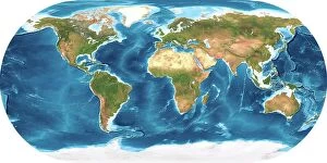
Background imageMap Collection: Earth, topographic and bathymetric map

Earth, topographic and bathymetric map. This whole Earth map is centred on the Greenwich meridian, at zero degrees latitude

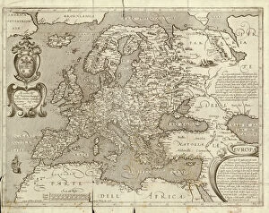
Background imageMap Collection: Map of Europe, 1600

Map of Europe, 1600
16th century map of Europe. Published in Sienna in 1600, this Italian map shows the latest knowledge of the geography of Europe

Background imageMap Collection: Map / Arctic Circle C1880

Map / Arctic Circle C1880
Map of the Arctic Circle with details of explorations

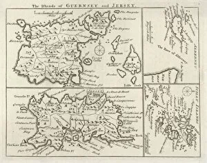
Background imageMap Collection: Map / Channel Islands 18C

Map / Channel Islands 18C
Map of Jersey, Guernsey, Alderney, Sark and the Scilly Isles

Background imageMap Collection: Map / Europe / Poland 1772

Map / Europe / Poland 1772
A German map of Poland and its neighbours in the late 18th century

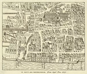
Background imageMap Collection: Map of St Pauls and area

Map of St Pauls and area
Map of St. Pauls area, from Agass plan

Background imageMap Collection: Map / Europe / Greece / Ford

Map / Europe / Greece / Ford
Map of ancient Greece

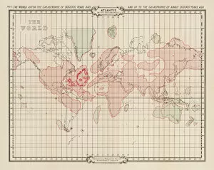
Background imageMap Collection: Atlantis / Map

Atlantis / Map
Map showing Atlantis during the period of its decadence

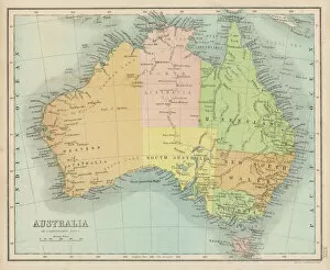
Background imageMap Collection: Maps / Australia 1860S

Maps / Australia 1860S
Map probably made soon after 1861

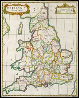
Background imageMap Collection: Map / England & Wales 9C

Map / England & Wales 9C
England and Wales during the Saxon era

Background imageMap Collection: Map /s Africa / Boer C1898

Map /s Africa / Boer C1898
SOUTH AFRICA on the eve of the Boer War

Background imageMap Collection: Map - Guernsey

Map - Guernsey
Map by M. F. Peck - Guernsey

Background imageMap Collection: Old County Map of Wigtown Scotland 1847 by A&C Black

Old County Map of Wigtown Scotland 1847 by A&C Black
A finely detailed facimile remastered in full colour from an antique original map of Wigtownshire featured in A&C Blacks Atlas of 1847

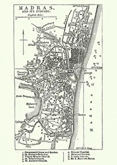
Background imageMap Collection: Map of Madras (Chennai), India, 19th Century

Map of Madras (Chennai), India, 19th Century
Vintage engraving of Map of Madras (Chennai), India, 19th Century

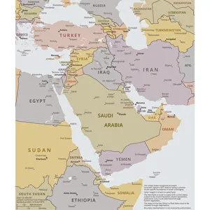
Background imageMap Collection: Political map of The Middle East

Political map of The Middle East
Vector illustration of the policital map of The Middle East Reference map was created by the US Central Intelligence Agency

Background imageMap Collection: Agas Map of London, c1561

Agas Map of London, c1561. Sheet 10, showing part of Southwark, London Bridge, ships on the River Thames, part of the City of London and the Tower of London with its moat

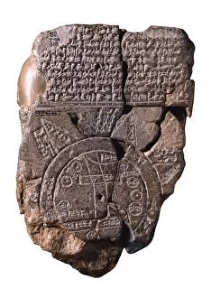
Background imageMap Collection: The Babylonian Map of the World, c. 510-c. 500 BC. Artist: Assyrian Art

The Babylonian Map of the World, c. 510-c. 500 BC. Artist: Assyrian Art
The Babylonian Map of the World, c. 510-c. 500 BC. Found in the collection of British Museum

Background imageMap Collection: Antquie Map of Italy

Antquie Map of Italy
Vintage map of Italy fron 1837

Background imageMap Collection: Bristol map, 1878

Bristol map, 1878
A map of Bristol in 1878. Date: 1878

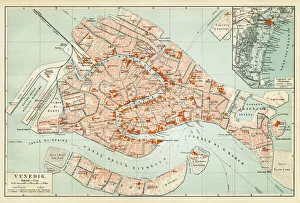
Background imageMap Collection: Map of Venice 1897

Map of Venice 1897
Map of the city of Venice, Italy

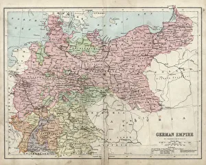
Background imageMap Collection: Antique damaged map of German Empire 19th Century

Antique damaged map of German Empire 19th Century


All Professionally Made to Order for Quick Shipping

"Journey through Time and Space: Exploring the World of Maps" Maps have been an essential tool for centuries, guiding us through uncharted territories and helping us understand our world. From the Thirteen original colonies in 1776 to William Smith's groundbreaking Geological Map, these visual representations have shaped our understanding of geography, history, and even ourselves. Step onto a Reflexology foot map, where every pressure point tells a story about our well-being. Or immerse yourself in the intricate details of Richard de Bello's masterpiece - The Hereford Mappa Mundi (c1285), a medieval treasure that showcases both geographical knowledge and artistic finesse. Travel back in time with antique maps like the Roman Empire or Britain under the Anglo Saxons; they offer glimpses into ancient civilizations that once thrived. And let's not forget the Falkland Islands Royal Engineer briefing map from 1982, reminding us how maps play crucial roles during times of conflict. Delve into Al-Idrisi's world map from 1154 or explore GWR Network Map from c1920s - each capturing different eras' perspectives on global connectivity. Swindon Works Map from c1940s takes you behind-the-scenes of industrial revolution marvels. Finally, lose yourself in a mesmerizing journey across Ancient Greece as you trace your finger along its contours on an old parchment-like map. Discover mythical lands and legendary tales that still resonate today, and are more than just navigational aids; they are gateways to exploration and understanding. They tell stories of triumphs, discoveries, cultures lost to time but preserved within their lines. So next time you unfold a map or scroll through digital coordinates (like EXPL2A-00352), remember that you hold much more than directions – you hold pieces of history waiting to be explored anew.