Fraud Blocker Skip to main content

Earth Observation Collection (page 20)

"Earth Observation: Glimpses of Our Pale Blue Dot and Beyond" In the vast expanse of space

Background imageEarth Observation Collection: Grimsvotn ash plume, May 2011

Grimsvotn ash plume, May 2011, satellite image. This ash cloud (brown, lower right) has been produced by the eruption of the Grimsvotn volcano in Iceland

Background imageEarth Observation Collection: Space shuttle over Argentina and Chile

Space shuttle over Argentina and Chile
Space shuttle over the Andes. Photograph, taken by astronauts on board the International space Stations showing the NASA space shuttle orbiting over the Andean mountains in South america

Background imageEarth Observation Collection: International Space Station, 2011

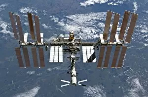
International Space Station, 2011

Background imageEarth Observation Collection: Greenland, artwork

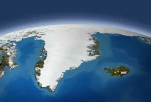
Greenland, artwork
Greenland. Artwork of the Arctic island of Greenland, as seen from space. This view looks north, towards the Arctic pack ice on the Earths curved limb

Background imageEarth Observation Collection: Shenzhen, China, 1999 - 2008

Shenzhen, China, 1999 - 2008, satellite image. Shenzhen is located in southern Chinas Guangdong province directly north of Hong Kong

Background imageEarth Observation Collection: A new start for Earth, conceptual image

A new start for Earth, conceptual image. Computer artwork representing the potential for the Earth to recover from current environmental concerns such as global warming and pollution

Background imageEarth Observation Collection: Mississippi Delta, satellite image

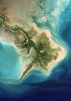
Mississippi Delta, satellite image
Mississippi Delta. True colour Landsat satellite image of the Mississippi River Delta, Louisiana, USA. North is at top. The Mississippi River is seen running from top left into the Gulf of Mexico at

Background imageEarth Observation Collection: Learning about the Earth, artwork

Learning about the Earth, artwork
Learning about the Earth, conceptual artwork

Background imageEarth Observation Collection: Shenzhen, China, 1988

Shenzhen, China, 1988, satellite image. Shenzhen is located in southern Chinas Guangdong province directly north of Hong Kong

Background imageEarth Observation Collection: Barcoded Earth, conceptual image

Barcoded Earth, conceptual image

Background imageEarth Observation Collection: Noctilucent clouds, ISS image

Noctilucent clouds, ISS image
Noctilucent clouds. International Space Station (ISS) image of the limb of the Earth, showing noctilucent clouds (polar mesospheric clouds, across top) in the upper atmosphere

Background imageEarth Observation Collection: Las Vegas, satellite image, 2009

Las Vegas, satellite image, 2009
Las Vegas. True colour satellite image of Las Vegas, Nevada, USA. North is at top. The lake at right is Lake Mead, the largest man-made lake in the world

Background imageEarth Observation Collection: Millennium Stadium car park, aerial view

Millennium Stadium car park, aerial view

Background imageEarth Observation Collection: Millennium Stadium, Cardiff, aerial view

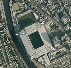
Millennium Stadium, Cardiff, aerial view

Background imageEarth Observation Collection: Near-Earth asteroids, artwork

Near-Earth asteroids, artwork
A 10-kilometer-sized Asteroid and smaller co-asteroids approaching the Earth, bringing death from space. Here an impact in North America seems to be possible

Background imageEarth Observation Collection: TIROS weather satellite, artwork

TIROS weather satellite, artwork
TIROS or Television (Vidicom Camera) Infrared Observation Satellite is a series of early weather satellites launched by NASA, beginning with TIROS 1 in 1960

Background imageEarth Observation Collection: TIROS weather satellite image

TIROS weather satellite image
TIROS Earth View of the United States and cloud-covered Mexico. TIROS or Television (Vidicom Camera) Infrared Observation Satellite is a series of early weather satellites launched by NASA

Background imageEarth Observation Collection: Manchester and environs, aerial view

Manchester and environs, aerial view. North is at top. Manchester, one of the largest cities in the UK, is at centre, surrounded by the M60 ring motorway

Background imageEarth Observation Collection: Manchester, aerial view

Manchester, aerial view
Manchester and environs, aerial view. North is at top. Manchester, one of the largest cities in the UK, is at centre left, surrounded by the M60 ring motorway

Background imageEarth Observation Collection: Earths rotation

Earths rotation
The Earth in 12 steps, each 30 degrees in the direction of natural rotation, which would be 2 hours

Background imageEarth Observation Collection: Greater Manchester, satellite image

Greater Manchester, satellite image
Greater Manchester and surroundings, satellite image. North is at top. The city of Manchester is at centre (grey-white). Liverpool is on the coast at left

Background imageEarth Observation Collection: The earth making ripples in a pool

The earth making ripples in a pool

Background imageEarth Observation Collection: Pine Island Glacier, satellite image

Pine Island Glacier, satellite image
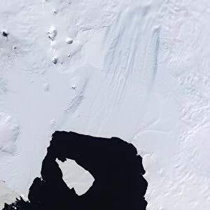
Pine Island Glacier. Satellite image of the Pine Island Glacier on the Antarctic coast. A large ice berg has calved from the glacier into Pine Island bay (bottom centre)
Background imageEarth Observation Collection: Crescent Moon from Earth orbit, artwork

Crescent Moon from Earth orbit, artwork
Crescent Moon from Earth orbit, computer artwork. The non-sunlit Earth-facing parts of the Moon are being illuminated by sunlight reflected from the Earth, a phenomenon known as Earthshine

Background imageEarth Observation Collection: Storm over Iceland, satellite image

Storm over Iceland, satellite image
Storm over Iceland. Satellite image showing the swirling clouds (white) of a storm over Iceland. North is at top, water is blue

Background imageEarth Observation Collection: Arctic ice retreat, artwork

Arctic ice retreat, artwork
Arctic ice retreat. Maps showing the area covered by ice (white) in the Arctic in 1980 (left) and 2007 (right). This shows the marked reduction in Arctic ice between the two dates

Background imageEarth Observation Collection: Peterborough, aerial image

Peterborough, aerial image
Peterborough. Aerial image of Peterborough, Cambridgeshire, UK

Background imageEarth Observation Collection: Antarctic ozone hole maximum, 2008

Antarctic ozone hole maximum, 2008
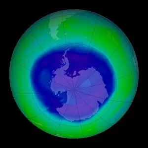
Antarctic ozone hole maximum. Satellite image of the maximum extent in 2008 of the ozone hole (blue) over Antarctica (centre)

Background imageEarth Observation Collection: Earth science research, artwork

Earth science research, artwork
Earth science research, conceptual computer artwork. Earth being studied under a light microscope

Background imageEarth Observation Collection: Moonrise over Mallorca

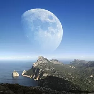
Moonrise over Mallorca, one of the Balearic islands. Mallorca, also called Majorca, is located off the east coast of Spain

Background imageEarth Observation Collection: Earth, artwork

Earth, artwork
Earth. Computer artwork of the Earth amongst stars and clouds of swirling star dust

Background imageEarth Observation Collection: Vredefort crater, satellite image

Vredefort crater, satellite image. The Vredefort meteor impact crater (semi-circular, lower centre) is the largest, and second-oldest, known impact crater on Earth

Background imageEarth Observation Collection: Mount Unzen, satellite image

Mount Unzen, satellite image. Satellite image showing part of the island of Kyushu with Mount Unzen at centre. Water is blue, vegetation is green, cloud, snow and ice are white

Background imageEarth Observation Collection: Europe at night, satellite image

Europe at night, satellite image
Europe at night. Satellite image of the Earth seen at 00:00 (midnight) GMT (UTC), centred on Europe. City lights (yellow) in dark areas show areas of dense population

Background imageEarth Observation Collection: Blue Marble image of Earth (2010)

Blue Marble image of Earth (2010)
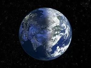
Blue Marble image of Earth. Composite satellite image of Earths eastern hemisphere, centred on India. North is at top. This image is one of a set released in March 2010 using Blue Marble

Background imageEarth Observation Collection: Eyjafjallajokull eruption, April 2010

Eyjafjallajokull eruption, April 2010
Eyjafjallajokull eruption. Satellite image of the ash cloud (grey, centre) from the April 2010 Eyjafjallajokull eruption being blown towards Europe

Background imageEarth Observation Collection: Ocean current speed

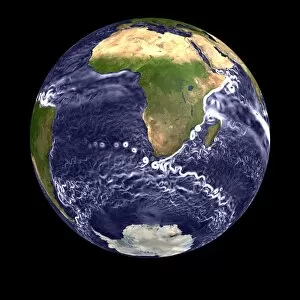
Ocean current speed. Computer visualisation of ocean surface current speeds. Major ocean currents (coloured white) are visible, such as the Agulhas current (eastern side of Africa)

Background imageEarth Observation Collection: Water vapour distribution, computer model

Water vapour distribution, computer model. Coloured supercomputer simulations showing the distribution of the Earths water vapour. Atmospheric water vapour is invisible

Background imageEarth Observation Collection: Antarctic ocean current, computer model

Antarctic ocean current, computer model
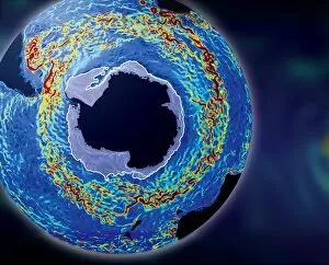
Antarctic ocean current. Computer model of the Antarctic circumpolar current in the Southern Ocean on the 12th May 2006. Ocean current data from satellites

Background imageEarth Observation Collection: Ozone hole prediction

Ozone hole prediction. Computer model showing Antarctic ozone levels from 1974 to 2054 if chlorofluorocarbons (CFCs), the chemicals widely blamed for destroying ozone

Background imageEarth Observation Collection: The Americas, satellite image

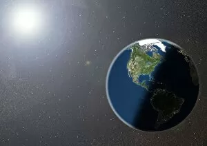
The Americas, satellite image. Oceans are blue and land is green and brown. City lights (yellow) in dark areas show areas of dense population

Background imageEarth Observation Collection: Hurricane Epsilon, satellite image

Hurricane Epsilon, satellite image
Hurricane Epsilon. Satellite image of hurricane Epsilon over the central Atlantic Ocean on 4th December 2005. This hurricane remained in the central Atlantic Ocean, never making landfall

Background imageEarth Observation Collection: San Francisco Bay, USA, satellite image

San Francisco Bay, USA, satellite image
San Francisco Bay, USA. Satellite image of the San Francisco Bay area in California, USA. North is at top. The city of San Francisco is located on the tip of the San Francisco Peninsula

Background imageEarth Observation Collection: Deforestation in the Amazon, 2000

Deforestation in the Amazon, 2000
Deforestation in the Amazon. True colour Landsat satellite image of the Eastern part of the state of Rondonia in Brazil, showing areas of deforestation (light green and brown)

Background imageEarth Observation Collection: Mount St Helens, 3D satellite image

Mount St Helens, 3D satellite image. Satellite image showing the snow-capped Mount St Helens (centre), viewed from the south

Background imageEarth Observation Collection: The Arctic, night-day satellite image

The Arctic, night-day satellite image
Asia, night-day satellite image. This composite image of the Earth is set against a background of stars, and is centred on the continent of Asia. North is at top

Background imageEarth Observation Collection: Norwegian fjords, satellite image

Norwegian fjords, satellite image. North is at top. Water is black, snow is white and ice is blue. Glaciers (blue) are seen in several of the valleys, carrying ice down from the mountains to the sea

Background imageEarth Observation Collection: Volcanic landscape, satellite image

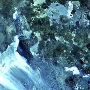
Volcanic landscape, satellite image. North is at top. Desert sands and salt deposits are white, with the colour varying to light blue depending on the amount of rock content


All Professionally Made to Order for Quick Shipping

"Earth Observation: Glimpses of Our Pale Blue Dot and Beyond" In the vast expanse of space, Voyager 1 captured an awe-inspiring image that forever changed our perspective. The iconic "Pale Blue Dot" photograph revealed Earth as a tiny speck in the cosmic ocean, reminding us of our interconnectedness on this magnificent planet. Zooming in closer, we witness the intricate details of human achievements. The Wimbledon tennis complex stands out amidst the bustling cityscape of London, UK. From high above, a satellite image showcases the British Isles with its lush green landscapes and rugged coastlines – a testament to nature's beauty. As night falls, lights illuminate cities across Europe like constellations on Earth's canvas. A mesmerizing satellite image captures the brilliance of UK at night from space – a tapestry woven by millions living their lives under starry skies. Expanding further into darkness reveals Europe at night; clusters of light representing vibrant metropolises and quiet towns alike. And then there it is - an astonishing view showcasing our entire planet bathed in nocturnal glow - Whole Earth at night seen from space. Venturing beyond terrestrial boundaries, Tenerife emerges through a satellite lens – its volcanic terrain contrasting against azure waters surrounding this Spanish island paradise. The International Space Station floats gracefully in orbit around Earth during 2008 – humanity's outpost where astronauts conduct research while gazing back upon their home planet with wonderment. From afar, another satellite image depicts Earth from space - swirling clouds dance over continents and oceans; an ever-changing masterpiece painted by atmospheric currents and weather patterns. Closer to home once more, Scotland's stunning landscape unfolds beneath us through yet another captivating satellite image. Majestic mountains blend seamlessly with lochs and glens creating breathtaking scenery that captivates all who behold it.