Tote Bag > Animals > Mammals > Cricetidae > California Mouse
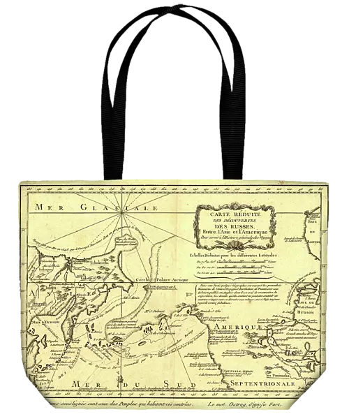
Tote Bag : Carte re´duite des de´couvertes des Russes, entre l'Asie et l'Amerique, (1747?). Creator: Jacques-Nicolas Bellin
![]()

Home Decor from Heritage Images
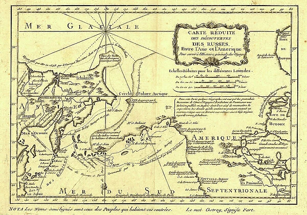
Carte re´duite des de´couvertes des Russes, entre l'Asie et l'Amerique, (1747?). Creator: Jacques-Nicolas Bellin
Carte re´duite des de´couvertes des Russes, entre l'Asie et l'Amerique, (1747?). This French map of Alaska, Siberia, and the North Pacific, published in 1747, was based upon geographical information gleaned from earlier Russian voyages. It was created by the French cartographer, Jacques-Nicolas Bellin (1703-72), and published by the French author, Abbe´ Pre´vost. Trained as a hydrographer, Bellin was attached to the French Marine Office and specialized in producing maritime maps showing coastlines. In 1764 he published Le Petit Atlas Maritime (Small maritime atlas), a work in five volumes containing 581 maps. This map outlines the routes taken on the voyages by Semen Dezhnev around the Chukotka Peninsula in 1648; Vitus Bering through what became known as the Bering Strait in 1728; Mikhail Gvozdev and Ivan Fyodorov through the Bering Strait to Cape Prince of Wales in Alaska in 1732; and Vitus Bering and Aleksei Chirikov to southern Alaska in 1741. The map includes specific and accurate details on the Russian Asian coast south to Japan, as well as Sakhalin Island and the Kurile Islands. It also shows parts of California, which were known from Spanish explorations, as well as interior sections of North America near Hudson Bay
Heritage Images features heritage image collections
Media ID 35129277
© Heritage Art/Heritage Images
1740s Alaska United States Of America California United States Of America Cartographer Cartographic Cartography Coastline Exploration Exploring Hudson Bay Hudsons Bay Map Making Mapmaker Mapmaking Marine Maritime North America Ocean Pacific Ocean Route Sakhalin Sakhalinskaya Oblast Russia Siberia Russia Strait Voyage Abbe Prevost Antoine Francois Prevost Bering Strait Kuril Islands Meeting Of Frontiers Routes
Canvas Tote Bag
Our tote bags are made from soft, durable, poly-poplin fabric and include a one inch (2.5cm) black strap for easy carrying on your shoulder. All seams are double-stitched for added durability. Each tote bag is machine-washable in cold water and is printed on both sides using the same image. Approximate size of bag is 50x33cm (20"x13")
Our tote bags are made from soft durable fabric and include a strap for easy carrying
Estimated Product Size is 50cm x 32.7cm (19.7" x 12.9")
These are individually made so all sizes are approximate
FEATURES IN THESE COLLECTIONS
> Animals
> Mammals
> Cricetidae
> California Mouse
> Arts
> Artists
> O
> Oceanic Oceanic
> Asia
> Japan
> Related Images
> Europe
> Russia
> Related Images
EDITORS COMMENTS
This historic map, titled "Carte reduite des decouvertes des Russes, entre l'Asie et l'Amerique," was created by the renowned French cartographer Jacques-Nicolas Bellin in 1747. The map represents a significant advancement in the understanding of the geography of Alaska, Siberia, and the North Pacific Ocean during the early modern period. Bellin, who was trained as a hydrographer and worked for the French Marine Office, specialized in producing detailed and accurate maritime maps. This particular map is based on geographical information gathered from Russian voyages, including those led by Semen Dezhnev around the Chukotka Peninsula in 1648, Vitus Bering through the Bering Strait in 1728, Mikhail Gvozdev and Ivan Fyodorov through the Bering Strait to Cape Prince of Wales in Alaska in 1732, and Vitus Bering and Aleksei Chirikov to southern Alaska in 1741. The map provides precise details on the Russian Asian coastline, extending south to Japan, as well as Sakhalin Island and the Kurile Islands. It also includes parts of California, which were known from Spanish explorations, and interior sections of North America near Hudson Bay. Bellin's "Carte reduite des decouvertes des Russes, entre l'Asie et l'Amerique" is an essential cartographic record of the early exploration of the North Pacific region and represents a significant contribution to the history of cartography. This map was published by the French author Abbe Prevost and is a testament to Bellin's expertise and dedication to accurate and detailed mapmaking.
MADE IN THE UK
Safe Shipping with 30 Day Money Back Guarantee
FREE PERSONALISATION*
We are proud to offer a range of customisation features including Personalised Captions, Color Filters and Picture Zoom Tools
SECURE PAYMENTS
We happily accept a wide range of payment options so you can pay for the things you need in the way that is most convenient for you
* Options may vary by product and licensing agreement. Zoomed Pictures can be adjusted in the Basket.

