Fraud Blocker Skip to main content

Cartographer Collection

"Unveiling the World

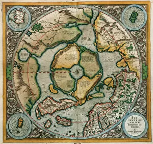
Background imageCartographer Collection: Septentrionalium Terrarum descriptio, 1595, by Gerardus Merc

Septentrionalium Terrarum descriptio, 1595, by Gerardus Merc
Gerardus Mercator (1512-1594). Flemish cartographer. Septentrionalium Terrarum descriptio. Map of the Arctic with the North Pole and surrounding lands within and outside the Arctic Circle, 1595

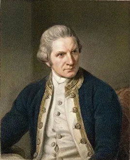
Background imageCartographer Collection: 1775 Captain James Cook explorer

1775 Captain James Cook explorer
James Cook, Captain of HMS Barc Endeavour (b. 7th November 1728 - d. 14th February 1779). Steel engraving by E. Scriven 1833 with later hand colouring, after the painting by N

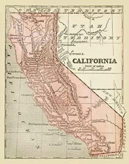
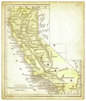
Background imageCartographer Collection: Old map of California 1855

Old map of California 1855
System of Geography for the use of schools by Sidney E. Morse - Published by Harper & Brothers - New York 1855

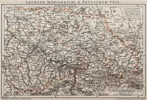
Background imageCartographer Collection: Kingdom of Saxony, Eastern part

Kingdom of Saxony, Eastern part
Antique illustration of a Kingdom of Saxony, Eastern part

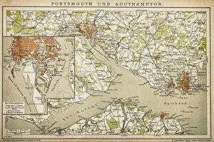
Background imageCartographer Collection: Portsmouth and Southampton

Portsmouth and Southampton
Antique map of a Portsmouth and Southampton

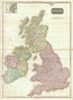
Background imageCartographer Collection: 1818, Pinkerton Map of the British Isles, England, Scotland, Ireland, John Pinkerton

1818, Pinkerton Map of the British Isles, England, Scotland, Ireland, John Pinkerton, 1758 - 1826, Scottish antiquarian, cartographer, UK

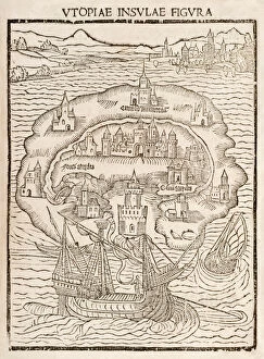
Background imageCartographer Collection: Utopiae Insulae Figura (Map of the New Island of Utopia

Utopiae Insulae Figura (Map of the New Island of Utopia
5615728 Utopiae Insulae Figura (Map of the New Island of Utopia) from the 1516 first edition of Utopia by Sir Thomas More (1478-1535)

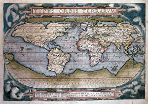
Background imageCartographer Collection: Theatrum Orbis Terrarum (Theatre of the World) by Abraham Or

Theatrum Orbis Terrarum (Theatre of the World) by Abraham Or
Theatrum Orbis Terrarum (Theatre of the World). Is considered to be the first true modern atlas. Written by Abraham Ortelius and originally printed on May 20, 1570, in Antwerp. World Map

Background imageCartographer Collection: Vintage Map of the World

Vintage Map of the World
Vintage map of the world from 1837

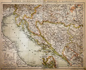
Background imageCartographer Collection: Bosnia, dalmatia, istria, croatia, slavonia

Bosnia, dalmatia, istria, croatia, slavonia
Antique illustration of a Bosnia, dalmatia, istria, croatia, slavonia map

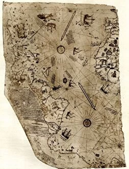
Background imageCartographer Collection: The new world revealed to Islam in 1513. The map of the Atlantic, work of Admiral

The new world revealed to Islam in 1513. The map of the Atlantic, work of Admiral Piri Reis, the celebrated Turkish cartographer

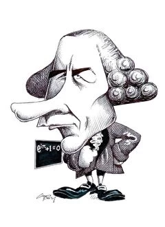
Background imageCartographer Collection: Leonard Euler, caricature C015 / 6711

Leonard Euler, caricature C015 / 6711
Leonhard Euler (1707-1783). Caricature of the Swiss mathematician and physicist Leonhard Euler. Euler made discoveries in a wide range of fields, including geometry, infinitesimal calculus

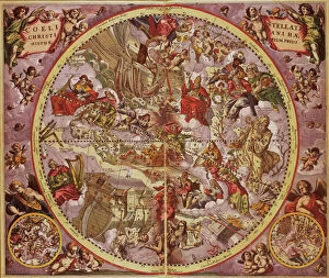
Background imageCartographer Collection: Andreas Cellarius (1596-1665). Dutch-German cartographer. Ha

Andreas Cellarius (1596-1665). Dutch-German cartographer. Harmonia Macrocosmica, 1660, a major star atlas, published by Johannes Janssonius in Amsterdam

Background imageCartographer Collection: Old map of California 1856

Old map of California 1856
Colton and Fitchs Modern School Geography by George W. Fitch - New York 1856

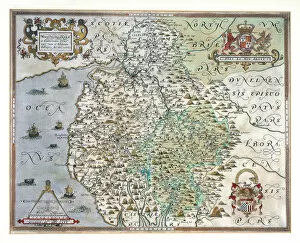
Background imageCartographer Collection: A Map of Westmorland and Cumberland, 1576 (hand-coloured engraving)

A Map of Westmorland and Cumberland, 1576 (hand-coloured engraving)
985982 A Map of Westmorland and Cumberland, 1576 (hand-coloured engraving) by Saxton, Christopher (c.1542-c.1610); 38x48.5 cm; Private Collection; (add.info)

Background imageCartographer Collection: RAOEgen

RAOEgen
Antique map of RAOEgen

Background imageCartographer Collection: Woodcut from 1518 third edition of Utopia by Sir Thomas More (1478-1535

Woodcut from 1518 third edition of Utopia by Sir Thomas More (1478-1535
5615729 Woodcut from 1518 third edition of Utopia by Sir Thomas More (1478-1535) published in Basel showing the author conversing with the protagonist Raphael Hythloday about the ideal society he

Background imageCartographer Collection: Captain Richard Francis Burton

Captain Richard Francis Burton
2905711 Captain Richard Francis Burton by English Photographer, (19th century); Private Collection; (add.info.: Captain Richard Francis Burton)

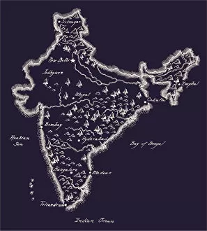
Background imageCartographer Collection: Antique India Map

Antique India Map
India Map, - Antique style. Includes mountains and water bodies. High detail - vector illustration

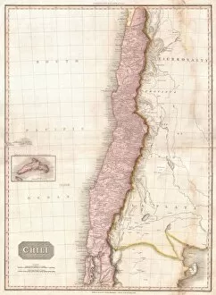
Background imageCartographer Collection: 1818, Pinkerton Map of Chile, John Pinkerton, 1758 - 1826, Scottish antiquarian, cartographer

1818, Pinkerton Map of Chile, John Pinkerton, 1758 - 1826, Scottish antiquarian, cartographer, UK

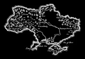
Background imageCartographer Collection: Antique Ukraine Map

Antique Ukraine Map
Ukraine Map, - Antique style. Includes mountains and water bodies. High detail - vector illustration

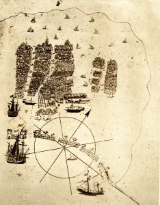
Background imageCartographer Collection: Venice, as a retired Turkish Admiral saw it in the early sixteenth ceuntry: a miniature

Venice, as a retired Turkish Admiral saw it in the early sixteenth ceuntry: a miniature from Piri Reiss geographical work on the Mediterranean; showing an arsenal with galleys building; the lagoon;

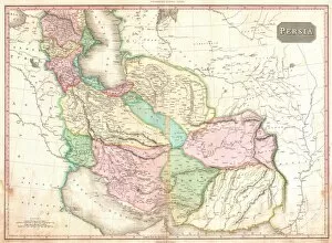
Background imageCartographer Collection: 1818, Pinkerton Map of Persia, Iran, Afghanistan, John Pinkerton, 1758 - 1826, Scottish

1818, Pinkerton Map of Persia, Iran, Afghanistan, John Pinkerton, 1758 - 1826, Scottish antiquarian, cartographer, UK

Background imageCartographer Collection: Antique Finland Map

Antique Finland Map
Finland Map, - Antique style. Includes mountains and water bodies. High detail - vector illustration

Background imageCartographer Collection: Principaute de Dombes - Bresse and Lyonnais, in 'Theatrum Orbis Terrarum

Principaute de Dombes - Bresse and Lyonnais, in 'Theatrum Orbis Terrarum, sive Atlas Novus' by Willem Blaeu
3918017 Principaute de Dombes - Bresse and Lyonnais, in 'Theatrum Orbis Terrarum, sive Atlas Novus' by Willem Blaeu, Amsterdam

Background imageCartographer Collection: Medieval 10th century World map by Estakhri

Medieval 10th century World map by Estakhri
3507857 Medieval 10th century World map by Estakhri; (add.info.: Medieval 10th century World map by Abu Ishaq Ibrahim ibn Muhammad al-Farisi al Istakhri (Estakhri)

Background imageCartographer Collection: Vitus Bering

Vitus Bering
3330200 Vitus Bering; (add.info.: Portrait of Vitus Bering (1681-1741) a Russian cartographer, Russian naval officer, and explorer of Danish origin

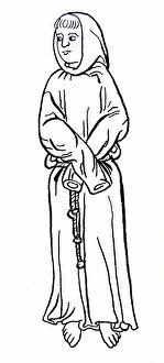
Background imageCartographer Collection: Line drawing of Brother William

Line drawing of Brother William
1578262 Line drawing of Brother William; (add.info.: Line drawing of Brother William, Englishman and companion of St Francis)

Background imageCartographer Collection: Amerigo Vespucci

Amerigo Vespucci
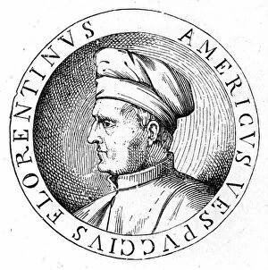
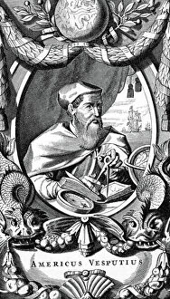
3586020 Amerigo Vespucci; (add.info.: Portrait of Amerigo Vespucci (1454-1512) an Italian explorer, financier, navigator and cartographer. Dated 16th Century.); Universal History Archive/UIG.

Background imageCartographer Collection: James Cook

James Cook
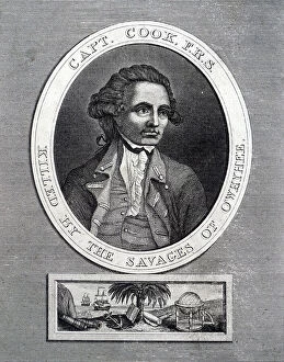
5308290 James Cook.; (add.info.: Portrait of James Cook (1728-1779) a British explorer, navigator, cartographer, and captain in the Royal Navy. Dated 19th century
Background imageCartographer Collection: Richard Francis Burton

Richard Francis Burton
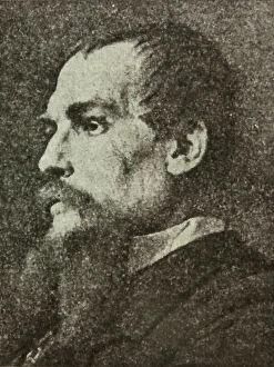
3078281 Richard Francis Burton; (add.info.: Portrait of Richard Francis Burton (1821-1890) British Explorer, geographer, translator, writer, soldier, orientalist

Background imageCartographer Collection: Gemma Frisius

Gemma Frisius
3480187 Gemma Frisius; (add.info.: Engraved portrait of Gemma Frisius (1508-1555) a Dutch physician; mathematician; cartographer; philosopher; and instrument maker

Background imageCartographer Collection: Gemma Frisius

Gemma Frisius
5308092 Gemma Frisius.; (add.info.: Engraving depicting Gemma Frisius (1508-1555) a Dutch physician, mathematician, cartographer, philosopher, and instrument maker

Background imageCartographer Collection: William Martin Conway, art critic

William Martin Conway, art critic
672706 William Martin Conway, art critic; (add.info.: William Martin Conway, 1st Baron Conway of Allington (12 April 1856 at Rochester, England - 19 April 1937 at London)

Background imageCartographer Collection: Jodocus Hondius' map showing the Straits of Magellan and Terra del Fueogo

Jodocus Hondius' map showing the Straits of Magellan and Terra del Fueogo
5310318 Jodocus Hondius' map showing the Straits of Magellan and Terra del Fueogo; (add.info.: Woodcut engraving based on Jodocus Hondius' map showing the Straits of Magellan)

Background imageCartographer Collection: Engraving depicting Gerardus Mercator and Jodocus Hondius

Engraving depicting Gerardus Mercator and Jodocus Hondius
5309030 Engraving depicting Gerardus Mercator and Jodocus Hondius; (add.info.: Engraving depicting Gerardus Mercator and Jodocus Hondius)

Background imageCartographer Collection: An aurora seen during the 7th Century from the Nuremburg Chronicle

An aurora seen during the 7th Century from the Nuremburg Chronicle
3740711 An aurora seen during the 7th Century from the Nuremburg Chronicle; (add.info.: Engraving depicting an aurora during the 7th Century from the from the Nuremburg Chronicle by Hartmann Schedel)

Background imageCartographer Collection: The fifth day of creation from the Nuremburg Chronicle

The fifth day of creation from the Nuremburg Chronicle
3740692 The fifth day of creation from the Nuremburg Chronicle; (add.info.: Engraving depicting the fifth day of creation - God creating the birds)

Background imageCartographer Collection: Amerigo Vespucci

Amerigo Vespucci
3586023 Amerigo Vespucci; (add.info.: Portrait of Amerigo Vespucci (1454-1512) an Italian explorer, financier, navigator and cartographer. Dated 16th Century.); Universal History Archive/UIG.

Background imageCartographer Collection: Amerigo Vespucci, from the 'Crabb's Historical Dictionary' pub. 1825 (print)

Amerigo Vespucci, from the 'Crabb's Historical Dictionary' pub. 1825 (print)
3555481 Amerigo Vespucci, from the 'Crabb's Historical Dictionary' pub. 1825 (print) by English School, (19th century); (add.info.: Amerigo Vespucci, 1454 - 1512)

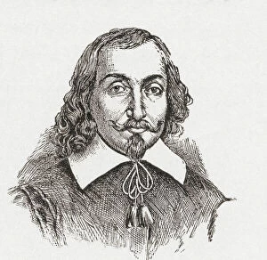
Background imageCartographer Collection: Samuel de Champlain, 1574-1635, 'The Father of New France'. French navigator, cartographer

Samuel de Champlain, 1574-1635, "The Father of New France". French navigator, cartographer, draughtsman
2603481 Samuel de Champlain, 1574-1635, "The Father of New France". French navigator, cartographer, draughtsman, soldier, explorer, geographer, ethnologist, diplomat and chronicler

Background imageCartographer Collection: Bourg-en-Bresse, in 'Theatrum Orbis Terrarum, sive Atlas Novus' by Willem Blaeu, Amsterdam, 1645-50

Bourg-en-Bresse, in 'Theatrum Orbis Terrarum, sive Atlas Novus' by Willem Blaeu, Amsterdam, 1645-50
3918020 Bourg-en-Bresse, in 'Theatrum Orbis Terrarum, sive Atlas Novus' by Willem Blaeu, Amsterdam, 1645-50; (add.info.: Bourg-en-Bresse, in 'Theatrum Orbis Terrarum)

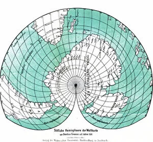
Background imageCartographer Collection: 1881 German version of the World Map 1531, 1881

1881 German version of the World Map 1531, 1881
3507797 1881 German version of the World Map 1531, 1881; (add.info.: 1881 German version of the World Map 1531, by Oronce Fine (Orontius Finnaeus)

Background imageCartographer Collection: James Cook

James Cook
5308269 James Cook.; (add.info.: Portrait of James Cook (1728-1779) a British explorer, navigator, cartographer, and captain in the Royal Navy. Dated 19th century

Background imageCartographer Collection: The sixth day of creation from the Nuremburg Chronicle

The sixth day of creation from the Nuremburg Chronicle
3732381 The sixth day of creation from the Nuremburg Chronicle; (add.info.: Engraving depicting the sixth day of creation - God creating Adam- from the Nuremburg Chronicle by Hartmann Schedel)

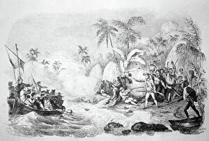
Background imageCartographer Collection: The death of Captain James Cook, 1850

The death of Captain James Cook, 1850
3480624 The death of Captain James Cook, 1850; (add.info.: 19th century illustration showing the death of Captain James Cook (1728 - 14 February 1779)

Background imageCartographer Collection: Amerigo Vespucci

Amerigo Vespucci
3586010 Amerigo Vespucci; (add.info.: Portrait of Amerigo Vespucci (1454-1512) an Italian explorer, financier, navigator and cartographer. Dated 16th Century.); Universal History Archive/UIG.

Background imageCartographer Collection: Amerigo Vespucci

Amerigo Vespucci
3586022 Amerigo Vespucci; (add.info.: Portrait of Amerigo Vespucci (1454-1512) an Italian explorer, financier, navigator and cartographer. Dated 16th Century.); Universal History Archive/UIG.


All Professionally Made to Order for Quick Shipping

"Unveiling the World: A Journey through the Eyes of Cartographers" Embark on a captivating voyage through time and space as we delve into the fascinating world of cartography. From the intrepid explorations of Captain James Cook in 1775 to Gerardus Mercator's groundbreaking map, Septentrionalium Terrarum descriptio, in 1595, these visionary individuals shaped our understanding of the globe. Traveling eastward, we encounter the Kingdom of Saxony's eastern part meticulously charted by skilled cartographers. The bustling ports of Portsmouth and Southampton come alive on Pinkerton Map's depiction of the British Isles in 1818, revealing their vital role in maritime history. Abraham Ortelius' magnum opus, Theatrum Orbis Terrarum (Theatre of the World), showcases an intricate tapestry that connects continents and cultures. Meanwhile, a glimpse at an old map from 1855 transports us to California's early days when its borders were still taking shape. A Vintage Map of the World invites us to explore distant lands like Bosnia, Dalmatia, Istria, Croatia, and Slavonia – regions steeped in rich history and cultural heritage. Leonard Euler's caricature adds a touch of whimsy to this journey as he playfully navigates his way across mathematical realms. As we turn back time once more with Sir Thomas More's Utopia woodcut from 1518 edition and Andreas Cellarius' masterful works capturing celestial wonders during Dutch-German Renaissance era; it becomes clear that cartography is not merely about maps but also about storytelling - weaving tales that transcend borders and eras. Join us as we celebrate these remarkable cartographers who dared to dream beyond horizons unknown – forever leaving their mark on our collective imagination. Let their artistry inspire you to see our world with fresh eyes while cherishing its ever-evolving beauty.