Fraud Blocker Skip to main content

Cartographer Collection (page 8)

"Unveiling the World

Background imageCartographer Collection: Siberia map, the Amur region

Siberia map, the Amur region
Illustration of a Siberia map, the Amur region

Background imageCartographer Collection: Belovar-koros, Croatio map from 1893

Belovar-koros, Croatio map from 1893
Antique illustration of a Belovar-koros, Croatio map from 1893

Background imageCartographer Collection: DUTCH COMMERCE, 1612. The Light of Navigation. Engraved frontispiece, 1612

DUTCH COMMERCE, 1612. The Light of Navigation. Engraved frontispiece, 1612, to a book of sea charts by the Dutch geographer Willem Janszoon Blaeu

Background imageCartographer Collection: Gerardus Mercator

Gerardus Mercator
GERARDUS MERCATOR Known also as Gerhard Kremer Flemish cartographer

Background imageCartographer Collection: abraham ortelius, abrahami ortelii, antique, architecture, archival, atlas, biography

abraham ortelius, abrahami ortelii, antique, architecture, archival, atlas, biography, book, cartographer, cartography, cover, depicting, engraving, fancy, frontispiece, geography, historic, history

Background imageCartographer Collection: Captain James Cook - British explorer, captain and navigator

Captain James Cook - British explorer, captain and navigator
Captain James Cook - British explorer, navigator, cartographer, and captain in the Royal Navy (1728-1779). Date: 1776

Background imageCartographer Collection: Portrait of Mercator with globe and compass

Portrait of Mercator with globe and compass
Title page illustration from Theatrum Geographiae Veteris, an early large-scale world Atlas by Pertius Bertius, printed in Amsterdam 1618-19 showing the great cartographer Mercator Date: 1618

Background imageCartographer Collection: Captain James Cook - Explorer - Portrait and Notable Places

Captain James Cook - Explorer - Portrait and Notable Places
Captain James Cook (1728-1779) - British explorer, navigator, cartographer, and captain in the Royal Navy - portrait and notable places associated with his life - his birthplace at Marton in

Background imageCartographer Collection: Portolan of Joan Martines (16th century). American west coas

Portolan of Joan Martines (16th century). American west coas
Portolan of Spanish cartographer Joan Martines (16th century). Majorcan school. American west coast (Peru, Ecuador and Colombia). 1587 Messina, Sicily

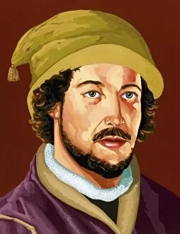
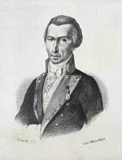
Background imageCartographer Collection: Juan de la Cosa (1460-1509)

Juan de la Cosa (1460-1509). Spanish navigator and cartographer. Portrait

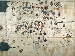
Background imageCartographer Collection: Chart by Juan de la Cosa (1450-1510). Spain. Madrid. Mavy Mu

Chart by Juan de la Cosa (1450-1510). Spain. Madrid. Mavy Museum

Background imageCartographer Collection: Salzburg and surroundings. Theatrum Orbis Terrarum by Abraha

Salzburg and surroundings. Theatrum Orbis Terrarum by Abraha
View of Salzburg and surroundings. Theatrum Orbis Terrarum by Abraham Ortelius (1527-1598). First Edition. Antwerp, 1574. Library of Catalonia. Barcelona. Spain

Background imageCartographer Collection: Ramon de Jaudenes y Alvarez (1841-1884). Spanish military an

Ramon de Jaudenes y Alvarez (1841-1884). Spanish military and cartographer. Their destinations were, Tetuan, Puerto Rico, Cuba and Ceuta. Engraving. La Ilustracion Espanola y Americana, 1884. Colored

Background imageCartographer Collection: Vespucci, Amerigo (1454-1512). Italian navigator, explorer a

Vespucci, Amerigo (1454-1512). Italian navigator, explorer and cartographer. Colored engraving. Cover of the German translation of the letter of Amerigo Vespucci to Lorenzo Pietro Pierfrancesco de

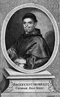
Background imageCartographer Collection: Vincente Maria Coronelli

Vincente Maria Coronelli
VINCENTE MARIA CORONELLI Venetian mathematician, geographer and cartographer (an important job for a trading nation like Venice) Date: 1650 - 1718

Background imageCartographer Collection: Richard Collin

Richard Collin
RICHARD COLLIN French geographer, cartographer and mathematician. Date: 1627 - ?

Background imageCartographer Collection: James King and James Cook - served in the Royal Navy

James King and James Cook - served in the Royal Navy
James King (1750-1784), british officer of the Royal Navy and the navigator and astronomer for Captain Cook (1728-1779), a British explorer, navigator, cartographer, and captain in the Royal Navy

Background imageCartographer Collection: ALCALA GALIANO Y DE ALCALA, Dionisio (1760-1805)

ALCALA GALIANO Y DE ALCALA, Dionisio (1760-1805). Spanish naval officer, cartographer, and explorer. Litography

Background imageCartographer Collection: AZARA, F鬩x de (1746-1821). Spanish explorer, naturalist

AZARA, F鬩x de (1746-1821). Spanish explorer, naturalist
AZARA, F鬩 x de (1746-1821). Spanish explorer, naturalist, engineer and cartographer. Engraving. SPAIN. MADRID (AUTONOMOUS COMMUNITY). Madrid. National Library

Background imageCartographer Collection: Captain James Cook

Captain James Cook
British Admiralty memorial statue of Captain James Cook (1728-1779) who made maps of Newfoundland before his 3 journies on the Endeavour to the Pacific where he discovered Australia

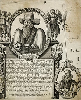
Background imageCartographer Collection: John More, clergyman and cartographer

John More, clergyman and cartographer
John More (?-1592), Fellow of Christs College, Cambridge, minister of St Andrews Church, Norwich, and cartographer. He worked for many years on a map of Canaan, based on biblical research

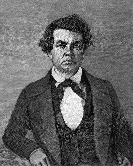
Background imageCartographer Collection: Charles Preuss

Charles Preuss
CHARLES PREUSS German-born cartographer, botanist and artist in America, working with Fremont to make important maps of the newly-explored West. Date: 1803 - 1864

Background imageCartographer Collection: Augustin Hirschvogel

Augustin Hirschvogel
AUGUSTIN HIRSCHVOGEL German artist, mathematician and cartographer, born at Nurnberg, died at Vienna. Date: 1503 - 1553

Background imageCartographer Collection: 1818, Pinkerton Map of Northern Africa and the Mediterranean, John Pinkerton, 1758 - 1826

1818, Pinkerton Map of Northern Africa and the Mediterranean, John Pinkerton, 1758 - 1826, Scottish antiquarian, cartographer, UK

Background imageCartographer Collection: 1818, Pinkerton Map of Australia and New Zealand, John Pinkerton, 1758 - 1826, Scottish antiquarian

1818, Pinkerton Map of Australia and New Zealand, John Pinkerton, 1758 - 1826, Scottish antiquarian, cartographer, UK

Background imageCartographer Collection: 1818, Pinkerton Map of the Northern United States, John Pinkerton, 1758 - 1826, Scottish

1818, Pinkerton Map of the Northern United States, John Pinkerton, 1758 - 1826, Scottish antiquarian, cartographer, UK

Background imageCartographer Collection: 1818, Pinkerton Map of the Austrian Empire, John Pinkerton, 1758 - 1826, Scottish antiquarian

1818, Pinkerton Map of the Austrian Empire, John Pinkerton, 1758 - 1826, Scottish antiquarian, cartographer, UK

Background imageCartographer Collection: 1818, Pinkerton Map of Spain and Portugal, John Pinkerton, 1758 - 1826, Scottish antiquarian

1818, Pinkerton Map of Spain and Portugal, John Pinkerton, 1758 - 1826, Scottish antiquarian, cartographer, UK

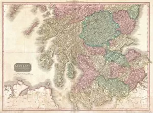
Background imageCartographer Collection: 1818, Pinkerton Map of Southern Scotland, John Pinkerton, 1758 - 1826, Scottish antiquarian

1818, Pinkerton Map of Southern Scotland, John Pinkerton, 1758 - 1826, Scottish antiquarian, cartographer, UK

Background imageCartographer Collection: 1818, Pinkerton Map of South America, John Pinkerton, 1758 - 1826, Scottish antiquarian

1818, Pinkerton Map of South America, John Pinkerton, 1758 - 1826, Scottish antiquarian, cartographer, UK

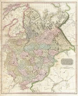
Background imageCartographer Collection: 1818, Pinkerton Map of Russia in Europe, John Pinkerton, 1758 - 1826, Scottish antiquarian

1818, Pinkerton Map of Russia in Europe, John Pinkerton, 1758 - 1826, Scottish antiquarian, cartographer, UK

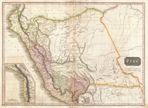
Background imageCartographer Collection: 1818, Pinkerton Map of Peru, John Pinkerton, 1758 - 1826, Scottish antiquarian, cartographer

1818, Pinkerton Map of Peru, John Pinkerton, 1758 - 1826, Scottish antiquarian, cartographer, UK

Background imageCartographer Collection: 1818, Pinkerton Map of Portugal, John Pinkerton, 1758 - 1826, Scottish antiquarian

1818, Pinkerton Map of Portugal, John Pinkerton, 1758 - 1826, Scottish antiquarian, cartographer, UK

Background imageCartographer Collection: 1818, Pinkerton Map of Poland, John Pinkerton, 1758 - 1826, Scottish antiquarian

1818, Pinkerton Map of Poland, John Pinkerton, 1758 - 1826, Scottish antiquarian, cartographer, UK

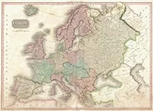
Background imageCartographer Collection: 1818, Pinkerton Map of of Europe, John Pinkerton, 1758 - 1826, Scottish antiquarian

1818, Pinkerton Map of of Europe, John Pinkerton, 1758 - 1826, Scottish antiquarian, cartographer, UK

Background imageCartographer Collection: 1818, Pinkerton Map of Northern England, John Pinkerton, 1758 - 1826, Scottish antiquarian

1818, Pinkerton Map of Northern England, John Pinkerton, 1758 - 1826, Scottish antiquarian, cartographer, UK

Background imageCartographer Collection: 1818, Pinkerton Map of North America, John Pinkerton, 1758 - 1826, Scottish antiquarian

1818, Pinkerton Map of North America, John Pinkerton, 1758 - 1826, Scottish antiquarian, cartographer, UK

Background imageCartographer Collection: 1818, Pinkerton Map of Northern Scotland, John Pinkerton, 1758 - 1826, Scottish antiquarian

1818, Pinkerton Map of Northern Scotland, John Pinkerton, 1758 - 1826, Scottish antiquarian, cartographer, UK

Background imageCartographer Collection: 1818, Pinkerton Map of North America and South America, John Pinkerton, 1758 - 1826

1818, Pinkerton Map of North America and South America, John Pinkerton, 1758 - 1826, Scottish antiquarian, cartographer, UK

Background imageCartographer Collection: 1818, Pinkerton Map of Holland or the Netherlands, John Pinkerton, 1758 - 1826, Scottish

1818, Pinkerton Map of Holland or the Netherlands, John Pinkerton, 1758 - 1826, Scottish antiquarian, cartographer, UK

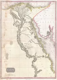
Background imageCartographer Collection: 1818, Pinkerton Map of Egypt, John Pinkerton, 1758 - 1826, Scottish antiquarian, cartographer

1818, Pinkerton Map of Egypt, John Pinkerton, 1758 - 1826, Scottish antiquarian, cartographer, UK

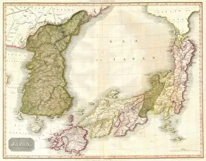
Background imageCartographer Collection: 1818, Pinkerton Map of Korea and Japan, John Pinkerton, 1758 - 1826, Scottish antiquarian

1818, Pinkerton Map of Korea and Japan, John Pinkerton, 1758 - 1826, Scottish antiquarian, cartographer, UK

Background imageCartographer Collection: 1818, Pinkerton Map of Ireland, John Pinkerton, 1758 - 1826, Scottish antiquarian

1818, Pinkerton Map of Ireland, John Pinkerton, 1758 - 1826, Scottish antiquarian, cartographer, UK

Background imageCartographer Collection: 1818, Pinkerton Map of France, John Pinkerton, 1758 - 1826, Scottish antiquarian

1818, Pinkerton Map of France, John Pinkerton, 1758 - 1826, Scottish antiquarian, cartographer, UK

Background imageCartographer Collection: 1818, Pinkerton Map of Asia, John Pinkerton, 1758 - 1826, Scottish antiquarian, cartographer

1818, Pinkerton Map of Asia, John Pinkerton, 1758 - 1826, Scottish antiquarian, cartographer, UK

Background imageCartographer Collection: 1818, Pinkerton Map of British North America or Canada, John Pinkerton, 1758 - 1826

1818, Pinkerton Map of British North America or Canada, John Pinkerton, 1758 - 1826, Scottish antiquarian, cartographer, UK

Background imageCartographer Collection: 1818, Pinkerton Map of Beligum, John Pinkerton, 1758 - 1826, Scottish antiquarian

1818, Pinkerton Map of Beligum, John Pinkerton, 1758 - 1826, Scottish antiquarian, cartographer, UK

Background imageCartographer Collection: 1818, Pinkerton Map of Africa, John Pinkerton, 1758 - 1826, Scottish antiquarian

1818, Pinkerton Map of Africa, John Pinkerton, 1758 - 1826, Scottish antiquarian, cartographer, UK


All Professionally Made to Order for Quick Shipping

"Unveiling the World: A Journey through the Eyes of Cartographers" Embark on a captivating voyage through time and space as we delve into the fascinating world of cartography. From the intrepid explorations of Captain James Cook in 1775 to Gerardus Mercator's groundbreaking map, Septentrionalium Terrarum descriptio, in 1595, these visionary individuals shaped our understanding of the globe. Traveling eastward, we encounter the Kingdom of Saxony's eastern part meticulously charted by skilled cartographers. The bustling ports of Portsmouth and Southampton come alive on Pinkerton Map's depiction of the British Isles in 1818, revealing their vital role in maritime history. Abraham Ortelius' magnum opus, Theatrum Orbis Terrarum (Theatre of the World), showcases an intricate tapestry that connects continents and cultures. Meanwhile, a glimpse at an old map from 1855 transports us to California's early days when its borders were still taking shape. A Vintage Map of the World invites us to explore distant lands like Bosnia, Dalmatia, Istria, Croatia, and Slavonia – regions steeped in rich history and cultural heritage. Leonard Euler's caricature adds a touch of whimsy to this journey as he playfully navigates his way across mathematical realms. As we turn back time once more with Sir Thomas More's Utopia woodcut from 1518 edition and Andreas Cellarius' masterful works capturing celestial wonders during Dutch-German Renaissance era; it becomes clear that cartography is not merely about maps but also about storytelling - weaving tales that transcend borders and eras. Join us as we celebrate these remarkable cartographers who dared to dream beyond horizons unknown – forever leaving their mark on our collective imagination. Let their artistry inspire you to see our world with fresh eyes while cherishing its ever-evolving beauty.