Fraud Blocker Skip to main content

Exploration Collection

"Unveiling the Unknown: A Journey through Time and Terrain" Embarking on a voyage of discovery, the HMS Erebus and HMS Terror set sail in 1845

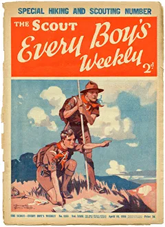
Background imageExploration Collection: The Scout, Every Boys Weekly front cover

The Scout, Every Boys Weekly front cover
Front cover of The Scout magazine, the " only weekly official organ of the boy scouts" featuring two enthusiastic and earnest looking boy scouts reading a map while out on a hike

Background imageExploration Collection: COOK: HMS RESOLUTION. Commanded by Captain James Cook on his second and third voyages of discovery

COOK: HMS RESOLUTION. Commanded by Captain James Cook on his second and third voyages of discovery. Watercolor by Midshipman Henry Roberts, a member of the ships company

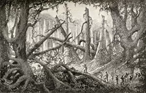
Background imageExploration Collection: Sir Henry Morton Stanley And His Men Crossing A Hazardous Forest Clearing During His Emin Pasha

Sir Henry Morton Stanley And His Men Crossing A Hazardous Forest Clearing During His Emin Pasha Relief Expedition In Africa, 1886 To 1889. From In Darkest Africa By Henry M. Stanley Published 1890

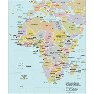
Background imageExploration Collection: Political Map of Africa

Political Map of Africa
Vector Illustration of the policital map of Africa Reference map as created by the US Central Intelligence Agency

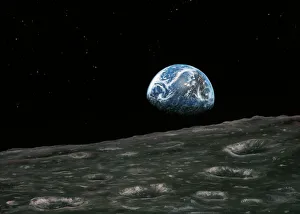
Background imageExploration Collection: Earthrise photograph, artwork

Earthrise photograph, artwork
Earthrise photograph. Artwork based on the famous Earthrise photographs taken by the Apollo 8 astronauts Frank Borman and William Anders

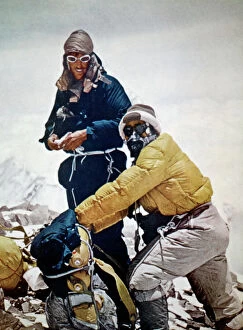
Background imageExploration Collection: SIR EDMUND HILLARY (1919-2008). New Zealand mountaineer and explorer. Sir Edmund Hillary

SIR EDMUND HILLARY (1919-2008). New Zealand mountaineer and explorer. Sir Edmund Hillary and Tenzing Norgay near the summit of Mount Everest, 28 May 1953

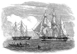
Background imageExploration Collection: HMS Erebus and HMS Terror, 1845

HMS Erebus and HMS Terror, 1845
Engraving showing HMS Erebus (left) and HMS Terror, pictured on the River Thames, 1845. In 1845 the British Admiralty sent two polar exploration ships, HMS Erebus and HMS Terror

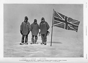
Background imageExploration Collection: Shackleton / Wild / Adams

Shackleton / Wild / Adams
Ernest Shackletons expedition reached within 100 miles of the South Pole. Shackleton, Wild and Adams 178 kilometres from the South Pole

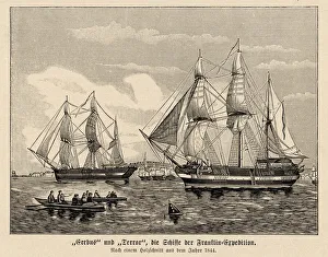
Background imageExploration Collection: Erebus and Terror, Franklins last trip

Erebus and Terror, Franklins last trip
The Erebus and Terror leave England on the Franklin polar expedition, never to return

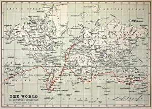
Background imageExploration Collection: Map Darwins Beagle Voyage South America

Map Darwins Beagle Voyage South America
Map of the World with Voyage of the Beagle coloured in red. Appendix from " The Voyage of HMS Beagle" by Charles Darwin (Cover Title) New Edition 1890 John Murray Publishers

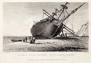
Background imageExploration Collection: HMS Beagle Ship laid up Darwins Voyage

HMS Beagle Ship laid up Darwins Voyage
" Beagle laid ashore, River Santa Cruz". Copperplate engraving, art by Conrad Martens, engraved by T. Landseer. Published by H. Colburn 1838

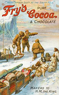
Background imageExploration Collection: Captain Robert Falcon Scott - Frys Cocoa Advert

Captain Robert Falcon Scott - Frys Cocoa Advert
Robert Falcon Scott (1868-1912), the English naval commander and explorer. A Captain in the Royal Navy, Scott led a number of expeditions to the Antarctic

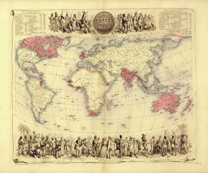
Background imageExploration Collection: British Empire world map, 19th century

British Empire world map, 19th century
British Empire world map. This world map shows the 19th-century British Empire (pink) and its indigenous peoples. Five illustrations (clockwise from upper left) show the people of Australia

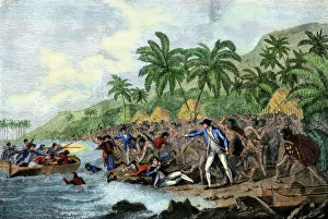
Background imageExploration Collection: Captain Cook killed by Hawaiian natives, 1779

Captain Cook killed by Hawaiian natives, 1779
Death of English explorer Captain James Cook in the Sandwich Islands (Hawaii), 1779. Hand-colored woodcut reproduction of a painting

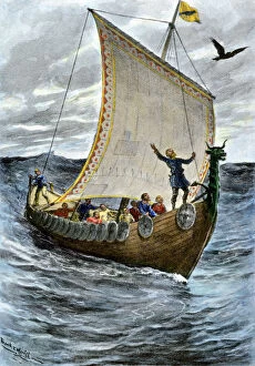
Background imageExploration Collection: Viking ship at sea

Viking ship at sea
Norsemen at sea following their raven pilot. Hand-colored halftone reproduction of a 19th-century illustration

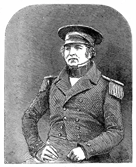
Background imageExploration Collection: Captain Francis Crozier of HMS Terror, 1845

Captain Francis Crozier of HMS Terror, 1845
Engraving of Captain Francis Crozier (1796-1848) of HMS Terror, pictured shortly before departing on the ill-fated Franklin Arctic expedition of 1845

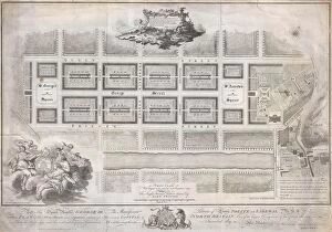
Background imageExploration Collection: 1768, James Craig Map of New Town, Edinburgh, Scotland, First Plan of New Town, topography

1768, James Craig Map of New Town, Edinburgh, Scotland, First Plan of New Town, topography
1768, James Craig Map of New Town, Edinburgh, Scotland, First Plan of New Town

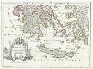
Background imageExploration Collection: 1794, Delisle Map of Southern Ancient Greece, Greeks Isles, and Crete, topography

1794, Delisle Map of Southern Ancient Greece, Greeks Isles, and Crete, topography
1794, Delisle Map of Southern Ancient Greece, Greeks Isles, and Crete

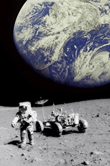
Background imageExploration Collection: Astronaut on Moon with Earth

Astronaut on Moon with Earth

Background imageExploration Collection: Durers world map, 1515

Durers world map, 1515. Albrecht Durer (1471- 1528) was a German artist. His skillful use of perspective and mathematical proportions made him one of the outstanding artistic figures of the early

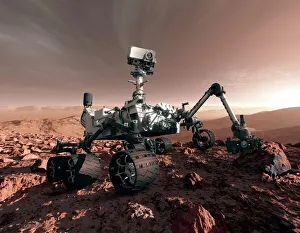
Background imageExploration Collection: Curiosity rover, artwork

Curiosity rover, artwork
NASAs next Mars rover, the Curiosity Rover, will land at the foot of a layered mountain inside the planets Gale Crater. Launch is palneed for November/ December 2011

Background imageExploration Collection: Amazing Crab Nebula

Amazing Crab Nebula
The Crab Nebula, the result of a supernova noted by Earth-bound chroniclers in 1054 A.D. is filled with mysterious filaments that are are not only tremendously complex

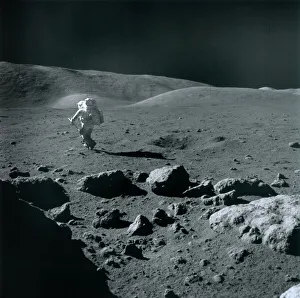
Background imageExploration Collection: Apollo 17 astronaut

Apollo 17 astronaut. US astronaut and geologist Dr Harrison Schmitt exploring the Taurus-Littrow region of the Moon, as part of NASAs Apollo 17 mission

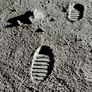
Background imageExploration Collection: Astronaut footprints on the Moon

Astronaut footprints on the Moon. Computer artwork recreating a photograph of boot imprints left by astronauts on the Moon

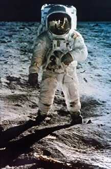
Background imageExploration Collection: APOLLO 11: BUZZ ALDRIN. Astronaut Edwin Buzz Aldrin standing on moon

APOLLO 11: BUZZ ALDRIN. Astronaut Edwin Buzz Aldrin standing on moon. Neil Armstrong and Eagle reflected in his visor
APOLLO 11: BUZZ ALDRIN. Astronaut Edwin Buzz Aldrin standing on moon. Armstrong and Eagle reflected in his visor, 20 July 1969

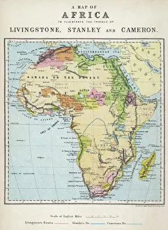
Background imageExploration Collection: Map of Africa illustrating travels of explorers

Map of Africa illustrating travels of explorers
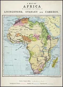
A map of Africa which illustrates the travels of the explorers Livingstone, Stanley and Cameron

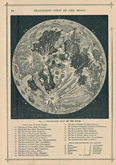
Background imageExploration Collection: 1886, Telescopic View and Map of the Moon, topography, cartography, geography, land

1886, Telescopic View and Map of the Moon, topography, cartography, geography, land
1886, Telescopic View and Map of the Moon

Background imageExploration Collection: Captain Scott in his workshop on board Terra Nova

Captain Scott in his workshop on board Terra Nova
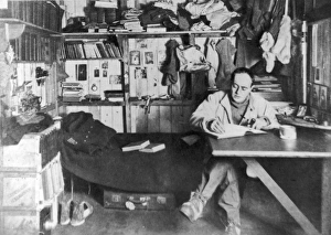
Captain Robert Falcon Scott (1868 - 1912), British polar explorer and leader of the ill-fated expedition to the South Pole in 1912, pictured in his work room on board the Terra Nova

Background imageExploration Collection: Derrick Floor of an oil rig, Iran

Derrick Floor of an oil rig, Iran
Derrick Floor of an oil drilling rig, Iran

Background imageExploration Collection: Map of Africa illustrating travels of explorers

Map of Africa illustrating travels of explorers
A map of Africa which illustrates the travels of Livingstone, Stanley and Cameron. Date: 19th Century

Background imageExploration Collection: Map of Europe, 1600

Map of Europe, 1600
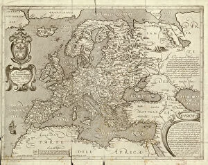
16th century map of Europe. Published in Sienna in 1600, this Italian map shows the latest knowledge of the geography of Europe

Background imageExploration Collection: Saturns rings, Cassini image

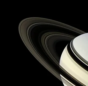
Saturns rings, Cassini image. The rings consist of particles of nearly pure water ice and meteoric dust and span almost 300, 000 kilometres

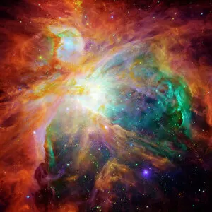
Background imageExploration Collection: Astronomy, Cloud, Constellation, Exploration, Galaxy, Illuminated, Light, Nebula

Astronomy, Cloud, Constellation, Exploration, Galaxy, Illuminated, Light, Nebula
Astronomy, Cloud, Constellation, Exploration, Galaxy, Illuminated, Lig, 78364142

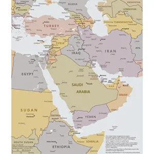
Background imageExploration Collection: Political map of The Middle East

Political map of The Middle East
Vector illustration of the policital map of The Middle East Reference map was created by the US Central Intelligence Agency

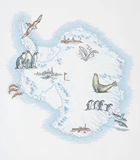
Background imageExploration Collection: Map of Antarctica overlaid with illustrations of Sea Gulls, Penguins, Elephant Seal

Map of Antarctica overlaid with illustrations of Sea Gulls, Penguins, Elephant Seal, Shrimp and buildings

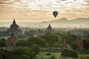
Background imageExploration Collection: Hot air balloon over the Temples of Bagan at dawn, Myanmar, November 2012

Hot air balloon over the Temples of Bagan at dawn, Myanmar, November 2012

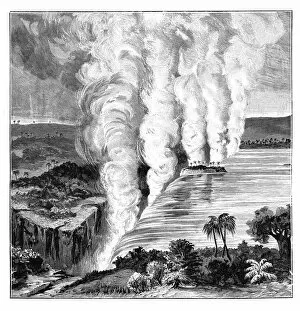
Background imageExploration Collection: Victoria Falls of the Zambezi River, on the border between Zambia and Zimbabwe, 1900

Victoria Falls of the Zambezi River, on the border between Zambia and Zimbabwe, 1900
Victoria Falls on the Zambezi River, on the border between Zambia and Zimbabwe, Africa, 1900. Scottish missionary and explorer David Livingstone (1813-1873)

Background imageExploration Collection: A sperm whale family swimming together

A sperm whale family swimming together
A sperm whale family swims together while sharing a close bond between them

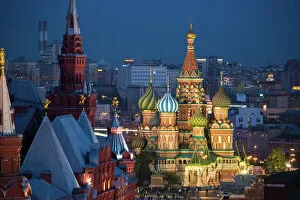
Background imageExploration Collection: St. Basils Cathedral

St. Basils Cathedral
Moscow, Russia, Red square, view of St. Basils Cathedral

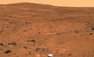
Background imageExploration Collection: Martian landscape, Spirit rover image

Martian landscape, Spirit rover image
Martian landscape. False-colour image of the Martian surface taken by NASAs Mars exploration rover Spirit between the 23rd and 24th November 2005. Part of the rover can be seen at bottom centre

Background imageExploration Collection: FRANKLIN'S WRITING

FRANKLIN'S WRITING
Document transcribed by Sir John Franklin stating that H.M.S Erebus & Terror wintered in the ice at Beechey Island. Informs of his death & signed by Capt.s Crozier & Fitzjames. Date: 28 May 1847

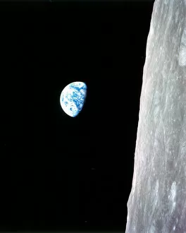
Background imageExploration Collection: Earthrise - Apollo 8, December 24, 1968. Creator: William A Anders

Earthrise - Apollo 8, December 24, 1968. Creator: William A Anders
Earthrise - Apollo 8, December 24, 1968. This view of the rising Earth greeted the Apollo 8 astronauts as they came from behind the Moon after the fourth nearside orbit

Background imageExploration Collection: Victoria Falls: The Leaping Water, pub. 1864. Creator: Thomas Baines (1820-75)

Victoria Falls: The Leaping Water, pub. 1864. Creator: Thomas Baines (1820-75)
Victoria Falls: The Leaping Water, from Explorations in South West Africa, pub. 1864 (colour lithograph). made in collaboration with James Chapman (1831-1872)

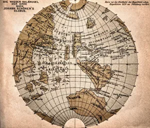
Background imageExploration Collection: World map from 1520

World map from 1520
Western hemisphere of the Johannes SchAoner globe from 1520. expedition

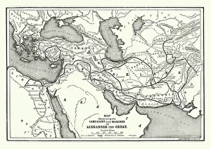
Background imageExploration Collection: Ancient History - Map of Alexander the Great Campaigns

Ancient History - Map of Alexander the Great Campaigns
Vintage engraving of a map of the campaigns and marches of Alexander the Great

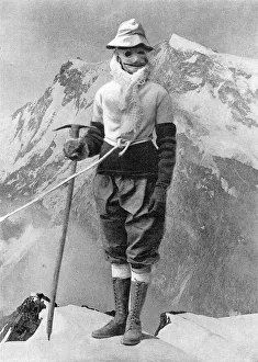
Background imageExploration Collection: Annie Peck masked and dressed for climbing

Annie Peck masked and dressed for climbing
Annie Smith Peck (October 19, 1850 July 18, 1935), American mountaineer pictured in her climbing outfit at the time she had scaled Mount Huascan

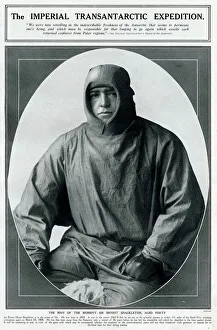
Background imageExploration Collection: Sir Ernest Henry Shackleton, polar explorer

Sir Ernest Henry Shackleton, polar explorer
Sir Ernest Henry Shackleton (1874 - 1922), Anglo-Irish Antarctic explorer. Seen here at the age of 40 in windproof garments

Background imageExploration Collection: Sir Ernest Shackleton and others, Antarctic

Sir Ernest Shackleton and others, Antarctic
Sir Ernest Shackleton and three members of a polar exploration party, photographed within 111 miles of the South Pole in 1907-9 on board the Nimrod


All Professionally Made to Order for Quick Shipping

"Unveiling the Unknown: A Journey through Time and Terrain" Embarking on a voyage of discovery, the HMS Erebus and HMS Terror set sail in 1845, their mission shrouded in mystery. As they ventured into uncharted waters, these vessels became symbols of exploration's relentless pursuit. Across distant lands, explorers like Sir Edmund Hillary left indelible marks on history. Scaling the majestic Mount Everest alongside Tenzing Norgay in 1953, they reached new heights both literally and metaphorically. Their triumph echoed throughout time as a testament to human resilience. Yet not all expeditions ended with glory. The ill-fated journey of Erebus and Terror marked Franklin's last endeavor, forever etched in maritime lore. These ships vanished into icy depths, leaving behind tales of bravery amidst treacherous conditions. In a single snapshot captured from space, the Earthrise photograph revealed our planet's fragility against the vastness of space—a reminder that exploration extends beyond earthly boundaries. Heroes emerged from adversity; Shackleton, Wild, and Adams defied nature's wrath during their Antarctic expedition—an epic tale of survival against all odds. The HMS Beagle Ship laid up after Darwin's transformative voyage—its significance imprinted upon scientific progress forevermore. This vessel carried ideas that challenged conventions and reshaped our understanding of life itself. Maps unfolded before us like portals to unknown territories—the British Empire world map depicted an era when exploration expanded horizons far beyond imagination. From ancient Viking ships sailing turbulent seas to Captain Francis Crozier leading his crew aboard HMS Terror—exploration coursed through veins filled with courage and determination. Even within city limits lay untrodden paths waiting to be discovered—the James Craig Map showcased Edinburgh's New Town emerging from topographical dreams into reality—an urban landscape born out of innovation and vision.