Premium Framed Print > Aerial Photography > Australia
Premium Framed Print : Australia, topographic map


![]()
Framed Photos from Science Photo Library
Australia, topographic map
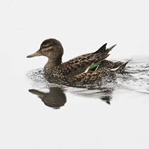
Australia, topographic map. Highlands and lowlands of the continents are shown as ridges and flat areas. Southeast Asia (top left), New Zealand (lower right) and Antarctica (bottom right, white) are also seen, along with the South Pacific Ocean and its various islands (upper right). The seabed depth varies from shallow (light blue) on the continental shelves to deep ocean basins (dark blue). Topographic and bathymetric data is usually gathered by using aerial and satellite imagery combined with radar and sonar mapping. The satellites in this case were NOas POES satellites
Science Photo Library features Science and Medical images including photos and illustrations
Media ID 1705083
© PLANETARY VISIONS LTD/SCIENCE PHOTO LIBRARY
Altimetric Altimetry Australasia Australia Basin Bathymetric Bathymetry Combined Data Continent Continental Shelf Continents Data Depth Depths Floor Globe Highlands Indonesia Island Land Lowlands Malaysia Mapped Mountains New Guinea Oceanic Oceanographic Oceanography Philippines Physical Geography Plains Radar Region Ridge Ridges Round Satellite Satellite Image Sea Bed Sea Floor Shelves Sonar Mapping Sonic South East Asia Southeast Asia Topographic Topography World Island Chain Papua South Pacific Ocean
31"x27" (79x69cm) Premium Frame
FSC real wood frame with double mounted 24x20 print. Double mounted with white conservation mountboard. Frame moulding comprises stained composite natural wood veneers (Finger Jointed Pine) 39mm wide by 21mm thick. Archival quality Fujifilm CA photo paper mounted onto 1mm card. Overall outside dimensions are 31x27 inches (787x685mm). Rear features Framing tape to cover staples, 50mm Hanger plate, cork bumpers. Glazed with durable thick 2mm Acrylic to provide a virtually unbreakable glass-like finish. Acrylic Glass is far safer, more flexible and much lighter than typical mineral glass. Moreover, its higher translucency makes it a perfect carrier for photo prints. Acrylic allows a little more light to penetrate the surface than conventional glass and absorbs UV rays so that the image and the picture quality doesn't suffer under direct sunlight even after many years. Easily cleaned with a damp cloth. Please note that, to prevent the paper falling through the mount window and to prevent cropping of the original artwork, the visible print may be slightly smaller to allow the paper to be securely attached to the mount without any white edging showing and to match the aspect ratio of the original artwork.
FSC Real Wood Frame and Double Mounted with White Conservation Mountboard - Professionally Made and Ready to Hang
Estimated Image Size (if not cropped) is 59.9cm x 59.9cm (23.6" x 23.6")
Estimated Product Size is 68.5cm x 78.7cm (27" x 31")
These are individually made so all sizes are approximate
Artwork printed orientated as per the preview above, with landscape (horizontal) or portrait (vertical) orientation to match the source image.
FEATURES IN THESE COLLECTIONS
> Aerial Photography
> Australia
> Aerial Photography
> Related Images
> Animals
> Mammals
> Muridae
> Plains Mouse
> Arts
> Artists
> O
> Oceanic Oceanic
> Asia
> Indonesia
> Related Images
> Asia
> Malaysia
> Related Images
> Asia
> Philippines
> Maps
> Science Photo Library
> Aerial and Satellite
EDITORS COMMENTS
This print showcases the topographic map of Australia, revealing its diverse landscapes and geographical features. The image not only highlights the highlands and lowlands of the continent but also provides a glimpse of neighboring regions such as Southeast Asia, New Zealand, and Antarctica. The South Pacific Ocean with its numerous islands can be seen in the upper right corner. The varying shades of blue represent the seabed depth, ranging from shallow waters on continental shelves to deep ocean basins. To gather this detailed topographic and bathymetric data, a combination of aerial and satellite imagery along with radar and sonar mapping techniques were utilized. In this case, NOas POES satellites played a crucial role in capturing accurate information. This print is an excellent representation of how technology has revolutionized our understanding of Earth's physical geography. It serves as a reminder that advancements in satellite imaging have enabled us to explore even the most remote corners of our planet. With its intricate details and comprehensive mapping, this image offers valuable insights into Australia's landforms while encompassing broader perspectives on regional geography. Science Photo Library has once again provided us with an awe-inspiring visual that celebrates both scientific exploration and our planet's natural beauty.
MADE IN THE UK
Safe Shipping with 30 Day Money Back Guarantee
FREE PERSONALISATION*
We are proud to offer a range of customisation features including Personalised Captions, Color Filters and Picture Zoom Tools
SECURE PAYMENTS
We happily accept a wide range of payment options so you can pay for the things you need in the way that is most convenient for you
* Options may vary by product and licensing agreement. Zoomed Pictures can be adjusted in the Basket.