
Bathymetric Collection
"Bathymetric: Unveiling the Hidden Depths of Earth's Topography" Dive into the mesmerizing world of bathymetry, where Earth's surface reveals its hidden secrets


All Professionally Made to Order for Quick Shipping
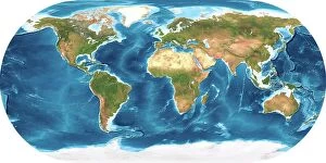
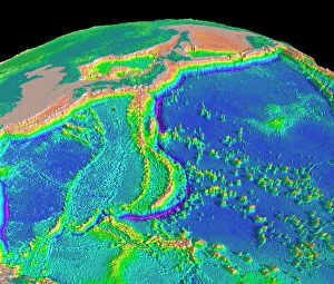
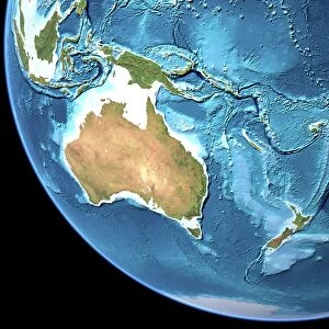
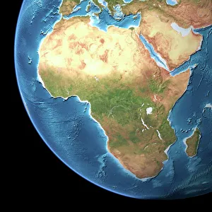
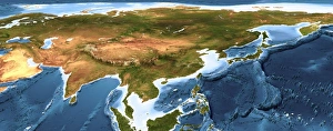
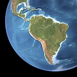
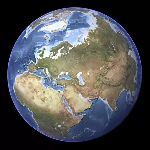
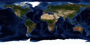
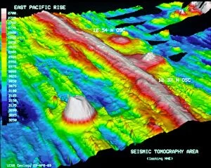
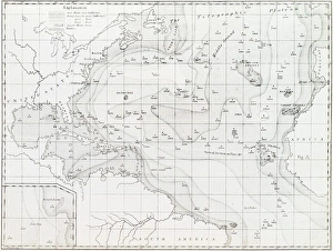
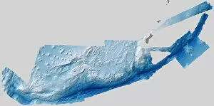
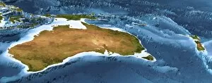
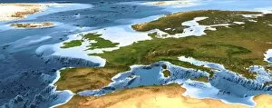
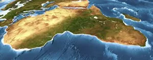
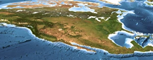
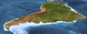
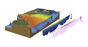
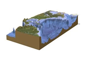
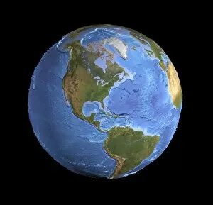
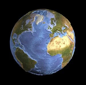
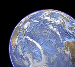
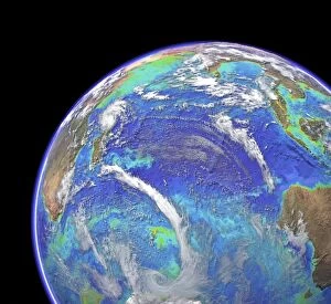
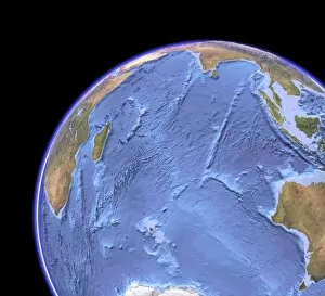
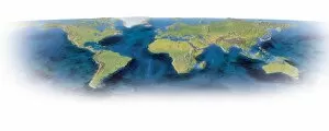
"Bathymetric: Unveiling the Hidden Depths of Earth's Topography" Dive into the mesmerizing world of bathymetry, where Earth's surface reveals its hidden secrets. Just as a topographic map showcases the highs and lows of landforms, a bathymetric map unravels the mysteries beneath our vast oceans. Explore the Mariana Trench sea floor topography, an abyss deeper than Mount Everest is tall. This astonishing feature reminds us that Earth's wonders extend far beyond what meets the eye. Venturing to Australia, witness how a topographic map unveils its diverse landscapes - from rugged mountains to expansive plains. But don't stop there; delve into an earthy fusion of both topographic and bathymetric maps revealing Australia's submerged treasures. Journeying across Africa, immerse yourself in its captivating contours through a detailed topographic map. From towering peaks to sprawling savannas, this continent boasts unparalleled natural beauty. Asia comes alive with breathtaking 3D artwork showcasing intricate details like never before. The C015 / 6575 masterpiece invites you to marvel at Asia's majestic mountains and winding rivers from an entirely new perspective. Witness Africa and Atlantic Ocean harmoniously depicted in C016 / 3727 artwork adorned with ethereal clouds. This artistic portrayal captures nature's interconnectedness between continents and seas. North America beckons exploration through its meticulously crafted topographic map. Traverse snow-capped peaks, mighty rivers, and vast forests while unraveling North America's geological tapestry. Eurasia unravels its rich tapestry on another stunning topographic map. Discover Europe blending seamlessly with Asia as mountain ranges intertwine amidst rolling hills and fertile valleys. Behold the full glory of Earth as it emerges through exquisite shading techniques combining both topography and bathymetry. This masterful depiction offers a holistic view of our planet’s dynamic landscape – above water or below it.