Home > North America > Canada > Maps
EXPL2A-00190
![]()

Wall Art and Photo Gifts from North Wind
EXPL2A-00190
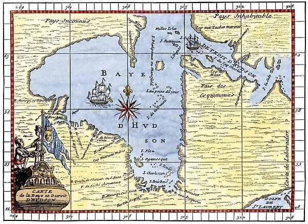
Map of Hudsons Bay, Canada, showing Hudsons Strait, 1722.
Hand-colored 19th-century woodcut reproduction of an 18th-century map
North Wind Picture Archives brings history to life with stock images and hand-colored illustrations
Media ID 5879596
© North Wind Picture Archives
1700s 18th Century Arctic Atlantic Canada Canadian Cartography Chart Colonial Colony Compass Discover Exploration Explore French French Canada Henry Hudson Hudson Journey Labrador Maritime Navigation New World Northwest Passage Ocean Quebec Sail Ship Strait Trade Travel Voyage 1722 Hudson Bay Hudson Strait Hudsons Bay
FEATURES IN THESE COLLECTIONS
> Maps and Charts
> World
> North America
> Canada
> Maps
> North Wind Picture Archives
> Canadian history
> North Wind Picture Archives
> Maps
EDITORS COMMENTS
This print showcases a remarkable piece of history - a hand-colored 19th-century woodcut reproduction of an 18th-century map titled "EXPL2A-00190 (Map of Hudsons Bay, Canada, showing Hudsons Strait, 1722)". The intricate details and vibrant colors bring to life the exploration and colonial era of North America. The map itself is a testament to the adventurous spirit that characterized this period. It depicts the vast expanse of Hudson's Bay, with its intricate network of waterways and islands. The strategic importance of this region for trade and navigation becomes evident as you trace the lines connecting Quebec to various points along the bay. As your eyes wander across the map, you can't help but imagine the brave sailors who embarked on perilous journeys through these treacherous waters. Ships gracefully sail through Hudson's Strait while navigating their way towards uncharted territories in search of new trade routes or undiscovered lands. This artwork not only captures a specific moment in time but also serves as a reminder of our collective past. It tells stories about French Canadian explorers like Henry Hudson and their quest for adventure in unknown territories. Whether you are fascinated by cartography or simply intrigued by maritime history, this vintage print offers an opportunity to delve into the rich tapestry that shaped North America centuries ago. Let it transport you back to an era when maps were essential tools for discovery and imagination knew no bounds.
MADE IN THE UK
Safe Shipping with 30 Day Money Back Guarantee
FREE PERSONALISATION*
We are proud to offer a range of customisation features including Personalised Captions, Color Filters and Picture Zoom Tools
SECURE PAYMENTS
We happily accept a wide range of payment options so you can pay for the things you need in the way that is most convenient for you
* Options may vary by product and licensing agreement. Zoomed Pictures can be adjusted in the Basket.


