Fraud Blocker Skip to main content

Chart Collection

"Unlocking the Secrets: Exploring the Fascinating World of Charts" Dive into the realm of reflexology with a detailed foot map chart

Background imageChart Collection: Reflexology foot map, artwork

Reflexology foot map, artwork. Reflexology is a form of alternative medicine in which disorders in the body are treated by massaging areas of the feet thought to correspond to the affected area

Background imageChart Collection: Kiss of the Oceans - Atlantic meets Pacific - Panama Canal

Kiss of the Oceans - Atlantic meets Pacific - Panama Canal
The Kiss of the Oceans - The Atlantic meets the Pacific due to the construction of The Panama Canal - A lovely allegorical card relating to this phenomenal engineering project

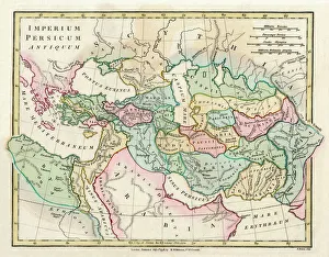
Background imageChart Collection: Map of the Ancient Persian Empire

Map of the Ancient Persian Empire, encompassing Greece to the north west, Arabia to the south east, Egypt and Libya to the south west and deep in the Caucasus in the north east. Date: 1798

Background imageChart Collection: Old Caucasus map

Old Caucasus map
Antique map of Caucasus

Background imageChart Collection: Antique Map of Tasmania

Antique Map of Tasmania
Antique map of Tasmania from 1867

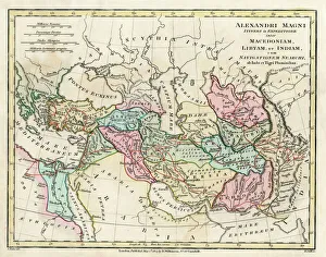
Background imageChart Collection: Map of the Empire of King Alexander the Great

Map of the Empire of King Alexander the Great (Alexander III of Macedon 356323 BC), from Greece in the west to India in the east. Date: 1807

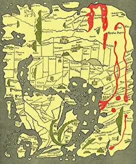
Background imageChart Collection: Anglo-Saxon 10th century world map

Anglo-Saxon 10th century world map
Anglo-Saxon world map, dating from the 10th century. East is top. This map of the known world was probably produced by an Irish monk

Background imageChart Collection: Eyesight test chart

Eyesight test chart

Background imageChart Collection: Old Map of the Alps

Old Map of the Alps
OLD MAP OF THE ALPS

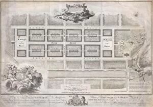
Background imageChart Collection: 1768, James Craig Map of New Town, Edinburgh, Scotland, First Plan of New Town, topography

1768, James Craig Map of New Town, Edinburgh, Scotland, First Plan of New Town, topography
1768, James Craig Map of New Town, Edinburgh, Scotland, First Plan of New Town

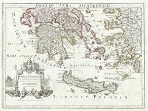
Background imageChart Collection: 1794, Delisle Map of Southern Ancient Greece, Greeks Isles, and Crete, topography

1794, Delisle Map of Southern Ancient Greece, Greeks Isles, and Crete, topography
1794, Delisle Map of Southern Ancient Greece, Greeks Isles, and Crete

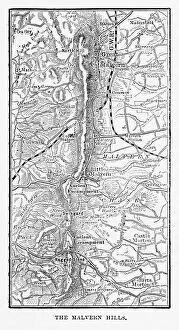
Background imageChart Collection: Map of Malvern Hills in Worcestershire, England Victorian Engraving, 1840

Map of Malvern Hills in Worcestershire, England Victorian Engraving, 1840
Very Rare, Beautifully Illustrated Antique Engraving of Map of Malvern Hills in Worcestershire, England Victorian Engraving, 1840. Source: Original edition from my own archives

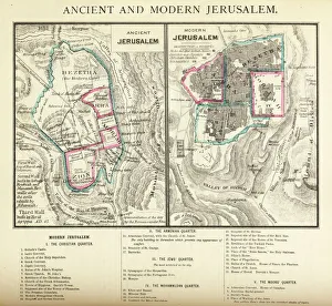
Background imageChart Collection: Ancient and Modern Jerusalem Map Engraving

Ancient and Modern Jerusalem Map Engraving
Engraved illustration of Ancient and Modern Jerusalem Map Engraving from The Popular Pictorial Bible, Containing the Old and New Testaments, Published in 1862. Copyright has expired on this artwork

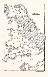
Background imageChart Collection: Map of England Showing the Anglo-Saxon Kingdoms and Danish Districts

Map of England Showing the Anglo-Saxon Kingdoms and Danish Districts

Background imageChart Collection: Map of Ancient Egypt

Map of Ancient Egypt. Date: 1814

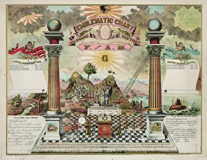
Background imageChart Collection: Emblematic chart and Masonic history of Free and Accepted Ma

Emblematic chart and Masonic history of Free and Accepted Ma

Background imageChart Collection: Masonic chart

Masonic chart. Date c1872

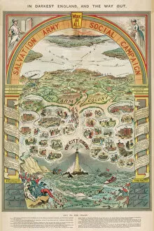
Background imageChart Collection: Salvation Army Campaign

Salvation Army Campaign
A social campaign chart

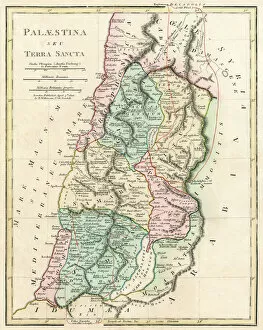
Background imageChart Collection: Map of Palestine and the Holy Land

Map of Palestine and the Holy Land - all places named in their Latin form. Date: 1806

Background imageChart Collection: Chinese Acupuncturechart

Chinese Acupuncturechart
CHINESE ACUPUNCTURE CHART showing the crucial locations on the body

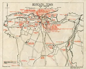
Background imageChart Collection: WW2 - Map of Beirut, Lebanon - with Military locations

WW2 - Map of Beirut, Lebanon - with Military locations
End of WW2 - Map of Beirut, Lebanon showing Military locations important for a British serviceman stationed in the city at the end of the Second World War

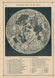
Background imageChart Collection: 1886, Telescopic View and Map of the Moon, topography, cartography, geography, land

1886, Telescopic View and Map of the Moon, topography, cartography, geography, land
1886, Telescopic View and Map of the Moon

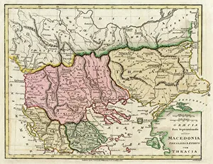
Background imageChart Collection: Map of the Macedonian and Thracian Empire

Map of the Macedonian and Thracian Empire. Date: 1808

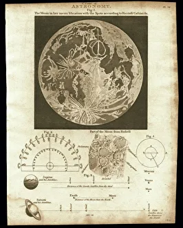
Background imageChart Collection: Early map of the Moon, 1810

Early map of the Moon, 1810
Map of the Moon, 1810. This plate depicts the geographical features of the moon using observations by Cassini and Riccioli

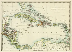
Background imageChart Collection: Caribbean islands, 1870s

Caribbean islands, 1870s
Map of West Indies and the Caribbean Sea, 1800s. Printed color lithograph

Background imageChart Collection: Antquie Map of Italy

Antquie Map of Italy
Vintage map of Italy fron 1837

Background imageChart Collection: Diagram showing the spectral class and luminosity of stars

Diagram showing the spectral class and luminosity of stars. The diagram was named The Hertzsprung-Russell Diagram, or the H-R diagram for short

Background imageChart Collection: Old Map of London

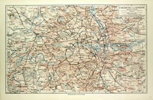
Old Map of London
OLD MAP OF LONDON

Background imageChart Collection: Paint Chart / 1908

Paint Chart / 1908
PAINT CHART

Background imageChart Collection: Antique Map of Western USA

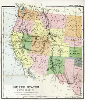
Antique Map of Western USA
Antique Map from 1867 of Western United States of America

Background imageChart Collection: Salvation Army Social Campaign propaganda poster, London, c. 1910 (chromolitho)

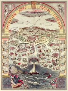
Salvation Army Social Campaign propaganda poster, London, c. 1910 (chromolitho)
XND75970 Salvation Army Social Campaign propaganda poster, London, c.1910 (chromolitho) by English School, (20th century); Private Collection; (add.info.: In Darkest England and the Way Out)

Background imageChart Collection: Map of Cyprus - The Island of Venus

Map of Cyprus - The Island of Venus. circa 1930s

Background imageChart Collection: The Selden Map of China. Artist: Chinese Master

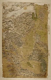
The Selden Map of China. Artist: Chinese Master
The Selden Map of China. Found in the collection of the Bodleian Library, Oxford

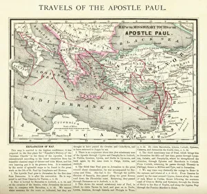
Background imageChart Collection: Travels of The Apostle Paul Map Engraving

Travels of The Apostle Paul Map Engraving
Engraved illustration of the Travels of The Apostle Paul Map Engraving from The Popular Pictorial Bible, Containing the Old and New Testaments, Published in 1862

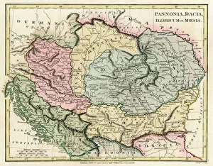
Background imageChart Collection: Map of the Dacian Empire and Roman provinces

Map of the Dacian Empire and Roman provinces. Date: 1801

Background imageChart Collection: Home cholesterol test kit

Home cholesterol test kit
Cholesterol indicator test for use at home. This kit tests a small sample of blood for the presence of high levels of cholesterol. The scale on the disk indicates the level of cholesterol

Background imageChart Collection: Soil triangle diagram

Soil triangle diagram. This diagram is used to work out the type of soil in an area. A sample of soil is left to settle in water. Larger particles settle out of suspension faster than smaller ones

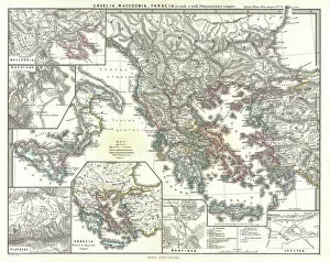
Background imageChart Collection: 1865, Spruner Map of Greece, Macedonia and Thrace before the Peloponnesian War. topography

1865, Spruner Map of Greece, Macedonia and Thrace before the Peloponnesian War. topography
1865, Spruner Map of Greece, Macedonia and Thrace before the Peloponnesian War

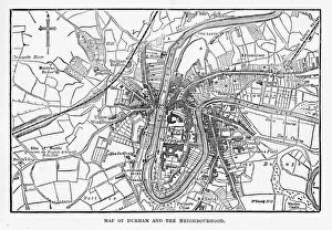
Background imageChart Collection: Map of the City of Durham, England Victorian Engraving, 1840

Map of the City of Durham, England Victorian Engraving, 1840
Very Rare, Beautifully Illustrated Antique Engraving of Map of the City of Durham, England Victorian Engraving, 1840. Source: Original edition from my own archives

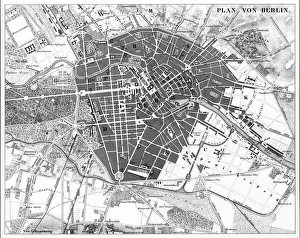
Background imageChart Collection: Berlin, Germany Map

Berlin, Germany Map
Engraved illustrations of a Map of the City of Berlin, Germany from Iconographic Encyclopedia of Science, Literature and Art, Published in 1851. Copyright has expired on this artwork

Background imageChart Collection: COMPARATIVE EMBRYOLOGY. Chart showing comparative embryology from a fish to a man

COMPARATIVE EMBRYOLOGY. Chart showing comparative embryology from a fish to a man, made by the Department of Comparative and Human Anatomy at the American Museum of Natural History, 1932

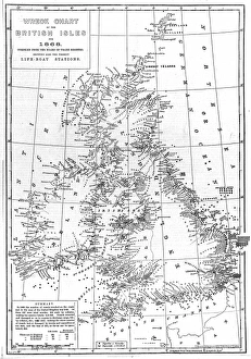
Background imageChart Collection: Wreck Chart of the British Isles For 1868

Wreck Chart of the British Isles For 1868
Chart showing the positions of all 2131 vessels wrecked around the British Isles during 1868, compiled from the Board of Trade records

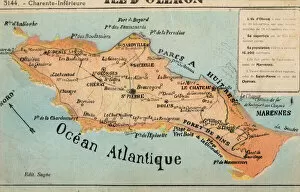
Background imageChart Collection: Ile d Oleron - off the French Atlantic Coast

Ile d Oleron - off the French Atlantic Coast
Ile d Oleron - an island off the Atlantic coast of France, on the southern side of the Pertuis d Antioche strait. It is the second largest island of Metropolitan France, after Corsica

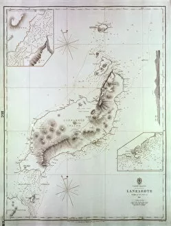
Background imageChart Collection: Map of Lanzarote, Canary Islands

Map of Lanzarote, Canary Islands, with soundings in fathoms. Date: 1835

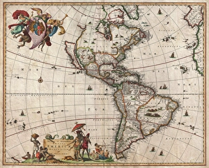
Background imageChart Collection: 1658, Visscher Map of North America and South America, topography, cartography, geography

1658, Visscher Map of North America and South America, topography, cartography, geography
1658, Visscher Map of North America and South America

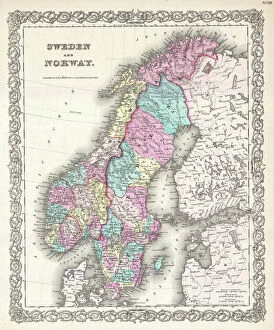
Background imageChart Collection: 1855, Colton Map of Scandinavia, Norway, Sweden, Finland, topography, cartography

1855, Colton Map of Scandinavia, Norway, Sweden, Finland, topography, cartography
1855, Colton Map of Scandinavia, Norway, Sweden, Finland

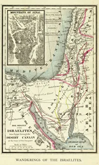
Background imageChart Collection: Wanderings of the Israelites Map Engraving

Wanderings of the Israelites Map Engraving
Engraved illustration of Wanderings of the Israelites Map Engraving from The Popular Pictorial Bible, Containing the Old and New Testaments, Published in 1862. Copyright has expired on this artwork
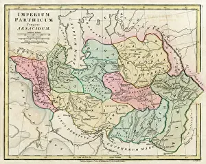
Background imageChart Collection: Map of Persia (Iran)

Map of Persia (Iran) - all place names in their Latin form. The ancient realms of Assyria, Babylonia Date: 1807


All Professionally Made to Order for Quick Shipping

"Unlocking the Secrets: Exploring the Fascinating World of Charts" Dive into the realm of reflexology with a detailed foot map chart, revealing hidden connections between pressure points and overall well-being. Immerse yourself in breathtaking artwork as "Kiss of the Oceans" captures the meeting point between Atlantic and Pacific through a mesmerizing chart inspired by the Panama Canal. Travel back in time with a captivating map showcasing the vast Ancient Persian Empire, unraveling its grandeur and historical significance. Follow in the footsteps of greatness as you trace King Alexander the Great's conquests on an intricate chart mapping his empire's expansion across continents. Join forces with The Salvation Army Campaign through their emblematic chart, highlighting their noble mission to bring hope and aid to those in need. Unveil Masonic mysteries through an enchanting chart that delves into both symbolic imagery and rich history surrounding Free and Accepted Masons. Embark on a journey through time with a remarkable Masonic chart, shedding light on ancient rituals, traditions, and brotherhood within this enigmatic society. Explore distant lands from centuries past as an Anglo-Saxon 10th-century world map unfolds before your eyes, offering insights into early cartography techniques. Discover rugged beauty amidst towering peaks with an old map of the Alps; let it guide you through nature's wonders while tracing historic routes taken by explorers long ago. Gain strategic insight during WWII using a military-focused map of Beirut, Lebanon; uncover hidden locations crucial for wartime operations throughout this historically significant cityscape. Step back in time to 1768 Edinburgh as James Craig's Map reveals New Town's first plan—a testament to meticulous topography shaping Scotland's capital cityscape over centuries. Test your vision acuity against an eye-catching eyesight test chart; decipher letters or symbols while appreciating the importance of visual health in our daily lives.