Home > Animals > Fishes > D > Dorado
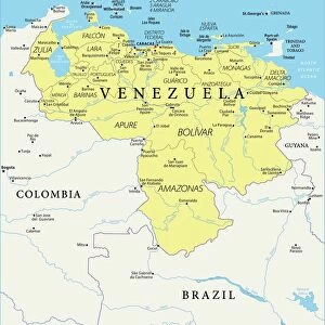
1635, Blaeu Map Guiana, Venezuela, and El Dorado, topography, cartography, geography

![]()
Wall Art and Photo Gifts from Liszt Collection
1635, Blaeu Map Guiana, Venezuela, and El Dorado, topography, cartography, geography
1635, Blaeu Map Guiana, Venezuela, and El Dorado
Liszt Collection of nineteenth-century engravings and images to browse and enjoy
Media ID 14004431
© Artokoloro Quint Lox Limited
1635 Venezuela Antique Map Atlas Chart Geographic Latitude Longitude Mappa Mundi Old Antique Plan Old Antique View Old Map Ols Antique Map Rare Old Maps Topo
FEATURES IN THESE COLLECTIONS
> Animals
> Fishes
> D
> Dorado
> Maps and Charts
> Early Maps
> Maps and Charts
> World
> South America
> Venezuela
> Maps
EDITORS COMMENTS
This print showcases the intricate beauty of the 1635 Blaeu Map Guiana, Venezuela, and El Dorado. With its detailed topography and precise cartography, this vintage map takes us on a journey through time to explore the geographic wonders of these regions. The carefully illustrated landforms and geographical features come alive on this ancient piece of paper, revealing a world long gone yet forever preserved in history. As we gaze upon this rare old map, we are transported back to an era when navigation relied on such meticulously crafted atlases. The grid lines marking latitude and longitude create a mesmerizing geometric pattern that adds to the allure of this decorative artwork. Its aged appearance tells tales of countless journeys taken by explorers who sought to uncover hidden treasures in these uncharted territories. The presence of El Dorado evokes dreams of untold riches waiting to be discovered amidst lush landscapes and mystical realms. This historical artifact serves as a window into humanity's thirst for exploration and discovery. With each glance at this remarkable mappa mundi, we are reminded not only of our planet's vastness but also its interconnectedness throughout history. It is a testament to the enduring power of maps as tools for understanding our world while simultaneously igniting our sense of wonder about what lies beyond their borders.
MADE IN THE UK
Safe Shipping with 30 Day Money Back Guarantee
FREE PERSONALISATION*
We are proud to offer a range of customisation features including Personalised Captions, Color Filters and Picture Zoom Tools
SECURE PAYMENTS
We happily accept a wide range of payment options so you can pay for the things you need in the way that is most convenient for you
* Options may vary by product and licensing agreement. Zoomed Pictures can be adjusted in the Basket.