Fraud Blocker Skip to main content

Atlas Collection

"Exploring the World through Atlas: Unveiling the Past and Present" Delving into history, the vintage Map of Ireland from 1897 takes us on a journey back in time

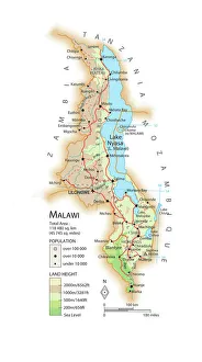
Background imageAtlas Collection: Map of Malawi

Map of Malawi

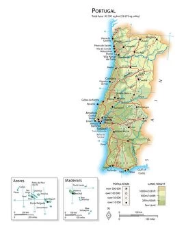
Background imageAtlas Collection: Map of Portugal

Map of Portugal

Background imageAtlas Collection: Map of Ireland 1897

Map of Ireland 1897
Map of Ireland

Background imageAtlas Collection: Old Caucasus map

Old Caucasus map
Antique map of Caucasus

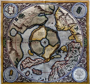
Background imageAtlas Collection: Atlas of Gerardus Mercator, 1595, map of the Arctic to the North Pole and surrounding

Atlas of Gerardus Mercator, 1595, map of the Arctic to the North Pole and surrounding lands within and outside the Arctic Circle

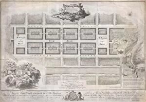
Background imageAtlas Collection: 1768, James Craig Map of New Town, Edinburgh, Scotland, First Plan of New Town, topography

1768, James Craig Map of New Town, Edinburgh, Scotland, First Plan of New Town, topography
1768, James Craig Map of New Town, Edinburgh, Scotland, First Plan of New Town

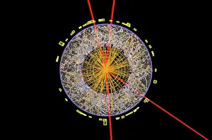
Background imageAtlas Collection: Higgs boson event, ATLAS detector C013 / 6892

Higgs boson event, ATLAS detector C013 / 6892
Higgs boson event. Graphic of a transverse section through a detector showing one of the numerous particle collision events recorded during the search for the Higgs boson

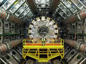
Background imageAtlas Collection: ATLAS detector, CERN

ATLAS detector, CERN
ATLAS detector. Engineer standing on a platform in front of the ATLAS (a torodial LHC apparatus) detector (circular) at CERN (the European particle physics laboratory) near Geneva, Switzerland

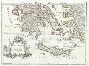
Background imageAtlas Collection: 1794, Delisle Map of Southern Ancient Greece, Greeks Isles, and Crete, topography

1794, Delisle Map of Southern Ancient Greece, Greeks Isles, and Crete, topography
1794, Delisle Map of Southern Ancient Greece, Greeks Isles, and Crete

Background imageAtlas Collection: Durers world map, 1515

Durers world map, 1515. Albrecht Durer (1471- 1528) was a German artist. His skillful use of perspective and mathematical proportions made him one of the outstanding artistic figures of the early

Background imageAtlas Collection: ATLAS detector, CERN

ATLAS detector, CERN
ATLAS detector. Composite image of the ATLAS (a torodial LHC apparatus) detector (circular) at CERN (the European particle physics laboratory) near Geneva, Switzerland

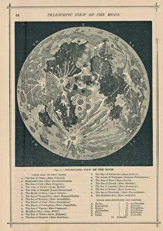
Background imageAtlas Collection: 1886, Telescopic View and Map of the Moon, topography, cartography, geography, land

1886, Telescopic View and Map of the Moon, topography, cartography, geography, land
1886, Telescopic View and Map of the Moon

Background imageAtlas Collection: Map of Guatemala

Map of Guatemala

Background imageAtlas Collection: Map of Vietnam

Map of Vietnam

Background imageAtlas Collection: 16th Century Plan of Florence

16th Century Plan of Florence
16th century plan of Florence, Italy. Detail from the map of Etruria (Tuscany and Northern Lazio), in the Gallery of Maps in the Vatican Museum.The Gallery of Maps holds maps which were commissioned

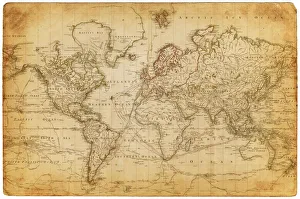
Background imageAtlas Collection: map of the world 1882

map of the world 1882
map of the world - 1882

Background imageAtlas Collection: Atlas and Vulcana music hall strongman, strongwoman

Atlas and Vulcana music hall strongman, strongwoman
(Atlas) Hedley Roberts (1864-1946) and Vulcana (Miriam Kate Roberts (nee Williams) (1874-1946) - performed shows of strength and classic poses

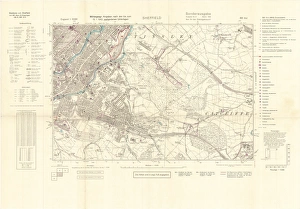
Background imageAtlas Collection: North Sheffield marked with bombing targets, c. 1940

North Sheffield marked with bombing targets, c. 1940
Full title: Ordnance Survey map of north Sheffield copied by the Germans, and marked with bombing targets, c. 1940 Original at Sheffield Libraries: y06718

Background imageAtlas Collection: Map of Croatia

Map of Croatia

Background imageAtlas Collection: Map of the world 1800

Map of the world 1800

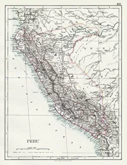
Background imageAtlas Collection: Peru map 1897

Peru map 1897
The World-Wide Atlas of Modern Geography, Political and Physical W. & A.K. Johnston - London 1897

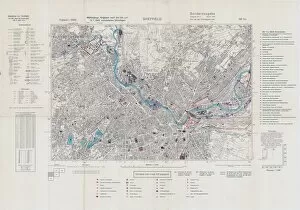
Background imageAtlas Collection: Ordnance Survey map of north Sheffield copied by the Germans, and marked with bombing targets

Ordnance Survey map of north Sheffield copied by the Germans, and marked with bombing targets
Original at Sheffield Local Studiess 26 M/4

Background imageAtlas Collection: Map of the world 1869

Map of the world 1869
Cornells Grammars-School Geography - S.S. Cornell - New York D. Appleton and Company 1869

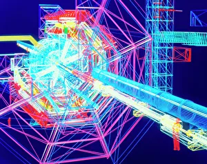
Background imageAtlas Collection: Computer artwork of ATLAS detector at CERN

Computer artwork of ATLAS detector at CERN
Virtual reality in physics. Computer-generated wire-frame drawing showing a cut-away view of the ATLAS particle detector to be built at the CERN European particle physics laboratory

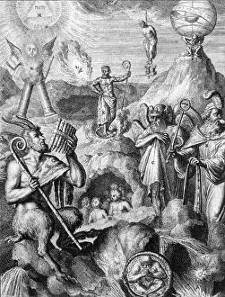
Background imageAtlas Collection: Classical Greek gods allegorised

Classical Greek gods allegorised
The classical Greek gods allegorised. Date: 18th century

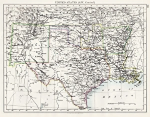
Background imageAtlas Collection: United States South West Central map 1897

United States South West Central map 1897
The World-Wide Atlas of Modern Geography, Political and Physical W. & A.K. Johnston - London 1897

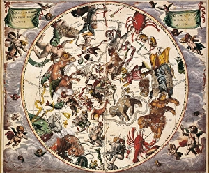
Background imageAtlas Collection: CELLARIUS, Andreas (1596-1665). Atlas Coelestis

CELLARIUS, Andreas (1596-1665). Atlas Coelestis seu Harmonia Macrocosmica. 1661. Fol 24. Hemisphaerium stellatum boreale antiquum. Representation of the Northern Hemisphere
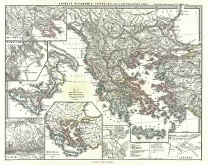
Background imageAtlas Collection: 1865, Spruner Map of Greece, Macedonia and Thrace before the Peloponnesian War. topography

1865, Spruner Map of Greece, Macedonia and Thrace before the Peloponnesian War. topography
1865, Spruner Map of Greece, Macedonia and Thrace before the Peloponnesian War

Background imageAtlas Collection: Buenos Aires map

Buenos Aires map
Antique engraving map of Buenos Aires

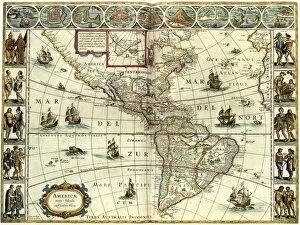
Background imageAtlas Collection: MAP: AMERICAS, c1630. A map of North and South America created by Dutch cartographer

MAP: AMERICAS, c1630. A map of North and South America created by Dutch cartographer and atlas maker Willem Blaeu. Map, c1630

Background imageAtlas Collection: Map of Bangladesh

Map of Bangladesh

Background imageAtlas Collection: ICELAND: MAP, 1595. Map of Iceland from a 1595 edition of Abraham Ortelius atlas Theatrum

ICELAND: MAP, 1595. Map of Iceland from a 1595 edition of Abraham Ortelius atlas Theatrum Orbis Terrarum

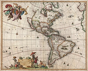
Background imageAtlas Collection: 1658, Visscher Map of North America and South America, topography, cartography, geography

1658, Visscher Map of North America and South America, topography, cartography, geography
1658, Visscher Map of North America and South America

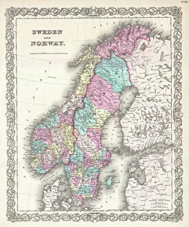
Background imageAtlas Collection: 1855, Colton Map of Scandinavia, Norway, Sweden, Finland, topography, cartography

1855, Colton Map of Scandinavia, Norway, Sweden, Finland, topography, cartography
1855, Colton Map of Scandinavia, Norway, Sweden, Finland

Background imageAtlas Collection: Statue of Atlas holding the Universe on his shoulders in the Royal Palace, Amsterdam, Netherlands

Statue of Atlas holding the Universe on his shoulders in the Royal Palace, Amsterdam, Netherlands, Europe

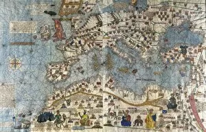
Background imageAtlas Collection: CRESQUES, Jafuda (1350-1410); CRESQUES, Abraham

CRESQUES, Jafuda (1350-1410); CRESQUES, Abraham ( -1381). Catalan Atlas. 1375. Third and Fourth Leaves. Map of the world known in the 14th c. (Finisterre and the Mediterranean)

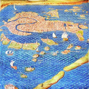
Background imageAtlas Collection: 16th century map of Venice

16th century map of Venice showing the lagoon. Venice is a coastal city in the north-east of Italy. The main bulk of Venice is in the upper frame of the image

Background imageAtlas Collection: Europe, 16th century nautical map

Europe, 16th century nautical map
Nautical map of Europe, 1544 copy of Agnese Atlas. Several copies of this atlas were produced between 1536 and 1564, in Venice, by the Italian mapmaker Battista Agnese

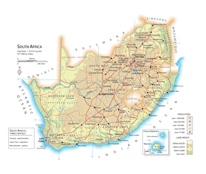
Background imageAtlas Collection: Map of South Africa

Map of South Africa

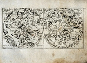
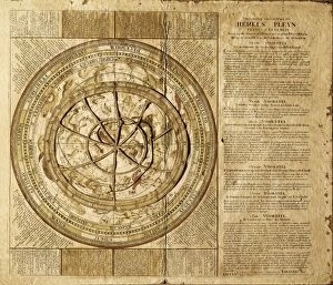
Background imageAtlas Collection: Constellation map. On the left side, the northern

Constellation map. On the left side, the northern
" Constellation map. On the left side, the northern constellations and on the right side, the southern constellations

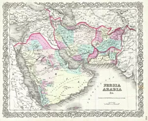
Background imageAtlas Collection: 1855, Colton Map of Persia, Afghanistan, and Arabia, topography, cartography, geography

1855, Colton Map of Persia, Afghanistan, and Arabia, topography, cartography, geography
1855, Colton Map of Persia, Afghanistan, and Arabia

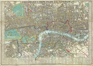
Background imageAtlas Collection: 1848, Crutchley Pocket Map or Plan of London, England, topography, cartography, geography

1848, Crutchley Pocket Map or Plan of London, England, topography, cartography, geography
1848, Crutchley Pocket Map or Plan of London, England

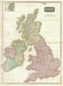
Background imageAtlas Collection: 1818, Pinkerton Map of the British Isles, England, Scotland, Ireland, John Pinkerton

1818, Pinkerton Map of the British Isles, England, Scotland, Ireland, John Pinkerton, 1758 - 1826, Scottish antiquarian, cartographer, UK

Background imageAtlas Collection: Map of Africa showing its most recent discoveries with the Island of St

Map of Africa showing its most recent discoveries with the Island of St
XOS1765717 Map of Africa showing its most recent discoveries with the Island of St. Helena inset from Mitchells new general atlas, 1863 (colour engraving) by American School

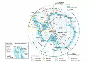
Background imageAtlas Collection: Map of Antarctica

Map of Antarctica

Background imageAtlas Collection: Celestial map by Johannes Van Keulen (1654-1715)

Celestial map by Johannes Van Keulen (1654-1715). SPAIN. Barcelona. Barcelona Maritime Museum

Background imageAtlas Collection: Body Culture / Building

Body Culture / Building
Charles Atlass body-building programme: " No other physical instructor in the world has ever dared to make such an offer!" Date: 1932

Background imageAtlas Collection: Statue of Atlas

Statue of Atlas, Rockefeller Center, Midtown Manhattan, New York City, New York, United States of America, North America


All Professionally Made to Order for Quick Shipping

"Exploring the World through Atlas: Unveiling the Past and Present" Delving into history, the vintage Map of Ireland from 1897 takes us on a journey back in time, unraveling the secrets of this enchanting land. Witnessing scientific breakthroughs, the Higgs boson event captured by ATLAS detector C013 / 6892 at CERN unveils a whole new realm of particle physics. The Map of the World from 1882 serves as a window to an era long gone, offering glimpses into how our planet was perceived centuries ago. James Craig's intricate map showcases Edinburgh's New Town in 1768, providing insight into its early development and topography. Embarking on an adventure to Croatia with its captivating map that unravels hidden gems and scenic landscapes waiting to be explored. Dürer's world map from 1515 offers a glimpse into Renaissance cartography, showcasing both geographical knowledge and artistic finesse. The ATLAS detector at CERN continues to push boundaries in scientific exploration, enabling us to delve deeper into understanding fundamental particles and their interactions. Transported back in time with a mesmerizing 16th Century Plan of Florence; it reveals architectural wonders that have stood the test of time. A haunting reminder of war-torn Sheffield during WWII emerges through an Ordnance Survey map copied by Germans marked with bombing targets - bearing witness to resilience amidst adversity. With Delisle's ancient Greek maps dating back to 1794, we can trace footsteps across Southern Greece, Greek Isles, and Crete while exploring their rich topography steeped in mythological tales. Discovering Buenos Aires through its vibrant cityscape depicted on an alluring map invites you to immerse yourself in Argentine culture and charm.