Fraud Blocker Skip to main content

Home > South America > Venezuela > Maps

Maps Collection

Venezuela is a country located in South America, bordered by Colombia, Guyana and Brazil and has a total area of 916,445 km2 and its capital is Caracas

Choose a picture from our Maps Collection for your Wall Art and Photo Gifts

71 items

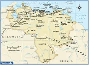
Background imageMaps Collection: Venezuela country map

Venezuela country map
2011 edition

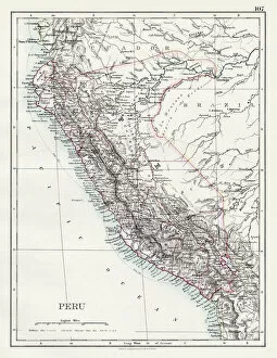
Background imageMaps Collection: Peru map 1897

Peru map 1897
The World-Wide Atlas of Modern Geography, Political and Physical W. & A.K. Johnston - London 1897

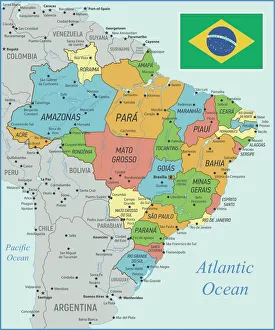
Background imageMaps Collection: Brazil Map with Rivers and National Flag

Brazil Map with Rivers and National Flag
Vintage Map of Brazil. Vector Illustration with Rivers and National Flag

Background imageMaps Collection: Map of Venezuela - Vector

Map of Venezuela - Vector illustration

Background imageMaps Collection: EXPL2A-00377

EXPL2A-00377
Chart of the West Indies sea depths and land elevations. Printed color lithograph of a 19th-century illustration

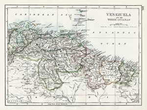
Background imageMaps Collection: Venezuela and the Guayanas map 1897

Venezuela and the Guayanas map 1897
The World-Wide Atlas of Modern Geography, Political and Physical W. & A.K. Johnston - London 1897

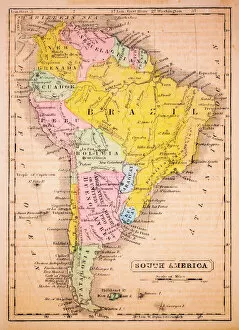
Background imageMaps Collection: South America 1852 Map

South America 1852 Map

Background imageMaps Collection: Peru, Ecuador, Colombia, Venezuela, lithograph, published in 1877

Peru, Ecuador, Colombia, Venezuela, lithograph, published in 1877
Ancient map of Peru, Ecuador, Colombia, and Venezuela. Lithograph, published in 1877

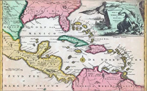
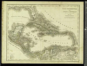
Background imageMaps Collection: 18th century map, Central America and Gulf of Mexico

18th century map, Central America and Gulf of Mexico
5322624 18th century map, Central America and Gulf of Mexico.; (add.info.: 18th century map of Central America and the Gulf of Mexico engraved by Balthasar Ruyter.)

Background imageMaps Collection: Venezuela (engraving)

Venezuela (engraving)
8676231 Venezuela (engraving) by Pritchett, Robert (1828-1907); Private Collection; (add.info.: Venezuela. Illustration from In the Trades, the Tropics & the Roaring Forties)

Background imageMaps Collection: Geography: map showing the Gulf of Mexico, the Caribbean Islands, Central America (Honduras)

Geography: map showing the Gulf of Mexico, the Caribbean Islands, Central America (Honduras, Costarica)
VEN5031255 Geography: map showing the Gulf of Mexico, the Caribbean Islands, Central America (Honduras, Costarica), northern South America (Venezuela) and southern United States

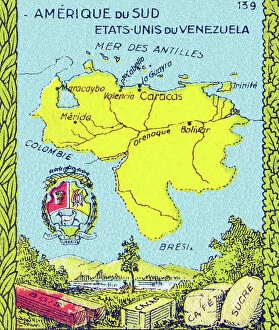
Background imageMaps Collection: Universal Geography: United States of Venezuela. Advertising images edited for the brand Louit

Universal Geography: United States of Venezuela. Advertising images edited for the brand Louit. Debut 20th century
DUV4218161 Universal Geography: United States of Venezuela. Advertising images edited for the brand Louit. Debut 20th century. (lithograph); 9.5x6.5 cm; Photo © Duvallon

Background imageMaps Collection: Map of the northwestern part of South America, c.1900 (engraving)

Map of the northwestern part of South America, c.1900 (engraving)
533259 Map of the northwestern part of South America, c.1900 (engraving); (add.info.: Map of northwest South America: Colombia, Venezuela, British Guiana, Ecuador, Peru, and Bolivia, circa 1902)

Background imageMaps Collection: Map of Venezuela, around 1870 - Lithography 19th century (Map of Venezuela)

Map of Venezuela, around 1870 - Lithography 19th century (Map of Venezuela)
NWI4876433 Map of Venezuela, around 1870 - Lithography 19th century (Map of Venezuela, 1870s - Color lithograph of a 19th-century illustration); (add.info.: Map of Venezuela)

Background imageMaps Collection: Eastern Caribbean, 1658 (engraving)

Eastern Caribbean, 1658 (engraving)
7340063 Eastern Caribbean, 1658 (engraving) by Doncker, Hendrick (c.1626-99); 44.5x54 cm; National Maritime Museum, London

Background imageMaps Collection: Geography: map showing the Gulf of Mexico, the Caribbean Islands, Central America (Mexico)

Geography: map showing the Gulf of Mexico, the Caribbean Islands, Central America (Mexico, Yucatan, Salvador, Honduras)
VEN5031242 Geography: map showing the Gulf of Mexico, the Caribbean Islands, Central America (Mexico, Yucatan, Salvador, Honduras, Nicaragua, Costarica) and northern South America (Venezuela)

Background imageMaps Collection: Geography map: representation of Venezuela in South America from an Atlas made by cartographer

Geography map: representation of Venezuela in South America from an Atlas made by cartographer Willem Janszoon Blaeu
VEN5030346 Geography map: representation of Venezuela in South America from an Atlas made by cartographer Willem Janszoon Blaeu (1571-1638), approximately 1630 Biblioteca Angelica

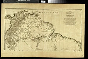
Background imageMaps Collection: Geography map: representation of the northern part of South America (Brazil, Venezuela)

Geography map: representation of the northern part of South America (Brazil, Venezuela)
VEN5030250 Geography map: representation of the northern part of South America (Brazil, Venezuela, Peru) from the Atlas " Amerique meridionale" by French cartographer Jean-Baptiste

Background imageMaps Collection: Geography map: representation of the Orenoque River in Venezuela, the Gulf of Paria

Geography map: representation of the Orenoque River in Venezuela, the Gulf of Paria, the islands of Tobago
VEN5030093 Geography map: representation of the Orenoque River in Venezuela, the Gulf of Paria, the islands of Tobago, Trinidad (Trinidad)

Background imageMaps Collection: Geographic Atlas: representation of the Caribbean Sea and the Greater Antilles (Cuba, Hispaniola)

Geographic Atlas: representation of the Caribbean Sea and the Greater Antilles (Cuba, Hispaniola)
VEN5029600 Geographic Atlas: representation of the Caribbean Sea and the Greater Antilles (Cuba, Hispaniola, Puerto Rico and Jamaica), the Bahamas Islands, the South of the United States

Background imageMaps Collection: Geography: map showing the Gulf of Mexico, the Caribbean Islands, Central America (Mexico)

Geography: map showing the Gulf of Mexico, the Caribbean Islands, Central America (Mexico, Yucatan, Salvador, Honduras)
VEN5031245 Geography: map showing the Gulf of Mexico, the Caribbean Islands, Central America (Mexico, Yucatan, Salvador, Honduras, Nicaragua, Costarica)

Background imageMaps Collection: Map of the Golden Castile (Venezuela, Panama and Colombia) - Colorisee engraving

Map of the Golden Castile (Venezuela, Panama and Colombia) - Colorisee engraving
NWI4853016 Map of the Golden Castile (Venezuela, Panama and Colombia) - Colorisee engraving, 16th century by Cornelius van Wytfliet (1555-1597) - Castilia del Oro (Gold Coast)

Background imageMaps Collection: Geography map: representation of the coasts of Venezuela, made by Dutch cartographer Gerard van

Geography map: representation of the coasts of Venezuela, made by Dutch cartographer Gerard van Keulen (1678-1726)
VEN5030202 Geography map: representation of the coasts of Venezuela, made by Dutch cartographer Gerard van Keulen (1678-1726) 1709-1713

Background imageMaps Collection: Geography Atlas: representation of the Caribbean Sea, Caribbean Sea (Cuba, Jamaica)

Geography Atlas: representation of the Caribbean Sea, Caribbean Sea (Cuba, Jamaica, Caiman Islands), Bahamas Islands
VEN5029603 Geography Atlas: representation of the Caribbean Sea, Caribbean Sea (Cuba, Jamaica, Caiman Islands), Bahamas Islands, South United States (Florida)

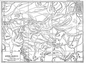
Background imageMaps Collection: Map of the Lower Orinoco; A Journey up the Orinoco, 1875. Creator: Unknown

Map of the Lower Orinoco; A Journey up the Orinoco, 1875. Creator: Unknown
Map of the Lower Orinoco; A Journey up the Orinoco, 1875. From, Illustrated Travels by H.W. Bates. [Cassell, Petter, and Galpin, c1880, London]

Background imageMaps Collection: 1 Maps 3 44

1 Maps 3 44
Emiliano Deificus

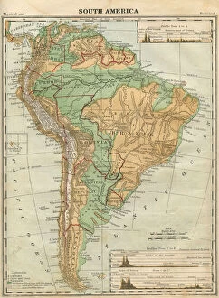
Background imageMaps Collection: South America Map Illustration, Travel, Exploration, Antique 1871 Illustration

South America Map Illustration, Travel, Exploration, Antique 1871 Illustration
Color stock photo of an antique South America map illustration. Salvaged from an 1871 geography book

Background imageMaps Collection: 1864 Mitchell Map Of Peru Equador Ecuador Argentina

1864 Mitchell Map Of Peru Equador Ecuador Argentina
1864, Mitchell Map of Peru, Equador, Ecuador, Argentina, Columbia and Venezuela

Background imageMaps Collection: 1860 Mitchell's Map Of Peru Ecuador Venezuela

1860 Mitchell's Map Of Peru Ecuador Venezuela
1860, Mitchell's Map of Peru, Ecuador, Venezuela, Columbia and Argentina

Background imageMaps Collection: 1855 Colton Map Of Columbia Venezuela And Ecuador

1855 Colton Map Of Columbia Venezuela And Ecuador
1855, Colton Map of Columbia, Venezuela and Ecuador

Background imageMaps Collection: 1818 Pinkerton Map Of Northeastern South America

1818 Pinkerton Map Of Northeastern South America
1818, Pinkerton Map of Northeastern South America, Venezuela, Guyana, Surinam, John Pinkerton, 1758 - 1826, Scottish antiquarian, cartographer, UK

Background imageMaps Collection: 1818 Pinkerton Map Of Northwestern South America

1818 Pinkerton Map Of Northwestern South America
1818, Pinkerton Map of Northwestern South America, Columbia, Venezuela, Ecuador, Panama, John Pinkerton, 1758 - 1826, Scottish antiquarian, cartographer, UK

Background imageMaps Collection: 1780 Bonne Map Of Northern South America Columbia

1780 Bonne Map Of Northern South America Columbia
1780, Bonne Map of Northern South America, Columbia, Venezuela, Brazil, Rigobert Bonne 1727 - 1794, one of the most important cartographers of the late 18th century

Background imageMaps Collection: 1656 Sanson Map Of Guiana Venezuela And El Dorado

1656 Sanson Map Of Guiana Venezuela And El Dorado
1656, Sanson Map of Guiana, Venezuela, and El Dorado

Background imageMaps Collection: 1635 Blaeu Map Guiana Venezuela And El Dorado

1635 Blaeu Map Guiana Venezuela And El Dorado
1635, Blaeu Map Guiana, Venezuela, and El Dorado

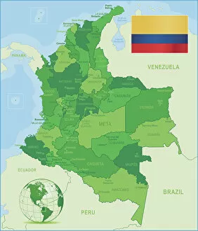
Background imageMaps Collection: Green Map of Colombia - states, cities and flag

Green Map of Colombia - states, cities and flag
Colombia, country of northwestern South America. Its 1, 000 miles (1, 600 km) of coast to the north are bathed by the waters of the Caribbean Sea, and its 800 miles (1)

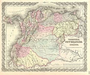
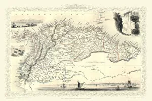
Background imageMaps Collection: Old Map of Venezuela, New Granada, Equador and The Guayanas 1851 by John Tallis

Old Map of Venezuela, New Granada, Equador and The Guayanas 1851 by John Tallis
A fine facimile artworked from an antique original map of Venezuela, New Granada, Equador and The Guayanas, issued as part of the 1851 edition of John Tallis

Background imageMaps Collection: Map of Peru, Colombia, Venezuela, Ecuador 1900

Map of Peru, Colombia, Venezuela, Ecuador 1900
Meyers hand-Atlas Leipzig und Wien Verlag des Bibliographischen Instituts 1900

Background imageMaps Collection: Map of South America 1895

Map of South America 1895
The Rand-McNally Grammar School Geography 1895 - Chicago & New York

Background imageMaps Collection: Map of South America 1877

Map of South America 1877
Warrens Common School Geography 1877

Background imageMaps Collection: Old chromolithograph map of Peru, Ecuador, Colombia and Venezuela

Old chromolithograph map of Peru, Ecuador, Colombia and Venezuela
Antique Illustration. Copyright has expired on this artwork. From my own archives, digitally restored

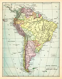
Background imageMaps Collection: Map of South America 19th Century

Map of South America 19th Century
Vintage map of South America from the 19th Century

Background imageMaps Collection: old map of south america

old map of south america
an old south american map (1881)

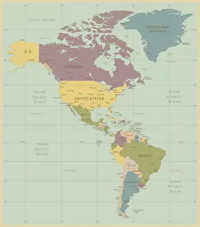
Background imageMaps Collection: Vintage Map of North and South America

Vintage Map of North and South America
534055040

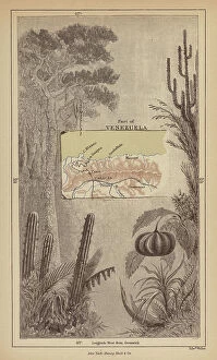
Background imageMaps Collection: Antique Map of the Andes Mountains in Ecuador, Venezuela and Columbia - 19th Century

Antique Map of the Andes Mountains in Ecuador, Venezuela and Columbia - 19th Century
Vintage Map of the Andes Mountains in Ecuador, Venezuela and Columbia. Vintage etching circa late 19th century

Background imageMaps Collection: Alexander von Humboldt and Aime Bonpland during their exploration of the Orinoco River

Alexander von Humboldt and Aime Bonpland during their exploration of the Orinoco River, South America, 1800 (engraving)
7184953 Alexander von Humboldt and Aime Bonpland during their exploration of the Orinoco River, South America, 1800 (engraving) by German School

Background imageMaps Collection: Flags of All Nations (colour litho)

Flags of All Nations (colour litho)
7178723 Flags of All Nations (colour litho) by American School, (19th century); Private Collection; (add.info.: Flags of All Nations)

Background imageMaps Collection: Members of the League of Nations (colour litho)

Members of the League of Nations (colour litho)
7163177 Members of the League of Nations (colour litho) by English School, (20th century); Private Collection; (add.info.: Members of the League of Nations)


All Professionally Made to Order for Quick Shipping


-

Maps Collection

Venezuela is a country located in South America, bordered by Colombia, Guyana and Brazil and has a total area of 916,445 km2 and its capital is Caracas. Venezuela is home to many different geographical features such as the Andes Mountains, the Caribbean Sea and the Amazon rainforest. The country also has numerous rivers including the Orinoco River which flows through much of Venezuela. Maps of Venezuela show its diverse terrain with its mountainous regions in the north and plains in the south. they also highlight important cities such as Maracaibo, Barquisimeto and Valencia as well as national parks like Canaima National Park which are popular tourist destinations. Additionally, maps of Venezuela can be used to explore its various islands including Isla Margarita and Los Roques archipelago which are known for their stunning beaches and coral reefs.
+

Our beautiful pictures are available as Framed Prints, Photos, Wall Art and Photo Gifts

The Maps of Venezuela South America collection from Media Storehouse is a stunning compilation of vintage and contemporary maps that capture the beauty and diversity of this South American country. Our collection features a range of maps, including topographical, political, geological, and historical maps that showcase the different regions and landscapes of Venezuela. Each map is carefully selected for its unique style, color scheme, and level of detail to provide an accurate representation of the country's geography. These high-quality prints are perfect for anyone who loves history or geography or wants to add some cultural flair to their home decor. They come in various sizes and framing options so you can choose the best fit for your space. Whether you're looking for a statement piece or something more subtle, there's sure to be a map in our collection that will catch your eye. The Maps of Venezuela South America collection offers a fascinating glimpse into one of the most beautiful countries in Latin America through its rich cartographic heritage.
+

What are Maps of Venezuela South America art prints?

Maps of Venezuela South America art prints are high-quality reproductions of maps that depict the geography and topography of Venezuela. These prints showcase the country's diverse landscape, including its mountains, rivers, forests, and coastlines. They are created using advanced printing techniques to ensure that every detail is captured accurately. These art prints are not only informative but also visually stunning. They make great additions to any home or office decor and can be used as educational tools in classrooms or libraries. Maps of Venezuela South America art prints come in a variety of sizes and formats to suit different preferences. Whether you're a geography enthusiast or simply looking for unique wall art, these prints offer something for everyone. With their vibrant colors and intricate details, they are sure to capture your attention and spark your imagination.
+

What Maps of Venezuela South America art prints can I buy from Media Storehouse?

We offer a wide range of Maps of Venezuela South America art prints that are perfect for those who love geography or want to add some cultural flair to their home decor. These maps showcase the various regions and cities within Venezuela, including Caracas, Maracaibo, and Valencia. They also highlight important landmarks such as Angel Falls, the Orinoco River, and Lake Maracaibo. In addition to traditional paper prints, Media Storehouse also offers canvas prints which provide a more textured look and feel. You can choose from a variety of sizes to fit their specific needs. Whether you're looking for a unique gift idea or simply want to decorate your own space with something meaningful and educational, these Maps of Venezuela South America art prints from Media Storehouse are sure to impress.
+

How do I buy Maps of Venezuela South America art prints?

To buy Maps of Venezuela South America art prints from Media Storehouse, you can browse through our extensive collection of maps and select the one that suits your needs. The website offers a variety of sizes and formats for each print, including canvas, framed or unframed prints. Once you have selected your preferred size and format, simply add it to your cart and proceed to checkout. We accept various payment methods such as credit cards, PayPal and Apple Pay. We also offer worldwide shipping options so you can receive your order wherever you are located. Maps of Venezuela South America art prints are perfect for those who love geography or want to decorate their home with unique artwork. These maps showcase the beauty of Venezuela's landscape while providing valuable information about its geography. Buying Maps of Venezuela South America art prints from Media Storehouse is easy and convenient. With their wide selection of high-quality prints and secure payment options, you can trust them to deliver a beautiful piece of artwork straight to your doorstep.
+

How much do Maps of Venezuela South America art prints cost?

As a leading provider of art prints, we offer a wide range of maps of Venezuela South America at various prices. The cost of these art prints depends on several factors such as the size, quality, and type of paper used to print them. You can choose from different sizes ranging from small to large formats that suit their preferences and budget. Moreover, the price may also vary depending on whether the map is an antique or modern version. Antique maps are generally more expensive due to their rarity and historical significance. On the other hand, modern maps are relatively cheaper but still offer excellent quality. We provide affordable options for customers who want to purchase high-quality maps of Venezuela South America art prints without breaking the bank. With its vast collection and competitive pricing policy, you can find something that suits their taste and budget while enjoying exceptional customer service from start to finish.
+

How will my Maps of Venezuela South America art prints be delivered to me?

Your Maps of Venezuela South America art prints will be delivered to you in a safe and secure manner. We take great care in packaging your order so that it arrives at your doorstep in pristine condition. Our team uses high-quality materials to ensure that your artwork is protected during transit. We offer various delivery options, including standard shipping and express delivery, depending on your location and preferences. You can track the progress of your shipment online using the tracking number provided once we dispatch your order. We are committed to providing our customers with an exceptional shopping experience from start to finish. If you have any questions or concerns about the delivery of your Maps of Venezuela South America art prints, please do not hesitate to contact us for assistance. We are always happy to help.