Home > Animals > Mammals > Cricetidae > Golden Mouse
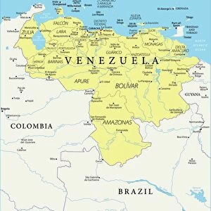
Map of the Golden Castile (Venezuela, Panama and Colombia) - Colorisee engraving, 16th century by Cornelius van Wytfliet (1555-1597) - Castilia del Oro (Gold Coast) of northeastern South America, as known from Wytfliet
 - Colorisee engraving, 16th century by Cornelius van Wytfliet (1555-1597) - Castilia del Oro (Gold Coast) of northeastern South America, as known from Wytfliet")
![]()
Wall Art and Photo Gifts from Fine Art Finder
Map of the Golden Castile (Venezuela, Panama and Colombia) - Colorisee engraving, 16th century by Cornelius van Wytfliet (1555-1597) - Castilia del Oro (Gold Coast) of northeastern South America, as known from Wytfliet
NWI4853016 Map of the Golden Castile (Venezuela, Panama and Colombia) - Colorisee engraving, 16th century by Cornelius van Wytfliet (1555-1597) - Castilia del Oro (Gold Coast) of northeastern South America, as known from Wytfliet, 1597 - Hand-colored woodcut of a 16th-century illustration; (add.info.: Map of the Golden Castile (Venezuela, Panama and Colombia) - Colorisee engraving, 16th century by Cornelius van Wytfliet (1555-1597) - Castilia del Oro (Gold Coast) of northeastern South America, as known from Wytfliet, 1597 - Hand-colored woodcut of a 16th-century illustration); Photo © North Wind Pictures
Media ID 38169220
© Photo © North Wind Pictures / Bridgeman Images
Central America Colombia Colombian Geographical Map Latin America Latine America Northwind Panama Venezuela Venezuelan
FEATURES IN THESE COLLECTIONS
> Animals
> Mammals
> Cricetidae
> Golden Mouse
> Fine Art Finder
> Artists
> Greek
> North America
> Panama
> Maps
> North America
> Panama
> Related Images
> North America
> United States of America
> Maps
> South America
> Colombia
> Maps
> South America
> Colombia
> Related Images
> South America
> Venezuela
> Maps
> South America
> Venezuela
> Related Images
EDITORS COMMENTS
This stunning print showcases a Map of the Golden Castile, depicting Venezuela, Panama, and Colombia in the 16th century. Created by Cornelius van Wytfliet in 1597, this colorized engraving offers a glimpse into the historical significance of the region known as Castilia del Oro (Gold Coast) in northeastern South America.
The intricate details and vibrant colors bring to life the geographical features and boundaries of these countries during that time period. The hand-colored woodcut highlights Wytfliet's meticulous attention to cartographic accuracy and artistic flair.
As you study this map, you can't help but marvel at the craftsmanship and expertise that went into its creation over four centuries ago. It serves as a reminder of the rich history and cultural heritage of Central and South America, showcasing how exploration and discovery shaped these lands.
Whether you are a history enthusiast or simply appreciate fine art, this print is sure to captivate your imagination and transport you back to an era when maps were not just tools for navigation but works of art in their own right.
MADE IN THE UK
Safe Shipping with 30 Day Money Back Guarantee
FREE PERSONALISATION*
We are proud to offer a range of customisation features including Personalised Captions, Color Filters and Picture Zoom Tools
SECURE PAYMENTS
We happily accept a wide range of payment options so you can pay for the things you need in the way that is most convenient for you
* Options may vary by product and licensing agreement. Zoomed Pictures can be adjusted in the Basket.