
Maps Collection
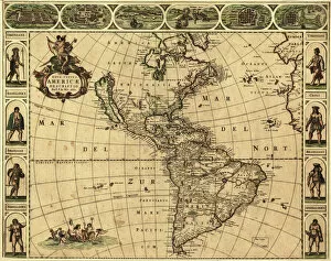
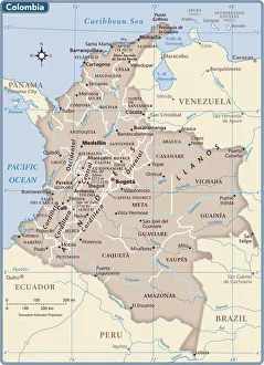
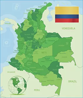
Colombia is a country located in the northwest of South America, bordered by Panama, Venezuela, Brazil
Choose a picture from our Maps Collection for your Wall Art and Photo Gifts
104 items


All Professionally Made to Order for Quick Shipping
-
Maps Collection
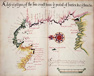
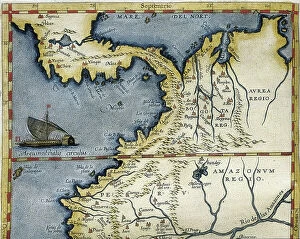
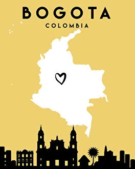
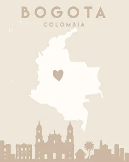
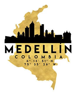
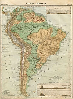
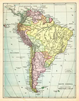
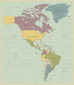
Colombia is a country located in the northwest of South America, bordered by Panama, Venezuela, Brazil, Ecuador and Peru and has an area of 1.14 million square kilometres and is the fourth largest country on the continent. The terrain of Colombia varies from tropical rainforest to snow-capped mountains, with many rivers and lakes throughout the country. Maps of Colombia show its diverse geography including major cities such as Bogota, Medellin and Cali; national parks; mountain ranges; rivers; lakes; beaches; islands and more. With its rich culture and history, Colombia offers plenty for visitors to explore - from colonial towns to modern cities - making it a great destination for those looking to experience something different in South America.
+
Our beautiful pictures are available as Framed Prints, Photos, Wall Art and Photo Gifts
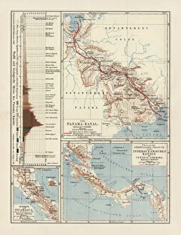
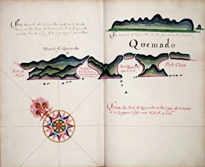
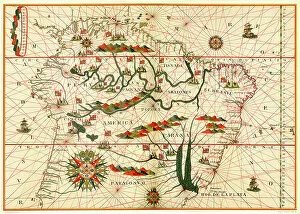
Media Storehouse offers a stunning collection of Maps of Colombia South America, which showcases the country's diverse geography and rich history. Our collection features a range of maps that depict different aspects of Colombia, including its topography, political boundaries, and natural resources. These maps are available as wall art and framed prints in various sizes to suit any space. The Maps of Colombia South America collection is perfect for those who want to explore the country's fascinating past or plan their next adventure. From colonial-era maps that show the Spanish conquests to modern-day roadmaps that highlight major cities and landmarks, our collection has something for everyone. Whether you're looking for a unique piece of decor for your home or office or searching for an educational resource on Colombian geography and history, our Maps of Colombia South America collection is an excellent choice. With high-quality prints and exceptional attention to detail, these maps are sure to impress anyone who sees them.
+
What are Maps of Colombia South America art prints?
Maps of Colombia South America art prints are high-quality reproductions of maps that depict the geography and topography of Colombia, a country located in the northern part of South America. These art prints are created using advanced printing techniques and materials to ensure their durability and longevity. These maps showcase various features such as mountains, rivers, cities, towns, and other landmarks that make up the unique landscape of Colombia. They serve as excellent decorative pieces for homes or offices while also providing valuable information about the country's geography. Maps of Colombia South America art prints come in different sizes and styles to suit individual preferences. They can be framed or unframed depending on your preference. Whether you're a collector or simply looking for an attractive piece to adorn your walls with, these art prints offer an affordable way to own a piece of Colombian history while adding beauty to any space.
+
What Maps of Colombia South America art prints can I buy from Media Storehouse?
We offer a wide range of Maps of Colombia South America art prints that are perfect for decorating your home or office. These maps come in various styles and designs, including vintage, antique, modern and colorful options. You can choose from detailed street maps of major Colombian cities like Bogota, Medellin and Cali or explore the country's diverse landscapes with topographical maps. Media Storehouse also has political maps that show the different regions and departments within Colombia as well as its neighboring countries. Whether you're interested in history, geography or just want to add some color to your walls, there is a map print for every taste. In addition to traditional paper prints, Media Storehouse also offers canvas prints and framed art options so you can customize your purchase to fit your specific needs. With such a vast selection available at Media Storehouse, finding the perfect Map of Colombia South America art print has never been easier.
+
How do I buy Maps of Colombia South America art prints?
To buy Maps of Colombia South America art prints from Media Storehouse, you can simply visit their online store and browse through the available options. Once you have found a print that you like, add it to your cart and proceed to checkout. During the checkout process, you will be prompted to enter your shipping information and payment details. We offer a wide range of maps of Colombia South America in various sizes and formats such as canvas prints, framed prints, or photographic prints. You can choose the one that best suits your needs and preferences. Our collection includes both vintage and contemporary maps with different styles ranging from colorful abstract designs to detailed topographical representations. Whether you are looking for a decorative piece for your home or office or an educational tool for students or travelers, we have something for everyone interested in exploring this fascinating region of the world through art.
+
How much do Maps of Colombia South America art prints cost?
We offer a wide range of Maps of Colombia South America art prints that vary in price depending on the size and type of print. Our collection includes high-quality paper prints, canvas prints, and framed prints that are perfect for adding a touch of elegance to any room. We understand the importance of providing our customers with affordable options without compromising on quality, which is why we have curated a selection that caters to all budgets. Whether you're looking for a small print or a large statement piece, we have something for everyone. Our Maps of Colombia South America art prints showcase the beauty and diversity of this stunning country and make great gifts for anyone who loves travel or geography. Browse our collection today to find your perfect match.
+
How will my Maps of Colombia South America art prints be delivered to me?
Your Maps of Colombia South America art prints will be delivered to you in a secure and timely manner. We take great care in packaging your artwork so that it arrives at your doorstep in pristine condition. Our standard delivery method is through a trusted courier service, ensuring that your package can be tracked every step of the way. We understand how important it is for you to receive your order as soon as possible, which is why we strive to dispatch all orders within 48 hours of receiving them. Depending on where you are located, delivery times may vary, but rest assured that we work with reliable couriers who will do their best to get your artwork to you as quickly as possible. Once your Maps of Colombia South America art prints have been dispatched, we will send you an email confirmation along with tracking information so that you can keep track of its progress until it reaches its final destination.