Fraud Blocker Skip to main content

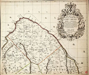
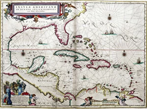
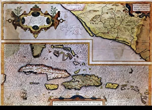
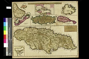
Caribbean Collection (page 20)

"Discover the Vibrant Spirit of the Caribbean: A Tapestry of Cultures and Natural Wonders" Jamaicans on board the Empire Windrush

Background imageCaribbean Collection: Geography: map representing the Greater and Lesser Antilles in the Caribbean Sea

Geography: map representing the Greater and Lesser Antilles in the Caribbean Sea
VEN5031208 Geography: map representing the Greater and Lesser Antilles in the Caribbean Sea. Plate taken from an Atlas of the geographer Robert, 1750

Background imageCaribbean Collection: Geography: map showing Central America (Mexico, Honduras, Yucatan)

Geography: map showing Central America (Mexico, Honduras, Yucatan) and the Caribbean Sea Islands (Antilles)
VEN5031197 Geography: map showing Central America (Mexico, Honduras, Yucatan) and the Caribbean Sea Islands (Antilles). Plate taken from an Atlas by Thomas Kitchin (1718-1784)

Background imageCaribbean Collection: Geography map: representation of the islands of the Greater Antilles (Cuba, Hispaniola)

Geography map: representation of the islands of the Greater Antilles (Cuba, Hispaniola, Jamaica) in the Caribbean Sea
VEN5030433 Geography map: representation of the islands of the Greater Antilles (Cuba, Hispaniola, Jamaica) in the Caribbean Sea. Engraved board from an Atlas of the 18th century

Background imageCaribbean Collection: Geography map: general view of the Caribbean Sea and the Caribbean Islands

Geography map: general view of the Caribbean Sea and the Caribbean Islands
VEN5030283 Geography map: general view of the Caribbean Sea and the Caribbean Islands and a detailed view of Jamaica from an Atlas by Charles Price, beginning of the 18th century

Background imageCaribbean Collection: Geography map: representation of Panama's coasts on the Caribbean Sea

Geography map: representation of Panama's coasts on the Caribbean Sea
VEN5030232 Geography map: representation of Panama's coasts on the Caribbean Sea, made by Dutch cartographer Gerard van Keulen (1678-1726) 1709-1713

Background imageCaribbean Collection: Geography map: representation of Barbados Island in the Caribbean Sea by Dutch cartographer Gerard

Geography map: representation of Barbados Island in the Caribbean Sea by Dutch cartographer Gerard van Keulen
VEN5030212 Geography map: representation of Barbados Island in the Caribbean Sea by Dutch cartographer Gerard van Keulen (1678-1726) 1709-1713

Background imageCaribbean Collection: Geography map: depiction of the island of Curacao in the small West Indies

Geography map: depiction of the island of Curacao in the small West Indies
VEN5030201 Geography map: depiction of the island of Curacao in the small West Indies, made by Dutch cartographer Gerard van Keulen (1678-1726) 1709-1713

Background imageCaribbean Collection: Geography map: representation of the island of Hispaniola grouping the present-day Haiti

Geography map: representation of the island of Hispaniola grouping the present-day Haiti
VEN5030177 Geography map: representation of the island of Hispaniola grouping the present-day Haiti and Santo Domingo in the West Indies

Background imageCaribbean Collection: Geography map: representation of the island of Cuba in the Caribbean

Geography map: representation of the island of Cuba in the Caribbean, made by Dutch cartographer Gerard van Keulen
VEN5030107 Geography map: representation of the island of Cuba in the Caribbean, made by Dutch cartographer Gerard van Keulen (1678-1726) 1709-1713

Background imageCaribbean Collection: Macouba, Rheuerie JM, since 1845 in Macouba - Martinique, island of the French Antilles

Macouba, Rheuerie JM, since 1845 in Macouba - Martinique, island of the French Antilles
JEB4949945 Macouba, Rheuerie JM, since 1845 in Macouba - Martinique, island of the French Antilles; (add.info.: Macouba, Rheuerie JM, since 1845 in Macouba - Martinique)

Background imageCaribbean Collection: Trois Ilets, Domaine de la Pagerie, Bust of Napoleon Bonaparte - Martinique

Trois Ilets, Domaine de la Pagerie, Bust of Napoleon Bonaparte - Martinique, island of the French Antilles
JEB4949232 Trois Ilets, Domaine de la Pagerie, Bust of Napoleon Bonaparte - Martinique, island of the French Antilles; (add.info.: Trois Ilets, Domaine de la Pagerie)

Background imageCaribbean Collection: French West Indies - French Antilles - La Trinite, Le chateau Dubuc was built in 1721

French West Indies - French Antilles - La Trinite, Le chateau Dubuc was built in 1721, by Louis du Buc du Galion
JEB4949177 French West Indies - French Antilles - La Trinite, Le chateau Dubuc was built in 1721, by Louis du Buc du Galion, grandson of Pierre du Buc, Sieur de La Caravelle et du Marigot

Background imageCaribbean Collection: French West Indies - French Antilles - La Trinite, Le chateau Dubuc was built in 1721

French West Indies - French Antilles - La Trinite, Le chateau Dubuc was built in 1721, by Louis du Buc du Galion
JEB4949144 French West Indies - French Antilles - La Trinite, Le chateau Dubuc was built in 1721, by Louis du Buc du Galion, grandson of Pierre du Buc, Sieur de La Caravelle et du Marigot

Background imageCaribbean Collection: English West Indies - French Antilles - Fort de France. Library Schoelcher

English West Indies - French Antilles - Fort de France. Library Schoelcher, architect Pierre Henri Picq. opened in 1893
JEB4948818 English West Indies - French Antilles - Fort de France. Library Schoelcher, architect Pierre Henri Picq. opened in 1893.; (add.info)

Background imageCaribbean Collection: Haiti, Port au Prince: Portrait of a young creole with a lace bodice, 1900

Haiti, Port au Prince: Portrait of a young creole with a lace bodice, 1900
LUX4712729 Haiti, Port au Prince: Portrait of a young creole with a lace bodice, 1900; (add.info.: Haiti, Port au Prince: Portrait of a young creole with a lace bodice)

Background imageCaribbean Collection: Map of Mexico and the Gulf of Mexico during the debarkage of Hernan Cortes

Map of Mexico and the Gulf of Mexico during the debarkage of Hernan Cortes (Fernando Cortes Monroy Pizarro Altamirano)
NWI4850926 Map of Mexico and the Gulf of Mexico during the debarkage of Hernan Cortes (Fernando Cortes Monroy Pizarro Altamirano, 1485-1547, Spanish conquistador), 1519

Background imageCaribbean Collection: Native hut in a village in Puerto Rico in the Caribbean Sea, circa 1890

Native hut in a village in Puerto Rico in the Caribbean Sea, circa 1890. Reproduction of after photography
NWI4865992 Native hut in a village in Puerto Rico in the Caribbean Sea, circa 1890. Reproduction of after photography; (add.info.: Native hut in a village in Puerto Rico in the Caribbean Sea)

Background imageCaribbean Collection: Mediterranee parrot fish - Atlantic parrot fish - Spanish labre (or Spanish pig)

Mediterranee parrot fish - Atlantic parrot fish - Spanish labre (or Spanish pig) - Caribbean Sea squirrel -Parrotfish
FLO4725591 Mediterranee parrot fish - Atlantic parrot fish - Spanish labre (or Spanish pig) - Caribbean Sea squirrel -Parrotfish, Sparisoma cretense 18, striped parrotfish, Scarus iseri 19

Background imageCaribbean Collection: Ports in the West Indies, 1630

Ports in the West Indies, 1630
2902885 Ports in the West Indies, 1630; (add.info.: Ports in the West Indies, 1630.); Buyenlarge Archive/UIG.

Background imageCaribbean Collection: Puerto Rico, 1886

Puerto Rico, 1886
2902875 Puerto Rico, 1886; (add.info.: Colton, Company.); Buyenlarge Archive/UIG.

Background imageCaribbean Collection: Mexican creeper, Antigonon leptopus. Handcoloured lithograph from Louis van Houtte

Mexican creeper, Antigonon leptopus. Handcoloured lithograph from Louis van Houtte
FLO4628715 Mexican creeper, Antigonon leptopus. Handcoloured lithograph from Louis van Houtte and Charles Lemaire's Flowers of the Gardens and Hothouses of Europe

Background imageCaribbean Collection: The city of Bombarde (Haiti). Lithography for the book: ' Galerie complete en tableaux fideles des

The city of Bombarde (Haiti). Lithography for the book: " Galerie complete en tableaux fideles des peuples
FLO4635962 The city of Bombarde (Haiti). Lithography for the book: " Galerie complete en tableaux fideles des peuples d'Amerique et d'Australie" by Friedrich Wilhelm Goedsche

Background imageCaribbean Collection: Idols, amulets and ceremonial greenstone axe of the Island Carib or Kalinago people, West Indies

Idols, amulets and ceremonial greenstone axe of the Island Carib or Kalinago people, West Indies
FLO4621619 Idols, amulets and ceremonial greenstone axe of the Island Carib or Kalinago people, West Indies. Handcoloured copperplate engraving from Giulio Ferrario's Costumes Antique

Background imageCaribbean Collection: Siege of Santo Domingo

Siege of Santo Domingo
2902889 Siege of Santo Domingo; (add.info.: Siege of Santo Domingo, 1895.); Buyenlarge Archive/UIG.

Background imageCaribbean Collection: Purple cymbidium orchid, Cymbidium purpureum, native to the Caribbean and the Caribbean

Purple cymbidium orchid, Cymbidium purpureum, native to the Caribbean and the Caribbean
FLO4569844 Purple cymbidium orchid, Cymbidium purpureum, native to the Caribbean and the Caribbean. Handcoloured stipple engraving on copper by Barrois from a botanical illustration by Pancrace Bessa

Background imageCaribbean Collection: Cactus Hylocereus, native to the Caribbean - Strawberry pear Hylocereus trigonus

Cactus Hylocereus, native to the Caribbean - Strawberry pear Hylocereus trigonus (Triangular creeping cereus)
FLO4579207 Cactus Hylocereus, native to the Caribbean - Strawberry pear Hylocereus trigonus (Triangular creeping cereus, Cactus triangularis)

Background imageCaribbean Collection: Map of the West Indies, c.1900 (engraving)

Map of the West Indies, c.1900 (engraving)
533240 Map of the West Indies, c.1900 (engraving); (add.info.: Map of the West Indies, circa 1902, from the 10th edition of Encyclopaedia Britannica.); Encyclopaedia Britannica/UIG.

Background imageCaribbean Collection: Machado's cigar factory, Jamaica 1889 (engraving)

Machado's cigar factory, Jamaica 1889 (engraving)
1574633 Machado's cigar factory, Jamaica 1889 (engraving); (add.info.: Machado's cigar factory, Jamaica: Wetting the leaves)

Background imageCaribbean Collection: Plan of the Island of St Vincent laid down by actual survey, 1776 (paper)

Plan of the Island of St Vincent laid down by actual survey, 1776 (paper)
7340448 Plan of the Island of St Vincent laid down by actual survey, 1776 (paper) by Bayly, John (fl.c.1754-1806); National Maritime Museum, London, UK; (add.info.: Creator: John Byres; J)

Background imageCaribbean Collection: Map of Santo Domingo, 1588 (engraving)

Map of Santo Domingo, 1588 (engraving)
7340019 Map of Santo Domingo, 1588 (engraving) by Boazio, Baptista (fl.1588-1606); 42x57 cm; National Maritime Museum, London, UK; (add.info.: Creator: Baptista Boazio Scale: ca. 1:5 000)

Background imageCaribbean Collection: 'His Majesty's Ship Barham hove down by His Majesty's Ship Shannon at the Island of Curacoa'

'His Majesty's Ship Barham hove down by His Majesty's Ship Shannon at the Island of Curacoa'
7341759 'His Majesty's Ship Barham hove down by His Majesty's Ship Shannon at the Island of Curacoa', c.1840 (pen drawing) by Eagles

Background imageCaribbean Collection: Caribbean and coasts of America, 1572 (vellum)

Caribbean and coasts of America, 1572 (vellum)
7339653 Caribbean and coasts of America, 1572 (vellum) by Martines, Joan (1556-1590); 30x41 cm; National Maritime Museum, London

Background imageCaribbean Collection: The loss of HMS 'Conqueror', c.1862 (pen & wash)

The loss of HMS 'Conqueror', c.1862 (pen & wash)
7341722 The loss of HMS 'Conqueror', c.1862 (pen & wash) by Mends, George Pechell (1815-71); 17.9x22.5 cm; National Maritime Museum, London

Background imageCaribbean Collection: A new & exact map of the island of Barbados in America according to survey made in the years 1717

A new & exact map of the island of Barbados in America according to survey made in the years 1717 to 1721 by William
7295398 A new & exact map of the island of Barbados in America according to survey made in the years 1717 to 1721 by William Mayo, 1722 (technical drawing) by Senex

Background imageCaribbean Collection: Gulf of Mexico and the Caribbean, from Blaeu's 'Atlas of the Americas'

Gulf of Mexico and the Caribbean, from Blaeu's 'Atlas of the Americas', 17th century (coloured engraving)
7295352 Gulf of Mexico and the Caribbean, from Blaeu's 'Atlas of the Americas', 17th century (coloured engraving) by Blaeu, Joan (1596-1673); National Maritime Museum, London

Background imageCaribbean Collection: Surrender of the 'Ville de Paris' at the Battle of The Saints, 12 April 1782, 1783 (oil on canvas)

Surrender of the 'Ville de Paris' at the Battle of The Saints, 12 April 1782, 1783 (oil on canvas)
7337670 Surrender of the 'Ville de Paris' at the Battle of The Saints, 12 April 1782, 1783 (oil on canvas) by Whitcombe, Thomas (1760-1824); 76.6x123 cm; National Maritime Museum, London

Background imageCaribbean Collection: On the waterfront at Roseau. Three women in straw hats and dresses chat together on the waterfront

On the waterfront at Roseau. Three women in straw hats and dresses chat together on the waterfront at Roseau
UIG5418959 On the waterfront at Roseau. Three women in straw hats and dresses chat together on the waterfront at Roseau. Roseau, Dominica, circa 1910 by Unknown photographer

Background imageCaribbean Collection: Portrait of Jean Jacques Dessalines (1758-1806), Jacques I Emperor of Haiti

Portrait of Jean Jacques Dessalines (1758-1806), Jacques I Emperor of Haiti
NWI4924167 Portrait of Jean Jacques Dessalines (1758-1806), Jacques I Emperor of Haiti. He was one of the leaders of the revolt of Haiti and the first emperor of the First Black Republic in 1804

Background imageCaribbean Collection: Geographic map of the New World, 1513, admiral map of the Caribbean and unknown lands of North

Geographic map of the New World, 1513, admiral map of the Caribbean and unknown lands of North and South America
NWI4846079 Geographic map of the New World, 1513, admiral map of the Caribbean and unknown lands of North and South America

Background imageCaribbean Collection: Geographic map of Central America (one distinguishes Puerto Rico, Haiti, Jamaica and Cuba)

Geographic map of Central America (one distinguishes Puerto Rico, Haiti, Jamaica and Cuba)
XEE5027156 Geographic map of Central America (one distinguishes Puerto Rico, Haiti, Jamaica and Cuba) - 17th or 18th century - Museum of America

Background imageCaribbean Collection: Geography map: double page of an Atlas showing maps and descriptive texts of the islands of

Geography map: double page of an Atlas showing maps and descriptive texts of the islands of Hispagnola
VEN5030442 Geography map: double page of an Atlas showing maps and descriptive texts of the islands of Hispagnola (Santo Domingo and Haiti) and the small Antilles in the Caribbean Sea

Background imageCaribbean Collection: Geography map: representation of the main British islands of the Caribbean Sea (Antigua, Barbados)

Geography map: representation of the main British islands of the Caribbean Sea (Antigua, Barbados, Jamaica, Tobago, St)
VEN5030281 Geography map: representation of the main British islands of the Caribbean Sea (Antigua, Barbados, Jamaica, Tobago, St. Christopher Island or St)

Background imageCaribbean Collection: Geography map: representation of the Caribbean Sea with part of the archipelago of the Great

Geography map: representation of the Caribbean Sea with part of the archipelago of the Great Antilles (Hispaniola)
VEN5030217 Geography map: representation of the Caribbean Sea with part of the archipelago of the Great Antilles (Hispaniola)

Background imageCaribbean Collection: Geography map: representation of the coasts of the island of Hispaniola (Santo Domingo and Haiti)

Geography map: representation of the coasts of the island of Hispaniola (Santo Domingo and Haiti) in the West Indies
VEN5030191 Geography map: representation of the coasts of the island of Hispaniola (Santo Domingo and Haiti) in the West Indies, made by Dutch cartographer Gerard van Keulen (1678-1726) 1709-1713

Background imageCaribbean Collection: Geography map: representation of the island of Puerto Rico in the Caribbean

Geography map: representation of the island of Puerto Rico in the Caribbean
VEN5030187 Geography map: representation of the island of Puerto Rico in the Caribbean, made by Dutch cartographer Gerard van Keulen (1678-1726) 1709-1713

Background imageCaribbean Collection: Geography map: representation of the coasts of Florida, the Bahamas Islands

Geography map: representation of the coasts of Florida, the Bahamas Islands
VEN5030120 Geography map: representation of the coasts of Florida, the Bahamas Islands, the island of Cuba and part of the island of Hispaniola (Santo Domingo and Haiti)

Background imageCaribbean Collection: Population and Culture of the Caribbean: Jamaican shopping for farm products in Jamaica, circa 1890

Population and Culture of the Caribbean: Jamaican shopping for farm products in Jamaica, circa 1890
NWI4866563 Population and Culture of the Caribbean: Jamaican shopping for farm products in Jamaica, circa 1890. Colourful engraving of the 19th century.; (add.info)

Background imageCaribbean Collection: Geography Atlas: representation of the island of Hispaniola (Haiti and Santo Domingo)

Geography Atlas: representation of the island of Hispaniola (Haiti and Santo Domingo)
VEN5030000 Geography Atlas: representation of the island of Hispaniola (Haiti and Santo Domingo) and the passage of the Winds (or Under-wind) in the Caribbean archipelago. Below is a Wind Rose


All Professionally Made to Order for Quick Shipping

"Discover the Vibrant Spirit of the Caribbean: A Tapestry of Cultures and Natural Wonders" Jamaicans on board the Empire Windrush: Celebrating the rich heritage and resilience brought by Jamaican immigrants, who embarked on a journey that forever shaped the Caribbean's cultural landscape. Small airplane landing at the airport of St. Barth (Saint Barthelemy), Lesser Antilles: Unveiling breathtaking views as you touch down in this idyllic island paradise, where luxury meets tranquility in perfect harmony. Cruz Bay, St. John, U. S. Virgin Islands, West Indies, Caribbean: Immerse yourself in the laid-back charm of this picturesque town nestled amidst lush greenery and crystal-clear waters – a true slice of heaven. Dunns River Falls, Ocho Rios, Jamaica: Feel your heart race as you climb these majestic cascades surrounded by verdant tropical foliage – an exhilarating adventure that captures Jamaica's natural beauty. Hammock hanging on famous White Bay, Jost Van Dyke, British Virgin Islands: Surrender to pure bliss as you sway gently in a hammock overlooking pristine white sands and turquoise waters – an oasis for relaxation seekers. The Pitons, St. Lucia: Marvel at nature's masterpiece - two towering volcanic peaks rising majestically from azure seas - a UNESCO World Heritage site that embodies Saint Lucia's dramatic allure. Divi Divi Trees on Eagle Beach, Aruba: Find solace under these iconic bent trees while basking in Aruba's year-round sunshine – an invitation to unwind amidst stunning coastal scenery. Poster advertising Royal Mail Lines to the West Indies: Step back in time through vintage artwork showcasing glamorous ocean voyages that once connected travelers with exotic destinations across the West Indies' archipelago. Cinnamon Bay beach and palms, St. John, U. S. Virgin Islands.