Fraud Blocker Skip to main content

Caribbean Collection (page 16)

"Discover the Vibrant Spirit of the Caribbean: A Tapestry of Cultures and Natural Wonders" Jamaicans on board the Empire Windrush

Background imageCaribbean Collection: Plan of the Island of Bequia laid down by actual survey under the direction of the Honorable

Plan of the Island of Bequia laid down by actual survey under the direction of the Honorable the Commissioners for
7340450 Plan of the Island of Bequia laid down by actual survey under the direction of the Honorable the Commissioners for the Sale of Lands in the Ceded Islands by John Byres Chief Surveyor 1776

Background imageCaribbean Collection: A map of a part of Yucatan or of that part of the eastern shore within the Bay of Honduras alloted

A map of a part of Yucatan or of that part of the eastern shore within the Bay of Honduras alloted [sic] to Great
7340447 A map of a part of Yucatan or of that part of the eastern shore within the Bay of Honduras alloted [sic] to Great Britain for the cutting of logwood

Background imageCaribbean Collection: Pascaerte vande Caribische eylanden, vande Barbados tot aende Bocht van Mexico

Pascaerte vande Caribische eylanden, vande Barbados tot aende Bocht van Mexico, 1661 (technical drawing)
7340062 Pascaerte vande Caribische eylanden, vande Barbados tot aende Bocht van Mexico, 1661 (technical drawing) by Doncker, Hendrick (c.1626-99); 43.5x53 cm; National Maritime Museum, London

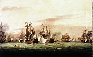
Background imageCaribbean Collection: The Battle of the Saints, 1782 (oil painting)

The Battle of the Saints, 1782 (oil painting)
7337665 The Battle of the Saints, 1782 (oil painting) by Luny, Thomas (1759-1837); 43.9x70.6 cm; National Maritime Museum, London

Background imageCaribbean Collection: Lesser Antilles and Caribbean Sea, c.1550-60 (vellum)

Lesser Antilles and Caribbean Sea, c.1550-60 (vellum)
7339618 Lesser Antilles and Caribbean Sea, c.1550-60 (vellum) by Unknown Artist, (16th century); 24x17 cm; National Maritime Museum, London, UK; (add.info.: Creator: unkown Scale: circa 1:15 500 000)

Background imageCaribbean Collection: Toussaint Louverture, Chief of the French Rebels in St Domingo, 1802 (etching, engraving)

Toussaint Louverture, Chief of the French Rebels in St Domingo, 1802 (etching, engraving)
7339343 Toussaint Louverture, Chief of the French Rebels in St Domingo, 1802 (etching, engraving) by Bonneville, Francois (fl.1787) (after); 16x9.5 cm; National Maritime Museum, London

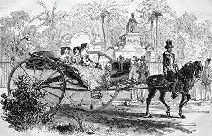
Background imageCaribbean Collection: Promenade in Havana, Cuba, historical wood engraving, circa 1888

Promenade in Havana, Cuba, historical wood engraving, circa 1888
UIG5414553 Promenade in Havana, Cuba, historical wood engraving, circa 1888; UIG.

Background imageCaribbean Collection: Cane inscribed 'Sugar Cane Barbados 1895' (sugar cane)

Cane inscribed 'Sugar Cane Barbados 1895' (sugar cane)
5923264 Cane inscribed 'Sugar Cane Barbados 1895' (sugar cane); National Army Museum, London; (add.info.: Cane inscribed 'Sugar Cane Barbados 1895')

Background imageCaribbean Collection: A buggy and mule, Barbados. circa 1910

A buggy and mule, Barbados. circa 1910
UIG5418953 A buggy and mule, Barbados. circa 1910 by Unknown photographer, (20th century); (add.info.: A buggy pulled by a mule stands outside a large colonial building in the centre of town)

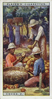
Background imageCaribbean Collection: Cocoa, 2, Opening the pods, Trinidad (colour litho)

Cocoa, 2, Opening the pods, Trinidad (colour litho)
8659393 Cocoa, 2, Opening the pods, Trinidad (colour litho) by English School, (20th century); Private Collection; (add.info.: Cocoa, 2, Opening the pods, Trinidad)

Background imageCaribbean Collection: Trinidad (engraving)

Trinidad (engraving)
8676230 Trinidad (engraving) by Pritchett, Robert (1828-1907); Private Collection; (add.info.: Trinidad. Illustration from In the Trades, the Tropics & the Roaring Forties)

Background imageCaribbean Collection: Geography: map showing the Gulf of Mexico, the Caribbean Islands, Central America (Honduras)

Geography: map showing the Gulf of Mexico, the Caribbean Islands, Central America (Honduras, Costarica)
VEN5031255 Geography: map showing the Gulf of Mexico, the Caribbean Islands, Central America (Honduras, Costarica), northern South America (Venezuela) and southern United States

Background imageCaribbean Collection: Geography: representation of the Gulf of Mexico with the coasts of Mexico, Yucatan

Geography: representation of the Gulf of Mexico with the coasts of Mexico, Yucatan, Florida and Cuba (Antilles)
VEN5031179 Geography: representation of the Gulf of Mexico with the coasts of Mexico, Yucatan, Florida and Cuba (Antilles)

Background imageCaribbean Collection: Frontispice of the Treaty 'Natural and moral history of the Caribbean Islands of America'

Frontispice of the Treaty "Natural and moral history of the Caribbean Islands of America" attributed to Cesar
VEN5031148 Frontispice of the Treaty "Natural and moral history of the Caribbean Islands of America" attributed to Cesar de Rochefort (1638-1691)

Background imageCaribbean Collection: Geography map: representation of the island of Hispaniola (Santo Domingo and Haiti)

Geography map: representation of the island of Hispaniola (Santo Domingo and Haiti) (Greater Antilles)
VEN5030472 Geography map: representation of the island of Hispaniola (Santo Domingo and Haiti) (Greater Antilles), of the Virgin Islands (Lesser Antilles)

Background imageCaribbean Collection: Geography map: representation of the Atlantic Ocean (or North Sea) with the coasts of the Americas

Geography map: representation of the Atlantic Ocean (or North Sea) with the coasts of the Americas
VEN5030386 Geography map: representation of the Atlantic Ocean (or North Sea) with the coasts of the Americas (South and United States), the Caribbean Sea and the Caribbean

Background imageCaribbean Collection: Geography map: representation of the coasts of Cuba and Havana Bay in the West Indies

Geography map: representation of the coasts of Cuba and Havana Bay in the West Indies
VEN5030185 Geography map: representation of the coasts of Cuba and Havana Bay in the West Indies, made by Dutch cartographer Gerard van Keulen (1678-1726) 1709-1713

Background imageCaribbean Collection: Geography Atlas: representation of the Bahamas islands, northern Hispaniola (Santo Domingo)

Geography Atlas: representation of the Bahamas islands, northern Hispaniola (Santo Domingo)
VEN5031335 Geography Atlas: representation of the Bahamas islands, northern Hispaniola (Santo Domingo) and the Leewind Passage between Cuba and Hispaniola in the West Indies

Background imageCaribbean Collection: Geography: Map of Puerto Rico Island, Beata Island, Hispaniola coasts in the West Indies

Geography: Map of Puerto Rico Island, Beata Island, Hispaniola coasts in the West Indies
VEN5031327 Geography: Map of Puerto Rico Island, Beata Island, Hispaniola coasts in the West Indies. Map from an Atlas of Maritime Geography of 1767

Background imageCaribbean Collection: French colonial empire: French possessions and colonies: Guadeloupe island

French colonial empire: French possessions and colonies: Guadeloupe island. Late 19th century (chromolithograph)
ELD4964660 French colonial empire: French possessions and colonies: Guadeloupe island. Late 19th century (chromolithograph); Private Collection; (add.info.: French colonial empire)

Background imageCaribbean Collection: Spanish-American War (1898) designed in Spain under the name of Desastre de 98 (Desastre del 98)

Spanish-American War (1898) designed in Spain under the name of Desastre de 98 (Desastre del 98)
NWI4837757 Spanish-American War (1898) designed in Spain under the name of Desastre de 98 (Desastre del 98), which led to the independence of Cuba

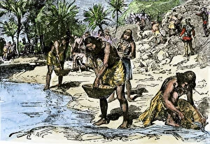
Background imageCaribbean Collection: Caribbean Indians wash gold for Spanish conquerors. 19th century coloring engraving

Caribbean Indians wash gold for Spanish conquerors. 19th century coloring engraving
NWI4850581 Caribbean Indians wash gold for Spanish conquerors. 19th century coloring engraving.; (add.info.: Caribbean Indians wash gold for Spanish conquerors)

Background imageCaribbean Collection: Rheuerie JM, since 1845 in Macouba - Martinique, island of the French Antilles

Rheuerie JM, since 1845 in Macouba - Martinique, island of the French Antilles
JEB4949971 Rheuerie JM, since 1845 in Macouba - Martinique, island of the French Antilles; (add.info.: Rheuerie JM, since 1845 in Macouba - Martinique)

Background imageCaribbean Collection: French West Indies - French Antilles - Fonds Saint Jacques, Sugar Housing du Pere Labat (1663-1736)

French West Indies - French Antilles - Fonds Saint Jacques, Sugar Housing du Pere Labat (1663-1736) - Martinique
JEB4950162 French West Indies - French Antilles - Fonds Saint Jacques, Sugar Housing du Pere Labat (1663-1736) - Martinique

Background imageCaribbean Collection: Fort de France. Schoelcher Library, architect Pierre Henri Picq. Opened in 1893

Fort de France. Schoelcher Library, architect Pierre Henri Picq. Opened in 1893
JEB4948866 Fort de France. Schoelcher Library, architect Pierre Henri Picq. Opened in 1893.; (add.info.: Fort de France. Schoelcher Library, architect Pierre Henri Picq)

Background imageCaribbean Collection: French West Indies - French Antilles - Fort de France copy of the graved rock

French West Indies - French Antilles - Fort de France copy of the graved rock
JEB4948812 French West Indies - French Antilles - Fort de France copy of the graved rock, petroglyph of the forest of Mon Travail in Sainte Luce

Background imageCaribbean Collection: Latin America. Boat sailing along the banks of the Chagres River at the port of the Caribbean Sea

Latin America. Boat sailing along the banks of the Chagres River at the port of the Caribbean Sea, Panama
NWI4876243 Latin America. Boat sailing along the banks of the Chagres River at the port of the Caribbean Sea, Panama, during the California Gold Rush

Background imageCaribbean Collection: Map of America with sea depth levels along the coasts of Mexico

Map of America with sea depth levels along the coasts of Mexico, the Caribbean Islands and the Caribbean
NWI4852948 Map of America with sea depth levels along the coasts of Mexico, the Caribbean Islands and the Caribbean. Color lithograph of the 19th century.; (add.info)

Background imageCaribbean Collection: Map of islands of the Caribbean Sea (or Caribbean Sea, Central America), circa 1870

Map of islands of the Caribbean Sea (or Caribbean Sea, Central America), circa 1870. Color lithography, 19th century
NWI4849885 Map of islands of the Caribbean Sea (or Caribbean Sea, Central America), circa 1870. Color lithography, 19th century.; (add.info.: Map of islands of the Caribbean Sea (or Caribbean Sea)

Background imageCaribbean Collection: Banana trees and other exotic fruit trees of Hispaniola (Antilles)

Banana trees and other exotic fruit trees of Hispaniola (Antilles) based on a sketch published in 1572
NWI4847418 Banana trees and other exotic fruit trees of Hispaniola (Antilles) based on a sketch published in 1572. Coloured engraving of the 19th century.; (add.info)

Background imageCaribbean Collection: Geography Atlas: representation of the Caribbean Sea region, the Caribbean (Cuba, Jamaica)

Geography Atlas: representation of the Caribbean Sea region, the Caribbean (Cuba, Jamaica, Hispaniola, Jamaica)
VEN5030043 Geography Atlas: representation of the Caribbean Sea region, the Caribbean (Cuba, Jamaica, Hispaniola, Jamaica), the Bahamas Islands, the Lesser Antilles

Background imageCaribbean Collection: Geography Atlas: description of the Caribbean Sea, Caribbean Sea (Cuba, Jamaica, Hispaniola)

Geography Atlas: description of the Caribbean Sea, Caribbean Sea (Cuba, Jamaica, Hispaniola, Jamaica)
VEN5030036 Geography Atlas: description of the Caribbean Sea, Caribbean Sea (Cuba, Jamaica, Hispaniola, Jamaica), the Bahamas Islands and the Lesser Antilles with map

Background imageCaribbean Collection: Geography Atlas: representation of the island of Antigua in the Caribbean

Geography Atlas: representation of the island of Antigua in the Caribbean
VEN5030006 Geography Atlas: representation of the island of Antigua in the Caribbean. Map taken from "The west indian atlas or general description of west indies" by Thomas Jefferys

Background imageCaribbean Collection: Geography Atlas: representation of Tobago Island in the Lesser Antilles

Geography Atlas: representation of Tobago Island in the Lesser Antilles. Map taken from "The west indian atlas or
VEN5029619 Geography Atlas: representation of Tobago Island in the Lesser Antilles. Map taken from "The west indian atlas or general description of west indies" by Thomas Jefferys

Background imageCaribbean Collection: Human skeleton found in Guadeloupe. in ' Discours sur Les Revolutions de La Surface du Globe

Human skeleton found in Guadeloupe. in " Discours sur Les Revolutions de La Surface du Globe
XEE5028515 Human skeleton found in Guadeloupe. in " Discours sur Les Revolutions de La Surface du Globe, et sur Les Changemens qu'elles produits dans Le Regne Animal " by Georges

Background imageCaribbean Collection: Caribbean spider-lily, Hymenocallis caribaea (Pancratium declinatum)

Caribbean spider-lily, Hymenocallis caribaea (Pancratium declinatum). Handcoloured copperplate engraving by George
FLO4665856 Caribbean spider-lily, Hymenocallis caribaea (Pancratium declinatum). Handcoloured copperplate engraving by George Cooke from Conrad Loddiges' Botanical Cabinet, Hackney, London

Background imageCaribbean Collection: Metisse de Martinique - Mixed-race woman of Martinique, 1865

Metisse de Martinique - Mixed-race woman of Martinique, 1865. Handcoloured steel engraving by Polydor Pauquet from
FLO4686696 Metisse de Martinique - Mixed-race woman of Martinique, 1865. Handcoloured steel engraving by Polydor Pauquet from the Pauquet Brothers' " Modes et Costumes Etrangers Anciens et

Background imageCaribbean Collection: Aristoloche pipe of Harlequin (Aristolochia anguicida). Lithograph from 'Afbeelding der

Aristoloche pipe of Harlequin (Aristolochia anguicida). Lithograph from "Afbeelding der Artseny-Gewassen" by
FLO4733101 Aristoloche pipe of Harlequin (Aristolochia anguicida). Lithograph from "Afbeelding der Artseny-Gewassen" by Johannes Zorn (1739-1799), Netherlands, 1796

Background imageCaribbean Collection: Triton (fish man) seen off the coast of Martinique May 23, 1671 - Water forte extracted from

Triton (fish man) seen off the coast of Martinique May 23, 1671 - Water forte extracted from the Encyclopedie of
FLO4727366 Triton (fish man) seen off the coast of Martinique May 23, 1671 - Water forte extracted from the Encyclopedie of Natural History: Humanite, by Gottlieb Tobias Wilhelm (1758-1811)

Background imageCaribbean Collection: Clamshell orchid, Epidendrum cochleatum, native to central and south America and the Caribbean

Clamshell orchid, Epidendrum cochleatum, native to central and south America and the Caribbean
FLO4569696 Clamshell orchid, Epidendrum cochleatum, native to central and south America and the Caribbean. Handcoloured stipple engraving on copper by Barrois from a botanical illustration by

Background imageCaribbean Collection: Marica has small white flower and spear-shaped leaf, bright green stripes

Marica has small white flower and spear-shaped leaf, bright green stripes. Origin Cayenne, Jamaican and Caribbean
FLO4585684 Marica has small white flower and spear-shaped leaf, bright green stripes. Origin Cayenne, Jamaican and Caribbean

Background imageCaribbean Collection: English adventurers preparing an expedition to the gold mines of Cuba, 1500s

English adventurers preparing an expedition to the gold mines of Cuba, 1500s
NWI4712561 English adventurers preparing an expedition to the gold mines of Cuba, 1500s.; (add.info.: English adventurers preparing an expedition to the gold mines of Cuba)

Background imageCaribbean Collection: Ribband fish, unknown species. Illustration copied from George Edwards from a specimen sent

Ribband fish, unknown species. Illustration copied from George Edwards from a specimen sent from the Caribbean islands
FLO4640575 Ribband fish, unknown species. Illustration copied from George Edwards from a specimen sent from the Caribbean islands

Background imageCaribbean Collection: Ornaments of the Island Carib or Kalinago people, West Indies, including garters

Ornaments of the Island Carib or Kalinago people, West Indies, including garters
FLO4621591 Ornaments of the Island Carib or Kalinago people, West Indies, including garters and body paint of roucou or achiote dye

Background imageCaribbean Collection: Other ranks excavated belt plate of the 4th West India Regiment

Other ranks excavated belt plate of the 4th West India Regiment
3030699 Other ranks excavated belt plate of the 4th West India Regiment; Private Collection; (add.info.: Other ranks excavated belt plate of the 4th West India Regiment)

Background imageCaribbean Collection: Map of Barbados, c.1900 (engraving)

Map of Barbados, c.1900 (engraving)
533469 Map of Barbados, c.1900 (engraving); (add.info.: Map showing the parish boundaries of Barbados, circa 1902, from the 10th edition of Encyclopaedia Britannica.); Encyclopaedia Britannica/UIG.

Background imageCaribbean Collection: Santo Domingo, 1796

Santo Domingo, 1796
2902892 Santo Domingo, 1796; (add.info.: Santo Domingo, Dominican Republic, 1796.); Buyenlarge Archive/UIG.

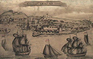
Background imageCaribbean Collection: Panorama of harbor showing siege of Curacao by English sailors and soldiers in 1800

Panorama of harbor showing siege of Curacao by English sailors and soldiers in 1800
2902887 Panorama of harbor showing siege of Curacao by English sailors and soldiers in 1800; (add.info.: Panorama of harbor showing siege of Curacao by English sailors and soldiers in 1800)


All Professionally Made to Order for Quick Shipping

"Discover the Vibrant Spirit of the Caribbean: A Tapestry of Cultures and Natural Wonders" Jamaicans on board the Empire Windrush: Celebrating the rich heritage and resilience brought by Jamaican immigrants, who embarked on a journey that forever shaped the Caribbean's cultural landscape. Small airplane landing at the airport of St. Barth (Saint Barthelemy), Lesser Antilles: Unveiling breathtaking views as you touch down in this idyllic island paradise, where luxury meets tranquility in perfect harmony. Cruz Bay, St. John, U. S. Virgin Islands, West Indies, Caribbean: Immerse yourself in the laid-back charm of this picturesque town nestled amidst lush greenery and crystal-clear waters – a true slice of heaven. Dunns River Falls, Ocho Rios, Jamaica: Feel your heart race as you climb these majestic cascades surrounded by verdant tropical foliage – an exhilarating adventure that captures Jamaica's natural beauty. Hammock hanging on famous White Bay, Jost Van Dyke, British Virgin Islands: Surrender to pure bliss as you sway gently in a hammock overlooking pristine white sands and turquoise waters – an oasis for relaxation seekers. The Pitons, St. Lucia: Marvel at nature's masterpiece - two towering volcanic peaks rising majestically from azure seas - a UNESCO World Heritage site that embodies Saint Lucia's dramatic allure. Divi Divi Trees on Eagle Beach, Aruba: Find solace under these iconic bent trees while basking in Aruba's year-round sunshine – an invitation to unwind amidst stunning coastal scenery. Poster advertising Royal Mail Lines to the West Indies: Step back in time through vintage artwork showcasing glamorous ocean voyages that once connected travelers with exotic destinations across the West Indies' archipelago. Cinnamon Bay beach and palms, St. John, U. S. Virgin Islands.