Fraud Blocker Skip to main content

Caribbean Collection (page 18)

"Discover the Vibrant Spirit of the Caribbean: A Tapestry of Cultures and Natural Wonders" Jamaicans on board the Empire Windrush

Background imageCaribbean Collection: Strategic Map of Our War with Spain

Strategic Map of Our War with Spain
2902891 Strategic Map of Our War with Spain; (add.info.: Strategic Map of Our War with Spain, 1898.); Buyenlarge Archive/UIG.

Background imageCaribbean Collection: Point Royal, Jamaica New Granada, 18th century (engraving)

Point Royal, Jamaica New Granada, 18th century (engraving)
2902884 Point Royal, Jamaica New Granada, 18th century (engraving); Buyenlarge Archive/UIG.

Background imageCaribbean Collection: The Evening Post map of the West Indies, 1898

The Evening Post map of the West Indies, 1898
2902870 The Evening Post map of the West Indies, 1898; (add.info.: The Evening Post map of the West Indies, 1898.); Buyenlarge Archive/UIG.

Background imageCaribbean Collection: To Captain Z Mudge... of the... 'Blanche'.. the gallant defence made by that Ship in the Sombero

To Captain Z Mudge... of the... 'Blanche'.. the gallant defence made by that Ship in the Sombero Passage
7342174 To Captain Z Mudge... of the... 'Blanche'.. the gallant defence made by that Ship in the Sombero Passage on July 19, 1805 against a French Squadron..., 1806 (aquatint) by Sartorius

Background imageCaribbean Collection: Plan of Tortola from survey by George King, 1798 (coloured engraving)

Plan of Tortola from survey by George King, 1798 (coloured engraving)
7340496 Plan of Tortola from survey by George King, 1798 (coloured engraving) by King, George (18th century); 48x63 cm; National Maritime Museum, London

Background imageCaribbean Collection: Eastern Caribbean, 1658 (engraving)

Eastern Caribbean, 1658 (engraving)
7340063 Eastern Caribbean, 1658 (engraving) by Doncker, Hendrick (c.1626-99); 44.5x54 cm; National Maritime Museum, London

Background imageCaribbean Collection: Francois-Dominique Toussaint Louverture. Portrait. (print)

Francois-Dominique Toussaint Louverture. Portrait. (print)
7419897 Francois-Dominique Toussaint Louverture. Portrait. (print); Photo © Ken Welsh. All rights reserved 2024.

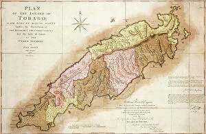
Background imageCaribbean Collection: Plan of Tobago, 1776 (coloured engraving)

Plan of Tobago, 1776 (coloured engraving)
7340444 Plan of Tobago, 1776 (coloured engraving) by Bayly, John (fl.c.1754-1806); 61x92 cm; National Maritime Museum, London, UK; (add.info.: Creator: John Byres; J)

Background imageCaribbean Collection: Map of Guadeloupe, c.1900 (engraving)

Map of Guadeloupe, c.1900 (engraving)
533480 Map of Guadeloupe, c.1900 (engraving); (add.info.: Map of Guadeloupe, circa 1902, from the 10th edition of Encyclopaedia Britannica.); Encyclopaedia Britannica/UIG.

Background imageCaribbean Collection: Map of Dominica, c.1900 (engraving)

Map of Dominica, c.1900 (engraving)
533477 Map of Dominica, c.1900 (engraving); (add.info.: Map of Dominica, circa 1902, from the 10th edition of Encyclopaedia Britannica.); Encyclopaedia Britannica/UIG.

Background imageCaribbean Collection: Man of the West Indies with bow and quibow, 1686 (watercolor)

Man of the West Indies with bow and quibow, 1686 (watercolor)
1835652 Man of the West Indies with bow and quibow, 1686 (watercolor); (add.info.: Man of the West Indies with bow and quibow)

Background imageCaribbean Collection: Eruption of Mount Pelee in Martinique, 1902 (illustration)

Eruption of Mount Pelee in Martinique, 1902 (illustration)
2093143 Eruption of Mount Pelee in Martinique, 1902 (illustration); (add.info.: France. Eruption de la montagne Pelee le 7/05/1902. Illustration in: Le Petit Parisien, France, 08/06/1902. Coll. Part)

Background imageCaribbean Collection: Picking the Cocoa Pods, Trinidad (b/w photo)

Picking the Cocoa Pods, Trinidad (b/w photo)
8674258 Picking the Cocoa Pods, Trinidad (b/w photo) by English Photographer, (20th century); Private Collection; (add.info.: Picking the Cocoa Pods, Trinidad)

Background imageCaribbean Collection: 'Dancing' Cacao Beans in Trinidad (b/w photo)

"Dancing" Cacao Beans in Trinidad (b/w photo)
8674205 "Dancing" Cacao Beans in Trinidad (b/w photo) by English Photographer, (20th century); Private Collection; (add.info.: "Dancing" Cacao Beans in Trinidad)

Background imageCaribbean Collection: Cocoa, 1, Cacao tree, Trinidad (colour litho)

Cocoa, 1, Cacao tree, Trinidad (colour litho)
8659389 Cocoa, 1, Cacao tree, Trinidad (colour litho) by English School, (20th century); Private Collection; (add.info.: Cocoa, 1, Cacao tree, Trinidad)

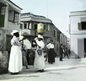
Background imageCaribbean Collection: A soft drinks vendor in Bridgetown, Barbados, circa 1910

A soft drinks vendor in Bridgetown, Barbados, circa 1910
UIG5418964 A soft drinks vendor in Bridgetown, Barbados, circa 1910 by Unknown photographer, (20th century); (add.info.: A female street vendor balances a soft drinks decanter on her head)

Background imageCaribbean Collection: On the way to market, Antigua. A woman and donkey travel to market laden with goods

On the way to market, Antigua. A woman and donkey travel to market laden with goods
UIG5418961 On the way to market, Antigua. A woman and donkey travel to market laden with goods, past an 'American House' in the centre of town. Probably St John's, Antigua, circa 1910

Background imageCaribbean Collection: A female fruit vendor aboard the SS Chaleur, circa 1910

A female fruit vendor aboard the SS Chaleur, circa 1910
UIG5418958 A female fruit vendor aboard the SS Chaleur, circa 1910 by Unknown photographer, (20th century); (add.info.: Portrait of a female fruit vendor aboard the SS Chaleur)

Background imageCaribbean Collection: Off to market, Jamaica, circa 1910. Mandeville, Manchester

Off to market, Jamaica, circa 1910. Mandeville, Manchester
UIG5418955 Off to market, Jamaica, circa 1910. Mandeville, Manchester by Unknown photographer, (20th century); (add.info.: A Jamaican boy, dressed in a cap and jacket)

Background imageCaribbean Collection: Plan of the harbour, fort, town and environs of Fort Royal in Martinique, 1793 (engraving)

Plan of the harbour, fort, town and environs of Fort Royal in Martinique, 1793 (engraving)
7340437 Plan of the harbour, fort, town and environs of Fort Royal in Martinique, 1793 (engraving) by Booth, William (18th century); 88x70 cm; National Maritime Museum, London

Background imageCaribbean Collection: The turtle, c.1910 (print)

The turtle, c.1910 (print)
7293390 The turtle, c.1910 (print); (add.info.: Food and beverage. The turtle as food. Imagery in: Histoire anecdotique de l'alimentation, France, ca 1910.); Photo: © Archives Charmet.

Background imageCaribbean Collection: Pirates chatting around a canoe on the beach of a deserte island of the Caribbean Sea, 18th century

Pirates chatting around a canoe on the beach of a deserte island of the Caribbean Sea, 18th century
NWI4963581 Pirates chatting around a canoe on the beach of a deserte island of the Caribbean Sea, 18th century. Illustration by Howard Pyle

Background imageCaribbean Collection: Crantzia tigrina (Heintzia tigrina). Handcoloured lithograph from Louis van Houtte

Crantzia tigrina (Heintzia tigrina). Handcoloured lithograph from Louis van Houtte
FLO4629832 Crantzia tigrina (Heintzia tigrina). Handcoloured lithograph from Louis van Houtte and Charles Lemaire's Flowers of the Gardens and Hothouses of Europe

Background imageCaribbean Collection: Geography: Map of Saint Kitts and Nevis Island in the West Indies

Geography: Map of Saint Kitts and Nevis Island in the West Indies. Map from an Atlas by Bryan Edwards (1743-1800)
VEN5031320 Geography: Map of Saint Kitts and Nevis Island in the West Indies. Map from an Atlas by Bryan Edwards (1743-1800) from 1791
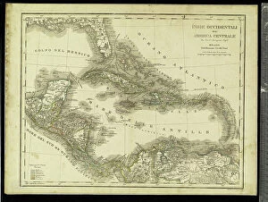
Background imageCaribbean Collection: Geography: map showing the Gulf of Mexico, the Caribbean Islands, Central America (Mexico)

Geography: map showing the Gulf of Mexico, the Caribbean Islands, Central America (Mexico, Yucatan, Salvador, Honduras)
VEN5031242 Geography: map showing the Gulf of Mexico, the Caribbean Islands, Central America (Mexico, Yucatan, Salvador, Honduras, Nicaragua, Costarica) and northern South America (Venezuela)

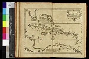
Background imageCaribbean Collection: Geography map: representation of the islands of the Greater Antilles (Cuba, Hispaniola)

Geography map: representation of the islands of the Greater Antilles (Cuba, Hispaniola)
VEN5030434 Geography map: representation of the islands of the Greater Antilles (Cuba, Hispaniola, Jamaica and Puerto Rico) and the Lesser Antilles in the Caribbean Sea

Background imageCaribbean Collection: Geography map: representation of the main British islands of the Caribbean Sea (Antigua, Barbados)

Geography map: representation of the main British islands of the Caribbean Sea (Antigua, Barbados, Jamaican, Bermuda)
VEN5030269 Geography map: representation of the main British islands of the Caribbean Sea (Antigua, Barbados, Jamaican, Bermuda, St. Christopher Island or St)

Background imageCaribbean Collection: Geography map: representation of the island of Martinique in the small Antilles

Geography map: representation of the island of Martinique in the small Antilles
VEN5030213 Geography map: representation of the island of Martinique in the small Antilles, made by Dutch cartographer Gerard van Keulen (1678-1726) 1709-1713

Background imageCaribbean Collection: Geography map: representation of part of the archipelago of the small Antilles

Geography map: representation of part of the archipelago of the small Antilles (island of Saint Lucia, Martinique)
VEN5030211 Geography map: representation of part of the archipelago of the small Antilles (island of Saint Lucia, Martinique, Dominica, Ile des Saintes, Guadeloupe, Montserrat, Antigua, Barbuda)

Background imageCaribbean Collection: Geography map: representation of the Orenoque River in Venezuela, the Gulf of Paria

Geography map: representation of the Orenoque River in Venezuela, the Gulf of Paria, the islands of Tobago
VEN5030093 Geography map: representation of the Orenoque River in Venezuela, the Gulf of Paria, the islands of Tobago, Trinidad (Trinidad)

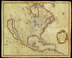
Background imageCaribbean Collection: Geography Atlas: representation of North America and the Caribbean Sea region, Caribbean (Cuba)

Geography Atlas: representation of North America and the Caribbean Sea region, Caribbean (Cuba, Jamaica, Hispaniola)
VEN5030056 Geography Atlas: representation of North America and the Caribbean Sea region, Caribbean (Cuba, Jamaica, Hispaniola, Jamaica). Map from an Atlas of 1785

Background imageCaribbean Collection: Geography Atlas: representation of South America and the Caribbean Sea region, Caribbean (Cuba)

Geography Atlas: representation of South America and the Caribbean Sea region, Caribbean (Cuba, Jamaica, Hispaniola)
VEN5030051 Geography Atlas: representation of South America and the Caribbean Sea region, Caribbean (Cuba, Jamaica, Hispaniola)

Background imageCaribbean Collection: Geography Atlas: representation of the island of Jamaica in the Caribbean archipelago

Geography Atlas: representation of the island of Jamaica in the Caribbean archipelago
VEN5029993 Geography Atlas: representation of the island of Jamaica in the Caribbean archipelago. Map taken from "The west indian atlas or general description of west indies" by Thomas

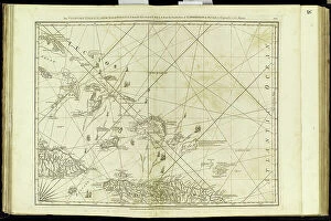
Background imageCaribbean Collection: Geography Atlas: representation of the Bahamas islands, northern Hispaniola (Santo Domingo)

Geography Atlas: representation of the Bahamas islands, northern Hispaniola (Santo Domingo)
VEN5029631 Geography Atlas: representation of the Bahamas islands, northern Hispaniola (Santo Domingo) and the Leewind Passage between Cuba and Hispaniola in the West Indies

Background imageCaribbean Collection: Geography Atlas: representation of the Bequia or Becouya Islands in the North of the Grenadines in

Geography Atlas: representation of the Bequia or Becouya Islands in the North of the Grenadines in the Caribbean Sea
VEN5029628 Geography Atlas: representation of the Bequia or Becouya Islands in the North of the Grenadines in the Caribbean Sea

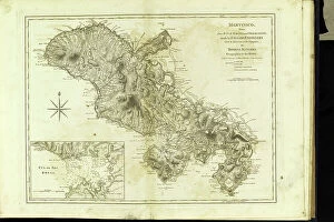
Background imageCaribbean Collection: Geography Atlas: representation of the island of Martinique in the West Indies

Geography Atlas: representation of the island of Martinique in the West Indies
VEN5029597 Geography Atlas: representation of the island of Martinique in the West Indies. Map taken from "The west indian atlas or general description of west indies" by Thomas Jefferys

Background imageCaribbean Collection: View of the tropical forest of the New World, discovered by the Spanish

View of the tropical forest of the New World, discovered by the Spanish (Central America or the Caribbean)
NWI4851815 View of the tropical forest of the New World, discovered by the Spanish (Central America or the Caribbean), late 16th century

Background imageCaribbean Collection: MONARDES, Nicolas (1507-1888). Dos libros, el uno que trata de todas las cosas que se traen de

MONARDES, Nicolas (1507-1888). Dos libros, el uno que trata de todas las cosas que se traen de nuestras Indias
CUL4853102 MONARDES, Nicolas (1507-1888). Dos libros, el uno que trata de todas las cosas que se traen de nuestras Indias Ouesterales, que sirven al uso de la medicina

Background imageCaribbean Collection: Taino, inhabitant of the Hispaniola Mountains (Haiti and Dominican Republic)

Taino, inhabitant of the Hispaniola Mountains (Haiti and Dominican Republic)
NWI4853761 Taino, inhabitant of the Hispaniola Mountains (Haiti and Dominican Republic) as described by the first explorers of the New World - Colorised engraving

Background imageCaribbean Collection: Indigenes of the islands under the wind (Lesser Antilles), as described by the early explorers of

Indigenes of the islands under the wind (Lesser Antilles), as described by the early explorers of the New World
NWI4853741 Indigenes of the islands under the wind (Lesser Antilles), as described by the early explorers of the New World - Colorized engraving

Background imageCaribbean Collection: Caribbean cucumber (Cucumis anguria). Lithograph from 'Afbeelding der Artseny-Gewassen' by

Caribbean cucumber (Cucumis anguria). Lithograph from "Afbeelding der Artseny-Gewassen" by Johannes Zorn
FLO4737977 Caribbean cucumber (Cucumis anguria). Lithograph from "Afbeelding der Artseny-Gewassen" by Johannes Zorn (1739-1799), Netherlands, 1796. West Indian gherkin, Cucumis anguria

Background imageCaribbean Collection: Woven hammock used by the Island Carib or Kalinago people. Handcoloured copperplate engraving

Woven hammock used by the Island Carib or Kalinago people. Handcoloured copperplate engraving from Giulio
FLO4621561 Woven hammock used by the Island Carib or Kalinago people. Handcoloured copperplate engraving from Giulio Ferrario's Costumes Antique and Modern of All Peoples

Background imageCaribbean Collection: Rattan table and sneakers for food and fish made by the Island Carib or Kalinago people, West Indies

Rattan table and sneakers for food and fish made by the Island Carib or Kalinago people, West Indies
FLO4621678 Rattan table and sneakers for food and fish made by the Island Carib or Kalinago people, West Indies. Handcoloured copperplate engraving by Migliavacca from Giulio Ferrario's Costumes

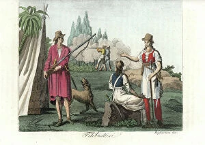
Background imageCaribbean Collection: Male and female pirates of the West Indies, armed with musket and cutlass.early 1800s

Male and female pirates of the West Indies, armed with musket and cutlass.early 1800s
FLO4621671 Male and female pirates of the West Indies, armed with musket and cutlass.early 1800s. The buccaneer at left wears a linen shirt dyed with animal blood

Background imageCaribbean Collection: Palamedes swallowtail butterfly, Papilio palamedes 1,2, Antillea pelops 3,4, and Caribbean duskywing

Palamedes swallowtail butterfly, Papilio palamedes 1,2, Antillea pelops 3,4, and Caribbean duskywing
FLO4615459 Palamedes swallowtail butterfly, Papilio palamedes 1,2, Antillea pelops 3,4, and Caribbean duskywing, Ephyriades arcas 5,6. Handcoloured lithograph from John O

Background imageCaribbean Collection: Trois Ilets, Domaine de la Pagerie, portrait of Josephine de Beauharnais - Martinique

Trois Ilets, Domaine de la Pagerie, portrait of Josephine de Beauharnais - Martinique, island of the French Antilles
JEB4949247 Trois Ilets, Domaine de la Pagerie, portrait of Josephine de Beauharnais - Martinique, island of the French Antilles; (add.info.: Trois Ilets, Domaine de la Pagerie)

Background imageCaribbean Collection: French West Indies - French Antilles - La Trinite, Le chateau Dubuc was built in 1721

French West Indies - French Antilles - La Trinite, Le chateau Dubuc was built in 1721, by Louis du Buc du Galion
JEB4949178 French West Indies - French Antilles - La Trinite, Le chateau Dubuc was built in 1721, by Louis du Buc du Galion, grandson of Pierre du Buc, Sieur de La Caravelle et du Marigot

Background imageCaribbean Collection: French West Indies - French Antilles - La Trinite, Le chateau Dubuc was built in 1721

French West Indies - French Antilles - La Trinite, Le chateau Dubuc was built in 1721, by Louis du Buc du Galion
JEB4949120 French West Indies - French Antilles - La Trinite, Le chateau Dubuc was built in 1721, by Louis du Buc du Galion, grandson of Pierre du Buc, Sieur de La Caravelle et du Marigot


All Professionally Made to Order for Quick Shipping

"Discover the Vibrant Spirit of the Caribbean: A Tapestry of Cultures and Natural Wonders" Jamaicans on board the Empire Windrush: Celebrating the rich heritage and resilience brought by Jamaican immigrants, who embarked on a journey that forever shaped the Caribbean's cultural landscape. Small airplane landing at the airport of St. Barth (Saint Barthelemy), Lesser Antilles: Unveiling breathtaking views as you touch down in this idyllic island paradise, where luxury meets tranquility in perfect harmony. Cruz Bay, St. John, U. S. Virgin Islands, West Indies, Caribbean: Immerse yourself in the laid-back charm of this picturesque town nestled amidst lush greenery and crystal-clear waters – a true slice of heaven. Dunns River Falls, Ocho Rios, Jamaica: Feel your heart race as you climb these majestic cascades surrounded by verdant tropical foliage – an exhilarating adventure that captures Jamaica's natural beauty. Hammock hanging on famous White Bay, Jost Van Dyke, British Virgin Islands: Surrender to pure bliss as you sway gently in a hammock overlooking pristine white sands and turquoise waters – an oasis for relaxation seekers. The Pitons, St. Lucia: Marvel at nature's masterpiece - two towering volcanic peaks rising majestically from azure seas - a UNESCO World Heritage site that embodies Saint Lucia's dramatic allure. Divi Divi Trees on Eagle Beach, Aruba: Find solace under these iconic bent trees while basking in Aruba's year-round sunshine – an invitation to unwind amidst stunning coastal scenery. Poster advertising Royal Mail Lines to the West Indies: Step back in time through vintage artwork showcasing glamorous ocean voyages that once connected travelers with exotic destinations across the West Indies' archipelago. Cinnamon Bay beach and palms, St. John, U. S. Virgin Islands.