Antique Framed Print > Universal Images Group (UIG) > Universal Images Group > Satellite and Aerial > Planet Observer 4
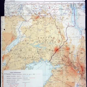
Antique Framed Print : Uganda, Relief Map with Border and Mask


![]()
Framed Photos from Universal Images Group (UIG)
Uganda, Relief Map with Border and Mask
Relief map of Uganda (with border and mask). This image was compiled from data acquired by landsat 5 & 7 satellites combined with elevation data
Universal Images Group (UIG) manages distribution for many leading specialist agencies worldwide
Media ID 9619123
© Planet Observer/UIG
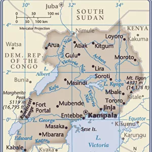
Africa Great Lakes Lake Victoria Relief Map Uganda Kampala Satellite View
14"x12" (36x31cm) Antique Frame
Bevelled wood effect frame, card mounted, 10x8 archival quality photo print. Overall outside dimensions 14x12 inches (36x31cm). Environmentally and ozone friendly, the Polycore® moulding has the look of real wood, is durable and light and easy to hang. Biodegradable and made with non-chlorinated gases (no toxic fumes) it is efficient; producing 100 tons of polystyrene can save 300 tons of trees! Prints are glazed with lightweight, shatterproof, optical clarity acrylic (providing the same general protection from the environment as glass). The back is stapled hardboard with a sawtooth hanger attached. Note: To minimise original artwork cropping, for optimum layout, and to ensure print is secure, the visible print may be marginally smaller
Bevelled Wood Effect Framed and Mounted Prints - Professionally Made and Ready to Hang
Estimated Image Size (if not cropped) is 17.3cm x 24.4cm (6.8" x 9.6")
Estimated Product Size is 31.2cm x 36.3cm (12.3" x 14.3")
These are individually made so all sizes are approximate
Artwork printed orientated as per the preview above, with portrait (vertical) orientation to match the source image.
EDITORS COMMENTS
This stunning print showcases the intricate beauty of Uganda's relief map, adorned with a border and mask. Compiled from data acquired by Landsat 5 & 7 satellites, combined with elevation data, this image offers a unique perspective on the physical geography of Uganda. The horizontal composition allows for an immersive viewing experience, transporting you to the heart of Africa. The vibrant colors bring out the diverse topography of this East African nation. From the majestic Great Lakes region to the bustling cityscape of Kampala, every detail is captured in this photograph. Lake Victoria takes center stage as it glistens under the golden sunlight, reflecting its significance as one of Africa's largest freshwater bodies. With no people in sight, this image invites you to explore Uganda's natural wonders at your own pace. The relief map provides valuable insights into the country's terrain and geographical features while highlighting its rich cultural heritage. Whether you are a cartography enthusiast or simply appreciate breathtaking landscapes, this print is sure to captivate your imagination. It serves as a reminder that our world is filled with hidden treasures waiting to be discovered and appreciated
MADE IN THE UK
Safe Shipping with 30 Day Money Back Guarantee
FREE PERSONALISATION*
We are proud to offer a range of customisation features including Personalised Captions, Color Filters and Picture Zoom Tools
SECURE PAYMENTS
We happily accept a wide range of payment options so you can pay for the things you need in the way that is most convenient for you
* Options may vary by product and licensing agreement. Zoomed Pictures can be adjusted in the Basket.