Acrylic Blox > Europe > United Kingdom > Wales > Maps
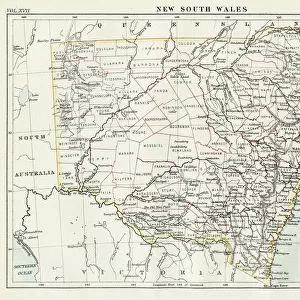
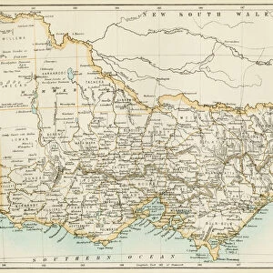
Acrylic Blox : New South Wales map, 1800s


![]()
Mounted Prints from North Wind
New South Wales map, 1800s
Map of New South Wales, Australia, 1870s.
Color lithograph reproduction of a 19th-century illustration
North Wind Picture Archives brings history to life with stock images and hand-colored illustrations
Media ID 5882613
© North Wind Picture Archives
Australia Australian British Empire
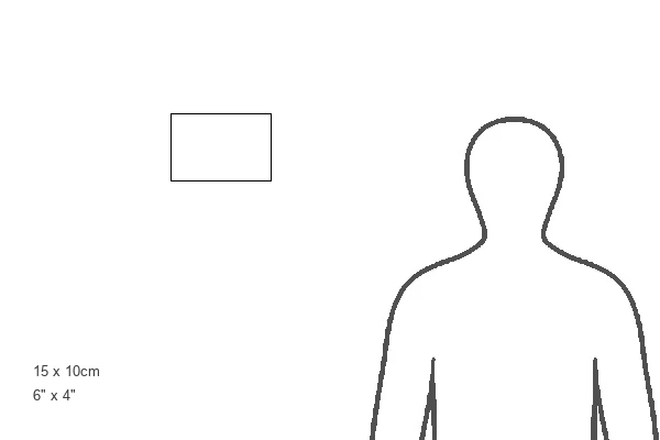
6"x4" (15x10cm) Acrylic Blox
Your photographic print is held in place by magnets and a micro thin sheet of metal covering the back of a 20mm piece of clear acrylic. Your print is held in place with magnets so can easily be replaced if needed.
Streamlined, one sided modern and attractive table top print
Estimated Product Size is 15.2cm x 10.2cm (6" x 4")
These are individually made so all sizes are approximate
Artwork printed orientated as per the preview above, with landscape (horizontal) orientation to match the source image.
FEATURES IN THESE COLLECTIONS
> Europe
> United Kingdom
> Wales
> Maps
> Europe
> United Kingdom
> Wales
> Posters
> Europe
> United Kingdom
> Wales
> Related Images
> Maps and Charts
> British Empire Maps
> Maps and Charts
> Related Images
> Maps and Charts
> Wales
> Oceania
> Australia
> Related Images
> North Wind Picture Archives
> Maps
EDITORS COMMENTS
This print transports us back to the 1800s, offering a glimpse into the rich history of New South Wales, Australia. The map depicted here is a color lithograph reproduction of an original 19th-century illustration, showcasing the intricate details and artistry that were prevalent during this era. As we gaze at this vintage piece, we are reminded of the deep heritage and traditional roots that shaped New South Wales. The map serves as a testament to the region's historical significance within the British Empire during the 1800s. It not only highlights geographical features but also provides insight into how society was structured at that time. The muted colors and delicate lines evoke a sense of nostalgia, transporting us to an era long gone by. This artwork allows us to appreciate both its aesthetic value and its historical importance in understanding how New South Wales has evolved over time. Whether you are an art enthusiast or a history buff, this print offers a unique opportunity to own a piece of Australian history. Display it proudly on your wall or use it as educational material for students eager to learn about their country's past
MADE IN THE UK
Safe Shipping with 30 Day Money Back Guarantee
FREE PERSONALISATION*
We are proud to offer a range of customisation features including Personalised Captions, Color Filters and Picture Zoom Tools
SECURE PAYMENTS
We happily accept a wide range of payment options so you can pay for the things you need in the way that is most convenient for you
* Options may vary by product and licensing agreement. Zoomed Pictures can be adjusted in the Basket.