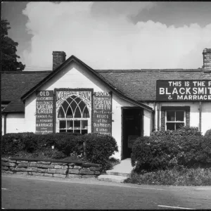
Postcard > Europe > France > Canton > Landes
Postcard : 1852 Colton Sectional Pocket Map Of Illinois


![]()
Cards From Universal Images Group (UIG)
1852 Colton Sectional Pocket Map Of Illinois
1852, Colton Sectional Pocket Map of Illinois
Universal Images Group (UIG) manages distribution for many leading specialist agencies worldwide
Media ID 38551056
© Artokoloro Quint Lox Limited
1852 Antique Map Latitude Longitude Mappa Mundi Old Antique Plan Old Antique View Ols Antique Map Rare Old Maps Topo
Postcards (8 pack of A6)
Set of 8, A6 Postcards, featuring the same image on all cards in a set. Printed on 350gsm premium white satin card, the back of the postcard includes space to write messages and an area for the address and stamp. Size of each postcard is 15cm x 10.6cm.
Photo postcards are a great way to stay in touch with family and friends.
Estimated Product Size is 10.6cm x 15cm (4.2" x 5.9")
These are individually made so all sizes are approximate
Artwork printed orientated as per the preview above, with landscape (horizontal) or portrait (vertical) orientation to match the source image.
FEATURES IN THESE COLLECTIONS
> Animals
> Fishes
> G
> Grouper
> Europe
> France
> Canton
> Landes
> Historic
> Space exploration
> Maps and Charts
> Early Maps
> Maps and Charts
> Related Images
> Maps and Charts
> World
> Universal Images Group (UIG)
> History
> Historical Maps
EDITORS COMMENTS
Step back in time to the mid-19th century with this stunning 1852 Colton Sectional Pocket Map of Illinois. This beautifully preserved print is a treasure trove of geographical information, showcasing the state's topography and cartography in intricate detail.
This vintage map was created by an unknown artist or cartographer, likely for use by travelers and explorers navigating the vast American frontier. The illustration features a grid-like layout, with latitude and longitude lines crisscrossing the page to provide a sense of scale and orientation.
The map depicts Illinois as it existed during the early years of its statehood, with many towns, cities, rivers, and landmarks carefully rendered in precise detail. From the bustling cityscapes of Chicago and Springfield to the rolling hills and prairies that stretch across the state's heartland, every feature is meticulously drawn to provide a comprehensive view of this pivotal region.
As you gaze upon this historic map, imagine yourself as one of those brave pioneers who once traversed these lands on horseback or by stagecoach. Take note of how much has changed since then - new cities have sprouted up like Chicago's skyscrapers piercing the sky - yet still appreciate how much remains unchanged: the rugged beauty of Illinois' natural landscape remains untouched.
This rare antique map is not only a fascinating piece for history buffs but also an exquisite work of art that will add a touch of nostalgia to any room.
MADE IN THE UK
Safe Shipping with 30 Day Money Back Guarantee
FREE PERSONALISATION*
We are proud to offer a range of customisation features including Personalised Captions, Color Filters and Picture Zoom Tools
SECURE PAYMENTS
We happily accept a wide range of payment options so you can pay for the things you need in the way that is most convenient for you
* Options may vary by product and licensing agreement. Zoomed Pictures can be adjusted in the Basket.