Photo Mug : HOGENBERG, Franz (1535-1590)
")
")

![]()
Home Decor from Mary Evans Picture Library
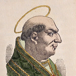
HOGENBERG, Franz (1535-1590)
HOGENBERG, Franz (1535-1590). Civitatis Orbis Terrarum. Map of Barcelona (upper part) and Ecija (1567). Illustrations for
Mary Evans Picture Library makes available wonderful images created for people to enjoy over the centuries
Media ID 8259275
© Mary Evans Picture Library 2015 - https://copyrighthub.org/s0/hub1/creation/maryevans/MaryEvansPictureID/10208036
1535 1567 1590 Barcelona Civitatis Ecija Franz Hogenberg Illustrations Orbis Terrarum Aisa Upper
Photo Mug
"Bring the rich history of cartography to your morning routine with our Media Storehouse Photo Mugs. Featuring an exquisite image of "HOGENBERG, Franz (1535-1590)" and his intricately detailed map of Barcelona and Ecija from 1567, sourced from Mary Evans Prints Online. Each mug holds your favorite beverage and serves as a daily reminder of the beauty and complexity of the world around us. Perfect for history enthusiasts, cartography lovers, or anyone who appreciates a touch of culture in their daily life. Order yours today and make every sip an adventure!"
A personalised photo mug blends sentimentality with functionality, making an ideal gift for cherished loved ones, close friends, or valued colleagues. Preview may show both sides of the same mug.
Elevate your coffee or tea experience with our premium white ceramic mug. Its wide, comfortable handle makes drinking easy, and you can rely on it to be both microwave and dishwasher safe. Sold in single units, preview may show both sides of the same mug so you can see how the picture wraps around.
Mug Size is 8cm high x 9.5cm diameter (3.1" x 3.7")
These are individually made so all sizes are approximate
EDITORS COMMENTS
This intriguing print is a captivating snapshot of two distinct and historically significant cities during the Renaissance period. The image is taken from the seminal work of the renowned Flemish cartographer, Franz Hogenberg, titled "Civitatis Orbis Terrarum" or "The Cities of the World," published in 1590. The upper part of the print showcases the maps of Barcelona and Ecija, both meticulously detailed and richly illustrated. Barcelona, located on the northeastern coast of Spain, is depicted in its medieval splendor. The map highlights the city's fortifications, winding streets, and the iconic La Rambla, a popular gathering place even in the 16th century. The illustrations accompanying the map offer a glimpse into Barcelona's rich history, featuring images of the Cathedral of the Holy Cross and Saint Eulalia, the city's patron saint, as well as the bustling marketplace and the harbor. The map of Ecija, a city in southern Spain, is equally fascinating. Established as a Roman settlement, Ecija boasts an impressive Roman theater, which is depicted in the illustration. The map also reveals the city's fortifications, winding streets, and the presence of a castle, which served as the residence of the local bishop. The accompanying illustrations provide a glimpse into the daily life of the city's inhabitants, showcasing scenes of agriculture, industry, and leisure. Franz Hogenberg's "Civitatis Orbis Terrarum" was a groundbreaking work, featuring 540 maps and illustrations of cities around the world. This print is a testament to the meticulous research and artistic skill of Hogenberg and his team, offering a unique window into the history and culture of two fascinating cities during the Renaissance period.
MADE IN THE UK
Safe Shipping with 30 Day Money Back Guarantee
FREE PERSONALISATION*
We are proud to offer a range of customisation features including Personalised Captions, Color Filters and Picture Zoom Tools
SECURE PAYMENTS
We happily accept a wide range of payment options so you can pay for the things you need in the way that is most convenient for you
* Options may vary by product and licensing agreement. Zoomed Pictures can be adjusted in the Basket.