
Orbis Collection
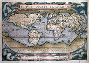
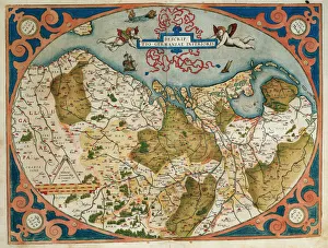
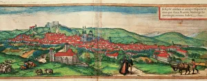
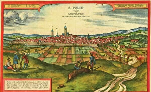
"Exploring the Theatrum Orbis Terrarum: A Journey through Maps and Views" Step into the world of cartography with Abraham Ortelius' Theatrum Orbis Terrarum


All Professionally Made to Order for Quick Shipping
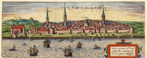
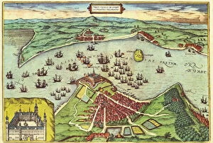
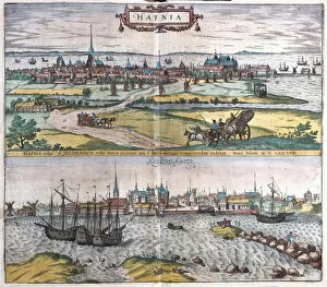
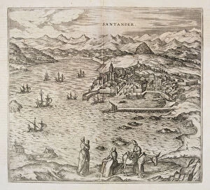
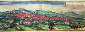
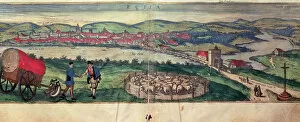
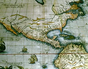
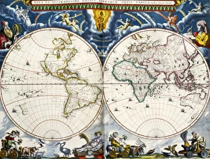
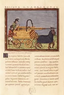
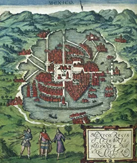
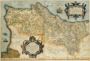
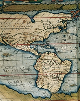
"Exploring the Theatrum Orbis Terrarum: A Journey through Maps and Views" Step into the world of cartography with Abraham Ortelius' Theatrum Orbis Terrarum, also known as the Theatre of the World. This magnificent collection takes us on a visual journey across continents and centuries. In this captivating orbis, we encounter vibrant fields of Papaver, showcasing two exquisite varieties of poppies. These delicate flowers add a touch of beauty to our exploration. As we delve deeper into Ortelius' maps, we are transported to Germany and the current Netherlands. The intricately detailed map reveals the historical landscape that once shaped these regions. We then find ourselves in Spain's Castile and Leon region, specifically Burgos, where another map from 1576 offers insights into its rich history. Ortelius' masterful work continues to amaze us as he presents Salzburg's map alongside a breathtaking view of the city itself. His attention to detail allows us to immerse ourselves in both cartographic accuracy and artistic beauty. Moving further westward, Central and South America unfold before our eyes through another masterpiece from Theatrum Orbis Terrarum. This comprehensive map provides an invaluable glimpse into these vast lands during a time when exploration was at its peak. Rumold Mercator's World Map adds yet another layer to our understanding of global geography during his era. As we examine this remarkable creation by Mercator (1512-1594), it becomes evident how crucial his contributions were in shaping modern cartography. Cusco, Peru comes alive within Civitates Orbis Terrarum's engravings from 1576. Through intricate details captured on paper, we witness Cusco's grandeur during that period – a testament to human ingenuity and architectural marvels. Our journey takes an unexpected turn as ancient siege machines come into focus – Ballista fulminalis and Ballista quadrirotis.