Mouse Mat > Universal Images Group (UIG) > Universal Images Group > Satellite and Aerial > Planet Observer 4
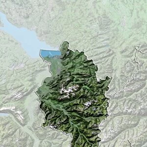
Mouse Mat : United Kingdom, Relief Map with Border and Mask


![]()
Home Decor from Universal Images Group (UIG)
United Kingdom, Relief Map with Border and Mask
Relief map of the United Kingdom (with border and mask). This image was compiled from data acquired by landsat 5 & 7 satellites combined with elevation data
Universal Images Group (UIG) manages distribution for many leading specialist agencies worldwide
Media ID 9618985
© Planet Observer/UIG
Belfast Bristol British Isles Coastline Edinburgh Glasgow Great Britain Island Manchester North Sea Northern Ireland Relief Map Scotland Shore United Kingdom Wales Satellite View
Mouse Mat
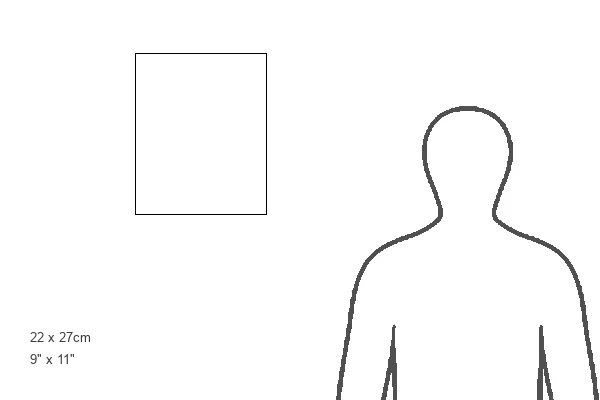
A high quality photographic print manufactured into a durable wipe clean mouse mat (27x22cm) with a non slip backing, which works with all mice.
Archive quality photographic print in a durable wipe clean mouse mat with non slip backing. Works with all computer mice
Estimated Image Size (if not cropped) is 18cm x 25.4cm (7.1" x 10")
Estimated Product Size is 21.8cm x 26.9cm (8.6" x 10.6")
These are individually made so all sizes are approximate
Artwork printed orientated as per the preview above, with portrait (vertical) orientation to match the source image.
EDITORS COMMENTS
This print showcases a detailed relief map of the United Kingdom, complete with borders and a mask. Compiled from data acquired by landsat 5 & 7 satellites combined with elevation data, this image offers an incredibly accurate representation of the British Isles' topography. From the bustling cities of Glasgow, Manchester, and London to the serene landscapes of Wales and Scotland, every corner is beautifully depicted. The photograph captures the diverse geography that makes up this island nation. The rugged coastlines along the North Sea and Irish Sea are highlighted, showcasing both its stunning beauty and strategic importance. The vast expanse of water surrounding England, Scotland, Wales, and Northern Ireland reminds us of their shared maritime heritage. With no people in sight, this aerial view allows us to appreciate the physical geography that shapes these lands. From rolling hills to towering mountains like Ben Nevis in Scotland or Snowdonia in Wales - each region has its own unique charm. Cartography enthusiasts will be enthralled by this color image as it provides an opportunity for exploration without leaving home. Whether you're studying Europe's physical features or simply admiring Britain's natural wonders from above – this print offers endless possibilities for discovery
MADE IN THE UK
Safe Shipping with 30 Day Money Back Guarantee
FREE PERSONALISATION*
We are proud to offer a range of customisation features including Personalised Captions, Color Filters and Picture Zoom Tools
SECURE PAYMENTS
We happily accept a wide range of payment options so you can pay for the things you need in the way that is most convenient for you
* Options may vary by product and licensing agreement. Zoomed Pictures can be adjusted in the Basket.