Home > Europe > Spain > Maps
COSA, Juan de la (1460-1510). Cartographer. Nautical
. Cartographer. Nautical")
![]()
Wall Art and Photo Gifts from Mary Evans Picture Library
COSA, Juan de la (1460-1510). Cartographer. Nautical
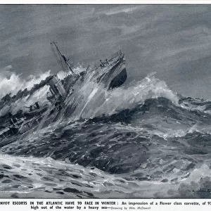
COSA, Juan de la (1460-1510). Cartographer. Nautical chart. 1500. Detail. SPAIN. Madrid. Navy Museum
Mary Evans Picture Library makes available wonderful images created for people to enjoy over the centuries
Media ID 8277649
© Mary Evans Picture Library 2015 - https://copyrighthub.org/s0/hub1/creation/maryevans/MaryEvansPictureID/10684198
Atlas Cartographer Cartographic Cartographies Cartography Chart Cosa Juan Maps Mediterranean Mediterraneans Nautical Navigation Sail Europeans
FEATURES IN THESE COLLECTIONS
> Africa
> Related Images
> Maps and Charts
> Spain
> Services
> Royal Navy
EDITORS COMMENTS
This intricately detailed nautical chart, created by the renowned European cartographer Juan de la Cosa in the year 1500, offers a glimpse into the advanced maritime knowledge of the late medieval period. Born in Spain, Cosa is considered one of the pioneers of cartography in Europe, and this chart is a testament to his expertise in charting the world's seas. The chart, housed in the Navy Museum in Madrid, Spain, focuses on the Mediterranean Sea and the African coastline. The level of detail is remarkable, with accurate depictions of various ports, islands, and coastlines. The chart also includes illustrations of sailing ships, some of which are labeled with their respective home ports. The chart's creation came at a time when European exploration and trade were expanding beyond the Mediterranean, with the Age of Discovery well underway. Cosa's chart would have been an essential tool for navigators and sailors, enabling them to safely navigate the waters and reach their destinations. Cosa's chart is also significant for its influence on the development of the atlas. The chart's format, which features multiple charts joined together, was a precursor to the atlas, a collection of maps that would become a standard reference tool for navigators and explorers. This detailed image of Cosa's nautical chart provides a fascinating glimpse into the world of European maritime exploration during the late medieval period. The intricate illustrations and precise cartography showcase the advanced knowledge and skill of European cartographers like Cosa, who played a crucial role in expanding European horizons and shaping the world as we know it today.
MADE IN THE UK
Safe Shipping with 30 Day Money Back Guarantee
FREE PERSONALISATION*
We are proud to offer a range of customisation features including Personalised Captions, Color Filters and Picture Zoom Tools
SECURE PAYMENTS
We happily accept a wide range of payment options so you can pay for the things you need in the way that is most convenient for you
* Options may vary by product and licensing agreement. Zoomed Pictures can be adjusted in the Basket.