Home > Maps and Charts > World
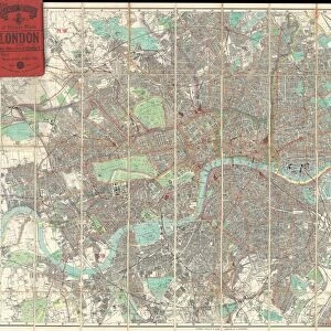
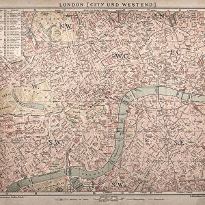
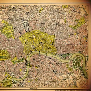
1910, Smiths Tape Indicator, Map of London, Pocket Map, topography, cartography

![]()
Wall Art and Photo Gifts from Liszt Collection
1910, Smiths Tape Indicator, Map of London, Pocket Map, topography, cartography
1910, Smiths Tape Indicator, Map of London, Pocket Map
Liszt Collection of nineteenth-century engravings and images to browse and enjoy
Media ID 14006512
© Artokoloro Quint Lox Limited
1910 Antique Map Atlas Chart Geographic Latitude Longitude Map Of London Mappa Mundi Old Antique Plan Old Antique View Old Map Ols Antique Map Rare Old Maps Topo
FEATURES IN THESE COLLECTIONS
> Europe
> United Kingdom
> England
> London
> Related Images
> Maps and Charts
> Early Maps
> Maps and Charts
> World
EDITORS COMMENTS
This vintage print from the Liszt Collection showcases a remarkable piece of cartographic history - the 1910 Smiths Tape Indicator Map of London. With its intricate topography and precise detailing, this pocket map offers a fascinating glimpse into the city's geography over a century ago. The artistry and craftsmanship evident in this illustration make it an exquisite addition to any collection. Its delicate lines and geometric grid display the expertise of early cartographers, capturing every latitude and longitude with meticulous accuracy. As you gaze upon this ancient artifact, you can't help but be transported back in time. The faded paper and aged appearance evoke a sense of nostalgia for bygone eras when maps were cherished companions on journeys of discovery and exploration. This decorative map not only serves as a historical document but also as an artistic representation of our world's ever-changing landscape. It reminds us that even amidst progress, there is value in preserving remnants from our past. Whether you are an avid traveler or simply appreciate the beauty found within old maps, this rare gem will undoubtedly captivate your imagination. Let it transport you to another era, where navigating through London's bustling streets was done with the aid of such intricately crafted tape indicators - truly a testament to human ingenuity throughout history.
MADE IN THE UK
Safe Shipping with 30 Day Money Back Guarantee
FREE PERSONALISATION*
We are proud to offer a range of customisation features including Personalised Captions, Color Filters and Picture Zoom Tools
SECURE PAYMENTS
We happily accept a wide range of payment options so you can pay for the things you need in the way that is most convenient for you
* Options may vary by product and licensing agreement. Zoomed Pictures can be adjusted in the Basket.