Fraud Blocker Skip to main content

Oceanography Collection (page 4)

Oceanography is the fascinating study of Earth's vast and mysterious oceans

Background imageOceanography Collection: Alvin Submersible, deep sea diving vehicle for underwater exploration

Alvin Submersible, deep sea diving vehicle for underwater exploration

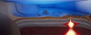
Background imageOceanography Collection: A model of the ocean floor with magma welling up from the mantle, creating a ridge

A model of the ocean floor with magma welling up from the mantle, creating a ridge

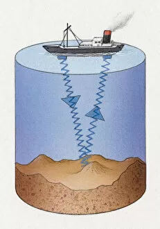
Background imageOceanography Collection: Ship mapping the ocean floor

Ship mapping the ocean floor

Background imageOceanography Collection: A community of hydrothermal vents and smokers at the bottom of the sea

A community of hydrothermal vents and smokers at the bottom of the sea

Background imageOceanography Collection: Cross-section model of the Atlantic Ocean

Cross-section model of the Atlantic Ocean

Background imageOceanography Collection: Portugal, Algarve, Low tide on Atlantic coast that uncover colored pebbles

Portugal, Algarve, Low tide on Atlantic coast that uncover colored pebbles

Background imageOceanography Collection: French Polynesia, Society Islands, Windward Islands, Tahiti Island

French Polynesia, Society Islands, Windward Islands, Tahiti Island
French Polynesia (French overseas territory) - Society Islands - Windward Islands - Tahiti. Waves

Background imageOceanography Collection: An outretched octopus

An outretched octopus

Background imageOceanography Collection: A Hermit Crab (Pagurus bernhardus) over a clear glass shell

A Hermit Crab (Pagurus bernhardus) over a clear glass shell

Background imageOceanography Collection: Orange cuttlefish with a luminous underside

Orange cuttlefish with a luminous underside

Background imageOceanography Collection: A bath sponge

A bath sponge

Background imageOceanography Collection: Spiny Lobster facing left, long antennae in the air behind it

Spiny Lobster facing left, long antennae in the air behind it

Background imageOceanography Collection: Adult Eel (Anguilliformes) swimming, making curving shape, side view

Adult Eel (Anguilliformes) swimming, making curving shape, side view

Background imageOceanography Collection: Orange and yellow anemone

Orange and yellow anemone

Background imageOceanography Collection: Blackdevil (Melanocetus johnsoni), a dark model of an angler fish before a meal

Blackdevil (Melanocetus johnsoni), a dark model of an angler fish before a meal

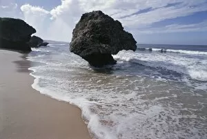
Background imageOceanography Collection: Barbados, Saint Joseph Parish, beach at Bathsheba

Barbados, Saint Joseph Parish, beach at Bathsheba
Barbados - Saint Joseph Parish - Bathsheba, the beach

Background imageOceanography Collection: A see through squid

A see through squid

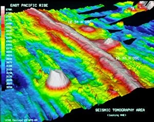
Background imageOceanography Collection: East Pacific Rise, topographic map

East Pacific Rise, topographic map
East Pacific Rise. Topographic map of the seabed of the Pacific Ocean around part of the East Pacific Rise (red), a mid-ocean ridge that runs northwards from near Antarctica to the Gulf of
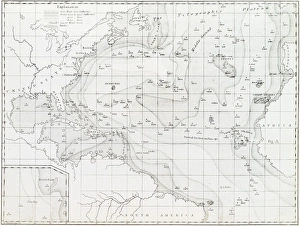
Background imageOceanography Collection: Basin of the North Atlantic Ocean, 1854 C016 / 8983

Basin of the North Atlantic Ocean, 1854 C016 / 8983
Basin of the North Atlantic Ocean. 1854 edition of the first printed bathymetric map, showing seabed depths in the North Atlantic. The original data was gathered in the 1830s
Background imageOceanography Collection: North Atlantic ocean currents, artwork C016 / 7694

North Atlantic ocean currents, artwork C016 / 7694
North Atlantic ocean currents. Computer artwork showing the main ocean currents in the North Atlantic, and extending in to the Arctic Ocean (top). Warm currents are red and cold currents are blue

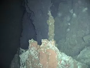
Background imageOceanography Collection: Underwater volcanic vent C015 / 1838

Underwater volcanic vent C015 / 1838
Underwater volcanic vent. This is a black smoker, a seabed volcanic vent where minerals dissolve in water superheated by magma (molten rock)

Background imageOceanography Collection: Underwater volcanic vent C015 / 1837

Underwater volcanic vent C015 / 1837
Underwater volcanic vent. This is a black smoker, a seabed volcanic vent where minerals dissolve in water superheated by magma (molten rock)

Background imageOceanography Collection: Rogue wave, artwork

Rogue wave, artwork
Rogue wave. Computer artwork showing an ocean liner and a rogue wave during a storm. Rogue waves are relatively large and spontaneous ocean surface waves that occur far out at sea

Background imageOceanography Collection: Rogue wave formation, artwork

Rogue wave formation, artwork
Rogue wave formation. Computer artwork showing the formation of a rogue wave near to an ocean liner. Rogue waves are relatively large and spontaneous ocean surface waves that occur far out at sea

Background imageOceanography Collection: False Bay, South Africa

False Bay, South Africa
False Bay. View from Cape Point across False Bay, towards Table Mountain National Park, South Africa

Background imageOceanography Collection: Surf

Surf. Heavy waves breaking off the coast. Photographed at Postberg, West Coast National Park, South Africa

Background imageOceanography Collection: Chart of the Atlantic Ocean, 1802 C015 / 5215

Chart of the Atlantic Ocean, 1802 C015 / 5215
Chart of the Atlantic Ocean from The New American Practical Navigator (1802) by US mathematician and astronomer Nathaniel Bowditch (1773-1838)

Background imageOceanography Collection: William Henry Harvey, Irish botanist C017 / 7986

William Henry Harvey, Irish botanist C017 / 7986
William Henry Harvey (1811-1866), Irish botanist. Harvey specialised in the study of algae (phycology), describing over 750 species

Background imageOceanography Collection: William Henry Harvey, Irish botanist C017 / 7985

William Henry Harvey, Irish botanist C017 / 7985
William Henry Harvey (1811-1866), Irish botanist. Harvey specialised in the study of algae (phycology), describing over 750 species

Background imageOceanography Collection: White smoker hydrothermal vents, artwork C016 / 5350

White smoker hydrothermal vents, artwork C016 / 5350
Protocell hydrothermal vents. Artwork of bubbles rising upwards from white smoker hydrothermal vents. These bubbles are being used to represent

Background imageOceanography Collection: William Carpenter, British naturalist C016 / 5058

William Carpenter, British naturalist C016 / 5058
William Benjamin Carpenter (1813-1885), British naturalist. Carpenter trained as a physician, but published widely in many fields

Background imageOceanography Collection: Sea surface temperature, 2010 global map C016 / 3800

Sea surface temperature, 2010 global map C016 / 3800
Sea surface temperature, 2010 global map. The worlds oceans are heated by sunlight, with variations in the surface temperature caused by varying latitude, the Earths rotation, and axial tilt

Background imageOceanography Collection: Sea surface salinity, 2012 global map C016 / 3796

Sea surface salinity, 2012 global map C016 / 3796
Sea surface salinity, 20 January 2012 global map. The salinity (salt content) of the sea surface, used in climate models, depends on sea surface temperature and evaporation, winds

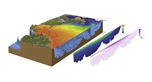
Background imageOceanography Collection: North-western Atlantic, oceanography data C016 / 3739

North-western Atlantic, oceanography data C016 / 3739
North-western Atlantic, oceanography data. Cutaway block diagram of the north-western Atlantic Ocean, showing in exaggerated form the height of land terrain and the depth of the seabed

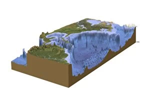
Background imageOceanography Collection: North-western Atlantic, bathymetry model C016 / 3738

North-western Atlantic, bathymetry model C016 / 3738
North-western Atlantic, bathymetry model. Cutaway block diagram of the north-western Atlantic Ocean, showing in exaggerated form the height of land terrain and the depth of the seabed

Background imageOceanography Collection: Atlantic Ocean, cloud-free C016 / 3728

Atlantic Ocean, cloud-free C016 / 3728
Atlantic Ocean, cloud-free. Computer graphic of the Atlantic Ocean on an Earth globe, generated using satellite and mapping data

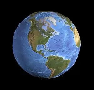
Background imageOceanography Collection: The Americas, sea floor topography C016 / 3726

The Americas, sea floor topography C016 / 3726
The Americas, sea floor topography. Computer graphic of an Earth globe centred on the Americas, generated using satellite and mapping data

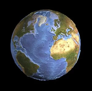
Background imageOceanography Collection: Atlantic Ocean, sea floor topography C016 / 3725

Atlantic Ocean, sea floor topography C016 / 3725
Atlantic Ocean, sea floor topography. Computer graphic of an Earth globe centred on the Atlantic Ocean, generated using satellite and mapping data

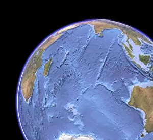
Background imageOceanography Collection: Indian Ocean, sea floor topography C016 / 3723

Indian Ocean, sea floor topography C016 / 3723
Indian Ocean, sea floor topography and clouds. Computer graphic of the Indian Ocean on an Earth globe, generated using satellite and mapping data

Background imageOceanography Collection: Indian Ocean, chlorophyll concentration C016 / 3722

Indian Ocean, chlorophyll concentration C016 / 3722
Indian Ocean, chlorophyll concentration and clouds. Computer graphic of the Indian Ocean on an Earth globe, generated using satellite and mapping data

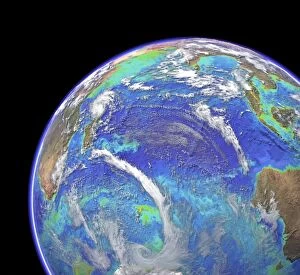
Background imageOceanography Collection: Indian Ocean, chlorophyll and bathymetry C016 / 3721

Indian Ocean, chlorophyll and bathymetry C016 / 3721
Indian Ocean, chlorophyll concentration and bathymetry with clouds. Computer graphic of the Indian Ocean on an Earth globe, generated using satellite and mapping data

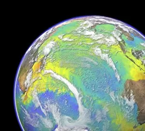
Background imageOceanography Collection: Indian Ocean, surface temperatures C016 / 3720

Indian Ocean, surface temperatures C016 / 3720
Indian Ocean, surface temperatures and clouds. Computer graphic of the Indian Ocean on an Earth globe, generated using satellite and mapping data

Background imageOceanography Collection: Indian Ocean, satellite imaging data C016 / 3718

Indian Ocean, satellite imaging data C016 / 3718
Indian Ocean, satellite imaging data. Computer graphic of the Indian Ocean on an Earth globe, showing the various parameters that can be measured by satellite instruments

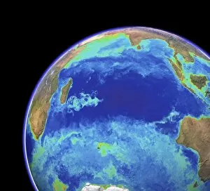
Background imageOceanography Collection: Indian Ocean, chlorophyll and bathymetry

Indian Ocean, chlorophyll and bathymetry
Indian Ocean, chlorophyll concentration and bathymetry. Computer graphic of the Indian Ocean on an Earth globe, generated using satellite and mapping data

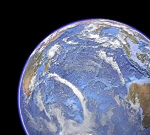
Background imageOceanography Collection: Indian Ocean, with clouds C016 / 3714

Indian Ocean, with clouds C016 / 3714
Indian Ocean, with clouds. Computer graphic of the Indian Ocean on an Earth globe, generated using satellite and mapping data

Background imageOceanography Collection: Indian Ocean, surface temperatures C016 / 3716

Indian Ocean, surface temperatures C016 / 3716
Indian Ocean, surface temperatures. Computer graphic of the Indian Ocean on an Earth globe, generated using satellite and mapping data. Cloud-free satellite images show the natural land colours

Background imageOceanography Collection: Indian Ocean, sea floor topography C016 / 3715

Indian Ocean, sea floor topography C016 / 3715
Indian Ocean, sea floor topography. Computer graphic of the Indian Ocean on an Earth globe, generated using satellite and mapping data

Background imageOceanography Collection: Indian Ocean, cloud-free C016 / 3713

Indian Ocean, cloud-free C016 / 3713
Indian Ocean, cloud-free. Computer graphic of the Indian Ocean on an Earth globe, generated using satellite and mapping data


All Professionally Made to Order for Quick Shipping

Oceanography is the fascinating study of Earth's vast and mysterious oceans. Through the use of topographic and bathymetric maps, scientists are able to explore the intricate features that make up our planet's watery depths. These maps provide a detailed understanding of both the land and seafloor, giving us insight into how they interact with one another. One area of focus is studying ocean currents off the Americas. By analyzing these powerful flows of water, researchers can better comprehend their impact on climate patterns and marine life distribution. This knowledge helps us navigate and understand our ever-changing world. Delving into history, we discover undersea exploration in 16th-century Europe played a crucial role in shaping modern oceanography. Pioneers like Jacques Cousteau paved the way for future generations to delve deeper into uncharted territories beneath the waves. Australia's topographic map reveals its unique coastal geography, showcasing its stunning beaches and diverse marine ecosystems. Understanding these features aids scientists in preserving this fragile environment for future generations to enjoy. The submersible Alvin with its silver body and control arms has revolutionized underwater research by allowing scientists to reach extreme depths previously inaccessible. Its advanced technology enables us to unravel mysteries hidden deep within our oceans. A flat projection map created from satellite images provides an awe-inspiring view of Earth as seen from space, highlighting just how much of our planet is covered by water. It serves as a reminder that oceans play a vital role in maintaining global balance. Charting specific sections such as Madeira, Portugal to St. Vincent allows researchers to gather valuable data about local currents, temperatures, and biodiversity hotspots along this stretch of coastline - essential information for conservation efforts. Intriguing creatures like box jellyfish captivate both scientists and enthusiasts alike due to their ethereal beauty but also their potent venomous sting - reminding us that there is still so much left undiscovered beneath the surface. A field that encompasses all these elements and more.