Fraud Blocker Skip to main content

Maps Collection (page 10)

Maps have always been a fascinating window into the past, allowing us to explore and understand the world as it once was

Background imageMaps Collection: A chart of New York Harbour with the soundings views of land marks

A chart of New York Harbour with the soundings views of land marks and nautical directions for the use of pilotage
7340415 A chart of New York Harbour with the soundings views of land marks and nautical directions for the use of pilotage

Background imageMaps Collection: The environs of Fort Cumberland in the Bay of Fundy, 1781 (engraving)

The environs of Fort Cumberland in the Bay of Fundy, 1781 (engraving)
7340406 The environs of Fort Cumberland in the Bay of Fundy, 1781 (engraving) by DesBarres, Joseph Frederick Wallet (1721-1824); 53x75 cm; National Maritime Museum, London

Background imageMaps Collection: The River St. John, 1776 (engraving)

The River St. John, 1776 (engraving)
7340402 The River St. John, 1776 (engraving) by DesBarres, Joseph Frederick Wallet (1721-1824); 54.5x78.5 cm; National Maritime Museum, London, UK; (add.info.: Creator: J. F. W. Des Barres Scale: ca)

Background imageMaps Collection: Royal Victoria and Albert and King George V Docks 1934, c.1934 (print)

Royal Victoria and Albert and King George V Docks 1934, c.1934 (print)
7340370 Royal Victoria and Albert and King George V Docks 1934, c.1934 (print) by Vincent Brooks, Day & Son (1867-1940); National Maritime Museum, London

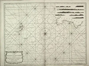
Background imageMaps Collection: A chart of the entrance into the Channel containing the west coast of Cornwall

A chart of the entrance into the Channel containing the west coast of Cornwall
7340130 A chart of the entrance into the Channel containing the west coast of Cornwall and Scilly Islands with all the soundings, 1779 (copperplate engraving) by British School

Background imageMaps Collection: New description of Ireland, the British Isles, 1573 (copperplate engraving on paper)

New description of Ireland, the British Isles, 1573 (copperplate engraving on paper)
7340125 New description of Ireland, the British Isles, 1573 (copperplate engraving on paper) by Ortelius, Abraham (1527-98); 42x53 cm; National Maritime Museum, London

Background imageMaps Collection: Europae, 1570 (copperplate engraving on paper)

Europae, 1570 (copperplate engraving on paper)
7340122 Europae, 1570 (copperplate engraving on paper) by Ortelius, Abraham (1527-98); 42x53 cm; National Maritime Museum, London

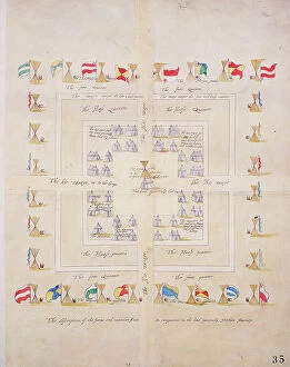
Background imageMaps Collection: The discription of the forme and mannre of our in campment in the lord Generalls Northern Journey

The discription of the forme and mannre of our in campment in the lord Generalls Northern Journey, c.1600 (paper)
7339833 The discription of the forme and mannre of our in campment in the lord Generalls Northern Journey, c.1600 (paper, linen) by Unknown Artist, (17th century); 47x37 cm; National Maritime Museum

Background imageMaps Collection: Map of Lismore, Ireland, 1589 (paper, linen)

Map of Lismore, Ireland, 1589 (paper, linen)
7339819 Map of Lismore, Ireland, 1589 (paper, linen) by Unknown Artist, (16th century); 104.5x117.5 cm; National Maritime Museum, London

Background imageMaps Collection: Ireland sourth of the Shannon, c.1585 (vellum, linen)

Ireland sourth of the Shannon, c.1585 (vellum, linen)
7339816 Ireland sourth of the Shannon, c.1585 (vellum, linen) by Unknown Artist, (16th century); 70.5x102 cm; National Maritime Museum, London

Background imageMaps Collection: The harbour of Dublin in Ireland, 1673 (paper, linen)

The harbour of Dublin in Ireland, 1673 (paper, linen)
7339815 The harbour of Dublin in Ireland, 1673 (paper, linen) by Unknown Artist, (17th century); 73.5x91 cm; National Maritime Museum, London, UK; (add.info.: Creator: unknown Scale: [ca)

Background imageMaps Collection: The citty and suburbs of Dublin from Kilmainham to Rings-End, werein the rivers, streets, lanes

The citty and suburbs of Dublin from Kilmainham to Rings-End, werein the rivers, streets, lanes, allys, churches
7339813 The citty and suburbs of Dublin from Kilmainham to Rings-End, werein the rivers, streets, lanes, allys, churches, gates &c are exactly described 15th No

Background imageMaps Collection: Central Ireland, Dublin to Sligo, c.1600 (laid on linen)

Central Ireland, Dublin to Sligo, c.1600 (laid on linen)
7339811 Central Ireland, Dublin to Sligo, c.1600 (laid on linen) by Boazio, Baptista (fl.1588-1606); 58x63 cm; National Maritime Museum, London

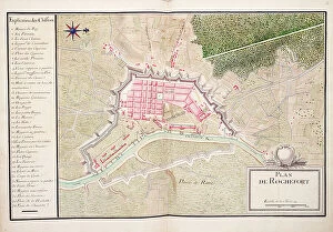
Background imageMaps Collection: Plan of Rochefort, 1724 (watercolour)

Plan of Rochefort, 1724 (watercolour)
7339802 Plan of Rochefort, 1724 (watercolour) by Unknown artist, (18th century); 39x52 cm; National Maritime Museum, London

Background imageMaps Collection: Chart of the Black Sea, c.1600 (manuscript)

Chart of the Black Sea, c.1600 (manuscript)
7339792 Chart of the Black Sea, c.1600 (manuscript) by Unknown Artist, (17th century); 47x35 cm; National Maritime Museum, London, UK; (add.info.: Creator: unknown Bound in an atlas of six charts)

Background imageMaps Collection: Chart of north-east Atlantic, from British Isles to Cape Verde, c.1620 (manuscript)

Chart of north-east Atlantic, from British Isles to Cape Verde, c.1620 (manuscript)
7339785 Chart of north-east Atlantic, from British Isles to Cape Verde, c.1620 (manuscript) by Unknown Artist, (17th century); 41x60 cm; National Maritime Museum, London

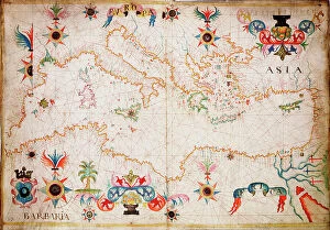
Background imageMaps Collection: This type of early vellum sea chart originated in the Mediterranean in the 13th century

This type of early vellum sea chart originated in the Mediterranean in the 13th century. c.1610 (manuscript)
7339782 This type of early vellum sea chart originated in the Mediterranean in the 13th century. c.1610 (manuscript) by Unknown Artist, (17th century); 40x56 cm; National Maritime Museum, London

Background imageMaps Collection: This type of early vellum sea chart originated in the Mediterranean in the 13th century

This type of early vellum sea chart originated in the Mediterranean in the 13th century. c.1610 (manuscript)
7339780 This type of early vellum sea chart originated in the Mediterranean in the 13th century. c.1610 (manuscript) by Unknown Artist, (17th century); 40x56 cm; National Maritime Museum, London

Background imageMaps Collection: Biobio [and] Labapi, 1685 (manuscript)

Biobio [and] Labapi, 1685 (manuscript)
7339773 Biobio [and] Labapi, 1685 (manuscript) by Hack, William (17th Century); 40.5x5 cm; National Maritime Museum, London

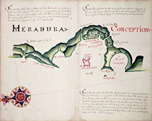
Background imageMaps Collection: Heradura [and] Conception, 1685 (manuscript)

Heradura [and] Conception, 1685 (manuscript)
7339771 Heradura [and] Conception, 1685 (manuscript) by Hack, William (17th Century); 40.5x5 cm; National Maritime Museum, London

Background imageMaps Collection: Limary, South American Pacific coast, 1685 (manuscript)

Limary, South American Pacific coast, 1685 (manuscript)
7339768 Limary, South American Pacific coast, 1685 (manuscript) by Hack, William (17th Century); 40x50 cm; National Maritime Museum, London

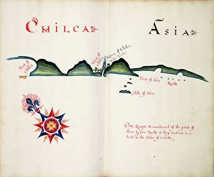
Background imageMaps Collection: Chilca and Asia, 1685 (bound sheet)

Chilca and Asia, 1685 (bound sheet)
7339761 Chilca and Asia, 1685 (bound sheet) by Hack, William (17th Century); 40x50 cm; National Maritime Museum, London, UK; (add.info.: Creator: William Hack South America)

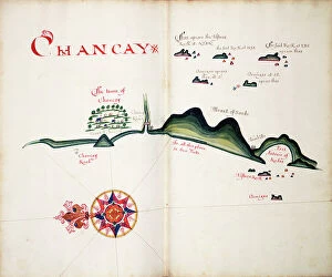
Background imageMaps Collection: Chancay, 1685 (bound sheet)

Chancay, 1685 (bound sheet)
7339758 Chancay, 1685 (bound sheet) by Hack, William (17th Century); 40x50 cm; National Maritime Museum, London, UK; (add.info.: Creator: William Hack South America, the Pacific Coast, Peru)

Background imageMaps Collection: Chancayllo, 1685 (bound sheet)

Chancayllo, 1685 (bound sheet)
7339757 Chancayllo, 1685 (bound sheet) by Hack, William (17th Century); 40x50 cm; National Maritime Museum, London, UK; (add.info.: Creator: William Hack South America, the Pacific Coast)

Background imageMaps Collection: Jaquey, 1685 (bound sheet)

Jaquey, 1685 (bound sheet)
7339755 Jaquey, 1685 (bound sheet) by Hack, William (17th Century); 40x50 cm; National Maritime Museum, London, UK; (add.info.: Creator: William Hack South America, the Pacific Coast)

Background imageMaps Collection: Guanapa, 1685 (bound sheet)

Guanapa, 1685 (bound sheet)
7339746 Guanapa, 1685 (bound sheet) by Hack, William (17th Century); 40x50 cm; National Maritime Museum, London, UK; (add.info.: Creator: William Hack South America, the Pacific Coast)

Background imageMaps Collection: Eten, 1685 (bound sheet)

Eten, 1685 (bound sheet)
7339738 Eten, 1685 (bound sheet) by Hack, William (17th Century); 40x50 cm; National Maritime Museum, London, UK; (add.info.: Creator: William Hack South America, the Pacific Coast, Peru)

Background imageMaps Collection: Sechura, 1685 (bound sheet)

Sechura, 1685 (bound sheet)
7339737 Sechura, 1685 (bound sheet) by Hack, William (17th Century); 40x50 cm; National Maritime Museum, London, UK; (add.info.: Creator: William Hack South America, the Pacific Coast and Peru)

Background imageMaps Collection: Views of Silla de Paita and Punta Aguja, 1685 (bound sheet)

Views of Silla de Paita and Punta Aguja, 1685 (bound sheet)
7339736 Views of Silla de Paita and Punta Aguja, 1685 (bound sheet) by Hack, William (17th Century); 40x50 cm; National Maritime Museum, London, UK; (add.info.: Creator: William Hack South America)

Background imageMaps Collection: Mancora, 1685 (bound sheet)

Mancora, 1685 (bound sheet)
7339732 Mancora, 1685 (bound sheet) by Hack, William (17th Century); 40x50 cm; National Maritime Museum, London, UK; (add.info.: Creator: William Hack South America, the Pacific Coast and Peru)

Background imageMaps Collection: Picoaza, 1685 (bound sheet)

Picoaza, 1685 (bound sheet)
7339730 Picoaza, 1685 (bound sheet) by Hack, William (17th Century); 40x50 cm; National Maritime Museum, London, UK; (add.info.: Creator: William Hack South America, the Pacific Coast, Ecuador)

Background imageMaps Collection: Montevideo, 1805 (coloured manuscript)

Montevideo, 1805 (coloured manuscript)
7295441 Montevideo, 1805 (coloured manuscript) by Unknown Artist, (19th century); 25x41 cm; National Maritime Museum, London, UK; (add.info.: Creator: unknown Scale: [ca)

Background imageMaps Collection: Mediterranean archipelago Rhodes Island surveyed...under the direction of Com'r T Graves RN HMS

Mediterranean archipelago Rhodes Island surveyed...under the direction of Com'r T Graves RN HMS Beacon (1841)
7342521 Mediterranean archipelago Rhodes Island surveyed...under the direction of Com'r T Graves RN HMS Beacon (1841), 1862-1906 (engraving) by Walker, J. & C

Background imageMaps Collection: Plan of the Commencement of the Battle of Trafalgar, 19th century (etching)

Plan of the Commencement of the Battle of Trafalgar, 19th century (etching)
7342311 Plan of the Commencement of the Battle of Trafalgar, 19th century (etching) by Unknown Artist, (19th century); 29.5x35.8 cm; National Maritime Museum, London

Background imageMaps Collection: A new and correct sea chart of the whole world showing the variations of the compass as they were

A new and correct sea chart of the whole world showing the variations of the compass as they were found in the year
7340787 A new and correct sea chart of the whole world showing the variations of the compass as they were found in the year 1700, 1702 (engraving) by British School

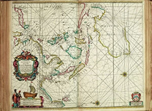
Background imageMaps Collection: A chart of the easternmost part of the East Indies with all the adjacent islands from Cape Comorin

A chart of the easternmost part of the East Indies with all the adjacent islands from Cape Comorin to Japan
7340780 A chart of the easternmost part of the East Indies with all the adjacent islands from Cape Comorin to Japan, 1675 (Hand coloured engraving) by Seller

Background imageMaps Collection: Celestial Globe Gores, 1636-95 (paper, copper plate, engraving)

Celestial Globe Gores, 1636-95 (paper, copper plate, engraving)
7340779 Celestial Globe Gores, 1636-95 (paper, copper plate, engraving) by Rossi, Domenico de (1659-1730); 44x19 cm; National Maritime Museum, London

Background imageMaps Collection: Pocket atlas and nautical almanac, c.1546 (vellum)

Pocket atlas and nautical almanac, c.1546 (vellum)
7340753 Pocket atlas and nautical almanac, c.1546 (vellum) by Brouscon, Guillaume (16th century); National Maritime Museum, London

Background imageMaps Collection: San Miguel, 1682 (paper)

San Miguel, 1682 (paper)
7340747 San Miguel, 1682 (paper) by Ringrose, Basil (c.1653-83); 16x20 cm; National Maritime Museum, London, UK; (add.info.: Creator: Basil Ringrose From a book of sailing directions of 110ff)

Background imageMaps Collection: Sonsonate, 1682 (paper)

Sonsonate, 1682 (paper)
7340746 Sonsonate, 1682 (paper) by Ringrose, Basil (c.1653-83); 16x20 cm; National Maritime Museum, London, UK; (add.info.: Creator: Basil Ringrose From a book of sailing directions of 110ff)

Background imageMaps Collection: Chart of the Bay of Sighajik, 1819 (paper)

Chart of the Bay of Sighajik, 1819 (paper)
7340734 Chart of the Bay of Sighajik, 1819 (paper) by British School, (19th century); 66.8x50.5 cm; National Maritime Museum, London, UK; (add.info.: Creator: British Admiralty; J)

Background imageMaps Collection: Plan of the harbour of Praslin, late 18th to early 19th century (paper)

Plan of the harbour of Praslin, late 18th to early 19th century (paper)
7340729 Plan of the harbour of Praslin, late 18th to early 19th century (paper) by Dalrymple, Alexander (18th-19th century); National Maritime Museum, London

Background imageMaps Collection: Map of Africa, 1564 - 1 of 8 sheets, 1564 (technical drawing)

Map of Africa, 1564 - 1 of 8 sheets, 1564 (technical drawing)
7340672 Map of Africa, 1564 - 1 of 8 sheets, 1564 (technical drawing) by Gastaldi, Giacomo (c.1500-66); National Maritime Museum, London

Background imageMaps Collection: Chart of area from Dover and Calais to Orfordness, 1906-10 (manuscript)

Chart of area from Dover and Calais to Orfordness, 1906-10 (manuscript)
7340551 Chart of area from Dover and Calais to Orfordness, 1906-10 (manuscript) by British School, (20th century) ; 69.6x103.1 cm; National Maritime Museum, London

Background imageMaps Collection: Chart of Sindh and Kutch coasts, 1848-50 (print)

Chart of Sindh and Kutch coasts, 1848-50 (print)
7340643 Chart of Sindh and Kutch coasts, 1848-50 (print) by British School, (19th century); 76.5x61.5 cm; National Maritime Museum, London

Background imageMaps Collection: A chart of Broach Bar and river surveyed by Lieut WIlliam Augustus Skynner 1773, 1775 (print)

A chart of Broach Bar and river surveyed by Lieut WIlliam Augustus Skynner 1773, 1775 (print)
7340638 A chart of Broach Bar and river surveyed by Lieut WIlliam Augustus Skynner 1773, 1775 (print) by British School, (18th Century); 18.8x35.6 cm; National Maritime Museum, London

Background imageMaps Collection: Chart of part of the coasts of Cutch and Guzarat by J G Richardson

Chart of part of the coasts of Cutch and Guzarat by J G Richardson... communicated by Capt Archibald Blair to whom this
7340637 Chart of part of the coasts of Cutch and Guzarat by J G Richardson... communicated by Capt Archibald Blair to whom this plate is inscribed by his most obliged A Dalrymple

Background imageMaps Collection: The fortifications of Monaco and St. Tropez, c.1760? (print)

The fortifications of Monaco and St. Tropez, c.1760? (print)
7340632 The fortifications of Monaco and St. Tropez, c.1760? (print) by French School, (18th century); National Maritime Museum, London, UK; (add.info.: Georges-Louis Le Rouge (c)


All Professionally Made to Order for Quick Shipping

Maps have always been a fascinating window into the past, allowing us to explore and understand the world as it once was. From the intricate details of an ancient Greek map to the vibrant landscapes of Jamaica, each map tells its own unique story. Take a journey back in time with a Map of Ancient Greece, where you can trace the footsteps of philosophers and warriors alike. Discover the birthplace of democracy and marvel at the city-states that shaped Western civilization. Venture further across continents with Maps showcasing the vastness of empires like Britain's. Explore territories under British rule through a Map of the British Empire or delve into Asia's history with a Map highlighting the mighty Mongol Empire. Uncover remnants of one of history's greatest civilizations with a Map depicting the grandeur and reach of Rome. Witness how this powerful empire spanned across Europe, Africa, and Asia, leaving behind an indelible mark on human history. During times filled with turmoil and conflict, maps served as crucial tools for understanding war efforts. The Daily Mail War Map from World War I provides insights into battlefronts while WW2 posters display strategic plans like never before - including those detailing activities specific to divisions such as 52 (Lowland) Division or mapping out positions held by troops in The British Army. Closer to home lies Isle Of Wight - its beauty captured perfectly on a detailed map inviting exploration along its stunning coastline. Meanwhile, travel even further east to discover ancient Persian splendor through an intricately designed Persian Empire map. For those seeking nostalgia or tracing ancestral roots, immerse yourself in Cornwall C1857's historical charm via an antique map capturing its essence during that era. From ancient civilizations to modern-day conflicts and everything in between – they can not just pieces of paper but gateways into our collective pasts. They hold stories waiting to be unraveled by curious minds eager for knowledge about our ever-changing world throughout time.