Fraud Blocker Skip to main content

Maps Collection (page 9)

Maps have always been a fascinating window into the past, allowing us to explore and understand the world as it once was

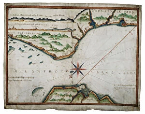
Background imageMaps Collection: Chart of Dover Strait, c.1587-88 (watercolour on vellum)

Chart of Dover Strait, c.1587-88 (watercolour on vellum)
7340491 Chart of Dover Strait, c.1587-88 (watercolour on vellum) by Teixeira, Luis (fl.1564-1612); 40x52 cm; National Maritime Museum, London, UK; (add.info.: Creator: Luis Teixeira Single sheet)

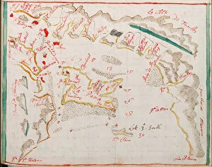
Background imageMaps Collection: The south part of Virginia, 1657 (vellum)

The south part of Virginia, 1657 (vellum)
7340490 The south part of Virginia, 1657 (vellum) by Comberford, Nicholas (d.1673); 39x25 cm; National Maritime Museum, London

Background imageMaps Collection: Bay of Navarino, 1830 (print)

Bay of Navarino, 1830 (print)
7340652 Bay of Navarino, 1830 (print) by Smyth, William Henry (1788-1865); 32.5x25.5 cm; National Maritime Museum, London

Background imageMaps Collection: Detail de la carte 6 de Robert Adams, gravee par Augustine Ryther et montrant la route pratiquee

Detail de la carte 6 de Robert Adams, gravee par Augustine Ryther et montrant la route pratiquee par la flotte de
AIS5373392 Detail de la carte 6 de Robert Adams, gravee par Augustine Ryther et montrant la route pratiquee par la flotte de l'Armada Espagnole ou Invincible Armada vers les iles britanniques

Background imageMaps Collection: Map known as ' Leo belgicus ' (Lion belgique) of the 17 United Provinces of the Netherlands

Map known as " Leo belgicus " (Lion belgique) of the 17 United Provinces of the Netherlands, 1583-85 (map)
AIS5338612 Map known as " Leo belgicus " (Lion belgique) of the 17 United Provinces of the Netherlands, 1583-85 (map); Mercatormuseum, Sint-Niklaas

Background imageMaps Collection: Guayaquil, 1682 (coloured manuscript)

Guayaquil, 1682 (coloured manuscript)
7339327 Guayaquil, 1682 (coloured manuscript) by Ringrose, Basil (c.1653-83); 16x20 cm; National Maritime Museum, London, UK; (add.info.: Creator)

Background imageMaps Collection: The province of Munster, Ireland, c.1595 (manuscript)

The province of Munster, Ireland, c.1595 (manuscript)
7339307 The province of Munster, Ireland, c.1595 (manuscript) by Unknown Artist, (16th century); 45x59 cm; National Maritime Museum, London, UK; (add.info.: Creator: unknown Scale: [ca)

Background imageMaps Collection: A complete map of the West Indies containing the coasts of Florida, Louisiana

A complete map of the West Indies containing the coasts of Florida, Louisiana
7339476 A complete map of the West Indies containing the coasts of Florida, Louisiana, New Spain and Terra Firma with all the islands, 1794 (print) by Dunn

Background imageMaps Collection: Map of Nagasaki, Japan, c.1868 (coloured woodcut)

Map of Nagasaki, Japan, c.1868 (coloured woodcut)
7339464 Map of Nagasaki, Japan, c.1868 (coloured woodcut) by Japanese School, (19th century); 44x65 cm; National Maritime Museum, London

Background imageMaps Collection: Inscription in North Pacific Ocean, c.1860 (papier mache, wood, metal, plaster, paper, varnish)

Inscription in North Pacific Ocean, c.1860 (papier mache, wood, metal, plaster, paper, varnish, hand-coloured)
7339254 Inscription in North Pacific Ocean, c.1860 (papier mache, wood, metal, plaster, paper, varnish, hand-coloured, copper plate engraved) by Newton

Background imageMaps Collection: Map of Hoogly River, c.1777 (engraving)

Map of Hoogly River, c.1777 (engraving)
7339428 Map of Hoogly River, c.1777 (engraving) by British School, (18th Century); 20.5x32.5 cm; National Maritime Museum, London, UK; (add.info.: Creator: Lacam, Benjamin Single sheet. Hand col)

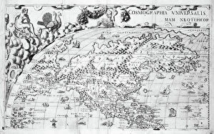
Background imageMaps Collection: Section plate from Francesco Camocio's 'Cosmographia Universalis', 1567

Section plate from Francesco Camocio's 'Cosmographia Universalis', 1567
7339211 Section plate from Francesco Camocio's 'Cosmographia Universalis', 1567, taken from the atlas 'Tavole Moderne di Geografia', 1567 (engraving) by Unknown Artist

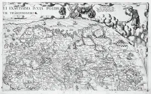
Background imageMaps Collection: Section plate from Francesco Camocio's 'Cosmographia Universalis', 1567

Section plate from Francesco Camocio's 'Cosmographia Universalis', 1567
7339210 Section plate from Francesco Camocio's 'Cosmographia Universalis', 1567, taken from the atlas 'Tavole Moderne di Geografia', 1567 (engraving) by Unknown Artist

Background imageMaps Collection: Section plate from Francesco Camocio's 'Cosmographia Universalis', 1567

Section plate from Francesco Camocio's 'Cosmographia Universalis', 1567
7339208 Section plate from Francesco Camocio's 'Cosmographia Universalis', 1567, taken from the atlas 'Tavole Moderne di Geografia', 1567 (engraving) by Unknown Artist

Background imageMaps Collection: Map of Asia from the Blaeu Atlas, 1662-65 (print)

Map of Asia from the Blaeu Atlas, 1662-65 (print)
7339178 Map of Asia from the Blaeu Atlas, 1662-65 (print) by Unknown Artist, (17th century); National Maritime Museum, London, UK; (add.info.: Creator: unknown Map of Asia from the Blaeu Atlas)

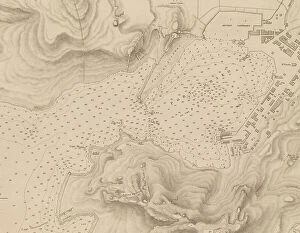
Background imageMaps Collection: Greece, the Peiraeus or Port Drako surveyed by Commander Thomas Graves, H.M.S

Greece, the Peiraeus or Port Drako surveyed by Commander Thomas Graves, H.M.S. Beacon 1840, [Detail], 1843 (print)
7342579 Greece, the Peiraeus or Port Drako surveyed by Commander Thomas Graves, H.M.S. Beacon 1840, [Detail], 1843 (print) by Walker, J. & C

Background imageMaps Collection: Greece, the Peiraeus or Port Drako surveyed by Commander Thomas Graves, H.M.S

Greece, the Peiraeus or Port Drako surveyed by Commander Thomas Graves, H.M.S. Beacon 1840, 1843 (print)
7342578 Greece, the Peiraeus or Port Drako surveyed by Commander Thomas Graves, H.M.S. Beacon 1840, 1843 (print) by Walker, J. & C

Background imageMaps Collection: Claudii Ptholemaei Alexandrini liber geographiae cum tabulis et universali figura et cum additione

Claudii Ptholemaei Alexandrini liber geographiae cum tabulis et universali figura et cum additione locorum quae a
7342516 Claudii Ptholemaei Alexandrini liber geographiae cum tabulis et universali figura et cum additione locorum quae a recentioribus reperta sunt diligenti cura emendatus et impressus

Background imageMaps Collection: Archipeligo, Rhodes Island, town and ports of Rhodes surveyed by Commander Thomas Graves

Archipeligo, Rhodes Island, town and ports of Rhodes surveyed by Commander Thomas Graves, HMS 'Beacon' 1838
7342500 Archipeligo, Rhodes Island, town and ports of Rhodes surveyed by Commander Thomas Graves, HMS 'Beacon' 1838, 1844 (print) by Walker, J. & C

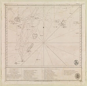
Background imageMaps Collection: Chart of the Archipelago to the Northward ot Mauritius laid down in 1776 by M le Victe Grenier

Chart of the Archipelago to the Northward ot Mauritius laid down in 1776 by M le Victe Grenier Lieut in the French Navy
7342593 Chart of the Archipelago to the Northward ot Mauritius laid down in 1776 by M le Victe Grenier Lieut in the French Navy [Includes Seychelles

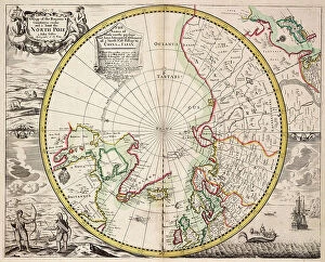
Background imageMaps Collection: Polar projection map with Arctic Circle, c.1680 (coloured engraving)

Polar projection map with Arctic Circle, c.1680 (coloured engraving)
7295393 Polar projection map with Arctic Circle, c.1680 (coloured engraving) by Seller, John (1632-97); 44x55 cm; National Maritime Museum, London

Background imageMaps Collection: Chart showing the North West Passage discovered by Captain R. Le M. McClure, HMS 'Investigator'

Chart showing the North West Passage discovered by Captain R. Le M. McClure, HMS 'Investigator'
7295388 Chart showing the North West Passage discovered by Captain R. Le M. McClure, HMS 'Investigator', 1853 (coloured engraving) by Inglefield

Background imageMaps Collection: Globus terrestris (Chart), 1564 (engraving)

Globus terrestris (Chart), 1564 (engraving)
7295387 Globus terrestris (Chart), 1564 (engraving) by Amman, Jost (1539-91); 30x20 cm; National Maritime Museum, London, UK; (add.info.: Creator: Jost Amman Single sheet)

Background imageMaps Collection: Nova & Acurata Totius Asiae Tabula, auct G. Blaeu, c.1673 (coloured engraving)

Nova & Acurata Totius Asiae Tabula, auct G. Blaeu, c.1673 (coloured engraving)
7337544 Nova & Acurata Totius Asiae Tabula, auct G. Blaeu, c.1673 (coloured engraving) by Blaeu, Joan (1596-1673); 109.5x149.2x5 cm; National Maritime Museum, London

Background imageMaps Collection: Linschoten's voyage to the East Indies, 1583-1595, 1599-1601 (etching)

Linschoten's voyage to the East Indies, 1583-1595, 1599-1601 (etching)
7341892 Linschoten's voyage to the East Indies, 1583-1595, 1599-1601 (etching) by Unknown Artist, (16th century); 39.5x44.5 cm; National Maritime Museum, London, UK; (add.info.: Unknown Artist)

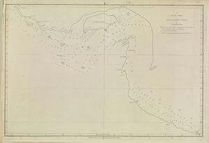
Background imageMaps Collection: Plans of Ports, Dalrymple, Alexander published in 1791. A plane chart of the Gulf of Persia

Plans of Ports, Dalrymple, Alexander published in 1791. A plane chart of the Gulf of Persia, by Lieut
7340868 Plans of Ports, Dalrymple, Alexander published in 1791. A plane chart of the Gulf of Persia, by Lieut. John Cant 1773, 1791 (print) by Dalrymple

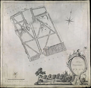
Background imageMaps Collection: Plan of Greenwich Park, showing the Royal Observatory, One Tree Hill and the Ranger's House

Plan of Greenwich Park, showing the Royal Observatory, One Tree Hill and the Ranger's House, 1790 (pen, wash)
7340660 Plan of Greenwich Park, showing the Royal Observatory, One Tree Hill and the Ranger's House, 1790 (pen, wash, vellum) by Morton

Background imageMaps Collection: A Large Chart of Part of the Coast of GUZARATT & INDIA from Diu Head to Bombay. (print)

A Large Chart of Part of the Coast of GUZARATT & INDIA from Diu Head to Bombay. (print)
7340646 A Large Chart of Part of the Coast of GUZARATT & INDIA from Diu Head to Bombay. (print) by Thornton, John (1641-1708); National Maritime Museum, London, UK; (add.info.: Creator: Thornton)

Background imageMaps Collection: Chart of the North Sea and Dutch coast, 1661 (coloured engraving)

Chart of the North Sea and Dutch coast, 1661 (coloured engraving)
7340609 Chart of the North Sea and Dutch coast, 1661 (coloured engraving) by British School, (17th century); 42x52 cm; National Maritime Museum, London

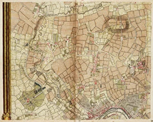
Background imageMaps Collection: Map of Greenford, Osterley, Ealing and Kew, 1746 (coloured engraving)

Map of Greenford, Osterley, Ealing and Kew, 1746 (coloured engraving)
7340517 Map of Greenford, Osterley, Ealing and Kew, 1746 (coloured engraving) by Rocque, John (c.1704-d.1762); 51x67 cm; National Maritime Museum, London

Background imageMaps Collection: Map of Wimbledon and Tooting, 1746 (coloured engraving)

Map of Wimbledon and Tooting, 1746 (coloured engraving)
7340512 Map of Wimbledon and Tooting, 1746 (coloured engraving) by Rocque, John (c.1704-d.1762); 51x67 cm; National Maritime Museum, London

Background imageMaps Collection: England East Coast. Sheet 1, late 19th century (print)

England East Coast. Sheet 1, late 19th century (print)
7340593 England East Coast. Sheet 1, late 19th century (print) by Imray, James & Son (19th century); National Maritime Museum, London

Background imageMaps Collection: Map of Highgate, Kentish Town, Holloway, Tottenham and Newington, 1746 (coloured engraving)

Map of Highgate, Kentish Town, Holloway, Tottenham and Newington, 1746 (coloured engraving)
7340507 Map of Highgate, Kentish Town, Holloway, Tottenham and Newington, 1746 (coloured engraving) by Rocque, John (c.1704-d.1762); 51x67 cm; National Maritime Museum, London

Background imageMaps Collection: The Peninsula of India from the Kistnah River to Cape Comorin, 1792 (print)

The Peninsula of India from the Kistnah River to Cape Comorin, 1792 (print)
7340497 The Peninsula of India from the Kistnah River to Cape Comorin, 1792 (print) by Rennell, James (1742-1830); 44x49 cm; National Maritime Museum, London

Background imageMaps Collection: Plymouth, 1672 (Ink, watercolour, paper, linen )

Plymouth, 1672 (Ink, watercolour, paper, linen )
7340487 Plymouth, 1672 (Ink, watercolour, paper, linen ) by Gomme, Bernard de (1620-85); 92x1015 cm; National Maritime Museum, London

Background imageMaps Collection: Mediterranean, Black Sea and the North East Atlantic, 1548 (vellum)

Mediterranean, Black Sea and the North East Atlantic, 1548 (vellum)
7340478 Mediterranean, Black Sea and the North East Atlantic, 1548 (vellum) by Maggiolo, Jacopo Vesconte (1475-1549/61); 79x118 cm; National Maritime Museum, London

Background imageMaps Collection: Chart of the western Atlantic, 1678 (vellum)

Chart of the western Atlantic, 1678 (vellum)
7340474 Chart of the western Atlantic, 1678 (vellum) by Burston, John (17th century); 71x53 cm; National Maritime Museum, London

Background imageMaps Collection: Map of Jamaica, 19th century (print)

Map of Jamaica, 19th century (print)
7340446 Map of Jamaica, 19th century (print) by Unknown Artist, (19th century); National Maritime Museum, London, UK; (add.info.: Creator)

Background imageMaps Collection: Chart of the Atlantic Ocean south of the Equator, 1785, c.1800 (engraving)

Chart of the Atlantic Ocean south of the Equator, 1785, c.1800 (engraving)
7340442 Chart of the Atlantic Ocean south of the Equator, 1785, c.1800 (engraving) by Unknown Artist, (19th century); 60x89 cm; National Maritime Museum, London

Background imageMaps Collection: Chart of South America and the Atlantic Coast, 1798 (engraving)

Chart of South America and the Atlantic Coast, 1798 (engraving)
7340435 Chart of South America and the Atlantic Coast, 1798 (engraving) by Langara, Juan de (18th century); 5.7x86 cm; National Maritime Museum, London

Background imageMaps Collection: Chart of Ipswich Bay and Cape Ann, Atlantic coast of North America, 1776 (coloured engraving)

Chart of Ipswich Bay and Cape Ann, Atlantic coast of North America, 1776 (coloured engraving)
7340432 Chart of Ipswich Bay and Cape Ann, Atlantic coast of North America, 1776 (coloured engraving) by DesBarres, Joseph Frederick Wallet (1721-1824); 54x75 cm; National Maritime Museum, London

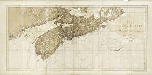
Background imageMaps Collection: A chart of Nova Scotia, 1775 (bates paper)

A chart of Nova Scotia, 1775 (bates paper)
7340420 A chart of Nova Scotia, 1775 (bates paper) by DesBarres, Joseph Frederick Wallet (1721-1824); 79.5x55.5 cm; National Maritime Museum, London

Background imageMaps Collection: The Magdalen Isles in the gulph of St. Lawrence, 1778 (engraving)

The Magdalen Isles in the gulph of St. Lawrence, 1778 (engraving)
7340417 The Magdalen Isles in the gulph of St. Lawrence, 1778 (engraving) by DesBarres, Joseph Frederick Wallet (1721-1824); 73x55 cm; National Maritime Museum, London

Background imageMaps Collection: A chart of New York Harbour with the soundings views of land marks

A chart of New York Harbour with the soundings views of land marks and nautical directions for the use of pilotage
7340415 A chart of New York Harbour with the soundings views of land marks and nautical directions for the use of pilotage

Background imageMaps Collection: The environs of Fort Cumberland in the Bay of Fundy, 1781 (engraving)

The environs of Fort Cumberland in the Bay of Fundy, 1781 (engraving)
7340406 The environs of Fort Cumberland in the Bay of Fundy, 1781 (engraving) by DesBarres, Joseph Frederick Wallet (1721-1824); 53x75 cm; National Maritime Museum, London

Background imageMaps Collection: The River St. John, 1776 (engraving)

The River St. John, 1776 (engraving)
7340402 The River St. John, 1776 (engraving) by DesBarres, Joseph Frederick Wallet (1721-1824); 54.5x78.5 cm; National Maritime Museum, London, UK; (add.info.: Creator: J. F. W. Des Barres Scale: ca)

Background imageMaps Collection: Royal Victoria and Albert and King George V Docks 1934, c.1934 (print)

Royal Victoria and Albert and King George V Docks 1934, c.1934 (print)
7340370 Royal Victoria and Albert and King George V Docks 1934, c.1934 (print) by Vincent Brooks, Day & Son (1867-1940); National Maritime Museum, London

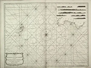
Background imageMaps Collection: A chart of the entrance into the Channel containing the west coast of Cornwall

A chart of the entrance into the Channel containing the west coast of Cornwall
7340130 A chart of the entrance into the Channel containing the west coast of Cornwall and Scilly Islands with all the soundings, 1779 (copperplate engraving) by British School


All Professionally Made to Order for Quick Shipping

Maps have always been a fascinating window into the past, allowing us to explore and understand the world as it once was. From the intricate details of an ancient Greek map to the vibrant landscapes of Jamaica, each map tells its own unique story. Take a journey back in time with a Map of Ancient Greece, where you can trace the footsteps of philosophers and warriors alike. Discover the birthplace of democracy and marvel at the city-states that shaped Western civilization. Venture further across continents with Maps showcasing the vastness of empires like Britain's. Explore territories under British rule through a Map of the British Empire or delve into Asia's history with a Map highlighting the mighty Mongol Empire. Uncover remnants of one of history's greatest civilizations with a Map depicting the grandeur and reach of Rome. Witness how this powerful empire spanned across Europe, Africa, and Asia, leaving behind an indelible mark on human history. During times filled with turmoil and conflict, maps served as crucial tools for understanding war efforts. The Daily Mail War Map from World War I provides insights into battlefronts while WW2 posters display strategic plans like never before - including those detailing activities specific to divisions such as 52 (Lowland) Division or mapping out positions held by troops in The British Army. Closer to home lies Isle Of Wight - its beauty captured perfectly on a detailed map inviting exploration along its stunning coastline. Meanwhile, travel even further east to discover ancient Persian splendor through an intricately designed Persian Empire map. For those seeking nostalgia or tracing ancestral roots, immerse yourself in Cornwall C1857's historical charm via an antique map capturing its essence during that era. From ancient civilizations to modern-day conflicts and everything in between – they can not just pieces of paper but gateways into our collective pasts. They hold stories waiting to be unraveled by curious minds eager for knowledge about our ever-changing world throughout time.