Fraud Blocker Skip to main content

Geography Collection (page 3)

"Exploring the Rich Tapestry of Geography: From Ancient Maps to Modern Wonders" The Al-Idrisi's world map from 1154 takes us back in time

Background imageGeography Collection: Geological map, South-East England, 1830s

Geological map, South-East England, 1830s. This map, dating from between 1830 and 1833, shows the denudation of The Weald

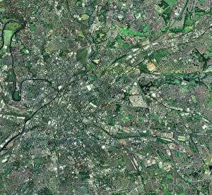
Background imageGeography Collection: Central Manchester, aerial view

Central Manchester, aerial view. North is at top. Manchester is one of the largest cities in the UK. The River Irwell (upper left) flows through the city centre (centre left)

Background imageGeography Collection: Antarctic exploration, route maps

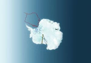
Antarctic exploration, route maps
Antarctic exploration. Map of Antarctica showing the routes taken by Ernest Shackleton (1914 to 1916, red), Roald Amundsen (1911 to 1912, brown), Robert Scott (1911 to 1912)

Background imageGeography Collection: Sunrise over the Kangaroo Valley, New South Wales, Australia, Pacific

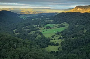
Sunrise over the Kangaroo Valley, New South Wales, Australia, Pacific

Background imageGeography Collection: Bombetoka Bay, Madagascar

Bombetoka Bay, Madagascar, satellite image. This bay links the Betsiboka River (at right) with the Mozambique Channel (top left), part of the Indian Ocean

Background imageGeography Collection: South America at night, satellite image

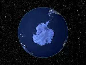
South America at night, satellite image
South America at night. Satellite image of the Earth at night, set against a background of stars, centred on the continent of South America. North is at top

Background imageGeography Collection: India at night, satellite image

India at night, satellite image
India at night, satellite view. This image is a composite showing the change in illumination over India from 1992-2003. Satellite data from 2003 is coloured red

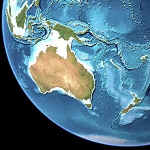
Background imageGeography Collection: Australia, topographic map

Australia, topographic map. Highlands and lowlands of the continents are shown as ridges and flat areas. Southeast Asia (top left), New Zealand (lower right) and Antarctica (bottom right)

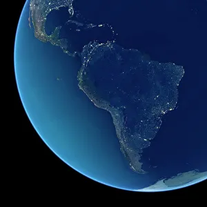
Background imageGeography Collection: South America at night, satellite image

South America at night, satellite image. City lights (yellow) show areas of dense population, particularly in North America (top left) and South Americas coasts

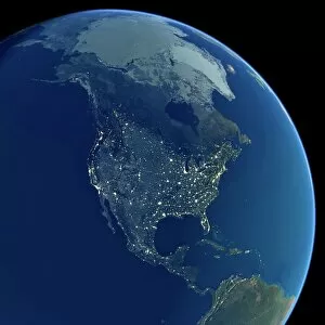
Background imageGeography Collection: North America at night, satellite image

North America at night, satellite image. City lights (yellow) show areas of dense population, particularly in North America (upper centre)

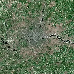
Background imageGeography Collection: London, UK, satellite image

London, UK, satellite image
London, UK. Satellite image of the city of London (centre) and its surrounding area. North is at top. The River Thames is seen running through the city from left to right

Background imageGeography Collection: Map of Europe, 1700

Map of Europe, 1700
17th century map of Europe. Published in 1700, this map by the Dutch cartographer Frederick de Witt (1630-1706) shows the latest knowledge of the geography of Europe

Background imageGeography Collection: Map of Western Europe, 1590

Map of Western Europe, 1590
16th century map of Western Europe. Published around 1590, this map shows the coasts of Western Europe and the Mediterranean

Background imageGeography Collection: Europe, 16th century nautical map

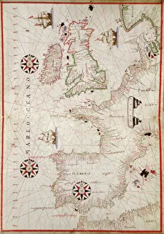
Europe, 16th century nautical map
Nautical map of Europe, 1544 copy of Agnese Atlas. Several copies of this atlas were produced between 1536 and 1564, in Venice, by the Italian mapmaker Battista Agnese

Background imageGeography Collection: Syrian Desert, satellite image

Syrian Desert, satellite image. North is at top. Vegetation is red and dark green, while arid areas of sand and rock are light green and light blue. Water is blue

Background imageGeography Collection: Saudi Arabian desert

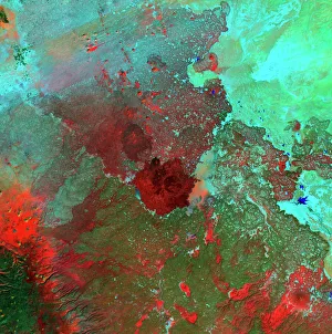
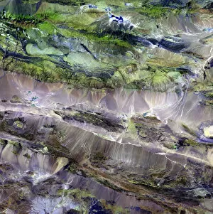
Saudi Arabian desert. Combined infrared and visible satellite image of the Jabal Tuwayq ridge (down centre) in the rocky desert region of Najd in central Saudi Arabia. North is at top

Background imageGeography Collection: Venus radar map, North Pole

Venus radar map, North Pole
Venus radar map, centred on the Venusian North Pole. The map is colour-coded for altitude, going from low altitude (purple) through blue, green, yellow and orange to high altitude (red)

Background imageGeography Collection: Horseshoe Falls, Niagara Falls, Ontario, Canada

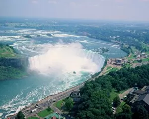
Horseshoe Falls, Niagara Falls, Ontario, Canada

Background imageGeography Collection: Grand Canal Looking South-East from the Campo Santa Sophia t

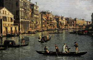
Grand Canal Looking South-East from the Campo Santa Sophia t
Canaletto (1697-1768). Italian painter. Grand Canal Looking South-East from the Campo Santa Sophia to the Rialto Bridge, c. 1756. Detail. Gemaldegalerie. Berlin. Germany

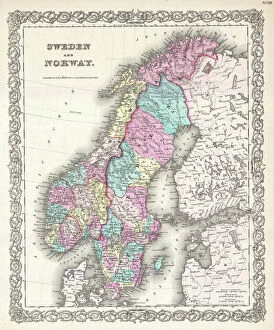
Background imageGeography Collection: 1855, Colton Map of Scandinavia, Norway, Sweden, Finland, topography, cartography

1855, Colton Map of Scandinavia, Norway, Sweden, Finland, topography, cartography
1855, Colton Map of Scandinavia, Norway, Sweden, Finland

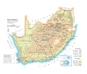
Background imageGeography Collection: Map of South Africa

Map of South Africa

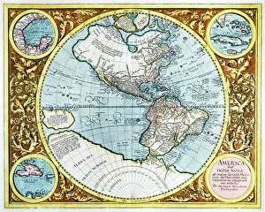
Background imageGeography Collection: 17th century map of the New World

17th century map of the New World

Background imageGeography Collection: Angel Falls

Angel Falls, Canaima National Park, Venezuela, South America

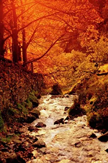
Background imageGeography Collection: Fall foliage and running stream, Grindsbrook Edale, Peak District, Derbyshire

Fall foliage and running stream, Grindsbrook Edale, Peak District, Derbyshire, England, UK

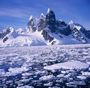
Background imageGeography Collection: Iceflow off the rugged west coast of the Antartic Peninsula, Antarctica

Iceflow off the rugged west coast of the Antartic Peninsula, Antarctica

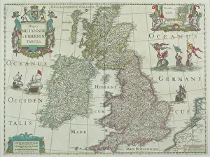
Background imageGeography Collection: 1643, antiquity, archival, british isles, cartography, england, europe, geographical

1643, antiquity, archival, british isles, cartography, england, europe, geographical, geography, historical, map, nobody, old-fashioned, text, uk, vintage, Antique Maps, 89687337

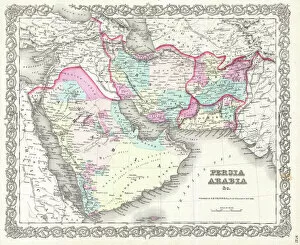
Background imageGeography Collection: 1855, Colton Map of Persia, Afghanistan, and Arabia, topography, cartography, geography

1855, Colton Map of Persia, Afghanistan, and Arabia, topography, cartography, geography
1855, Colton Map of Persia, Afghanistan, and Arabia

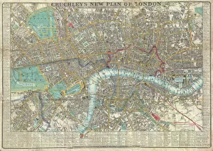
Background imageGeography Collection: 1848, Crutchley Pocket Map or Plan of London, England, topography, cartography, geography

1848, Crutchley Pocket Map or Plan of London, England, topography, cartography, geography
1848, Crutchley Pocket Map or Plan of London, England

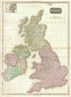
Background imageGeography Collection: 1818, Pinkerton Map of the British Isles, England, Scotland, Ireland, John Pinkerton

1818, Pinkerton Map of the British Isles, England, Scotland, Ireland, John Pinkerton, 1758 - 1826, Scottish antiquarian, cartographer, UK

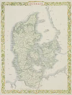
Background imageGeography Collection: Antique map of Denmark

Antique map of Denmark

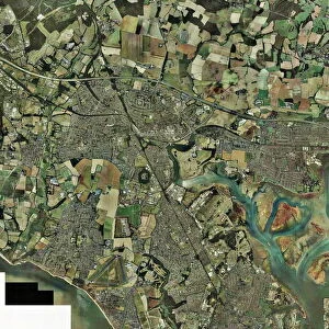
Background imageGeography Collection: Fareham, UK, aerial image

Fareham, UK, aerial image
Fareham, UK, aerial photograph. Fareham is a market town in Hampshire, England, between the two cities of Portsmouth and Southampton

Background imageGeography Collection: Mar Lodge Estate, Scotland, UK

Mar Lodge Estate, Scotland, UK
Mar Lodge Estate house and the Cairngorms mountain range. Photographed in August, in Cairngorms National Park, Aberdeenshire, Scotland, UK

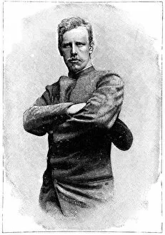
Background imageGeography Collection: Fridtjof Nansen, Norwegian explorer

Fridtjof Nansen, Norwegian explorer
Fridtjof Nansen (1861-1930), Norwegian explorer, biologist and humanitarian. In 1888 he was the first to cross the Greenland ice sheet and showed that it covered the entire island

Background imageGeography Collection: Earth from space, artwork

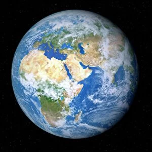
Earth from space, artwork. View of the Earth centred on 165 degrees East, showing Russia (top left), Southeast Asia (centre left), China and Japan (upper left), Australia (lower left)

Background imageGeography Collection: Orteliuss map of Italy, 1570

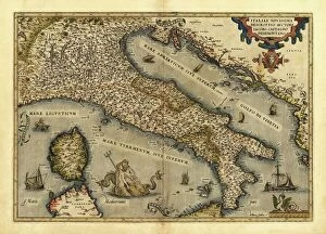
Orteliuss map of Italy, 1570
Orteliuss map of Italy. This map is from the 1570 first edition of Theatrum orbis terrarum ( Theatre of the World ). Drawn by the Flemish mapmaker Abraham Ortelius (1527-1598)

Background imageGeography Collection: Orteliuss map of Poland, 1570

Orteliuss map of Poland, 1570
Orteliuss map of Poland. This map is from the 1570 first edition of Theatrum orbis terrarum ( Theatre of the World ). Drawn by the Flemish mapmaker Abraham Ortelius (1527-1598)

Background imageGeography Collection: Orteliuss map of Greece, 1570

Orteliuss map of Greece, 1570
Orteliuss map of Greece. This map is from the 1570 first edition of Theatrum orbis terrarum ( Theatre of the World ). Drawn by the Flemish mapmaker Abraham Ortelius (1527-1598)

Background imageGeography Collection: Twisted Lakes and Little Horn, Cradle Mountain-Lake St. Clair National Park

Twisted Lakes and Little Horn, Cradle Mountain-Lake St. Clair National Park, UNESCO World Heritage Site, Tasmania, Australia, Pacific

Background imageGeography Collection: The Geography of Iceland

The Geography of Iceland
The peaks of mountains and volcanoes in Iceland depicted in this fascinating postcard. Featured is the Eyjafjallajoekull volcano (just to the left of the erupting Hekla Volcano - centre left)

Background imageGeography Collection: Steppe-desert border, satellite image

Steppe-desert border, satellite image. North is at top. Arid areas of desert rock are brown, while grassy steppe areas are green. A small area of desert sands (yellow) is seen at far centre right

Background imageGeography Collection: Earth, topographic and bathymetric map

Earth, topographic and bathymetric map. This map is centred on the Pacific Ocean, at longitude 140 degrees west. Highlands and lowlands of the continents are shown as ridges and flat areas

Background imageGeography Collection: Berlin, Germany, satellite image

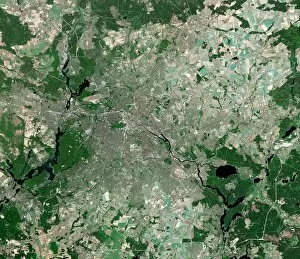
Berlin, Germany, satellite image
Berlin, Germany. Satellite image of the city of Berlin (centre) and its surrounding area in northeastern Germany. North is at top

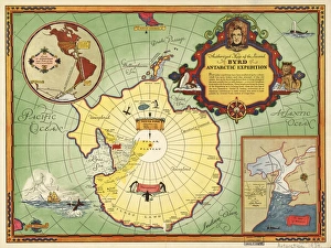
Background imageGeography Collection: Second Byrd Antarctic Expedition, 1933-35

Second Byrd Antarctic Expedition, 1933-35
Second Byrd Antarctic Expedition, historical map. This expedition took place between 1933 and 1935, and followed an earlier expedition from 1928 to 1930

Background imageGeography Collection: Aspen trees during winter

Aspen trees during winter, Dixie National Forest, Utah, USA

Background imageGeography Collection: Winter scene beside the River Tay

Winter scene beside the River Tay, Aberfeldy, Perthshire, Scotaland, UK

Background imageGeography Collection: Boats pulled onto beach below the Rock of Gibraltar

Boats pulled onto beach below the Rock of Gibraltar, Gibraltar

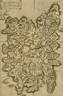
Background imageGeography Collection: Map of Corsica. Italian engraving. 16th century

Map of Corsica. Italian engraving. 16th century

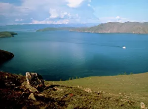
Background imageGeography Collection: Strait of Olkhon, Lake Baikal

Strait of Olkhon, Lake Baikal
Lake Baikal. View of the Strait of Olkhon, on the west coast of Lake Baikal, Russia. The land on the horizon is Olkhon Island


All Professionally Made to Order for Quick Shipping

"Exploring the Rich Tapestry of Geography: From Ancient Maps to Modern Wonders" The Al-Idrisi's world map from 1154 takes us back in time, showcasing the early understanding and its importance in navigation. Derwent Water, with Blencathra standing tall behind it, offers a breathtaking view of nature's wonders in the Lake District, Cumbria, England. Jacopo de Barbari's Map of Venice in 1500 allows us to delve into the intricate layout of this enchanting city built on water. An antique map of Tasmania reveals how explorers once charted unknown territories and expanded our knowledge about distant lands. The V & A waterfront and Table Mountain create an awe-inspiring backdrop for Cape Town, South Africa – a testament to geography shaping stunning landscapes. Continental drift after 250 million years shows us that our planet is constantly evolving, reminding us of the dynamic forces at work beneath Earth's surface. Malham Cove stands as a geological marvel within Yorkshire Dales National Park, captivating visitors with its limestone formations carved by natural processes over millennia. Whole Earth (Blue Marble 2000) provides a mesmerizing image capturing our beautiful planet from space – highlighting both its vastness and interconnectedness through geography. The British Empire world map from the 19th century reflects an era when geographical exploration played a significant role in expanding colonial influence across continents. James Craig's Map of New Town Edinburgh from 1768 showcases meticulous topography planning that shaped one of Scotland's most iconic cities even today. Anglo-Saxon 10th-century world map gives insight into early European perceptions and interpretations regarding global geography during medieval times In summary, these diverse hints remind us that geography is not just about maps but also encompasses breathtaking landscapes, historical perspectives on human exploration and settlement, and the ever-changing nature of our planet.