Fraud Blocker Skip to main content

Geography Collection (page 6)

"Exploring the Rich Tapestry of Geography: From Ancient Maps to Modern Wonders" The Al-Idrisi's world map from 1154 takes us back in time

Background imageGeography Collection: One of the planets orbiting 70 Virginis is a super-Jupiter

One of the planets orbiting 70 Virginis is a super-Jupiter, so close to the star that it is heated to a red heat

Background imageGeography Collection: Ice spires on Jupiters large moon, Callisto

Ice spires on Jupiters large moon, Callisto
The ice spires of Jupiters moon Callisto were created when softer ice evaporated, leaving behind the harder cores

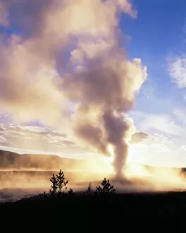
Background imageGeography Collection: USA, Wyoming, Old Faithful geyser at Yellowstone National Park

USA, Wyoming, Old Faithful geyser at Yellowstone National Park (Large format sizes available)

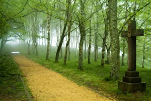
Background imageGeography Collection: Urkiola Natural Park. Cross. Biscay province. Basque Country. Spain

Urkiola Natural Park. Cross. Biscay province. Basque Country. Spain
Urkiola Natural Park. Cross. Biscay province, Basque country, Spain

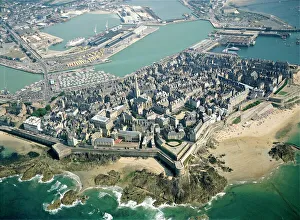
Background imageGeography Collection: France, Brittany, Aerial view of Saint Malo

France, Brittany, Aerial view of Saint Malo
Aerial view of Saint Malo - Brittany, France

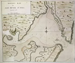
Background imageGeography Collection: Map of Botany Bay, New South Wales, Australia

Map of Botany Bay, New South Wales, Australia
Cartography, 18th century. Map of Botany Bay, New South Wales, Australia

Background imageGeography Collection: Netherlands, Holland, Aerial view of the Polders near Amsterdam

Netherlands, Holland, Aerial view of the Polders near Amsterdam
Aerial view of the Polders near Amsterdam - Holland, Netherlands

Background imageGeography Collection: Middle East, satellite image

Middle East, satellite image
Middle East. North is at top. Satellite image of the Middle East, showing the borders (white lines) of the countries. The Middle East is a Eurocentric term used to describe a region that roughly
Background imageGeography Collection: JAPAN. HONSHU. HIROSHIMA. Hiroshima. Atomic Bomb

JAPAN. HONSHU. HIROSHIMA. Hiroshima. Atomic Bomb

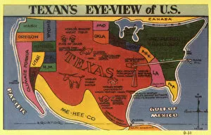
Background imageGeography Collection: A Texans eye view of the USA

A Texans eye view of the USA, with a certain state having slightly more georgraphical significance than the physical reality....!! Date: circa 1930s

Background imageGeography Collection: WORLD MAP, 1641. Engraved map of the world by Henricus Hondius, 1641

WORLD MAP, 1641. Engraved map of the world by Henricus Hondius, 1641

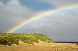
Background imageGeography Collection: Rainbow over sand dunes

Rainbow over sand dunes. This arching spectrum of colours is seen when sunlight from behind the observer is reflected and refracted by rain in front

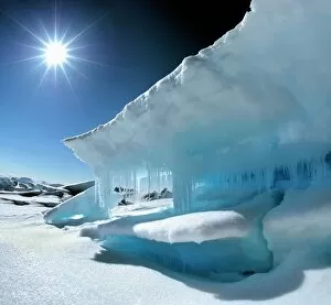
Background imageGeography Collection: Arctic landscape, Canada

Arctic landscape, Canada
Arctic landscape, Lancaster Sound, Nunavut, Canada. The midnight sun is seen in the sky. In recent years, the effects of global warming have caused sea ice to melt earlier in the season

Background imageGeography Collection: Eroded sea arch

Eroded sea arch
Sea arch and a calm sea. This is Durdle Door, near Lulworth Cove in Dorset, UK. A sea arch forms when wave action erodes part of a headland quicker than the rest

Background imageGeography Collection: Northern Corries at dawn

Northern Corries at dawn. View looking west just before sunrise across Coire an t-Sneachda (hollow area) to Coire Lochain. The ridge separating the two hollows is is the Fiacaill Ridge

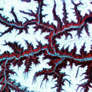
Background imageGeography Collection: Eastern Himalayas, satellite image

Eastern Himalayas, satellite image. North is at top. Snow is white, vegetation is red, barren areas are light blue and water is dark blue

Background imageGeography Collection: Artwork showing Chicxulub impact crater, Yucatan

Artwork showing Chicxulub impact crater, Yucatan
Chicxulub crater. Artwork of the Chicxulub impact crater on the Yucatan Peninsula, Mexico, soon after its creation. This impact may have caused the extinction of the dinosaurs

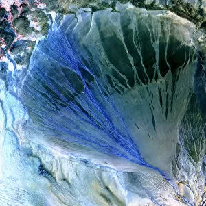
Background imageGeography Collection: Desert alluvial fan, satellite image

Desert alluvial fan, satellite image. North is at top. Desert areas can sometimes go for years without rain, and then intense storms will cause flooding that fills old dry river beds

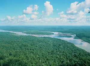
Background imageGeography Collection: Aerial view of Rio Napo, eastern Equador

Aerial view of Rio Napo, eastern Equador

Background imageGeography Collection: Europe, satellite image

Europe, satellite image
Europe. Satellite image centred on Europe. North converges towards top. Water is blue, vegetation is green, arid areas are brown, and snow and ice are white

Background imageGeography Collection: Native copper, macrophotograph

Native copper, macrophotograph
Native copper. Native copper is copper found naturally in a pure (chemically uncombined) state. Native copper deposits are now almost depleted

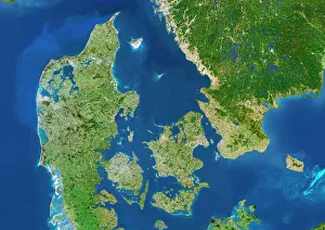
Background imageGeography Collection: Denmark - Sweden border, satellite image

Denmark - Sweden border, satellite image
Denmark. Satellite image of the European country of Denmark (left) and the surrounding area. North is at top. Water is blue, vegetation is green

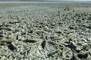
Background imageGeography Collection: Selenite crystals on a dried lake bed

Selenite crystals on a dried lake bed, White Sands National Monument, near Alamagordo, New Mexico, United States

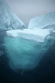
Background imageGeography Collection: Iceberg

Iceberg floating in the sea. Photographed off the western coast of Greenland, in the Ilulissat Icefjord. This fjord is the birthplace of thousands of icebergs

Background imageGeography Collection: Martin Frobisher, English explorer

Martin Frobisher, English explorer
Martin Frobisher (c.1535-1594), English navigator and explorer. Frobisher became a cabin boy in 1544 and rose to the rank of captain by 1565

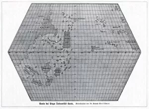
Background imageGeography Collection: Toscanellis world map, 1474

Toscanellis world map, 1474
Toscanellis world map. This map was drawn by the Italian mathematician and astronomer Paolo Toscanelli (1397-1482) in 1474

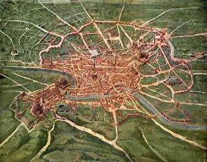
Background imageGeography Collection: 16th Century Plan of Rome

16th Century Plan of Rome
16th century plan of Rome. Details from the map of Latium et Sabina (Southern Lazio), in the Gallery of Maps in the Vatican Museum.The Gallery of Maps holds maps which were commissioned between 1578

Background imageGeography Collection: Ordnance Survey benchmark, UK

Ordnance Survey benchmark, UK
Ordnance Survey (OS) benchmark. OS benchmarks were installed by the Ordnance Survey department throughout the UK to record the height above mean sea level as determined by the Ordnance Datum Newlyn

Background imageGeography Collection: Woodland river

Woodland river. This is the East Lyn river, which flows through Exmoor National Park. Photographed near Rockford, Somerset, UK

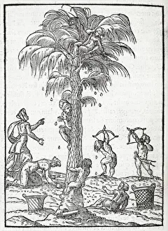
Background imageGeography Collection: Egyptian palm tree, 16th century artwork

Egyptian palm tree, 16th century artwork. The fruits of this palm tree are being harvested. The palm tree most commonly cultivated in this way is the date palm tree, which has sweet edible fruit

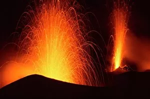
Background imageGeography Collection: Stromboli double eruption

Stromboli double eruption. Two craters of the volcano Stromboli erupting at night, throwing out pyroclastic material in the form of lava (molten rock)

Background imageGeography Collection: Glacier crevasse, Canada

Glacier crevasse, Canada
Glacier crevasse. Crevasse in the surface of the Tellot glacier. Crevasses form in glaciers as the ice cracks when the glacier moves

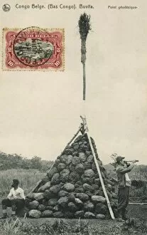
Background imageGeography Collection: Trigonometry Point

Trigonometry Point
A Trigonometry Point at Buvita in the Belgium Congo, topped off with a broom!

Background imageGeography Collection: Great Sandy Desert, satellite image

Great Sandy Desert, satellite image. North is at upper left. Vegetation is green and purple, while more barren, rocky areas are various shades of white and brown

Background imageGeography Collection: Great Salt Desert, satellite image

Great Salt Desert, satellite image. North is at top. Desert soil and mud is light brown, barren rocky areas are pink, and salt pans are blue

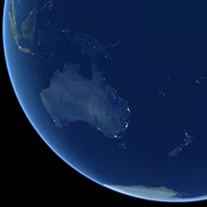
Background imageGeography Collection: Australia at night, satellite image

Australia at night, satellite image. City lights (yellow) show areas of more dense population, particularly in Southeast Asia (top left) and on Australias east coast

Background imageGeography Collection: Close-up of white water in the Dunns River Falls

Close-up of white water in the Dunns River Falls, Ocho Rico, Jamaica, Caribbean

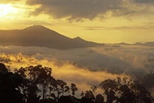
Background imageGeography Collection: Dawn over Bukit or Mt. Danum and the virgin dipterocarp rainforest canopy

Dawn over Bukit or Mt. Danum and the virgin dipterocarp rainforest canopy
Dawn over Bukit or Mt.Danum and the virgin dipterocarp rainforest canopy, Danum Valley, Sabah, Borneo, Asia

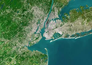
Background imageGeography Collection: New York City, satellite image

New York City, satellite image
New York City, USA, satellite image. North is attop. Urban areas are white, vegetation is greenand water is blue. The island of Manhattan is atupper centre on the east coast of the HudsonRiver

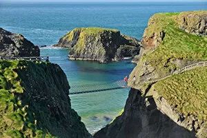
Background imageGeography Collection: EyeUbiquitous_20120989

EyeUbiquitous_20120989
Ireland, County Antrim, Causeway Coast, Carrick a Rede Rope Bridge

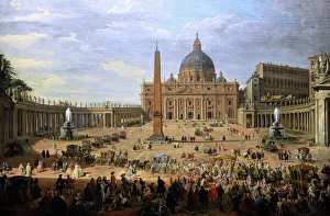
Background imageGeography Collection: The output of the Duke of Choiseul (1719-1785) of St. Peter

The output of the Duke of Choiseul (1719-1785) of St. Peter
Giovanni Paolo Panini (1691-1765). Italian painter. The output of the Duke of Choiseul (1719-1785) of St. Peters Square in Rome, 1754. Gemaldegalerie. Berlin. Germany

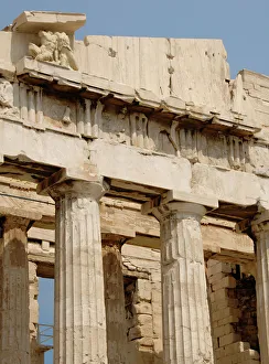
Background imageGeography Collection: Parthenon. Athens. Greece

Parthenon. Athens. Greece
Greece. Athens. Parthenon. 447-438 BC. in Doric style under leadership of Pericles. The building was designed by the architects Ictinos and Callicrates. Acropolis

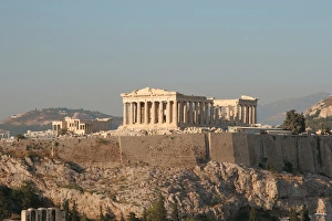
Background imageGeography Collection: Athens. Panoramic view of the Acropolis. Parthenon

Athens. Panoramic view of the Acropolis. Parthenon. Attica. Central Greece

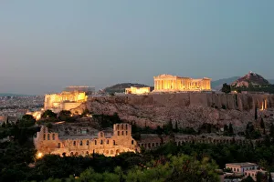
Background imageGeography Collection: Athens. Panoramic view of the Acropolis at night

Athens. Panoramic view of the Acropolis at night. Attica. Central Greece

Background imageGeography Collection: Chaging of the guard. Athens. Greece

Chaging of the guard. Athens. Greece
Changing of the guar. The Tomb of the Unknown Soldier. Athens. Attica. Greece

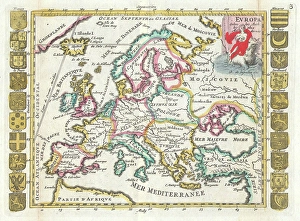
Background imageGeography Collection: 1706, De La Feuille Map of Europe, topography, cartography, geography, land, illustration

1706, De La Feuille Map of Europe, topography, cartography, geography, land, illustration
1706, De La Feuille Map of Europe

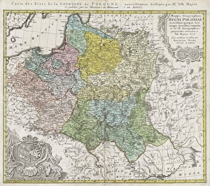
Background imageGeography Collection: 1750, Homann Heirs Map of Poland, topography, cartography, geography, land, illustration

1750, Homann Heirs Map of Poland, topography, cartography, geography, land, illustration
1750, Homann Heirs Map of Poland

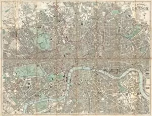
Background imageGeography Collection: 1890, Bacon Travelers Pocket Map of London, England, topography, cartography

1890, Bacon Travelers Pocket Map of London, England, topography, cartography
1890, Bacon Travelers Pocket Map of London, England


All Professionally Made to Order for Quick Shipping

"Exploring the Rich Tapestry of Geography: From Ancient Maps to Modern Wonders" The Al-Idrisi's world map from 1154 takes us back in time, showcasing the early understanding and its importance in navigation. Derwent Water, with Blencathra standing tall behind it, offers a breathtaking view of nature's wonders in the Lake District, Cumbria, England. Jacopo de Barbari's Map of Venice in 1500 allows us to delve into the intricate layout of this enchanting city built on water. An antique map of Tasmania reveals how explorers once charted unknown territories and expanded our knowledge about distant lands. The V & A waterfront and Table Mountain create an awe-inspiring backdrop for Cape Town, South Africa – a testament to geography shaping stunning landscapes. Continental drift after 250 million years shows us that our planet is constantly evolving, reminding us of the dynamic forces at work beneath Earth's surface. Malham Cove stands as a geological marvel within Yorkshire Dales National Park, captivating visitors with its limestone formations carved by natural processes over millennia. Whole Earth (Blue Marble 2000) provides a mesmerizing image capturing our beautiful planet from space – highlighting both its vastness and interconnectedness through geography. The British Empire world map from the 19th century reflects an era when geographical exploration played a significant role in expanding colonial influence across continents. James Craig's Map of New Town Edinburgh from 1768 showcases meticulous topography planning that shaped one of Scotland's most iconic cities even today. Anglo-Saxon 10th-century world map gives insight into early European perceptions and interpretations regarding global geography during medieval times In summary, these diverse hints remind us that geography is not just about maps but also encompasses breathtaking landscapes, historical perspectives on human exploration and settlement, and the ever-changing nature of our planet.