Fraud Blocker Skip to main content

Geography Collection (page 2)

"Exploring the Rich Tapestry of Geography: From Ancient Maps to Modern Wonders" The Al-Idrisi's world map from 1154 takes us back in time

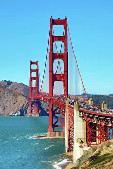
Background imageGeography Collection: Golden Gate Bridge, San Franciso, California, USA

Golden Gate Bridge, San Franciso, California, USA

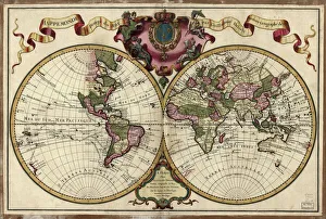
Background imageGeography Collection: Map of the world, 1720

Map of the world, 1720
(Original Caption) 18th century map of the world. Published in Paris in 1720, this French map shows the known world, including the new lands that had been discovered in the preceding centuries by

Background imageGeography Collection: Celestial sky with Sirius, Orion and Aldebaran shining bove Pharilapche Peak in Nepal

Celestial sky with Sirius, Orion and Aldebaran shining bove Pharilapche Peak in Nepal
The winter Milky Way with bright Sirius, Orion and Aldebaran shining above the moonlight mountainscape of Pharilapche at Sagarmatha National Park of Nepal

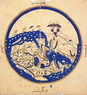
Background imageGeography Collection: Copy made in Cairo in 1456 of the world map prepared by the Arab geographer Muhammad al-Idrisi

Copy made in Cairo in 1456 of the world map prepared by the Arab geographer Muhammad al-Idrisi (1100-1165) for Roger II (1095-1154) King of Sicily from 1130. In this map, North is at the bottom

Background imageGeography Collection: Map of Scandinavia, from Carta Marina, Sea Map by Olaus Magnus, 1539

Map of Scandinavia, from Carta Marina, Sea Map by Olaus Magnus, 1539
Cartography, 16th century. Map of Scandinavia. From Carta Marina (Sea Map) by Olaus Magnus, 1539

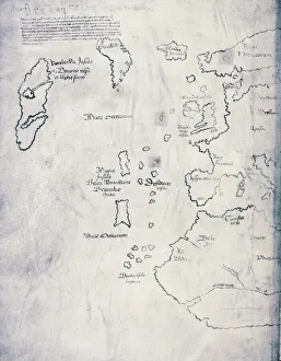
Background imageGeography Collection: Vinland Map, oldest map of Greenland and Northern America areas discovered by Norse

Vinland Map, oldest map of Greenland and Northern America areas discovered by Norse, Vikings during their explorations
Cartography, 15th century. Vinland Map (circa 1440). Oldest map of Greenland and Northern America areas discovered by Norse (Vikings) during their explorations

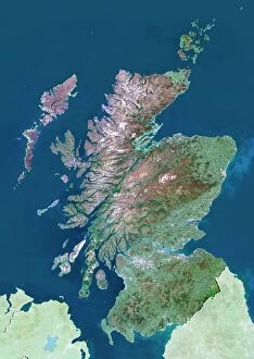
Background imageGeography Collection: Scotland, UK, satellite image

Scotland, UK, satellite image
Scotland, UK. North is at top. Natural colour satellite image showing Scotland in the United Kingdom, with the surrounding territories shaded out

Background imageGeography Collection: 17th century map of Europe

17th century map of Europe

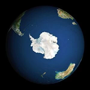
Background imageGeography Collection: Earth

Earth. Satellite image of the Earth, centred on Antarctica. The South Pole is at centre. Water is blue, vegetation is green, arid areas are brown, and snow and ice are white

Background imageGeography Collection: Soil triangle diagram

Soil triangle diagram. This diagram is used to work out the type of soil in an area. A sample of soil is left to settle in water. Larger particles settle out of suspension faster than smaller ones

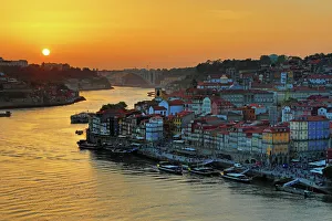
Background imageGeography Collection: The City of Porto and the River Douro at sunset, Porto, Portugal

The City of Porto and the River Douro at sunset, Porto, Portugal

Background imageGeography Collection: Arch rock formation on Perranporth Beach

Arch rock formation on Perranporth Beach
Arch rock formation Perranporth Beach in Ligger Bay with Saint Pirans Flag the standard flag of Cornwall against blue skies

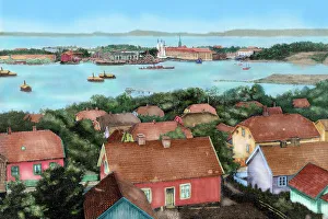
Background imageGeography Collection: Norway. Horten. 19th century

Norway. Horten. 19th century. View of the city with the port and arsenal of the state with the Spanish frigate Blanca entering in the drydock

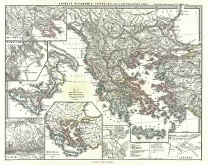
Background imageGeography Collection: 1865, Spruner Map of Greece, Macedonia and Thrace before the Peloponnesian War. topography

1865, Spruner Map of Greece, Macedonia and Thrace before the Peloponnesian War. topography
1865, Spruner Map of Greece, Macedonia and Thrace before the Peloponnesian War

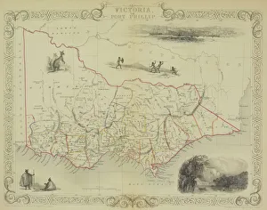
Background imageGeography Collection: Antique map of Victoria or Port Phillip in Australia with vignettes

Antique map of Victoria or Port Phillip in Australia with vignettes

Background imageGeography Collection: Antique map of Russia

Antique map of Russia

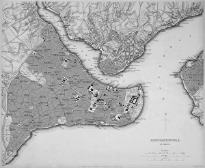
Background imageGeography Collection: Antique map of Constantinople, present day Istanbul

Antique map of Constantinople, present day Istanbul

Background imageGeography Collection: Map of Scandinavia

Map of Scandinavia

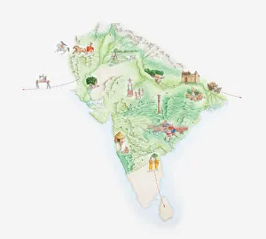
Background imageGeography Collection: Illustrated map of India showing ancient Mauryan empire

Illustrated map of India showing ancient Mauryan empire

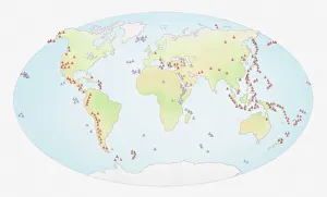
Background imageGeography Collection: Illustration of world map showing sites of volcanic activity

Illustration of world map showing sites of volcanic activity

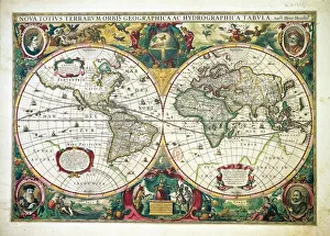
Background imageGeography Collection: Nova totius Terrarum Orbis Geographica ac hydrographica tabula, by Henricus Hondius, Amsterdam

Nova totius Terrarum Orbis Geographica ac hydrographica tabula, by Henricus Hondius, Amsterdam
Cartography, 17th century. Nova totius Terrarum Orbis Geographica ac hydrographica tabula, by Henricus Hondius, Amsterdam, 1630. Illustrated copperplate, 38 x 54 cm

Background imageGeography Collection: Map of Bangladesh

Map of Bangladesh

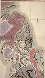
Background imageGeography Collection: First geological map of Britain, 1815 C016 / 5683

First geological map of Britain, 1815 C016 / 5683
First geological map of Britain, detail of the north east coast (figure 8). This map was published in 1815 by British geologist William Smith (1769-1839)

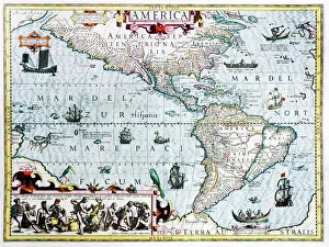
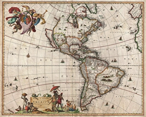
Background imageGeography Collection: 17th century map of the New World

17th century map of the New World
Western Hemisphere, 17th century Dutch map. This shows the New World that was being discovered by Europeans exploring the Western Hemisphere of the Earth

Background imageGeography Collection: Continental drift, 100 million years ago

Continental drift, 100 million years ago. Map of the Earth showing the continents some 100 million years after the start of the break-up of the ancient supercontinent of Pangea

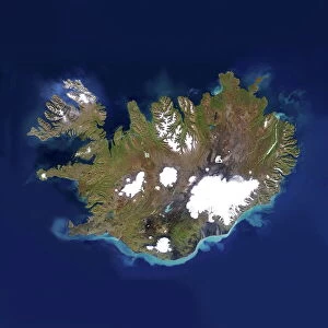
Background imageGeography Collection: Iceland

Iceland, satellite image. Located in the Atlantic Ocean, just below the Arctic Circle, Iceland is a sparsely populated country of around 300, 000 people and an area of 100, 000 square kilometres

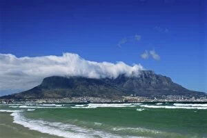
Background imageGeography Collection: Table Mountain viewed from Bloubergstrand

Table Mountain viewed from Bloubergstrand, Cape Town, South Africa

Background imageGeography Collection: Cave of Crystals, Naica Mine, Mexico

Cave of Crystals, Naica Mine, Mexico
^BCave of Crystals.^b Geologist in the Cave of Crystals (^ICueva de los Cristales^i) in Naica Mine, Chihuahua, Mexico. The crystals are the largest known in the world

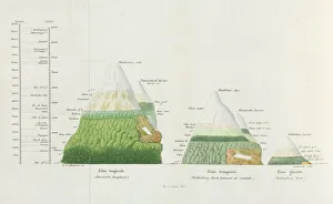
Background imageGeography Collection: Distributions of plants at various altitudes

Distributions of plants at various altitudes
Coloured engraving of Alexander Humboldt illustration. Tableaux de la Nature, 1865. Date: 1865

Background imageGeography Collection: 1658, Visscher Map of North America and South America, topography, cartography, geography

1658, Visscher Map of North America and South America, topography, cartography, geography
1658, Visscher Map of North America and South America

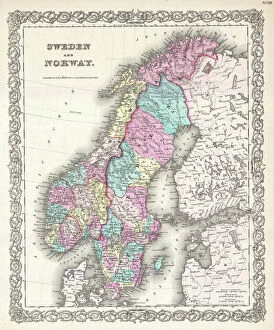
Background imageGeography Collection: 1855, Colton Map of Scandinavia, Norway, Sweden, Finland, topography, cartography

1855, Colton Map of Scandinavia, Norway, Sweden, Finland, topography, cartography
1855, Colton Map of Scandinavia, Norway, Sweden, Finland

Background imageGeography Collection: Chapel of the Kaiser Wilhelm Memorial Church, Berlin, Germany

Chapel of the Kaiser Wilhelm Memorial Church, Berlin, Germany

Background imageGeography Collection: Ocean currents off the Americas

Ocean currents off the Americas. Satellite-based graphic showing ocean currents (swirling coloured lines) on an Earth globe centred on the Americas

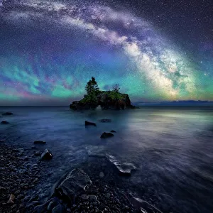
Background imageGeography Collection: Milky Way Over Hollow Rock

Milky Way Over Hollow Rock
Hollow rock is an iconic coastal formation located on the North West side of Lake Superior. Air glow creates a colorful luminescent atmosphere below the night sky and Milky Way

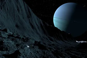
Background imageGeography Collection: A gigantic scarp on the surface of Uranus moon, Miranda

A gigantic scarp on the surface of Uranus moon, Miranda. It is the sheerest known cliff in the solar system. It may be 3 miles high

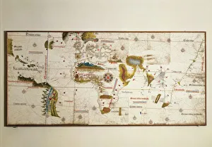
Background imageGeography Collection: Cantino planisphere by Alberto Cantino, 1502

Cantino planisphere by Alberto Cantino, 1502
Cartography, 16th century. Cantino planisphere, by Alberto Cantino, 1502

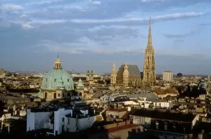
Background imageGeography Collection: Austria. Vienna. Vienna

Austria. Vienna. Vienna
AUSTRIA. VIENNA. Vienna

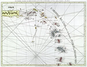
Background imageGeography Collection: CARIBBEAN: MAP, 1775. English engraved map of The Caribee Islands from Puerto Rico to Barbados by

CARIBBEAN: MAP, 1775. English engraved map of The Caribee Islands from Puerto Rico to Barbados by Thomas Jefferys, 1775

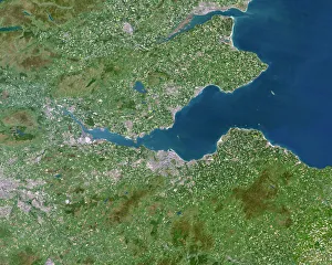
Background imageGeography Collection: Firth of Forth, UK, satellite image

Firth of Forth, UK, satellite image. The Firth of Forth is the major estuary of the River Forth in Scotland. The grey area at centre is the city of Edinburgh

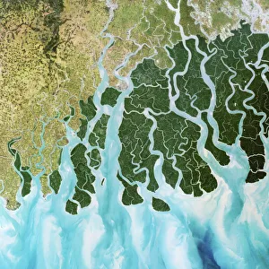
Background imageGeography Collection: Ganges River delta, India

Ganges River delta, India
Ganges delta, India, satellite image. The Ganges is a river which flows for over 2400 kilometres from the Himalayas to the Indian Oceans Bay of Bengal

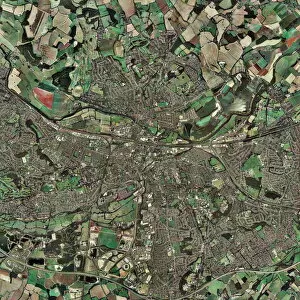
Background imageGeography Collection: Reading, UK

Reading, UK, aerial photograph

Background imageGeography Collection: Barbados, satellite image

Barbados, satellite image
Barbados. Landsat image of the island of Barbados in the Caribbean sea. North is at top. Barbados has a total land area of about 430 square kilometres

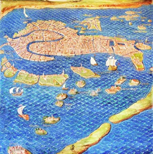
Background imageGeography Collection: 16th century map of Venice

16th century map of Venice showing the lagoon. Venice is a coastal city in the north-east of Italy. The main bulk of Venice is in the upper frame of the image

Background imageGeography Collection: Earth from space

Earth from space. Computer artwork of a gibbous Earth, seen from space

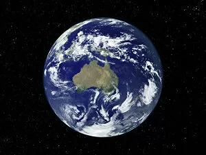
Background imageGeography Collection: Australia, satellite image

Australia, satellite image
Australia. Satellite image of the Earth, set against a background of stars, centred on the island continent of Australia. North is at top. Clouds (white) are seen in the atmosphere

Background imageGeography Collection: Australia, satellite image

Australia, satellite image. North is at top. Australia is the worlds smallest continent. It is located in the southern hemisphere, southeast of Asia
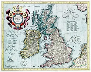
Background imageGeography Collection: 16th century map of the British Isles

16th century map of the British Isles
British Isles, 16th century Dutch map. This shows England, Scotland, Wales and Ireland, though Ireland is not yet accurately mapped. Published in 1595, from work by Gerard Mercator
Background imageGeography Collection: 16th century world map

16th century world map made by Pierre Desceliers in 1546 on a commission by King Francis I for Henri II of France. Most noticeable is that the Northern hemisphere is upside-down


All Professionally Made to Order for Quick Shipping

"Exploring the Rich Tapestry of Geography: From Ancient Maps to Modern Wonders" The Al-Idrisi's world map from 1154 takes us back in time, showcasing the early understanding and its importance in navigation. Derwent Water, with Blencathra standing tall behind it, offers a breathtaking view of nature's wonders in the Lake District, Cumbria, England. Jacopo de Barbari's Map of Venice in 1500 allows us to delve into the intricate layout of this enchanting city built on water. An antique map of Tasmania reveals how explorers once charted unknown territories and expanded our knowledge about distant lands. The V & A waterfront and Table Mountain create an awe-inspiring backdrop for Cape Town, South Africa – a testament to geography shaping stunning landscapes. Continental drift after 250 million years shows us that our planet is constantly evolving, reminding us of the dynamic forces at work beneath Earth's surface. Malham Cove stands as a geological marvel within Yorkshire Dales National Park, captivating visitors with its limestone formations carved by natural processes over millennia. Whole Earth (Blue Marble 2000) provides a mesmerizing image capturing our beautiful planet from space – highlighting both its vastness and interconnectedness through geography. The British Empire world map from the 19th century reflects an era when geographical exploration played a significant role in expanding colonial influence across continents. James Craig's Map of New Town Edinburgh from 1768 showcases meticulous topography planning that shaped one of Scotland's most iconic cities even today. Anglo-Saxon 10th-century world map gives insight into early European perceptions and interpretations regarding global geography during medieval times In summary, these diverse hints remind us that geography is not just about maps but also encompasses breathtaking landscapes, historical perspectives on human exploration and settlement, and the ever-changing nature of our planet.