Fraud Blocker Skip to main content

Geography Collection (page 5)

"Exploring the Rich Tapestry of Geography: From Ancient Maps to Modern Wonders" The Al-Idrisi's world map from 1154 takes us back in time

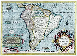
Background imageGeography Collection: 17th century map of South America

17th century map of South America
South America, 17th century Dutch map. This shows the new continent that was being discovered by European explorers. The shape is distorted because it had not yet been accurately mapped

Background imageGeography Collection: Atlas compass, 16th century

Atlas compass, 16th century
Atlas compass in a 1544 copy of the Agnese Atlas. Several copies of this atlas were produced between 1536 and 1564, in Venice, by the Italian mapmaker Battista Agnese

Background imageGeography Collection: Southeast Asia at night, satellite image

Southeast Asia at night, satellite image
Southeast Asia at night. Satellite image of the Earth seen at 18:00 (6pm) GMT (UCT), centred on China. City lights (yellow) show areas of dense population, particularly in India (left)
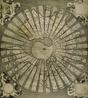
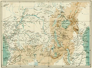
Background imageGeography Collection: EXPL2A-00366

EXPL2A-00366
Map of equatorial Africa as known in the 1870s. Printed color lithograph, 19th century

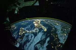
Background imageGeography Collection: Italy at night, ISS image

Italy at night, ISS image
Italy at night. International Space Station (ISS) image of Italy (centre) and the Adriatic coast (right) at night. The island of Sicily is at centre left

Background imageGeography Collection: Africa, night-day satellite image

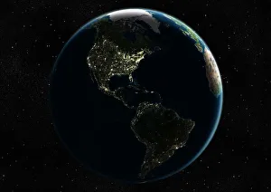
Africa, night-day satellite image. This composite image of the Earth is set against a background of stars, and is centred on the continent of Africa. North is at top

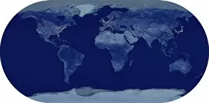
Background imageGeography Collection: Whole Earth at night, satellite image

Whole Earth at night, satellite image. This map is centred on the Greenwich meridian, at zero degrees latitude. City lights (yellow) show areas of dense population

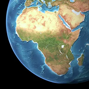
Background imageGeography Collection: Africa, topographic map

Africa, topographic map. Highlands and lowlands of the continents are shown as ridges and flat areas. Southern Europe and the Middle East are also seen at top and upper right respectively

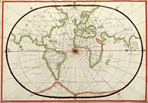
Background imageGeography Collection: Map of the world, 1590

Map of the world, 1590
16th century map of the world. Published around 1590, this map shows the known world, including the new lands being discovered by Europeans exploring across the Atlantic

Background imageGeography Collection: Silver birch (Betula pendula)

Silver birch (Betula pendula)
Silver birch trees (Betula pendula)

Background imageGeography Collection: Altocumulus undulatus clouds

Altocumulus undulatus clouds. This cloud formation consists of parallel bands of cumulus clouds. It occurs when a layer of altocumulus cloud is affected by wind shear

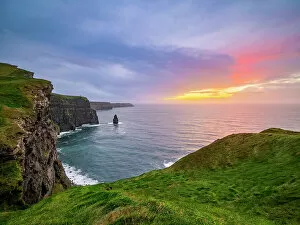
Background imageGeography Collection: Cliffs of Moher at dusk, County Clare, Ireland

Cliffs of Moher at dusk, County Clare, Ireland

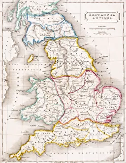
Background imageGeography Collection: Map of England Britannia Antiqua From The Atlas of Ancient Geography by Samuel Butler published

Map of England Britannia Antiqua From The Atlas of Ancient Geography by Samuel Butler published London circa 1829

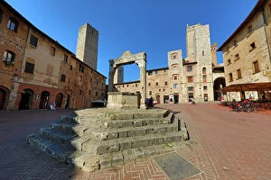
Background imageGeography Collection: Well in the Piazza Cisterna in San Gimignano, Tuscany, Italy

Well in the Piazza Cisterna in San Gimignano, Tuscany, Italy

Background imageGeography Collection: Old Guild houses in the Market Square or Markt, Bruges, Belgium

Old Guild houses in the Market Square or Markt, Bruges, Belgium
Guild houses converted into restaurants at sunset in the Market Square or Markt, Bruges, Belgium

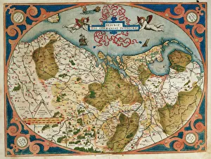
Background imageGeography Collection: Map of Germany and current Netherlands. Theatrum Orbis Terra

Map of Germany and current Netherlands. Theatrum Orbis Terrarum by Abraham Ortelius (1527-1598). First Edition. Antwerp, 1574. Library of Catalonia. Barcelona. Spain

Background imageGeography Collection: Nyanga Forest and pool - Zimbabwe

Nyanga Forest and pool - Zimbabwe

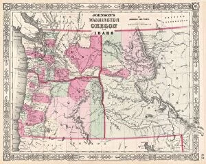
Background imageGeography Collection: 1864, Johnson Map of Washington, Oregon, and Idaho, topography, cartography, geography

1864, Johnson Map of Washington, Oregon, and Idaho, topography, cartography, geography
1864, Johnson Map of Washington, Oregon, and Idaho

Background imageGeography Collection: Antique map of Van Diemen Island off Australia with vignettes

Antique map of Van Diemen Island off Australia with vignettes

Background imageGeography Collection: Antique map of holy land including Syria and Lebanon

Antique map of holy land including Syria and Lebanon

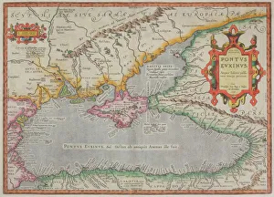
Background imageGeography Collection: Antique map of the Black Sea and surrounding lands

Antique map of the Black Sea and surrounding lands

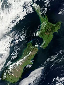
Background imageGeography Collection: Satellite view of New Zealand

Satellite view of New Zealand
October 23, 2002 - This stunning true-color image provides a rare, cloud-free look at the island nation of New Zealand, including most of its North and South Islands

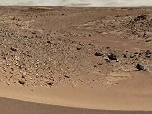
Background imageGeography Collection: Martian valley on planet Mars

Martian valley on planet Mars

Background imageGeography Collection: Myocastor Coypus. Rome. Chm Lipu Ostia Italy

Myocastor Coypus. Rome. Chm Lipu Ostia Italy

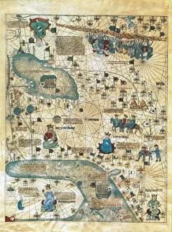
Background imageGeography Collection: Map of Cathay, China, from Catalan Atlas created for Charles V, King of France

Map of Cathay, China, from Catalan Atlas created for Charles V, King of France
Cartography, 14th century. Map of Cathay (China). From Catalan Atlas created for Charles V, King of France, attributed to Abraham and Jafuda Cresques Maiorca (circa 1375)

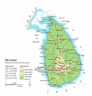
Background imageGeography Collection: Map of Sri Lanka

Map of Sri Lanka

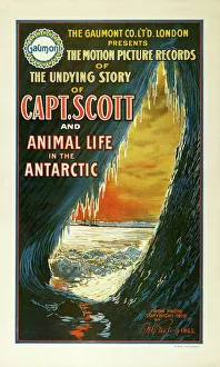
Background imageGeography Collection: Captain Scott film poster, 1913 C014 / 2073

Captain Scott film poster, 1913 C014 / 2073
Captain Scott film poster. This 1913 film told the story of the British Antarctic Expedition (1910-1913), led by Captain Robert Falcon Scott (1868-1912)

Background imageGeography Collection: Mount Etna erupting, 2012 C016 / 4639

Mount Etna erupting, 2012 C016 / 4639
Mount Etna erupting, 2012. Mount Etna is an active stratovolcano on the east coast of Sicily, Italy. Photographed on 27th April 2012

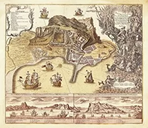
Background imageGeography Collection: Map of Gibraltar (XVIIIIth c. ). Etching

Map of Gibraltar (XVIIIIth c. ). Etching
Map of Gibraltar (XVIIIIth c.). Etching

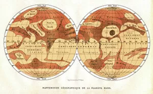
Background imageGeography Collection: Mars map from 1881

Mars map from 1881
Map of Mars, published in Paris in 1881. The first accurate telescope observations of Mars were made in 1877 and 1881 when Mars was at its closest to Earth (a situation called an opposition)

Background imageGeography Collection: Invention of the compass, Ancient China

Invention of the compass, Ancient China
Invention of the compass in Ancient China. These early compasses consisted of a magnetised needle floating in a bowl of water

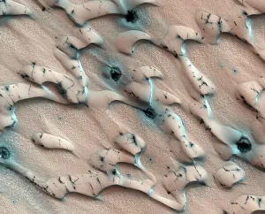
Background imageGeography Collection: Martian sand dunes, satellite image

Martian sand dunes, satellite image
Martian sand dunes. Coloured satellite image of north polar sand dunes blown into crescent shapes by the wind. The dunes are covered by carbon dioxide frost except dark-coloured patches where

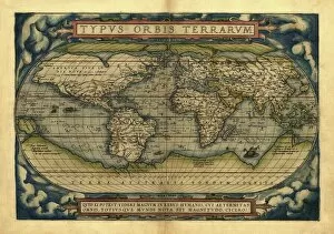
Background imageGeography Collection: Orteliuss world map, 1570

Orteliuss world map, 1570
Orteliuss world map. This world map is from the 1570 first edition of Theatrum orbis terrarum ( Theatre of the World ). Drawn by the Flemish mapmaker Abraham Ortelius (1527-1598)

Background imageGeography Collection: World map, February 2004

World map, February 2004
World Map. Blue Marble: Next Generation cloud-free true-colour composite image of the Earth in February 2004. It is winter in the Northern Hemisphere and large areas of land are covered in snow

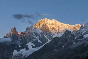
Background imageGeography Collection: The Mont Blanc at sunrise from the Alp Lechey, Ferret Valley (Courmayeur, Aosta province)

The Mont Blanc at sunrise from the Alp Lechey, Ferret Valley (Courmayeur, Aosta province)
The Mont Blanc at sunrise from the Alp Lechey, Ferret Valley (Courmayeur, Aosta province, Aosta Valley, Italy)

Background imageGeography Collection: Historic ancient archeological Incan Machu Picchu on mountain in Andes, Cuzco Region

Historic ancient archeological Incan Machu Picchu on mountain in Andes, Cuzco Region, Peru

Background imageGeography Collection: Map Of Germany, Bohemia And Hungary, Circa. 1760. From 'Atlas De Toutes Les Parties Connues Du

Map Of Germany, Bohemia And Hungary, Circa. 1760. From "Atlas De Toutes Les Parties Connues Du Globe Terrestre
Map Of Germany, Bohemia And Hungary, Circa.1760. From " Atlas De Toutes Les Parties Connues Du Globe Terrestre " By Cartographer Rigobert Bonne. Published Geneva Circa. 1760

Background imageGeography Collection: World map by Claudius Ptolemy (90-168). Engraving, 16th cent

World map by Claudius Ptolemy (90-168). Engraving, 16th cent
Claudius Ptolemy (90-168) Greco-Egyptian geographer. World map. Engraving, 16th century

Background imageGeography Collection: The Golden Bend in the Herengracht, Amsterdam, Seen from the

The Golden Bend in the Herengracht, Amsterdam, Seen from the
Gerrit Adriaensz Berckheyde (1638-1698). Dutch painter. The Golden Bend in the Herengracht, Amsterdam, Seen from the East, 1671-1672. Rijksmuseum. Amsterdam. Holland

Background imageGeography Collection: Italy. Lucca. Panorama

Italy. Lucca. Panorama of the old town with the Basilica of San Frediano, 12th century, from the Guinigi Tower

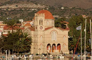
Background imageGeography Collection: Church of Agios Nikolaos. Aegina. Greece

Church of Agios Nikolaos. Aegina. Greece
Greece. Aegina. Church of Agios Nikolaos. Exterior. Aegina Island

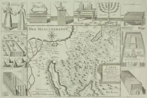
Background imageGeography Collection: Antique map of Israel with vignettes

Antique map of Israel with vignettes

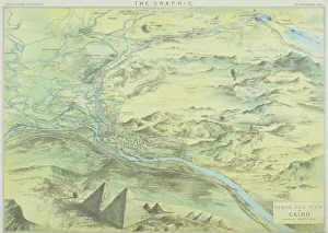
Background imageGeography Collection: Antique engraving depicting birds eye view of Cairo

Antique engraving depicting birds eye view of Cairo

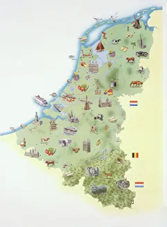
Background imageGeography Collection: Netherlands, map showing distinguishing features and landmarks

Netherlands, map showing distinguishing features and landmarks

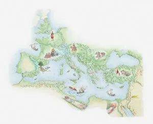
Background imageGeography Collection: Illustrated map of Roman Empire, BC

Illustrated map of Roman Empire, BC

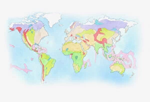
Background imageGeography Collection: Illustration of Biomes (climatic variation) on world map

Illustration of Biomes (climatic variation) on world map

Background imageGeography Collection: One of the planets orbiting 70 Virginis is a super-Jupiter

One of the planets orbiting 70 Virginis is a super-Jupiter, so close to the star that it is heated to a red heat

Background imageGeography Collection: Ice spires on Jupiters large moon, Callisto

Ice spires on Jupiters large moon, Callisto
The ice spires of Jupiters moon Callisto were created when softer ice evaporated, leaving behind the harder cores


All Professionally Made to Order for Quick Shipping

"Exploring the Rich Tapestry of Geography: From Ancient Maps to Modern Wonders" The Al-Idrisi's world map from 1154 takes us back in time, showcasing the early understanding and its importance in navigation. Derwent Water, with Blencathra standing tall behind it, offers a breathtaking view of nature's wonders in the Lake District, Cumbria, England. Jacopo de Barbari's Map of Venice in 1500 allows us to delve into the intricate layout of this enchanting city built on water. An antique map of Tasmania reveals how explorers once charted unknown territories and expanded our knowledge about distant lands. The V & A waterfront and Table Mountain create an awe-inspiring backdrop for Cape Town, South Africa – a testament to geography shaping stunning landscapes. Continental drift after 250 million years shows us that our planet is constantly evolving, reminding us of the dynamic forces at work beneath Earth's surface. Malham Cove stands as a geological marvel within Yorkshire Dales National Park, captivating visitors with its limestone formations carved by natural processes over millennia. Whole Earth (Blue Marble 2000) provides a mesmerizing image capturing our beautiful planet from space – highlighting both its vastness and interconnectedness through geography. The British Empire world map from the 19th century reflects an era when geographical exploration played a significant role in expanding colonial influence across continents. James Craig's Map of New Town Edinburgh from 1768 showcases meticulous topography planning that shaped one of Scotland's most iconic cities even today. Anglo-Saxon 10th-century world map gives insight into early European perceptions and interpretations regarding global geography during medieval times In summary, these diverse hints remind us that geography is not just about maps but also encompasses breathtaking landscapes, historical perspectives on human exploration and settlement, and the ever-changing nature of our planet.