Home > Europe > Finland > Maps
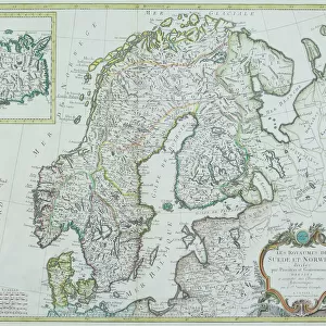
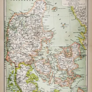
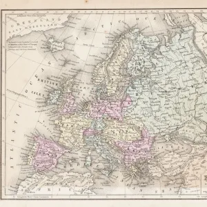
Map of the northern kingdoms (Denmark, Sweden, Norway and Finland) (etching, 1730)
 (etching, 1730)")
![]()
Wall Art and Photo Gifts from Fine Art Finder
Map of the northern kingdoms (Denmark, Sweden, Norway and Finland) (etching, 1730)
LRI4706355 Map of the northern kingdoms (Denmark, Sweden, Norway and Finland) (etching, 1730) by Delisle, Guillaume (1675-1726); Private Collection; (add.info.: Map of the northern kingdoms, Kingdom of Denmark, Sweden, Norway and Finland - Strong water extracted from the " New Atlas containing all parts of the world" 1730 by Guillaume de L Isle (1675-1726)); Luisa Ricciarini; French, out of copyright
Media ID 23328054
© Luisa Ricciarini / Bridgeman Images
Atlas Book Danish Danish Women Denmark Finland Finnish Geographical Map Nordic Countries Norvege Norwegian Suede Swedish
FEATURES IN THESE COLLECTIONS
> Arts
> Artists
> Related Images
> Fine Art Finder
> Artists
> Frederic Theodore Lix
> Fine Art Finder
> Artists
> Guillaume Delisle
> Maps and Charts
> World
EDITORS COMMENTS
This etching from 1730 showcases a detailed map of the northern kingdoms, namely Denmark, Sweden, Norway, and Finland. Created by the talented cartographer Guillaume de L'Isle (1675-1726), this print is a testament to his expertise in geographical mapping. The map was extracted from his renowned work "New Atlas containing all parts of the world" which solidifies its significance. The intricate details on this etching allow viewers to explore the diverse landscapes and borders of these Nordic countries. From the fjords of Norway to the archipelagos surrounding Sweden and Finland, every feature is meticulously depicted. This historical artifact provides an invaluable glimpse into Europe's past. Preserved within a private collection, this piece has been beautifully captured by photographer Luisa Ricciarini. Her lens captures not only the artistry but also highlights its cultural importance for generations to come. As we delve into this image, let us appreciate how it transports us back in time to an era when maps were hand-drawn with precision and care. It serves as a reminder that geography plays an integral role in shaping our understanding of history and culture. This photograph invites us to marvel at both artistic mastery and historical significance while reminding us that knowledge knows no boundaries or limitations - just like these magnificent northern kingdoms themselves.
MADE IN THE UK
Safe Shipping with 30 Day Money Back Guarantee
FREE PERSONALISATION*
We are proud to offer a range of customisation features including Personalised Captions, Color Filters and Picture Zoom Tools
SECURE PAYMENTS
We happily accept a wide range of payment options so you can pay for the things you need in the way that is most convenient for you
* Options may vary by product and licensing agreement. Zoomed Pictures can be adjusted in the Basket.