
Maps Collection
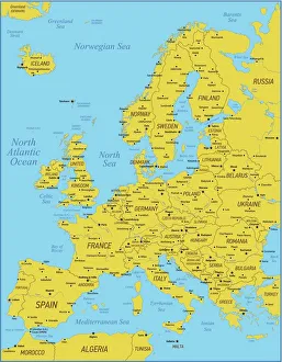
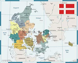
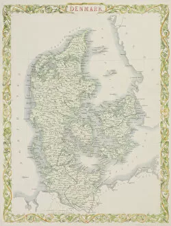
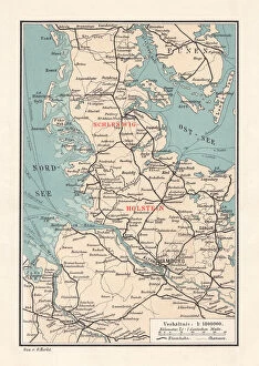
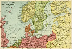
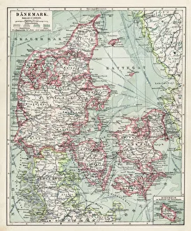
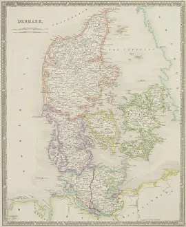
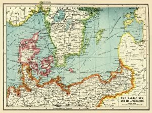
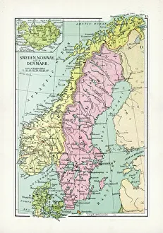
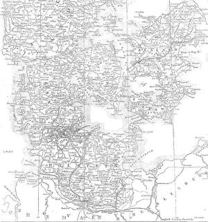
Denmark is a country located in northern Europe, bordered by the North Sea and the Baltic Sea
Choose a picture from our Maps Collection for your Wall Art and Photo Gifts
482 items


All Professionally Made to Order for Quick Shipping
-
Maps Collection
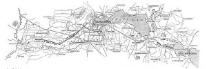
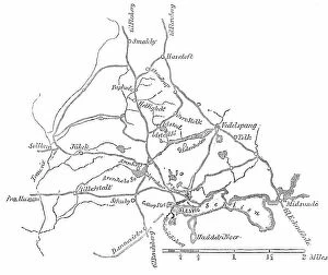
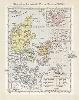
Denmark is a country located in northern Europe, bordered by the North Sea and the Baltic Sea, and is part of Scandinavia and consists of the Jutland peninsula, several islands, and an archipelago. Denmark has a rich history dating back to prehistoric times, with evidence of human habitation as far back as 12000 BC. Maps of Denmark are essential for understanding its geography and culture. They show its many cities, towns, villages, rivers, lakes and mountains; its political divisions; its transportation networks; and other features such as parks or protected areas. It also provide insight into the country's cultural heritage through depictions of historical sites or monuments. With such detailed maps available online or in print form it is easy to explore all that Denmark has to offer.
+
Our beautiful pictures are available as Framed Prints, Photos, Wall Art and Photo Gifts
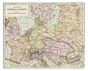
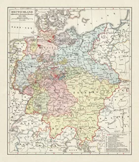
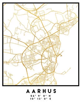
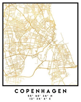
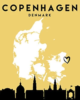
Media Storehouse offers a stunning collection of Maps of Denmark Europe wall art and framed prints that capture the beauty and history of this Scandinavian country. Our collection features an array of maps, including antique maps from the 17th century to modern-day cartography, showcasing the evolution of Denmark's geography over time. These high-quality prints are perfect for adding a touch of sophistication to any room in your home or office. The Maps of Denmark Europe collection includes detailed depictions of major cities such as Copenhagen, Aarhus, and Odense, as well as famous landmarks like Kronborg Castle and Tivoli Gardens. Each print is carefully crafted using premium materials to ensure long-lasting durability and vibrant colors. Whether you're a fan of Danish culture or simply appreciate beautiful artwork, our Maps of Denmark Europe collection is sure to impress. With its wide selection and exceptional quality, it's no wonder why these prints have become so popular among art enthusiasts around the world.
+
What are Maps of Denmark Europe art prints?
Maps of Denmark Europe art prints are high-quality reproductions of vintage and modern maps that showcase the geography, topography, and landmarks of Denmark. These prints are perfect for those who love to travel or have an interest in cartography. They can be used as educational tools or decorative pieces in homes, offices, or classrooms. The Maps of Denmark Europe art prints available at Media Storehouse feature a range of styles and designs. Some highlight the major cities and regions within Denmark while others focus on specific aspects such as transportation routes or historical landmarks. The prints come in various sizes to suit different needs and preferences. Media Storehouse takes pride in offering only the best quality products to its customers. All Maps of Denmark Europe art prints are printed using state-of-the-art technology on premium paper stock to ensure vibrant colors and sharp details that will last for years to come.
+
What Maps of Denmark Europe art prints can I buy from Media Storehouse?
We offer a wide range of Maps of Denmark Europe art prints for purchase. These maps are available in various sizes and styles, including vintage and modern designs. You can choose from detailed street maps, topographic maps, political maps, and more. The Maps of Denmark Europe art prints offered by Media Storehouse are perfect for those who want to decorate their homes or offices with unique and interesting pieces. They also make great gifts for friends or family members who have an interest in geography or history. Whether you're looking for a map that shows the major cities and landmarks of Denmark or one that highlights the country's natural features like rivers and mountains, we have something to suit your needs. The high-quality printing ensures that each map is crisp and clear, making it easy to read even the smallest details. If you're looking for beautiful Maps of Denmark Europe art prints to add to your collection or give as a gift, we have plenty of options available.
+
How do I buy Maps of Denmark Europe art prints?
To buy Maps of Denmark Europe art prints from Media Storehouse, you can browse our extensive collection of maps and select the one that catches your eye. Once you have found the map print you want to purchase, simply add it to your cart and proceed to checkout. You will be prompted to enter your shipping information and payment details before finalizing the order. We offer a variety of sizes for their art prints, so make sure to choose the size that best fits your needs. We also offer different framing options if you prefer a framed print. Maps of Denmark Europe are perfect for anyone who loves geography or wants to decorate their home or office with unique artwork. These prints are high-quality reproductions of vintage maps, making them both beautiful and informative. Buying Maps of Denmark Europe art prints from Media Storehouse is easy and straightforward - just find the map you like, add it to your cart, and complete the checkout process.
+
How much do Maps of Denmark Europe art prints cost?
We offer a wide range of Maps of Denmark Europe art prints at varying prices. Our collection includes high-quality prints that are perfect for decorating your home or office space with beautiful and detailed maps of Denmark and Europe. The cost of these prints depends on various factors such as the size, quality, and type of print you choose. We have a variety of options available to suit different budgets and preferences. Whether you're looking for a small poster or a large canvas print, we have something for everyone. Our Maps of Denmark Europe art prints are created using state-of-the-art printing technology to ensure that they look stunning and last for years to come. If you're interested in purchasing one of our Maps of Denmark Europe art prints, please visit our website to browse our collection today.
+
How will my Maps of Denmark Europe art prints be delivered to me?
Your Maps of Denmark Europe art prints will be delivered to you in a safe and secure manner. We take great care in packaging your artwork so that it arrives at your doorstep undamaged. Our standard delivery method is through trusted courier services, who will ensure that your package is handled with care during transit. We offer various sizes for our Maps of Denmark Europe art prints, and they are printed on high-quality paper using state-of-the-art printing technology. You can expect vibrant colors and sharp details that capture the beauty of this European country. Once your order has been processed, we will send you a confirmation email with tracking information so that you can monitor the progress of your shipment. If you have any questions or concerns about the delivery process, please do not hesitate to contact us – we are always happy to help.