
Maps Collection
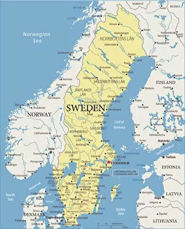
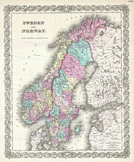
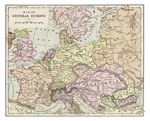
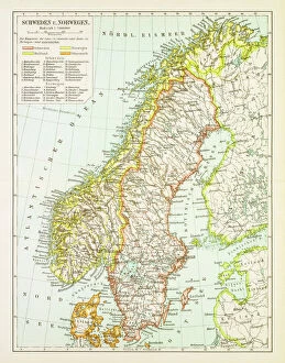
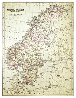
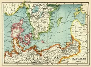
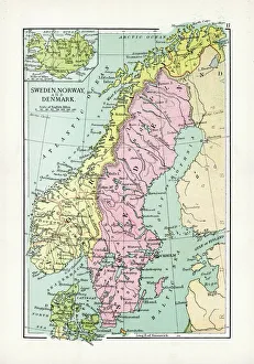
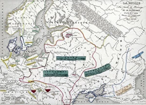
Sweden is a country located in Northern Europe, bordered by Norway and Finland, and is the largest of the Nordic countries
Choose a picture from our Maps Collection for your Wall Art and Photo Gifts
424 items


All Professionally Made to Order for Quick Shipping
-
Maps Collection
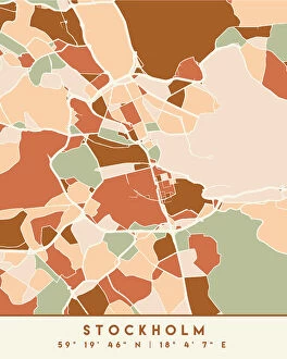
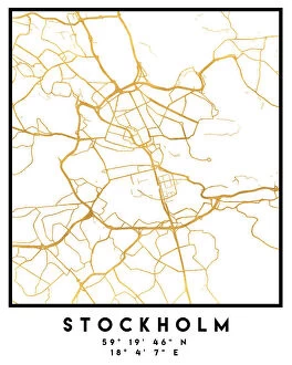
Sweden is a country located in Northern Europe, bordered by Norway and Finland, and is the largest of the Nordic countries, with an area of 449,964 square kilometres. Sweden has a long history and rich cultural heritage, with many ancient sites to explore. Maps of Sweden provide an excellent way to discover this beautiful country. They show its geographical features such as mountains, rivers, lakes and forests; its major cities; and its political boundaries. It also highlight important landmarks such as castles and churches that are part of Sweden's history. With maps of Sweden you can plan your journey through this fascinating land or simply admire its beauty from afar.
+
Our beautiful pictures are available as Framed Prints, Photos, Wall Art and Photo Gifts
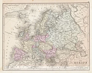
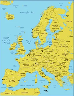
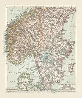
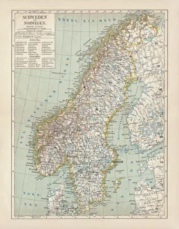
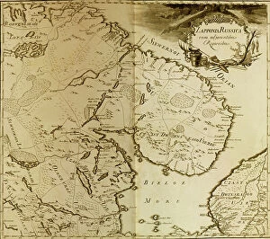
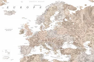
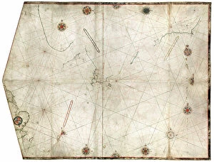
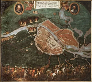
The Maps of Sweden Europe collection, available on Media Storehouse, is a stunning assortment of wall art and framed prints that showcases the beauty and intricacy of Swedish cartography. Our collection features a range of maps dating back to the 16th century, including antique maps from renowned cartographers such as Abraham Ortelius and Gerard Mercator. These maps offer a fascinating glimpse into the history and evolution of Sweden's geography over time. In addition to historical maps, our collection also includes contemporary designs featuring modern-day landmarks and attractions in cities like Stockholm and Gothenburg. Each print is expertly crafted using high-quality materials to ensure durability and longevity. Whether you're an avid collector or simply looking for a unique piece of wall art to add character to your home or office space, the Maps of Sweden Europe collection offers something for everyone. With its rich history, intricate details, and striking visuals, our collection is sure to impress anyone with an appreciation for fine artistry.
+
What are Maps of Sweden Europe art prints?
Maps of Sweden Europe art prints are high-quality reproductions of antique and contemporary maps that depict the geography, topography, and political boundaries of Sweden and other European countries. These prints are created using advanced printing techniques to ensure that every detail is captured accurately, from the intricate lines and symbols on the map to the colors used to represent different regions. These art prints offer a unique way for people to explore and appreciate the rich history and culture of Sweden and Europe. They can be used as decorative pieces in homes or offices, or as educational tools in classrooms or libraries. Whether you're interested in tracing your family's roots back to their Swedish homeland or simply want to learn more about this fascinating country, Maps of Sweden Europe art prints provide an engaging visual representation that will enhance your understanding and appreciation of these places.
+
What Maps of Sweden Europe art prints can I buy from Media Storehouse?
We offer a wide range of Maps of Sweden Europe art prints that are perfect for anyone who loves geography, history or travel. These prints showcase the beauty and diversity of Sweden's landscapes, cities and regions, as well as its rich cultural heritage. Some of the most popular Maps of Sweden Europe art prints available at Media Storehouse include vintage maps from different eras, detailed topographic maps that show the country's terrain and natural features, political maps that highlight its administrative divisions and major cities, and artistic interpretations that capture its unique character. Whether you're looking for a decorative piece to hang in your home or office or a gift for someone special who shares your passion for cartography, we have something to suit every taste and budget. With high-quality printing techniques and materials used in all their products, you can be sure that these Maps of Sweden Europe art prints will look stunning wherever they are displayed.
+
How do I buy Maps of Sweden Europe art prints?
To buy Maps of Sweden Europe art prints from Media Storehouse, you can browse our online collection and select the print that best suits your needs. The website offers a wide range of options to choose from, including different sizes and framing options. Once you have made your selection, simply add it to your cart and proceed to checkout. At checkout, you will be prompted to enter your shipping information and payment details. We accept various forms of payment, including credit cards and PayPal. Once your order has been processed, the print will be carefully packaged and shipped directly to your doorstep. It's important to note that while these prints are perfect for personal use or as gifts for friends and family members who love maps or geography-related artwork, they should not be used for commercial purposes without permission from the copyright holder.
+
How much do Maps of Sweden Europe art prints cost?
We offer a wide range of Maps of Sweden Europe art prints at varying prices. Our collection includes vintage and modern maps that showcase the beauty and history of Sweden and Europe. The cost of our Maps of Sweden Europe art prints depends on several factors such as size, framing options, and printing materials. We have different sizes available to suit your preferences ranging from small to large formats. Our high-quality paper prints are affordable while our premium canvas prints are more expensive due to their durability and longevity. We also offer a variety of framing options which can add to the overall cost but enhance the aesthetic appeal of your chosen print. You can find Maps of Sweden Europe art prints that fit within any budget at Media Storehouse without compromising on quality or style.
+
How will my Maps of Sweden Europe art prints be delivered to me?
Your Maps of Sweden Europe art prints will be delivered to you with utmost care and attention. We use high-quality packaging materials to ensure that your prints arrive in pristine condition. Our team takes great pride in delivering your order promptly, so you can expect a timely delivery once your order is processed. We work with reliable shipping partners who are committed to providing excellent service. You can track the progress of your shipment using the tracking number provided upon dispatch. We understand how important it is for our customers to receive their orders on time and in perfect condition. That's why we take every step necessary to ensure that your Maps of Sweden Europe art prints are delivered safely and securely. Whether you're ordering for personal or commercial use, rest assured that we'll handle your order with professionalism and efficiency from start to finish.