
Denmark Collection
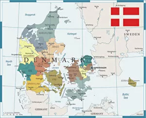
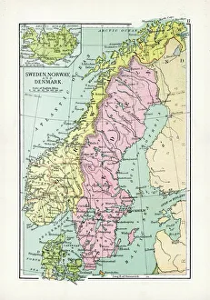
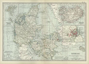
Denmark is a Nordic country located in Northern Europe and has a population of approximately 5.8 million people and covers an area of 42,924 square kilometers
Choose a picture from our Denmark Collection for your Wall Art and Photo Gifts
496 items


All Professionally Made to Order for Quick Shipping
-
Denmark Collection
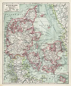
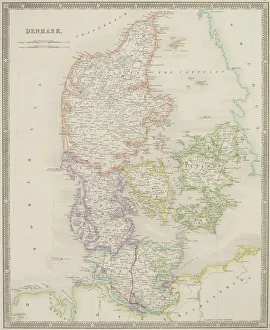
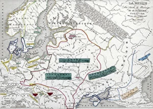
Denmark is a Nordic country located in Northern Europe and has a population of approximately 5.8 million people and covers an area of 42,924 square kilometers. The country is known for its high standard of living, social welfare system, and strong economy. Denmark's capital city is Copenhagen, which is also the largest city in the country with a population of over 600,000 people. A constitutional monarchy system with Queen Margrethe II as the current monarch. The official language spoken is Danish and the currency used is the Danish krone (DKK). A diverse landscape that includes beaches, forests, lakes, and islands scattered throughout the surrounding seas.
+
Our beautiful pictures are available as Framed Prints, Photos, Wall Art and Photo Gifts
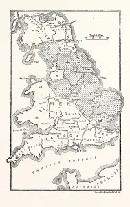
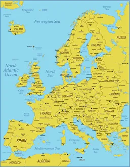
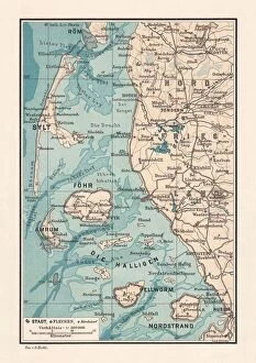
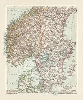
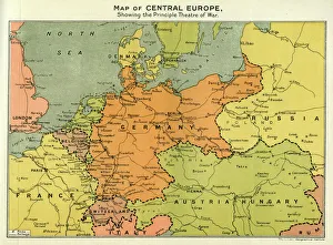
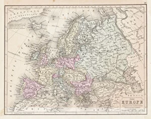
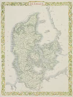
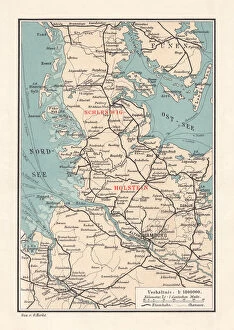
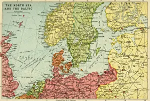
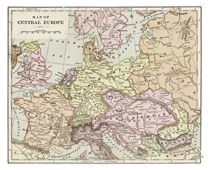
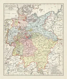
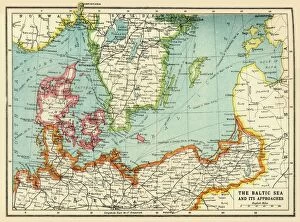
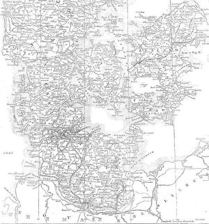
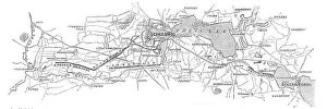
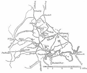
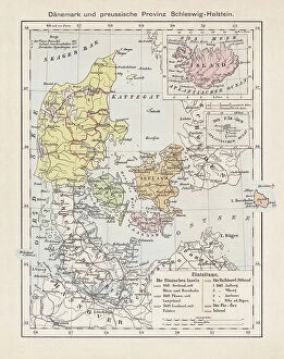
The Denmark collection from Media Storehouse offers a stunning selection of wall art and framed prints that showcase the beauty and history of Denmark. Our collection features a wide range of maps and charts that depict the country's geography, landmarks, cities, regions, and historical events. These high-quality prints are perfect for anyone who loves Danish culture or wants to add some unique décor to their home or office. From vintage maps dating back centuries to modern designs with vibrant colors, there is something for everyone in this collection. Each print is carefully crafted using premium materials such as archival paper and fade-resistant ink to ensure long-lasting quality. Whether you're looking for a striking centerpiece or an accent piece to complement your existing décor, these prints are sure to impress. The Denmark collection from Media Storehouse is an excellent choice for anyone who appreciates beautiful artwork that celebrates the rich history of this fascinating country.
+
What are Denmark (Maps and Charts) art prints?
Denmark art prints are a collection of high-quality, visually stunning prints that showcase the beauty and intricacies of Denmark's geography. These prints feature detailed maps and charts that highlight the country's topography, waterways, cities, towns, and landmarks. They are perfect for anyone who loves to travel or has an interest in geography. These art prints are created using state-of-the-art printing technology to ensure that they capture every detail of the original map or chart. The result is a beautiful piece of artwork that can be displayed in any home or office. Whether you're looking for a unique gift for someone special or want to add some visual interest to your own space, Denmark art prints are an excellent choice. With their intricate details and vibrant colors, these prints will transport you straight to Denmark without ever leaving your home.
+
What Denmark (Maps and Charts) art prints can I buy from Media Storehouse?
We offer a wide range of Denmark art prints, including maps and charts. These prints showcase the beauty and history of Denmark in stunning detail, making them perfect for anyone who loves this fascinating country. Whether you're looking for vintage maps or contemporary designs, we have something to suit every taste. Some of the most popular Denmark art prints available from Media Storehouse include detailed city maps that highlight all the major landmarks and attractions. You can also find beautiful coastal charts that show off the country's stunning coastline and islands. In addition to these traditional map-based designs, Media Storehouse also offers a range of artistic interpretations of Denmark. From abstract paintings to photographic collages, these unique prints capture the essence of this vibrant nation in a truly original way. So if you're looking for high-quality Denmark art prints that will add style and sophistication to your home or office, look no further than Media Storehouse.
+
How do I buy Denmark (Maps and Charts) art prints?
To purchase Denmark art prints from Media Storehouse, you can browse our extensive collection of high-quality images online. Once you have found the print that you would like to purchase, simply add it to your cart and proceed to checkout. You will be prompted to enter your shipping and payment information before completing your order. We offer a range of sizes for their art prints, so be sure to select the size that best fits your needs. We also offer framing options if you prefer a ready-to-hang piece. Their Denmark art prints are perfect for adding a touch of history or geography to any room in your home or office. Whether you are looking for a vintage map or a modern chart, we have something for everyone's taste. With our easy ordering process and fast shipping times, purchasing artwork has never been easier.
+
How much do Denmark (Maps and Charts) art prints cost?
We offer a wide range of Denmark maps and charts art prints. Our collection includes various styles and sizes to suit your preferences. The cost of our Denmark maps and charts art prints varies depending on the size, style, and material you choose. We have options ranging from small posters to large canvas prints that can fit any budget. Our Denmark maps and charts art prints are perfect for adding a touch of elegance to any room in your home or office. They make great gifts for anyone who loves history, geography or travel. You can browse our selection online at Media Storehouse without worrying about shipping costs or delivery times as we provide fast shipping services worldwide. Whether you're looking for a vintage map of Copenhagen or an antique chart of the North Sea, we've got you covered with high-quality Denmark maps and charts art prints that will last for years to come.
+
How will my Denmark (Maps and Charts) art prints be delivered to me?
Your Denmark art prints will be delivered to you in a safe and secure manner. We take great care in packaging your artwork so that it arrives at your doorstep undamaged. We use high-quality materials such as sturdy cardboard tubes or flat packaging to ensure that your prints are protected during transit. Once your order has been processed, our team will carefully package your artwork and dispatch it for delivery. Depending on the size of the print, we may use different courier services to deliver your order. However, rest assured that all our couriers are reliable and experienced in handling delicate items like art prints. When you receive your Denmark art prints, please inspect them carefully to ensure they have arrived in perfect condition. If there are any issues with the delivery or quality of the product, please do not hesitate to contact us so we can assist you further.