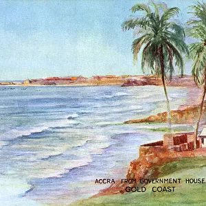
Home > Africa > Ghana > Accra
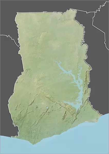
Poster Print : Ghana, Relief Map With Border and Mask


![]()
Poster Prints from Universal Images Group (UIG)
Ghana, Relief Map With Border and Mask
Relief map of Ghana (with border and mask). This image was compiled from data acquired by landsat 5 & 7 satellites combined with elevation data
Universal Images Group (UIG) manages distribution for many leading specialist agencies worldwide
Media ID 9613157
© Planet Observer/UIG
Africa Coastline Ghana Relief Map Shore Accra Satellite View
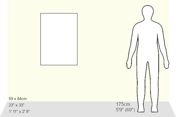
A1 (84.1 x 59.4cm) Poster Print
Discover the beauty and complexity of Ghana with our stunning Relief Map Print from Media Storehouse, featuring an intricately detailed representation of the West African country's borders and topography. Compiled from satellite data acquired by Landsat 5 and 7, this high-resolution map also includes an iconic Ghanaian mask design for an authentic and culturally rich touch. Bring a piece of the world into your home or office with this captivating and educational poster print.
A1 Poster (84.1 x 59.4cm, 33.1" x 23.4" inches) printed on 170gsm Satin Poster Paper. Securely packaged, rolled and inserted into a strong mailing tube and shipped tracked. Poster Prints are of comparable archival quality to our Photographic prints, they are simply printed on thinner Poster Paper. Whilst we only use Photographic Prints in our frames, you can frame Poster Prints if they are carefully supported to prevent sagging over time.
Poster prints are budget friendly enlarged prints in standard poster paper sizes (A0, A1, A2, A3 etc). Whilst poster paper is sometimes thinner and less durable than our other paper types, they are still ok for framing and should last many years. Our Archival Quality Photo Prints and Fine Art Paper Prints are printed on higher quality paper and the choice of which largely depends on your budget.
Estimated Product Size is 59.4cm x 84.1cm (23.4" x 33.1")
These are individually made so all sizes are approximate
Artwork printed orientated as per the preview above, with portrait (vertical) orientation to match the source image.
FEATURES IN THESE COLLECTIONS
> Africa
> Ghana
> Lakes
> Related Images
> Africa
> Ghana
> Related Images
> Africa
> Liberia
> Related Images
> Universal Images Group (UIG)
> Universal Images Group
> Satellite and Aerial
> Planet Observer 4
EDITORS COMMENTS
This print showcases the stunning relief map of Ghana, adorned with a border and mask. The intricate details of this image were meticulously compiled from data acquired by Landsat 5 & 7 satellites, combined with elevation data. As we gaze upon this masterpiece, we are transported to the enchanting shores of Ghana. The vibrant colors and vertical perspective in this photograph beautifully capture the physical geography of Ghana's diverse landscape. From the bustling cityscape of Accra to the serene Lake Volta, every element is brought to life through cartography and satellite view technology. The absence of people in this image allows us to fully appreciate the natural beauty that lies within Ghana's coastline along the Gulf of Liberia. The contours and textures depicted on this relief map provide a sense of depth and dimensionality, making it an ideal piece for those fascinated by topography or photography enthusiasts seeking unique subjects. As we admire this remarkable artwork, let us not forget its origin as part of Universal Images Group (UIG). This particular print should not be used for commercial purposes but rather cherished as a visual representation celebrating Ghana's rich cultural heritage and geographical wonders.
MADE IN THE UK
Safe Shipping with 30 Day Money Back Guarantee
FREE PERSONALISATION*
We are proud to offer a range of customisation features including Personalised Captions, Color Filters and Picture Zoom Tools
SECURE PAYMENTS
We happily accept a wide range of payment options so you can pay for the things you need in the way that is most convenient for you
* Options may vary by product and licensing agreement. Zoomed Pictures can be adjusted in the Basket.