Fraud Blocker Skip to main content

Home > Universal Images Group (UIG) > Art > Painting, Sculpture & Prints > Cartography

Cartography Collection (page 7)

953 items

We are proud to offer this selection in partnership with Universal Images Group (UIG)

Background imageCartography Collection: The course of Rhone river from the spring to the sea, Map by Giacomo Cantelli, Rome, 1690

The course of Rhone river from the spring to the sea, Map by Giacomo Cantelli, Rome, 1690
Cartography, France, 17th century. The course of Rhone river from the spring to the sea. Map by Giacomo Cantelli, Rome, 1690

Background imageCartography Collection: Map of Mombasa, Kenya, from Civitates Orbis Terrarum by Georg Braun and Franz Hogenberg, engraving

Map of Mombasa, Kenya, from Civitates Orbis Terrarum by Georg Braun and Franz Hogenberg, engraving
Cartography, Africa, 16th century. Map of Mombasa. From Civitates Orbis Terrarum by Georg Braun (1541-1622) and Franz Hogenberg (1540-1590), Cologne. Engraving

Background imageCartography Collection: San Felipe Bay in Portobel from Map of Panama, 1744

San Felipe Bay in Portobel from Map of Panama, 1744
Cartography, 17th century. Map of Panama, 1744. Detail: San Felipe Bay in Portobelo

Background imageCartography Collection: Grodno from Civitates Orbis Terrarum by Georg Braun, 1541-1622 and Franz Hogenberg, 1540-1590

Grodno from Civitates Orbis Terrarum by Georg Braun, 1541-1622 and Franz Hogenberg, 1540-1590, engraving
Cartography, Russia, 16th century. Grodno. From Civitates Orbis Terrarum by Georg Braun (1541-1622) and Franz Hogenberg (1540-1590), Cologne. Engraving

Background imageCartography Collection: Map of Tartary, Northern-Central Asia

Map of Tartary, Northern-Central Asia
Cartography, Asia, 17th century. Map of Tartary (Northern-Central Asia)

Background imageCartography Collection: Italy, Andria (Bari) and its nearby churches and monasteries by Giovan Battista Pacichelli from Il

Italy, Andria (Bari) and its nearby churches and monasteries by Giovan Battista Pacichelli from Il Regno di Napoli in
Cartography, Italy, 18th century. The city of Andria (Bari) and its nearby churches and monasteries. Engraving from Il Regno di Napoli in prospettiva (The Kingdom of Naples in Perspective)

Background imageCartography Collection: Map of Barcelona and Ecija from Civitates Orbis Terrarum by Georg Braun

Map of Barcelona and Ecija from Civitates Orbis Terrarum by Georg Braun, 1541-1622 and Franz Hogenberg, 1540-1590
Cartography, Spain, 16th century. Map of Barcelona and Ecija. From Civitates Orbis Terrarum by Georg Braun (1541-1622) and Franz Hogenberg (1540-1590), Cologne. Engraving

Background imageCartography Collection: Map of Austria, from Theatrum Orbis Terrarum by Abraham Ortelius, 1528-1598, Antwerp, 1570

Map of Austria, from Theatrum Orbis Terrarum by Abraham Ortelius, 1528-1598, Antwerp, 1570
Cartography, 16th century. Map of Austria, from Theatrum Orbis Terrarum by Abraham Ortelius (1528-1598), Antwerp, 1570

Background imageCartography Collection: Map of Greater New York, USA, color lithography by Charles Hart, 1897

Map of Greater New York, USA, color lithography by Charles Hart, 1897
Cartography, United States of America, 19th century - Greater New York. Color lithography by Charles Hart, 1897

Background imageCartography Collection: Italy, Palmanova, map, engraving from Civitates Orbis Terrarum by Georg Braun and Franz Hogenberg

Italy, Palmanova, map, engraving from Civitates Orbis Terrarum by Georg Braun and Franz Hogenberg, active in Cologne
Cartography, Italy, 16th century. Map of Palmanova. Engraving from Civitates Orbis Terrarum by Georg Braun and Franz Hogenberg, active in Cologne

Background imageCartography Collection: The mouth of the Chagres River from Map of Panama, 1744

The mouth of the Chagres River from Map of Panama, 1744
Cartography, 17th century. Map of Panama, 1744. Detail: The mouth of the Chagre River

Background imageCartography Collection: Map of Norcia, from Theatrum civitatum et admirandorum Italiae by Joan Blaeu, engraving

Map of Norcia, from Theatrum civitatum et admirandorum Italiae by Joan Blaeu, engraving
Cartography, Italy, 17th century. Map of Norcia, from Theatrum civitatum et admirandorum Italiae by Joan Blaeu. Engraving

Background imageCartography Collection: Santo Domingo map and Charles Baltazars estate, by Julien Fevret di Saint-Mesmin, watercolour

Santo Domingo map and Charles Baltazars estate, by Julien Fevret di Saint-Mesmin, watercolour
Cartography, America, 18th-19th centuries. Santo Domingo, map and map of Charles Baltazars estate. Watercolor by Julien Fevret di Saint-Mesmin

Background imageCartography Collection: Representation of Mount Argentario, Tuscany region, Italy

Representation of Mount Argentario, Tuscany region, Italy
Cartography, Italy, 16th century. Representation of Mount Argentario, Tuscany region, Italy

Background imageCartography Collection: Piedmont, Monferrato and Western Liguria Regions, Map by Gerhard Kremer, Copper engraving

Piedmont, Monferrato and Western Liguria Regions, Map by Gerhard Kremer, Copper engraving
Cartography, Italy, 16th century. Piedmont, Monferrato and Western Liguria Regions. Map by Gerhard Kremer. Copper engraving

Background imageCartography Collection: Northern Venezuela coast and Maracaibo Lagoon, 1552

Northern Venezuela coast and Maracaibo Lagoon, 1552
Cartography, Venezuela, 16th century. The northern Venezuela coast and Maracaibo Lagoon, 1552

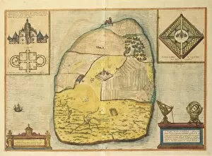
Background imageCartography Collection: Uranienborg from Civitates Orbis Terrarum by Georg Braun, 1541-1622 and Franz Hogenberg

Uranienborg from Civitates Orbis Terrarum by Georg Braun, 1541-1622 and Franz Hogenberg, 1540-1590, engraving
Cartography, Norway, 16th century. Uranienborg. From Civitates Orbis Terrarum by Georg Braun (1541-1622) and Franz Hogenberg (1540-1590), Cologne. Engraving

Background imageCartography Collection: Ptolemaic world map, pen drawing

Ptolemaic world map, pen drawing
Cartography, 9th century. Ptolemaic world map. Pen drawing

Background imageCartography Collection: Representation of the Marshall Islands made with listels of palm tree

Representation of the Marshall Islands made with listels of palm tree and shells to indicate the relative positions of
Cartography, Micronesia. Representation of the Marshall Islands made with listels of palm tree and shells to indicate the relative positions of the islands, the current and the route

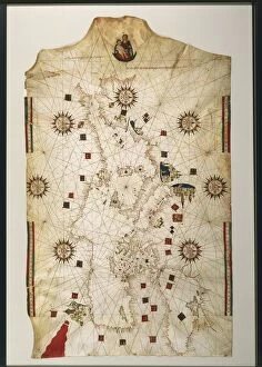
Background imageCartography Collection: 19th century copy of the nautical planisphere by Juan de la Cosa, 1500

19th century copy of the nautical planisphere by Juan de la Cosa, 1500
Cartography, 16th century. 19th century copy of the nautical planisphere by Juan de la Cosa, circa 1500

Background imageCartography Collection: Map of Lisbon and Cascais from Civitates Orbis Terrarum by Georg Braun

Map of Lisbon and Cascais from Civitates Orbis Terrarum by Georg Braun, 1541-1622 and Franz Hogenberg, 1540-1590
Cartography, Portugal, 16th century. Map of Lisbon and Cascais. From Civitates Orbis Terrarum by Georg Braun (1541-1622) and Franz Hogenberg (1540-1590), Cologne. Engraving

Background imageCartography Collection: Detail from Portolan chart by Ioannes Superantius

Detail from Portolan chart by Ioannes Superantius
Cartography, 16th century. Portolan chart by Ioannes Superantius, detail

Background imageCartography Collection: Map of Treviso, Italy

Map of Treviso, Italy
Cartography, Italy, 16th century. Map of Treviso

Background imageCartography Collection: Map attributed to Paolo dal Pozzo Toscanelli, 1397-1482

Map attributed to Paolo dal Pozzo Toscanelli, 1397-1482
Cartography, Italy, 15th century. Map attributed to Paolo dal Pozzo Toscanelli (1397-1482)

Background imageCartography Collection: Map of Piedmont and Western Liguria Region, by Giovanni Battista Cassini from the atlas

Map of Piedmont and Western Liguria Region, by Giovanni Battista Cassini from the atlas Chorographica Descriptio
Cartography, Italy, 17th century. Map of Piedmont and Western Liguria Region, by Giovanni Battista Cassini from the atlas Chorographica Descriptio Provinciarum et Convetuum Fratrum Minorum S

Background imageCartography Collection: Map of the Nile Delta and of ancient city of Carthage, from Theatrum Orbis Terrarum by Abraham

Map of the Nile Delta and of ancient city of Carthage, from Theatrum Orbis Terrarum by Abraham Ortelius, 1528-1598
Cartography, 16th century. Map of the Nile Delta and of ancient city of Carthage, from Theatrum Orbis Terrarum by Abraham Ortelius (1528-1598), Antwerp, 1570

Background imageCartography Collection: Easter Island, from Travel Atlas by James Cook, 1774

Easter Island, from Travel Atlas by James Cook, 1774
Cartography, 18th century. Easter Island. From the Travel Atlas by James Cook, 1774

Background imageCartography Collection: 16th century Map of Granada, Spain, from Civitates Orbis Terrarum by Georg Braun

16th century Map of Granada, Spain, from Civitates Orbis Terrarum by Georg Braun and Franz Hogenberg, engraving
Cartography, Spain, 16th century. Map of Granada. From Civitates Orbis Terrarum by Georg Braun (1541-1622) and Franz Hogenberg (1540-1590), Cologne. Engraving

Background imageCartography Collection: Map of Lugo, Province of Ravenna, Italy, engraving, 1823

Map of Lugo, Province of Ravenna, Italy, engraving, 1823
Cartography, Italy, 19th century. Map of Lugo, Province of Ravenna, 1823. Engraving

Background imageCartography Collection: Map of Bruges from Civitates Orbis Terrarum by Georg Braun, 1541-1622 and Franz Hogenberg

Map of Bruges from Civitates Orbis Terrarum by Georg Braun, 1541-1622 and Franz Hogenberg, 1540-1590, engraving
Cartography, Belgium, 16th century. Map of Bruges. From Civitates Orbis Terrarum by Georg Braun (1541-1622) and Franz Hogenberg (1540-1590), Cologne. Engraving

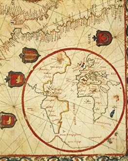
Background imageCartography Collection: Map of Africa and the Americas by Pierre de Vaulx, 1613

Map of Africa and the Americas by Pierre de Vaulx, 1613
Cartography, 17th century. Map of Africa and the Americas by Pierre de Vaulx, 1613

Background imageCartography Collection: Map of Venetian domain, from Regionum Italiae by Willem Blaeu, engraving

Map of Venetian domain, from Regionum Italiae by Willem Blaeu, engraving
Cartography, Italy, 17th century. Venetian domain. From Regionum Italiae by Willem Blaeu. Engraving

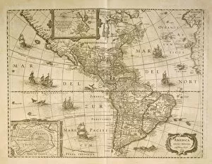
Background imageCartography Collection: Map of the Americas by Henricus Hondius, 1631

Map of the Americas by Henricus Hondius, 1631
Cartography, 17th century. Map of the Americas by Henricus Hondius, 1631

Background imageCartography Collection: Warsaw from Civitates Orbis Terrarum by Georg Braun, 1541-1622 and Franz Hogenberg, 1540-1590

Warsaw from Civitates Orbis Terrarum by Georg Braun, 1541-1622 and Franz Hogenberg, 1540-1590, engraving
Cartography, Poland, 16th century. Warsaw. From Civitates Orbis Terrarum by Georg Braun (1541-1622) and Franz Hogenberg (1540-1590), Cologne. Engraving

Background imageCartography Collection: Milan from Civitates Orbis Terrarum by Georg Braun, 1541-1622 and Franz Hogenberg, 1540-1590

Milan from Civitates Orbis Terrarum by Georg Braun, 1541-1622 and Franz Hogenberg, 1540-1590, engraving
Cartography, Italy, 16th century. Milan. From Civitates Orbis Terrarum by Georg Braun (1541-1622) and Franz Hogenberg (1540-1590), Cologne. Engraving

Background imageCartography Collection: Marina di Finale, Finale Ligure, Liguria Region, Map by Giovanni Battista Sesti,

Marina di Finale, Finale Ligure, Liguria Region, Map by Giovanni Battista Sesti,
Cartography, Italy, 18th century. Marina di Finale (Finale Ligure), Liguria Region. Map by Giovanni Battista Sesti, from " Piante delle citta... in questo Stato di Milano", Milan, 1707

Background imageCartography Collection: Detail from Perspective map of Venice dockyard by Gian Maria Maffioletti, engraving, 1798

Detail from Perspective map of Venice dockyard by Gian Maria Maffioletti, engraving, 1798
Cartography, Italy, 18th century. Perspective map of Venice dockyard by Gian Maria Maffioletti, 1798, engraving. Detail

Background imageCartography Collection: Portolan chart by Jacopo Maggiolo, 1561

Portolan chart by Jacopo Maggiolo, 1561
Cartography, Italy, 16th century. Portolan chart by Jacopo Maggiolo, 1561

Background imageCartography Collection: Map of farm homesteads and fields in Morghengo, Novara, drawing by Cabreo Guarischelli, 1611

Map of farm homesteads and fields in Morghengo, Novara, drawing by Cabreo Guarischelli, 1611
Cartography, Italy, 17th century. Morghengo, Novara, farm homesteads and fields. Drawing by Cabreo Guarischelli, 1611

Background imageCartography Collection: Map of Casale Monferrato, Piedmont Region, and its citadel during the siege in 1630

Map of Casale Monferrato, Piedmont Region, and its citadel during the siege in 1630
Cartography, Italy, 17th century. Map of Casale Monferrato, Piedmont Region, and its citadel during the siege in 1630

Background imageCartography Collection: Map of Chios Island, Greece by Benedetto Bordone, 1460-1531, from Isolario, Book of Islands, 1528

Map of Chios Island, Greece by Benedetto Bordone, 1460-1531, from Isolario, Book of Islands, 1528
Cartography, Greece, 16th century. Map of Chios Island, Greece, by Benedetto Bordone (1460-1531), from Isolario (Book of Islands), 1528

Background imageCartography Collection: Survey on the course of water as far as the village of San Andres Chalchicomula

Survey on the course of water as far as the village of San Andres Chalchicomula
Cartography, Mexico, 18th century. Survey on the course of water as far as the village of San Andres Chalchicomula

Background imageCartography Collection: Kingdom of France, from portolan atlas consisting of six charts

Kingdom of France, from portolan atlas consisting of six charts, by Placido Caloiro and Francesco Oliva, Parchment
Cartography, 17th century. The Kingdom of France, from a portolan atlas consisting of six charts, by Placido Caloiro and Francesco Oliva, 1646. Parchment

Background imageCartography Collection: Map of Islands of Terra Nuova and Isola de Demoni, from Gian Battista Ramusios Account of His

Map of Islands of Terra Nuova and Isola de Demoni, from Gian Battista Ramusios Account of His Travels to the Indies
Cartography, 16th century. Map of Islands of Terra Nuova and Isola de Demoni. Engraving from Gian Battista Ramusios Account of His Travels to the Indies, Venice, 1556

Background imageCartography Collection: Map of the Horn of Africa, oil painting by Stefano Buonsignori 1575-1584

Map of the Horn of Africa, oil painting by Stefano Buonsignori 1575-1584
Italy - Tuscany region - Florence. Palazzo Vecchio, Hall of the Geographical Maps. Map of the Horn of Africa, oil painting by Stefano Buonsignori 1575-1584

Background imageCartography Collection: Mediterranean coast, from the Portolan Charts by Francesco Oliva, printed in Italy, 1611

Mediterranean coast, from the Portolan Charts by Francesco Oliva, printed in Italy, 1611
Cartography, 17th century. Mediterranean coast. From the Portolan Charts by Francesco Oliva, 1611

Background imageCartography Collection: Map of Italy. Woodcut from relief map by Claudius Ptolemy, Vienna-Lyon, 1541

Map of Italy. Woodcut from relief map by Claudius Ptolemy, Vienna-Lyon, 1541
Cartography, Italy, 16th century. Map of Italy. Woodcut from a relief map by Claudius Ptolemy, Vienna-Lyon, 1541

Background imageCartography Collection: Northern Europe, Scandinavia and the Baltic Sea, from Claudius Ptolemys Cosmographia, Ulm Edition

Northern Europe, Scandinavia and the Baltic Sea, from Claudius Ptolemys Cosmographia, Ulm Edition, 1482
Cartography, 15th century. Northern Europe, Scandinavia and the Baltic Sea, from Claudius Ptolemys " Cosmographia." Ulm Edition, 1482


All Professionally Made to Order for Quick Shipping


-

Why Choose Us?

We are a leading provider of Art Prints and Photo Gifts since 2003, working in partnership with a range of Sporting Clubs, Charities, Museums and Picture Libraries. A large share of profits from any of their images will go directly towards supporting that charity or club. Our archive of images is carefully curated to bring you a wide range of subjects, including landscapes, wildlife, architecture, and more. We ship from our partner labs in the UK, USA, EU (Netherlands) and Australia.
+

How do I place an order?

Ordering is quick & easy - Just follow 5 Simple Steps:
  1. Find your image: Use our search box or browse our online photo Collections to find the image you want.

  2. Choose your print format: Select your desired product and add it to your cart.

  3. Enter your details: If you're a returning customer, simply enter your email address and password, and we'll fill in your billing and shipping address details. All personal details are held securely and are fully GDPR compliant. As standard, we remove all Personally Identifiable Information after 12 months.

  4. Pay for your purchase: We use state-of-the-art security for online shopping and do not have access to your card details.

  5. Sit back and relax: We'll email you confirmation of your order and when it's dispatched. Registered customers can also track orders in the 'My Account' area.

+

How do I pay for an order?

You can pay for your order with most of the major credit and debit cards, or PayPal. For added security, major financial institutions process payment details separately and securely on our behalf. We do not have access to your online payment card details. Online payments are preferred however we do take phone orders. For UK customers only we accept cheques issued against a UK bank.
+

Is my data safe?

We take data security very seriously. We do not have access to your full card details and all payments are requested over a fully secure connection. Additionally, we fully comply with current European and GDPR legislation, and automatically remove all personal data after at most 12 months (unless you have an account with us and have signed in recently). We also have a strict opt-in policy and would never sell your personal details. Your data is only used to fulfill your order promptly and efficiently.
+

Is wall art ready to hang?

For quick and easy installation all wall art, including framed prints, canvas prints and metal prints are supplied with a ready to hang solution on the back. Generally, saw tooth hangers are applied as they allow wall art to hang flush against the wall. The serrated edge of the hanger prevents the frame from shifting or tilting when hung.
+

Are the photo prints fade resistant?

Yes, we use archival quality photo paper photographic paper for vivid reproduction Prints are an accurate representations of the original artwork, which is preserved for artistic character and authenticity. We guarantee they match previews shown on our web site