Fraud Blocker Skip to main content

Home > Universal Images Group (UIG) > Art > Painting, Sculpture & Prints > Cartography

Cartography Collection

Choose a picture from our Cartography Collection for your Wall Art and Photo Gifts

953 items

We are proud to offer this selection in partnership with Universal Images Group (UIG)

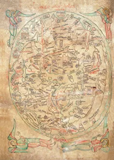
Background imageCartography Collection: Mappa Mundi by Sawley or Enrico di Magonza, ink and colors on parchment, 12th Century

Mappa Mundi by Sawley or Enrico di Magonza, ink and colors on parchment, 12th Century
Cartography, 12th century. Mappa Mundi, Medieval world map by Sawley or Enrico di Magonza, from the end of the 12th century. Ink and colors on parchment, 29.5 x 20.5 cm

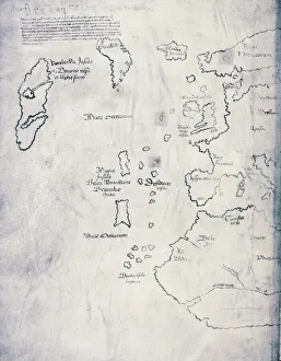
Background imageCartography Collection: Vinland Map, oldest map of Greenland and Northern America areas discovered by Norse

Vinland Map, oldest map of Greenland and Northern America areas discovered by Norse, Vikings during their explorations
Cartography, 15th century. Vinland Map (circa 1440). Oldest map of Greenland and Northern America areas discovered by Norse (Vikings) during their explorations

Background imageCartography Collection: Map of ancient Abruzzo, by Giovan Battista Pacichelli, engraving, 1702

Map of ancient Abruzzo, by Giovan Battista Pacichelli, engraving, 1702
Cartography, Italy, 18th century. Ancient Abruzzo. From The Kingdom of Naples in perspective by Giovan Battista Pacichelli, 1702. Engraving

Background imageCartography Collection: Map of Scandinavia, from Carta Marina, Sea Map by Olaus Magnus, 1539

Map of Scandinavia, from Carta Marina, Sea Map by Olaus Magnus, 1539
Cartography, 16th century. Map of Scandinavia. From Carta Marina (Sea Map) by Olaus Magnus, 1539

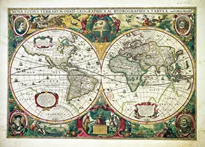
Background imageCartography Collection: Nova totius Terrarum Orbis Geographica ac hydrographica tabula, by Henricus Hondius, Amsterdam

Nova totius Terrarum Orbis Geographica ac hydrographica tabula, by Henricus Hondius, Amsterdam
Cartography, 17th century. Nova totius Terrarum Orbis Geographica ac hydrographica tabula, by Henricus Hondius, Amsterdam, 1630. Illustrated copperplate, 38 x 54 cm

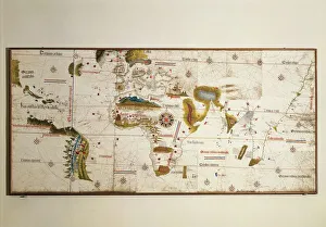
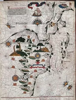
Background imageCartography Collection: Cantino planisphere by Alberto Cantino, 1502

Cantino planisphere by Alberto Cantino, 1502
Cartography, 16th century. Cantino planisphere, by Alberto Cantino, 1502

Background imageCartography Collection: Map of Verona from Civitates Orbis Terrarum by Georg Braun, 1541-1622 and Franz Hogenberg

Map of Verona from Civitates Orbis Terrarum by Georg Braun, 1541-1622 and Franz Hogenberg, 1540-1590, engraving
Cartography, Italy, 16th century. Map of Verona, from Civitates Orbis Terrarum by Georg Braun (1541-1622) and Franz Hogenberg (1540-1590), Cologne. Engraving

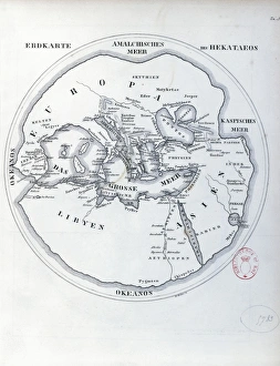
Background imageCartography Collection: Circular world map by Hecataeus of Miletus

Circular world map by Hecataeus of Miletus
Cartography, 6th-5th century b.C. Circular world map by Hecataeus of Miletus

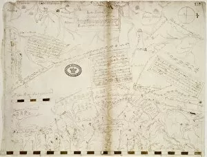
Background imageCartography Collection: Italy, Tuscany, Lucca, map of Lucca, cartography

Italy, Tuscany, Lucca, map of Lucca, cartography 17th century, Archivio Di Stato (National Archives)

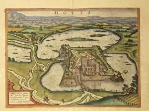
Background imageCartography Collection: Tata, Dotis from Civitates Orbis Terrarum by Georg Braun, 1541-1622 and Franz Hogenberg

Tata, Dotis from Civitates Orbis Terrarum by Georg Braun, 1541-1622 and Franz Hogenberg, 1540-1590, engraving
Cartography, Hungary, 16th century. Tata (Dotis). From Civitates Orbis Terrarum by Georg Braun (1541-1622) and Franz Hogenberg (1540-1590), Cologne. Engraving

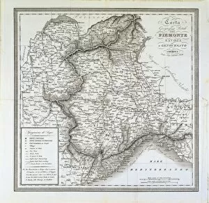
Background imageCartography Collection: Map of Piedmont, of the Savoy and Genovas. Cremona, engraving on copper, 1832

Map of Piedmont, of the Savoy and Genovas. Cremona, engraving on copper, 1832
Cartography, Italy, 19th century. Map of Piedmont, of the Savoy and Genovas. Cremona, 1832. Engraving on copper

Background imageCartography Collection: Map of India and Indian Ocean, from Miller Atlas by Pedro and Jorge Reinel, Lopo Homen

Map of India and Indian Ocean, from Miller Atlas by Pedro and Jorge Reinel, Lopo Homen
Cartography, 16th century. Map of India and Indian Ocean, from Miller Atlas, by Pedro and Jorge Reinel, Lopo Homen (cartographers) and Antonio de Holanda (miniaturist), 1519

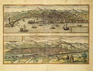
Background imageCartography Collection: Map of Genoa and Florence from Civitates Orbis Terrarum by Georg Braun

Map of Genoa and Florence from Civitates Orbis Terrarum by Georg Braun, 1541-1622 and Franz Hogenberg, 1540-1590
Cartography, Italy, 16th century. Map of Genoa and Florence. From Civitates Orbis Terrarum by Georg Braun (1541-1622) and Franz Hogenberg (1540-1590), Cologne. Engraving

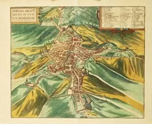
Background imageCartography Collection: Map of Perugia from Civitates Orbis Terrarum by Georg Braun, 1541-1622 and Franz Hogenberg

Map of Perugia from Civitates Orbis Terrarum by Georg Braun, 1541-1622 and Franz Hogenberg, 1540-1590, engraving
Cartography, Italy, 16th century. Map of Perugia. From Civitates Orbis Terrarum by Georg Braun (1541-1622) and Franz Hogenberg (1540-1590), Cologne. Engraving

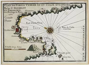
Background imageCartography Collection: Portovenere and the Gulf of La Spezia, Map by Henry Michelot

Portovenere and the Gulf of La Spezia, Map by Henry Michelot and Laurens Bremond from the Portolan Charts of
Cartography, Italy, 18th century. Portovenere and the Gulf of La Spezia. Map by Henry Michelot and Laurens Bremond from the Portolan Charts of the Mediterranean Sea, Amsterdam 1709. Copper engraving

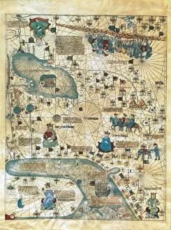
Background imageCartography Collection: Map of Cathay, China, from Catalan Atlas created for Charles V, King of France

Map of Cathay, China, from Catalan Atlas created for Charles V, King of France
Cartography, 14th century. Map of Cathay (China). From Catalan Atlas created for Charles V, King of France, attributed to Abraham and Jafuda Cresques Maiorca (circa 1375)

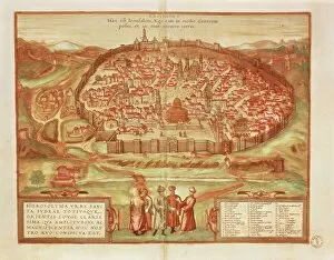
Background imageCartography Collection: Jerusalem from Civitates Orbis Terrarum by Georg Braun, 1541-1622 and Franz Hogenberg, 1540-1590

Jerusalem from Civitates Orbis Terrarum by Georg Braun, 1541-1622 and Franz Hogenberg, 1540-1590, engraving
Cartography, Israel and Palestine, 16th century. Jerusalem. From Civitates Orbis Terrarum by Georg Braun (1541-1622) and Franz Hogenberg (1540-1590), Cologne. Engraving

Background imageCartography Collection: Duchies of Milan, Mantua, Modena and Parma; Republic of Venice and Genoa, Map by Justus Danckerts

Duchies of Milan, Mantua, Modena and Parma; Republic of Venice and Genoa, Map by Justus Danckerts, Amsterdam
Cartography, Italy, 18th century. Duchies of Milan, Mantua, Modena and Parma; Republic of Venice and Genoa. Map by Justus Danckerts, Amsterdam, early 1700. Copper engraving

Background imageCartography Collection: Egypt, Cairo, from Description of Africa by Olfert Dapper, engraving, 1686

Egypt, Cairo, from Description of Africa by Olfert Dapper, engraving, 1686
Cartography, Egypt, 17th century. Cairo in 1686. From Description of Africa by Olfert Dapper, 1686. Engraving

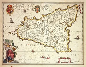
Background imageCartography Collection: Map of Sicily region, by Joan Blaeu

Map of Sicily region, by Joan Blaeu
Cartography, Italy, 17th century. Map of Sicily region, by Joan Blaeu

Background imageCartography Collection: Map of the Battle of Waterloo, 18 June 1815

Map of the Battle of Waterloo, 18 June 1815
Cartography, 19th century. Map of the Battle of Waterloo (18 June 1815) won by the armies under the command of the Duke of Wellington (1769-1852) and Prince von Wahlstaff (1742-1819)

Background imageCartography Collection: The Orinoco River course up to Maracaibo, Venezuela, 1675

The Orinoco River course up to Maracaibo, Venezuela, 1675
Cartography, Venezuela, XII century. The Orinoco River course up to Maracaibo, 1675

Background imageCartography Collection: Map of Mediterranean Sea by Francois Ollive, Marseille, 1664

Map of Mediterranean Sea by Francois Ollive, Marseille, 1664
Cartography, 17th century. Map of the Mediterranean Sea by Francois Ollive, Marseille, 1664

Background imageCartography Collection: Forma Urbis Severiana, detail featuring Portuense Street and south bank of Tiber

Forma Urbis Severiana, detail featuring Portuense Street and south bank of Tiber, marble sculpture, 3rd Century
Cartography, Italy, 3rd century AD. Forma Urbis Severiana, marble map of ancient Rome. Fragment featuring Portuense Street and the south bank of the Tiber

Background imageCartography Collection: Map of the Kingdom of Naples, Italy, from Theatrum Orbis Terrarum by Abraham Ortelius, 1528-1598

Map of the Kingdom of Naples, Italy, from Theatrum Orbis Terrarum by Abraham Ortelius, 1528-1598, 1570
Cartography, Italy, 16th century. Map of the Kingdom of Naples, from Theatrum Orbis Terrarum by Abraham Ortelius (1528-1598), Antwerp, 1570

Background imageCartography Collection: Map of the Iberian peninsula, from Theatrum Orbis Terrarum by Abraham Ortelius, 1528-1598

Map of the Iberian peninsula, from Theatrum Orbis Terrarum by Abraham Ortelius, 1528-1598, Antwerp, 1570
Cartography, 16th century. Map of the Iberian peninsula, from Theatrum Orbis Terrarum by Abraham Ortelius (1528-1598), Antwerp, 1570

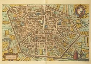
Background imageCartography Collection: Map of Bologna from Civitates Orbis Terrarum by Georg Braun, 1541-1622 and Franz Hogenberg

Map of Bologna from Civitates Orbis Terrarum by Georg Braun, 1541-1622 and Franz Hogenberg, 1540-1590, engraving
Cartography, Italy, 16th century. Map of Bologna. From Civitates Orbis Terrarum by Georg Braun (1541-1622) and Franz Hogenberg (1540-1590), Cologne. Engraving

Background imageCartography Collection: Republic of Genoa, Map by Tobia Corrado Lotterio with view of Genoa by F. B

Republic of Genoa, Map by Tobia Corrado Lotterio with view of Genoa by F. B. Weber, Augsburg, Copper engraving, 1770
Cartography, Italy, 18th century. Republic of Genoa. Map by Tobia Corrado Lotterio with view of Genoa by F.B. Weber. Augsburg, 1770. Copper engraving

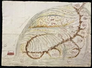
Background imageCartography Collection: Map of Gallo Island and adjoining coast

Map of Gallo Island and adjoining coast
Cartography, South America, 15th century. Gallo Island and the adjoining coast

Background imageCartography Collection: Eastern Europe and Central Asia, from Atlas of the World in thirty-three Maps, by Battista Agnese

Eastern Europe and Central Asia, from Atlas of the World in thirty-three Maps, by Battista Agnese, 1553
Cartography, 16th century. Eastern Europe and Central Asia, from Atlas of the World in thirty-three Maps, by Battista Agnese, 1553

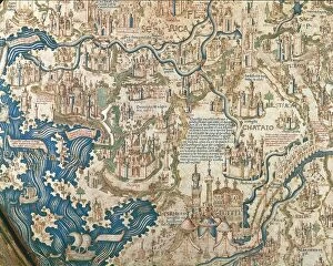
Background imageCartography Collection: Map of China, from World map by Camaldolese monk Fra Mauro, 1449

Map of China, from World map by Camaldolese monk Fra Mauro, 1449
Cartography, 15th century. Map of China. From World map by Camaldolese monk Fra Mauro, 1449. Detail

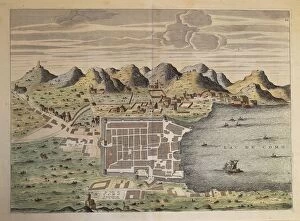
Background imageCartography Collection: Map of the city of Como, Italy, 1570

Map of the city of Como, Italy, 1570
Cartography, Italy, 16th century. Map of the city of Como, 1570

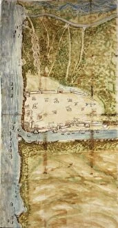
Background imageCartography Collection: Map of Santo Domingo city showing the citys defensive wall, watercolor, 1619

Map of Santo Domingo city showing the citys defensive wall, watercolor, 1619
Cartography, Dominican Republic, 17th century. Map of Santo Domingo city showing the citys defensive wall, 1619. Watercolor

Background imageCartography Collection: World map by Giorgio Sideri, known as Callapoda or Calopodio da Candia, details of Africa

World map by Giorgio Sideri, known as Callapoda or Calopodio da Candia, details of Africa
Cartography, 16th century. World map by Giorgio Sideri, known as Callapoda or Calopodio da Candia. Details of Africa

Background imageCartography Collection: Plan of Crema, Italy

Plan of Crema, Italy
Cartography, Italy. Plan of Crema

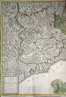
Background imageCartography Collection: Cisalpine Republic, 1st part. Florence, Copper engraving. 1797

Cisalpine Republic, 1st part. Florence, Copper engraving. 1797
Cartography, Italy, 18th century. Cisalpine Republic (1st part). Florence, 1797. Copper engraving

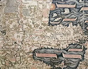
Background imageCartography Collection: World map by Camaldolese monk Fra Mauro, 1449, detail: Asian Turkey and Mesopotamia

World map by Camaldolese monk Fra Mauro, 1449, detail: Asian Turkey and Mesopotamia
Cartography, 15th century. World map by Camaldolese monk Fra Mauro, 1449. Detail: Asian Turkey and Mesopotamia

Background imageCartography Collection: Map of Italy in 1743

Map of Italy in 1743
Cartography, 18th century. Map of Italy in 1743

Background imageCartography Collection: Italy, Map of Pesaro, from Theatrum civitatum et admirandorum Italiae by Joan Blaeu, engraving

Italy, Map of Pesaro, from Theatrum civitatum et admirandorum Italiae by Joan Blaeu, engraving
Cartography, Italy, 17th century. Map of Pesaro, from Theatrum civitatum et admirandorum Italiae by Joan Blaeu. Engraving

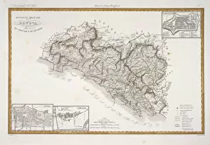
Background imageCartography Collection: Military division of Genoa, plan of Sarzana, La Spezia and Chiavari

Military division of Genoa, plan of Sarzana, La Spezia and Chiavari. Map by Attilio Zuccagni-Orlandini
Cartography, Italy, 19th century. Military division of Genoa, plan of Sarzana, La Spezia and Chiavari. Map by Attilio Zuccagni-Orlandini, taken from the Geographic Atlas of Italian States

Background imageCartography Collection: Map of Portugal, from Theatrum Orbis Terrarum by Abraham Ortelius, 1528-1598, Antwerp, 1570

Map of Portugal, from Theatrum Orbis Terrarum by Abraham Ortelius, 1528-1598, Antwerp, 1570
Cartography, 16th century. Map of Portugal, from Theatrum Orbis Terrarum by Abraham Ortelius (1528-1598), Antwerp, 1570

Background imageCartography Collection: World map from Treatise of Geography by Al Idrisi, circa 1099-1165, manuscript

World map from Treatise of Geography by Al Idrisi, circa 1099-1165, manuscript
Cartography, Asia, 11th century. World map from Treatise of Geography by Al Idrisi (circa 1099-1165), manuscript

Background imageCartography Collection: Detail of Portuguese planisphere, 1550

Detail of Portuguese planisphere, 1550
Cartography, 16th century. Europe and Africa, detail of a Portuguese planisphere, 1550. Facsimile of an original located in the Biblioteca Vallicelliana in Rome

Background imageCartography Collection: Map of Italy, From Geographiae Opus Novissima by Martin Waldseemueller, Woodcut, 1513

Map of Italy, From Geographiae Opus Novissima by Martin Waldseemueller, Woodcut, 1513
Cartography, 16th century. Map of Italy. From Geographiae Opus Novissima by Martin Waldseemueller, 1513. Woodcut

Background imageCartography Collection: Map of Mediterranean Islands, from Theatrum Orbis Terrarum by Abraham Ortelius, 1528-1598, 1570

Map of Mediterranean Islands, from Theatrum Orbis Terrarum by Abraham Ortelius, 1528-1598, 1570
Cartography, 16th century. Map of Mediterranean Islands, from Theatrum Orbis Terrarum by Abraham Ortelius (1528-1598), Antwerp, 1570

Background imageCartography Collection: Map of central and southern America and Cuba, Hispaniola and Puerto Rico islands, by Lazaro Luis

Map of central and southern America and Cuba, Hispaniola and Puerto Rico islands, by Lazaro Luis, from the Atlas, 1563
Cartography, 16th century. Map of central and southern America and Cuba, Hispaniola and Puerto Rico islands. From the Atlas by Lazaro Luis, 1563

Background imageCartography Collection: Perspective map of the city of Turin, Piedmont region by Joan Blaeu, 1596-1673

Perspective map of the city of Turin, Piedmont region by Joan Blaeu, 1596-1673
Cartography, Italy, 17th century. Perspective map of the city of Turin, Piedmont region by Joan Blaeu (1596-1673)

Background imageCartography Collection: Territory of Nice. Map by Jean Baptiste Raymond from military topographic map of Alps

Territory of Nice. Map by Jean Baptiste Raymond from military topographic map of Alps. Paris, engraving on copper. 1820
Cartography, France, 19th century. Territory of Nice. Map by Jean Baptiste Raymond from a military topographic map of the Alps. Paris 1820. Engraving on copper


All Professionally Made to Order for Quick Shipping


-

Why Choose Us?

We are a leading provider of Art Prints and Photo Gifts since 2004, working in partnership with a range of Sporting Clubs, Charities, Museums and Picture Libraries. A large share of profits from any of their images will go directly towards supporting that charity or club. Our archive of images is carefully curated to bring you a wide range of subjects, including landscapes, wildlife, architecture, and more. We ship from our partner labs in the UK, USA, EU (Netherlands) and Australia.
+

How do I place an order?

Ordering is quick & easy - Just follow 5 Simple Steps:
  1. Find your image: Use our search box or browse our online photo Collections to find the image you want.

  2. Choose your print format: Select your desired product and add it to your cart.

  3. Enter your details: If you're a returning customer, simply enter your email address and password, and we'll fill in your billing and shipping address details. All personal details are held securely and are fully GDPR compliant. As standard, we remove all Personally Identifiable Information after 12 months.

  4. Pay for your purchase: We use state-of-the-art security for online shopping and do not have access to your card details.

  5. Sit back and relax: We'll email you confirmation of your order and when it's dispatched. Registered customers can also track orders in the 'My Account' area.

+

How do I pay for an order?

You can pay for your order with most of the major credit and debit cards, or PayPal. For added security, major financial institutions process payment details separately and securely on our behalf. We do not have access to your online payment card details. Online payments are preferred however we do take phone orders. For UK customers only we accept cheques issued against a UK bank.
+

Is my data safe?

We take data security very seriously. We do not have access to your full card details and all payments are requested over a fully secure connection. Additionally, we fully comply with current European and GDPR legislation, and automatically remove all personal data after at most 12 months (unless you have an account with us and have signed in recently). We also have a strict opt-in policy and would never sell your personal details. Your data is only used to fulfill your order promptly and efficiently.
+

Is wall art ready to hang?

For quick and easy installation all wall art, including framed prints, canvas prints and metal prints are supplied with a ready to hang solution on the back. Generally, saw tooth hangers are applied as they allow wall art to hang flush against the wall. The serrated edge of the hanger prevents the frame from shifting or tilting when hung.
+

Are the photo prints fade resistant?

Yes, we use archival quality photo paper photographic paper for vivid reproduction Prints are an accurate representations of the original artwork, which is preserved for artistic character and authenticity. We guarantee they match previews shown on our web site