Premium Framed Print > Historic > World War I and II > Naval warfare
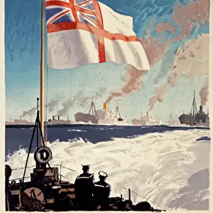
Premium Framed Print : Map showing the naval bases of the North Sea during World War One, from The History of the Great War, pub.c.1919


![]()
Framed Photos From Fine Art Finder
Map showing the naval bases of the North Sea during World War One, from The History of the Great War, pub.c.1919
3502817 Map showing the naval bases of the North Sea during World War One, from The History of the Great War, pub.c.1919; (add.info.: Map showing the naval bases of the North Sea during World War One, from The History of the Great War, pub.c. 1919); Photo © Hilary Morgan
Media ID 38321178
© © Hilary Morgan / Bridgeman Images
1914 1918 Bases Chart North Showing
17"x15" (43x38cm) Premium Frame
FSC real wood frame with double mounted 10x8 print. Double mounted with white conservation mountboard. Frame moulding comprises stained composite natural wood veneers (Finger Jointed Pine) 39mm wide by 21mm thick. Archival quality Fujifilm CA photo paper mounted onto 1mm card. Overall outside dimensions are 17x15 inches (431x381mm). Rear features Framing tape to cover staples, 50mm Hanger plate, cork bumpers. Glazed with durable thick 2mm Acrylic to provide a virtually unbreakable glass-like finish. Acrylic Glass is far safer, more flexible and much lighter than typical mineral glass. Moreover, its higher translucency makes it a perfect carrier for photo prints. Acrylic allows a little more light to penetrate the surface than conventional glass and absorbs UV rays so that the image and the picture quality doesn't suffer under direct sunlight even after many years. Easily cleaned with a damp cloth. Please note that, to prevent the paper falling through the mount window and to prevent cropping of the original artwork, the visible print may be slightly smaller to allow the paper to be securely attached to the mount without any white edging showing and to match the aspect ratio of the original artwork.
FSC Real Wood Frame and Double Mounted with White Conservation Mountboard - Professionally Made and Ready to Hang
Estimated Image Size (if not cropped) is 19.2cm x 24.4cm (7.6" x 9.6")
Estimated Product Size is 38.1cm x 43.1cm (15" x 17")
These are individually made so all sizes are approximate
Artwork printed orientated as per the preview above, with portrait (vertical) orientation to match the source image.
FEATURES IN THESE COLLECTIONS
> Fine Art Finder
> America & American Art (+canada)
> Historic
> World War I and II
> Naval warfare
> Maps and Charts
> Early Maps
> Maps and Charts
> Related Images
> Maps and Charts
> World
> Services
> Royal Navy
EDITORS COMMENTS
This print showcases a detailed map depicting the naval bases of the North Sea during World War One, offering a glimpse into the strategic importance of these locations during one of the most significant conflicts in history. Published around 1919 as part of The History of the Great War, this image provides valuable insight into the military operations and movements that took place in this region during the early 20th century.
The intricate chart highlights key naval bases that played a crucial role in shaping the outcome of the war, serving as vital hubs for both offensive and defensive maneuvers. From major ports to smaller outposts, each location represented on this map tells a story of bravery, sacrifice, and determination exhibited by those who served their countries with unwavering dedication.
As we study this historical artifact, we are reminded of the immense impact that naval warfare had on shaping global events during World War One. The meticulous attention to detail and accuracy displayed in this map serve as a testament to the significance of understanding our past in order to navigate our future with wisdom and foresight.
MADE IN THE UK
Safe Shipping with 30 Day Money Back Guarantee
FREE PERSONALISATION*
We are proud to offer a range of customisation features including Personalised Captions, Color Filters and Picture Zoom Tools
SECURE PAYMENTS
We happily accept a wide range of payment options so you can pay for the things you need in the way that is most convenient for you
* Options may vary by product and licensing agreement. Zoomed Pictures can be adjusted in the Basket.