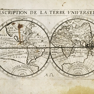
Poster Print > Europe > France > Canton > Landes
Poster Print : Spanish map of England, Scotland and Ireland


![]()
Poster Prints from Mary Evans Picture Library
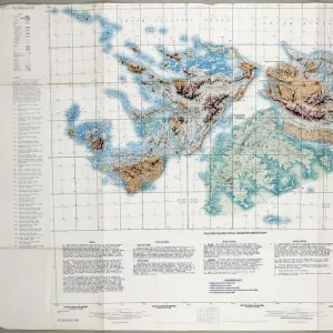
Spanish map of England, Scotland and Ireland
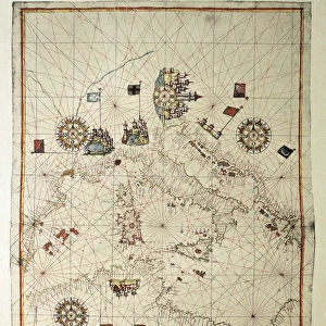
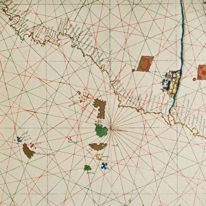
A Spanish map of England, Scotland and Ireland and the coast of northern France from the time of the Anglo Spanish War. Joan Martines (1556-1591). Date: 1587
Mary Evans Picture Library makes available wonderful images created for people to enjoy over the centuries
Media ID 8262607
© Mary Evans Picture Library 2015 - https://copyrighthub.org/s0/hub1/creation/maryevans/MaryEvansPictureID/10410063
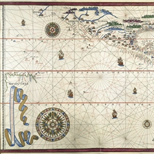
Document Joan Martines Nautical Navigation Portolan Scot Land
A2 (59.4 x 42cm) Poster Print
Introducing the captivating selection of poster prints from Media Storehouse, featuring an intriguing historical map of England, Scotland, and Ireland from Mary Evans Prints Online. This exquisite antique map, dating back to 1587, offers a fascinating glimpse into the past as it was created during the Anglo-Spanish War. The map, beautifully rendered by Joan Martines, provides an intriguing perspective with its unique Spanish interpretation of the British Isles and the northern coast of France. Add an air of historical intrigue to your space with this stunning, high-quality poster print that is sure to spark conversations and ignite the imagination.
A2 Poster (59.4 x 42cm, 23.4" x 16.5" inches) printed on 170gsm Satin Poster Paper. Securely packaged, rolled and inserted into a strong mailing tube and shipped tracked. Poster Prints are of comparable archival quality to our Photographic prints, they are simply printed on thinner Poster Paper. Whilst we only use Photographic Prints in our frames, you can frame Poster Prints if they are carefully supported to prevent sagging over time.
Poster prints are budget friendly enlarged prints in standard poster paper sizes (A0, A1, A2, A3 etc). Whilst poster paper is sometimes thinner and less durable than our other paper types, they are still ok for framing and should last many years. Our Archival Quality Photo Prints and Fine Art Paper Prints are printed on higher quality paper and the choice of which largely depends on your budget.
Estimated Image Size (if not cropped) is 53.9cm x 42cm (21.2" x 16.5")
Estimated Product Size is 59.4cm x 42cm (23.4" x 16.5")
These are individually made so all sizes are approximate
Artwork printed orientated as per the preview above, with landscape (horizontal) orientation to match the source image.
FEATURES IN THESE COLLECTIONS
> Europe
> France
> Canton
> Landes
> Europe
> Republic of Ireland
> Maps
> Europe
> Spain
> Related Images
> Europe
> United Kingdom
> England
> Maps
> Europe
> United Kingdom
> England
> Posters
> Europe
> United Kingdom
> England
> Related Images
EDITORS COMMENTS
This intriguing map print, titled "Nueva Carta de Inglaterra, Escocia, y Hibernia, con parte de Galia," is a rare and captivating representation of the British Isles and the northern coast of France as depicted in a Spanish map from the time of the Anglo-Spanish War. Dated 1587, the map was created by the cartographer Joan Martines, who meticulously documented the coastlines and geographical features of the region with remarkable detail and accuracy. The map is a testament to the rich history of maritime exploration and the complex political landscape of the late 16th century. At the time, Spain and England were engaged in a protracted conflict, with England seeking to assert its dominance in the New World and Spain determined to protect its colonial territories. This map reflects the strategic importance of the waters surrounding the British Isles and northern France, which were crucial for the movement of troops and supplies between the various European powers. The map is also an excellent example of the portolan chart tradition, which originated in the Mediterranean and was characterized by its use of rhumb lines and detailed depictions of coastlines. The map's vibrant colors and ornate cartouche further enhance its visual appeal and historical significance. Despite the map's Spanish origin, it offers valuable insights into the geographical knowledge of the period, as well as the cartographic techniques and artistic styles employed by European mapmakers during the Age of Discovery. This fascinating document is a must-have for scholars of history, cartography, and maritime exploration, as well as anyone interested in the rich and complex history of the British Isles and Europe during the late 16th century.
MADE IN THE UK
Safe Shipping with 30 Day Money Back Guarantee
FREE PERSONALISATION*
We are proud to offer a range of customisation features including Personalised Captions, Color Filters and Picture Zoom Tools
SECURE PAYMENTS
We happily accept a wide range of payment options so you can pay for the things you need in the way that is most convenient for you
* Options may vary by product and licensing agreement. Zoomed Pictures can be adjusted in the Basket.