Poster Print > Asia > Hong Kong > Maps
Poster Print : Map of Hong Kong, c.1900 (engraving)
")


![]()
Poster Prints From Fine Art Finder
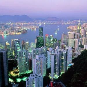
Map of Hong Kong, c.1900 (engraving)
532770 Map of Hong Kong, c.1900 (engraving); (add.info.: Map of Hong Kong, circa 1900, from the 10th edition of Encyclopaedia Britannica.); Encyclopaedia Britannica/UIG
Media ID 38140580
© Encyclopaedia Britannica/UIG / Bridgeman Images
1900 19th Century Style Direction Geographical Border Guidance Hong Kong Illustration Technique Navigational Equipment Number Old Fashioned Peninsula Physical Geography South China Sea The Past Western Script Hong Kong Island Kowloon Bay
A2 (59.4 x 42cm) Poster Print
Discover the historic charm of Hong Kong with this stunning engraving from 1900. Perfect for adding a touch of vintage elegance to any space, this Poster Print is sure to be a conversation starter in your home or office.
A2 Poster (59.4 x 42cm, 23.4" x 16.5" inches) printed on 170gsm Satin Poster Paper. Securely packaged, rolled and inserted into a strong mailing tube and shipped tracked. Poster Prints are of comparable archival quality to our Photographic prints, they are simply printed on thinner Poster Paper. Whilst we only use Photographic Prints in our frames, you can frame Poster Prints if they are carefully supported to prevent sagging over time.
Poster prints are budget friendly enlarged prints in standard poster paper sizes (A0, A1, A2, A3 etc). Whilst poster paper is sometimes thinner and less durable than our other paper types, they are still ok for framing and should last many years. Our Archival Quality Photo Prints and Fine Art Paper Prints are printed on higher quality paper and the choice of which largely depends on your budget.
Estimated Product Size is 59.4cm x 42cm (23.4" x 16.5")
These are individually made so all sizes are approximate
Artwork printed orientated as per the preview above, with landscape (horizontal) orientation to match the source image.
FEATURES IN THESE COLLECTIONS
> Fine Art Finder
> Temp Classification
> Asia
> Hong Kong
> Related Images
> Maps and Charts
> Related Images
EDITORS COMMENTS
This stunning engraving of a Map of Hong Kong, circa 1900, captures the intricate details and historical significance of this bustling city. The map, originally featured in the 10th edition of Encyclopaedia Britannica, showcases the coastline, geographical borders, and navigational equipment of Hong Kong during the late 19th century.
The old-fashioned style and Western script used in this engraving provide a glimpse into the past and highlight the exploration and discovery that took place on this peninsula jutting out into the South China Sea. The map offers guidance and direction for travelers navigating through Kowloon Bay and around Hong Kong Island.
With no people present in the illustration, viewers are left to imagine what life was like in Hong Kong at the turn of the century. The detailed depiction of physical geography and landmarks such as Victoria Peak give insight into how much has changed over time while also preserving a piece of history.
This horizontal illustration is not just a map but a work of art that tells a story about Hong Kong's rich heritage. It serves as a reminder of where we have been and how far we have come since 1900.
MADE IN THE UK
Safe Shipping with 30 Day Money Back Guarantee
FREE PERSONALISATION*
We are proud to offer a range of customisation features including Personalised Captions, Color Filters and Picture Zoom Tools
SECURE PAYMENTS
We happily accept a wide range of payment options so you can pay for the things you need in the way that is most convenient for you
* Options may vary by product and licensing agreement. Zoomed Pictures can be adjusted in the Basket.