Fraud Blocker Skip to main content

Direction Collection

Embarking on a journey through time and space, these diverse images guide us in the right direction

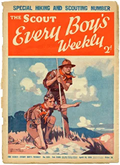
Background imageDirection Collection: The Scout, Every Boys Weekly front cover

The Scout, Every Boys Weekly front cover
Front cover of The Scout magazine, the " only weekly official organ of the boy scouts" featuring two enthusiastic and earnest looking boy scouts reading a map while out on a hike

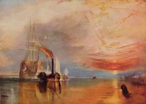
Background imageDirection Collection: The Fighting Temeraire, 1839. Artist: JMW Turner

The Fighting Temeraire, 1839. Artist: JMW Turner
The Fighting Temeraire, 1839. The 98-gun ship Temeraire became known as the Fighting Temeraire after its role in Nelsons victory at the Battle of Trafalgar in 1805

Background imageDirection Collection: Mappa Mundi, ink and colors on parchment, created in London about 1265

Mappa Mundi, ink and colors on parchment, created in London about 1265
Cartography, 13th century. Mappa Mundi, Medieval map, London about 1265. Ink and colors on parchment. The maps diameter is 9 cm
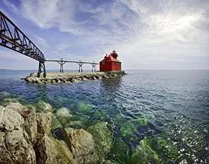
Background imageDirection Collection: Sturgeon Bay Lighthouse Door County Wisconsin

Sturgeon Bay Lighthouse Door County Wisconsin
USA Wisconsin Door County Sturgeon Bay North Pierhead Ship Canal Lighthouse. Door County, Wisconsin

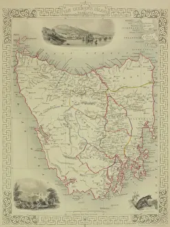
Background imageDirection Collection: Antique map of Tasmania

Antique map of Tasmania

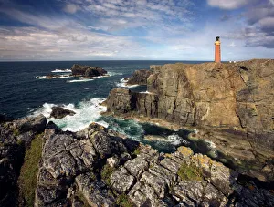
Background imageDirection Collection: Lighthouse and cliffs at Butt of Lewis, Isle of Lewis, Outer Hebrides, Scotland

Lighthouse and cliffs at Butt of Lewis, Isle of Lewis, Outer Hebrides, Scotland, United Kingdom, Europe

Background imageDirection Collection: Viking ship, sunset, silhouette, 3D graphics

Viking ship, sunset, silhouette, 3D graphics

Background imageDirection Collection: Police Officer / Children

Police Officer / Children
Police officer giving directions to three boys with a three person bicycle pointing in the opposite direction Transport

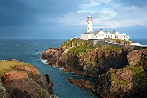
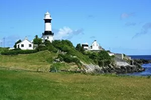
Background imageDirection Collection: Fanad Head Lighthouse

Fanad Head Lighthouse
Fanad is a peninsula that lies between Lough Swilly and Mulroy Bay on the north coast of County Donegal in Ireland

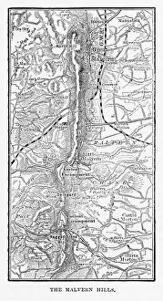
Background imageDirection Collection: Map of Malvern Hills in Worcestershire, England Victorian Engraving, 1840

Map of Malvern Hills in Worcestershire, England Victorian Engraving, 1840
Very Rare, Beautifully Illustrated Antique Engraving of Map of Malvern Hills in Worcestershire, England Victorian Engraving, 1840. Source: Original edition from my own archives

Background imageDirection Collection: National Aviation Day Display poster

National Aviation Day Display poster
Poster, National Aviation Day Display, new events, new thrills, new aircraft, fly with the three aces, under the direction of Sir Alan Cobham, Coming Soon. 20th century

Background imageDirection Collection: Programme for the London Palladium

Programme for the London Palladium
Programme for variety show at the London Palladium, 1932, under the direction of George Black Date: 1932

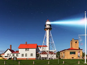
Background imageDirection Collection: Whitefish Point Lighthouse by Moonlight

Whitefish Point Lighthouse by Moonlight
The Whitefish Point Lighthouse illumintated by moonlight. Whitefish Point is located at the extreme southeastern end of Lake Superior

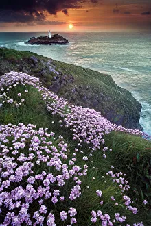
Background imageDirection Collection: Godrevy lighthouse

Godrevy lighthouse
Wild flowers in foreground and Godrevy lighthouse in distance at Cornwall

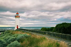
Background imageDirection Collection: Griffiths Island lighthouse

Griffiths Island lighthouse, port fairy, Victoria, Australia

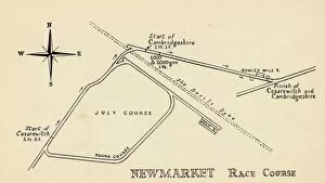
Background imageDirection Collection: Newmarket Race Course, 1940

Newmarket Race Course, 1940. Racing in Newmarket was first recorded in the time of James I. Charles II was known to attend races on Newmarket Heath with his brother, the future James II

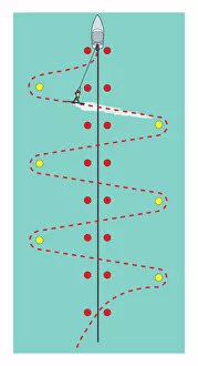
Background imageDirection Collection: Waterskiing slalom course

Waterskiing slalom course

Background imageDirection Collection: Multi directional signpost, John O Groats, Caithness, Highland Region, Scotland, United Kingdom

Multi directional signpost, John O Groats, Caithness, Highland Region, Scotland, United Kingdom, Europe

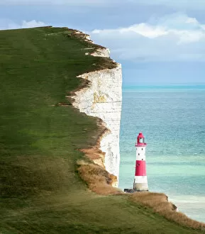
Background imageDirection Collection: Beachy Head and Lighthouse

Beachy Head and Lighthouse
A profile of the Beachy Head Lighthouse. Beachy Head is a series of cliffs along the southdowns coastal path in East Sussex close to Eastbourne and is a renowned suicide hotspot

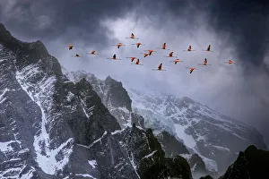
Background imageDirection Collection: Chilean flamingos (Phoenicopterus chilensis) in flight over mountain peaks with glacier in

Chilean flamingos (Phoenicopterus chilensis) in flight over mountain peaks with glacier in the distance, Torres Del Paine National Park, Chile

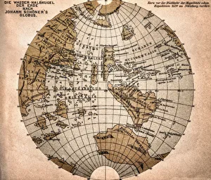
Background imageDirection Collection: World map from 1520

World map from 1520
Western hemisphere of the Johannes SchAoner globe from 1520. expedition

Background imageDirection Collection: Map of Australia and New Zealand 1856

Map of Australia and New Zealand 1856
Colton and Fitchs Modern School Geography by George W. Fitch - New York 1856

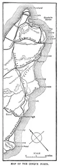
Background imageDirection Collection: Map of the Cinque Ports (Victorian engraving)

Map of the Cinque Ports (Victorian engraving)
An old map of the Cinque Ports, which are five historic ports on the south-eastern corner of Kent, England. The Confederation of Cinque Ports (Cinque is pronounced asinka)

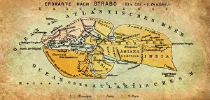
Background imageDirection Collection: Map of the world according to Strabo

Map of the world according to Strabo 63 B.C

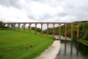
Background imageDirection Collection: The nineteenth century arched Leaderfoot Viaduct over the River Tweed in the Scottish Borders

The nineteenth century arched Leaderfoot Viaduct over the River Tweed in the Scottish Borders, Scotland
Leaderfoot Viaduct is a disused railway viaduct over the River Tweed near Melrose in the Scottish Borders, Scotland. The viaduct was completed in 1863

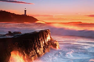
Background imageDirection Collection: Sunrise at Soldiers Beach, NSW, Australia

Sunrise at Soldiers Beach, NSW, Australia
Norah Head lighthouse in the distance

Background imageDirection Collection: Shrove Lighthouse, Greencastle, Co Donegal, Ireland; View of beach and lighthouse

Shrove Lighthouse, Greencastle, Co Donegal, Ireland; View of beach and lighthouse

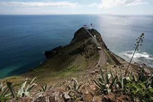
Background imageDirection Collection: Azores lighthouse, Maia, Santa Maria, Azores, Portugal

Azores lighthouse, Maia, Santa Maria, Azores, Portugal

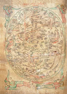
Background imageDirection Collection: Mappa Mundi by Sawley or Enrico di Magonza, ink and colors on parchment, 12th Century

Mappa Mundi by Sawley or Enrico di Magonza, ink and colors on parchment, 12th Century
Cartography, 12th century. Mappa Mundi, Medieval world map by Sawley or Enrico di Magonza, from the end of the 12th century. Ink and colors on parchment, 29.5 x 20.5 cm

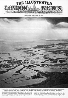
Background imageDirection Collection: Canvey Island Flooded

Canvey Island Flooded
An aerial photograph taken over South Benfleet, looking in a south-westerly direction over Canvey Island: the desolation caused by floods

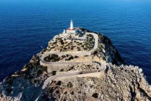
Background imageDirection Collection: Aerial of the lighthouse at the Cap de Formentor, Mallorca, Balearic Islands, Spain

Aerial of the lighthouse at the Cap de Formentor, Mallorca, Balearic Islands, Spain, Mediterranean, Europe

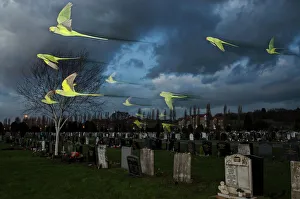
Background imageDirection Collection: Rose-ringed / ring-necked parakeets (Psittacula krameri) in flight on way to roost in an urban

Rose-ringed / ring-necked parakeets (Psittacula krameri) in flight on way to roost in an urban cemetery, London, UK. January

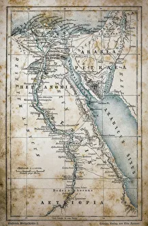
Background imageDirection Collection: Map of Egypt

Map of Egypt
Illustration of a Map of Egypt

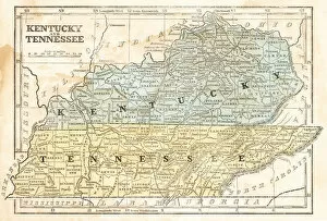
Background imageDirection Collection: Map of Kentucky and Tennessee 1855

Map of Kentucky and Tennessee 1855
System of Geography for the use of schools by Sidney E. Morse - Published by Harper & Brothers - New York 1855

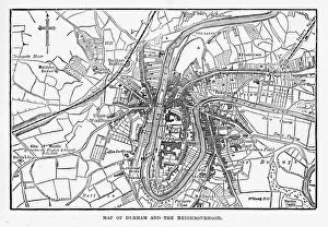
Background imageDirection Collection: Map of the City of Durham, England Victorian Engraving, 1840

Map of the City of Durham, England Victorian Engraving, 1840
Very Rare, Beautifully Illustrated Antique Engraving of Map of the City of Durham, England Victorian Engraving, 1840. Source: Original edition from my own archives

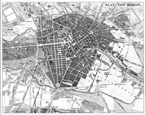
Background imageDirection Collection: Berlin, Germany Map

Berlin, Germany Map
Engraved illustrations of a Map of the City of Berlin, Germany from Iconographic Encyclopedia of Science, Literature and Art, Published in 1851. Copyright has expired on this artwork

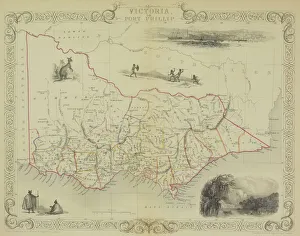
Background imageDirection Collection: Antique map of Victoria or Port Phillip in Australia with vignettes

Antique map of Victoria or Port Phillip in Australia with vignettes

Background imageDirection Collection: Antique map of Russia

Antique map of Russia

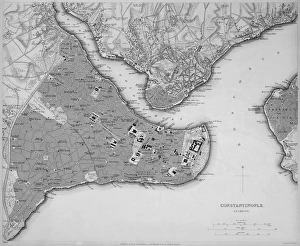
Background imageDirection Collection: Antique map of Constantinople, present day Istanbul

Antique map of Constantinople, present day Istanbul

Background imageDirection Collection: Buenos Aires map

Buenos Aires map
Antique engraving map of Buenos Aires

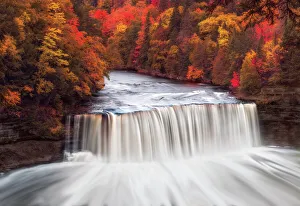
Background imageDirection Collection: Dream Falls - Tahquamenon Falls State Park

Dream Falls - Tahquamenon Falls State Park
Upper Tahquamenon Falls in Fall Color. Tahquamenon Falls State Park encompasses close to 50, 000 acres stretching over 13 miles

Background imageDirection Collection: Halong Bay in Vietnam

Halong Bay in Vietnam

Background imageDirection Collection: Fanad Lighthouse, Donegal, Ireland

Fanad Lighthouse, Donegal, Ireland
Cumulous cloud at sunset, a huge storm hits Fanad Lighthouse off the coastline of Fanad, Donegal, Ireland

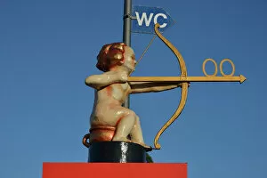
Background imageDirection Collection: Archer Cupid as a toilet sign, Oktoberfest, Munich, Upper Bavaria, Bavaria, Germany

Archer Cupid as a toilet sign, Oktoberfest, Munich, Upper Bavaria, Bavaria, Germany

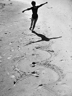
Background imageDirection Collection: Beach Ballet

Beach Ballet
August 1955: A ballet dancer draws circles in the sand with the points of her toes. Original Publication: Picture Post - 8498 - Festival Ballet Dancer - unpub

Background imageDirection Collection: Famous multi directional signpost, John O Groats, Caithness, Highland Region, Scotland

Famous multi directional signpost, John O Groats, Caithness, Highland Region, Scotland, United Kingdom, Europe

Background imageDirection Collection: Lighthouse

Lighthouse
A lighthouse on Rottnest Island, Perth, Australia

Background imageDirection Collection: Female Harpy Eagle (Harpia harpyja) in flight

Female Harpy Eagle (Harpia harpyja) in flight. Returning to its nest. Pousada Currupira d Araras, south west Brazil


All Professionally Made to Order for Quick Shipping

Embarking on a journey through time and space, these diverse images guide us in the right direction. From JMW Turner's iconic painting 'The Fighting Temeraire' to the ancient Mappa Mundi inked on parchment, we navigate history's vast tapestry. An antique map of Tasmania leads us to uncharted territories, while the Sturgeon Bay Lighthouse stands as a beacon of hope in Door County, Wisconsin. The rugged cliffs and lighthouse at Butt of Lewis remind us that even amidst nature's challenges, guidance is always present. In contrast, a painting showcasing Kim Jong Il and Kim Il Sung reveals an authoritarian direction taken by North Korea. Yet, it serves as a reminder that they can be shaped by ideology too. Fanad Head Lighthouse transports us to Ireland's stunning coastline where light pierces through darkness. A Viking ship silhouette against a sunset sky reminds us of our ancestors' adventurous spirit and their quest for new horizons. Meanwhile, police officers guiding children symbolize protection and nurturing guidance within our communities. Victorian engravings depict maps like the one showcasing Malvern Hills in Worcestershire; they invite exploration into England's picturesque landscapes. Griffiths Island lighthouse invites wanderers to discover its hidden beauty along Australia's coast. Lastly, National Aviation Day Display poster inspires dreams to take flight with its depiction of soaring planes against blue skies – reminding us that sometimes all we need is a little push towards our aspirations. Through artistry and imagery from various corners of the world, these captivating visuals point towards different directions – both literal and metaphorical – inviting us to embark on unique journeys filled with wonderment.